Randonnée du Bout du Monde – Hike in the Cirque du Fer-à-Cheval
The Randonnée du Bout du Monde hike is a scenic hike in Sixt-Fer-à-Cheval.
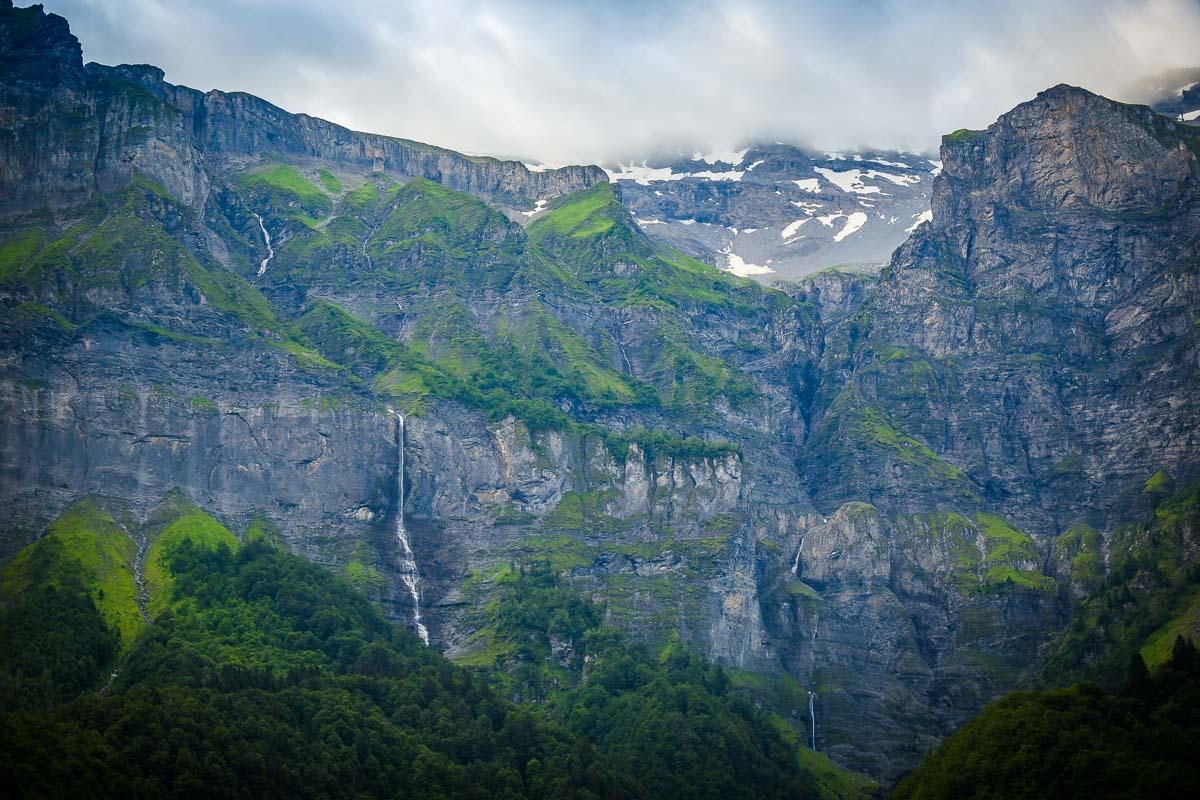
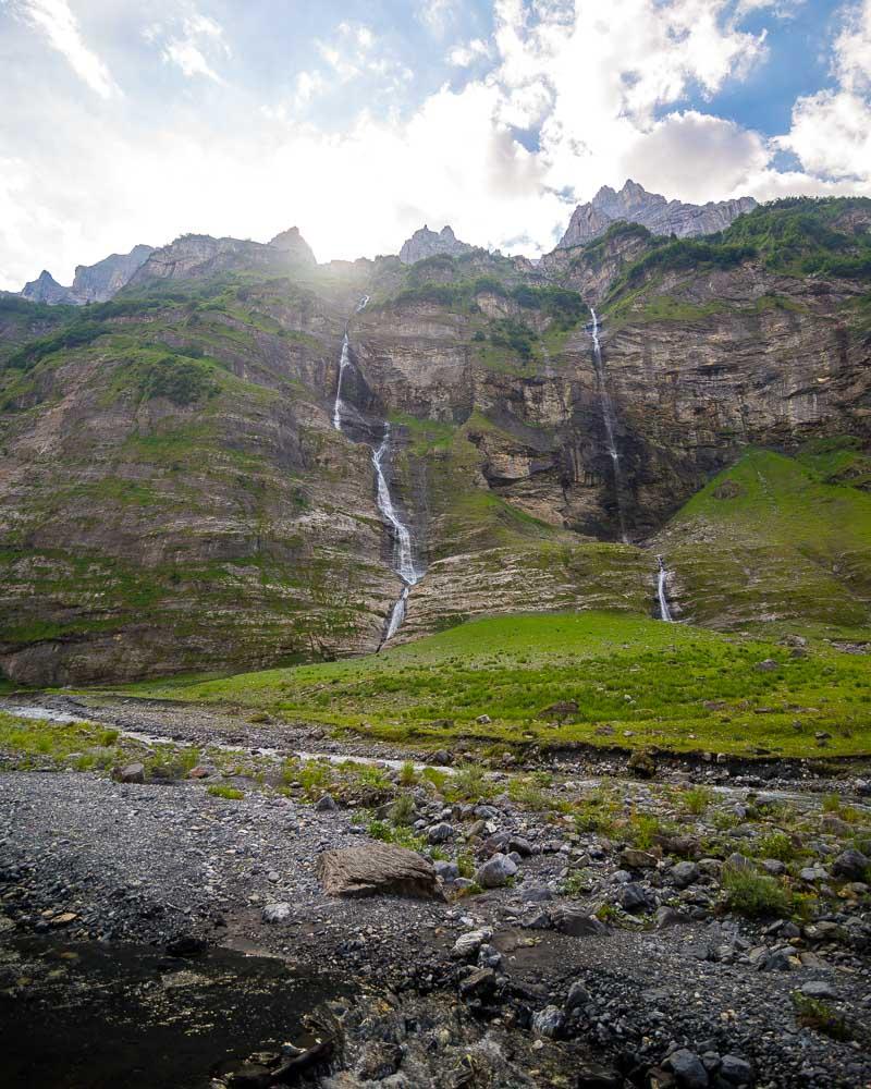
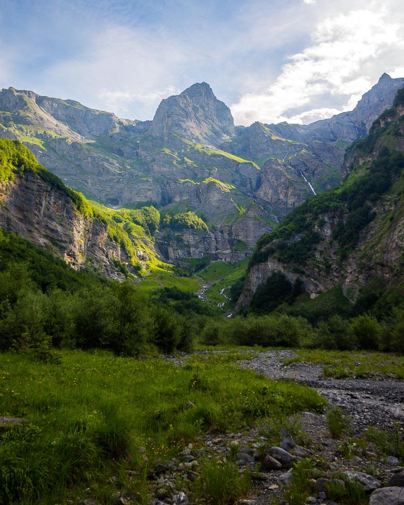
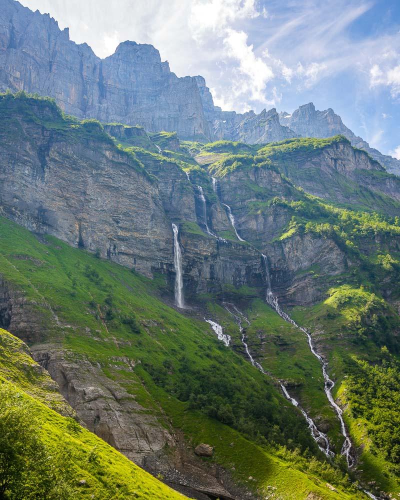
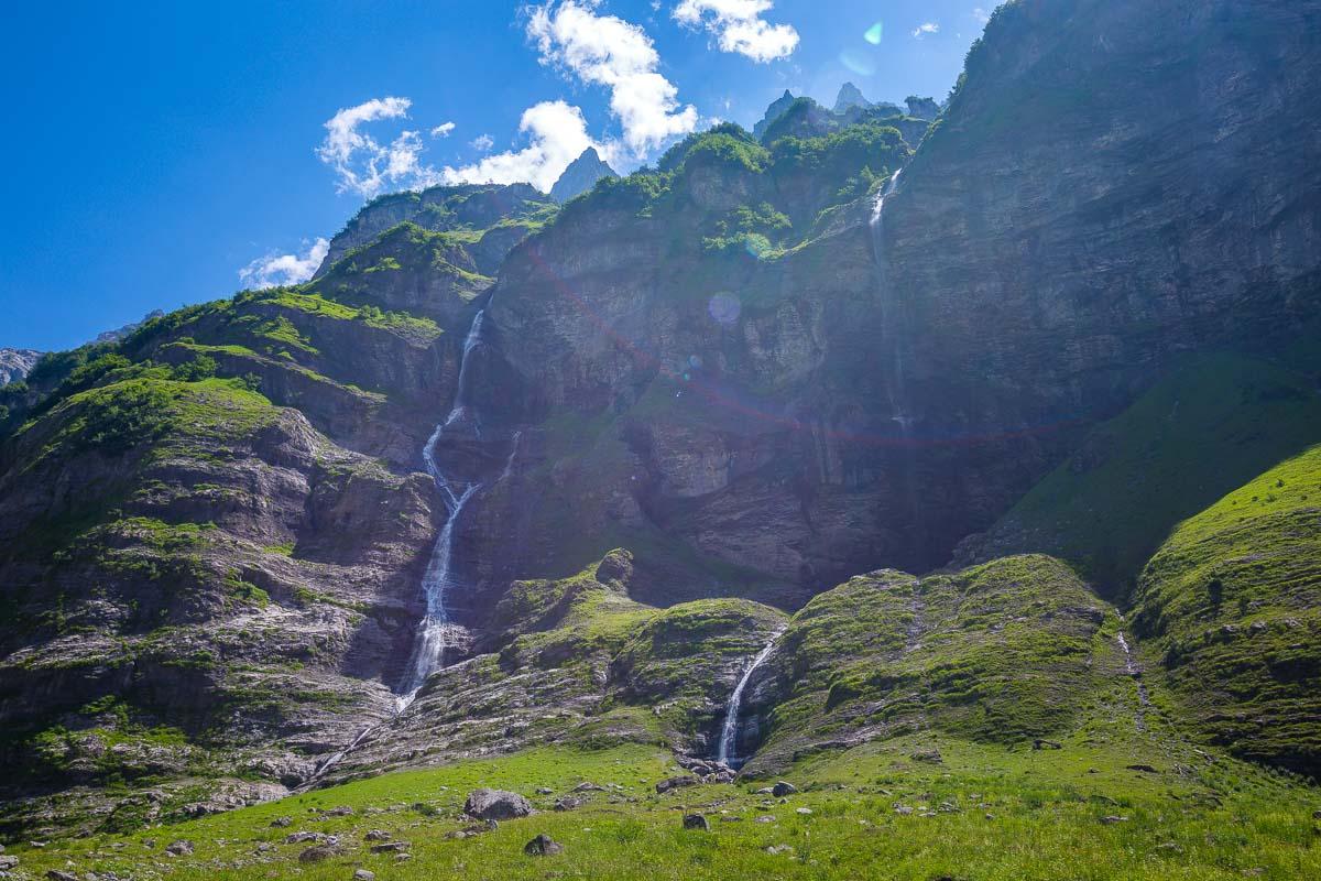
It’s set in the gorgeous Cirque du Fer-à-Cheval, a U-shaped mountain range with more than 30 waterfalls along the high walls.
Let’s see everything you need to plan your hike!
Where is the Cirque du Fer à Cheval
The Cirque du Fer à Cheval is located in Haute-Savoie, in the Sixt-Fer-à-Cheval area. It’s located on the eastern part of the department, next to the border with Switzerland.
Location: Google Maps
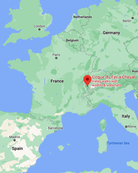
Just 10mn drive away from the village of Sixt-Fer-à-Cheval, the Cirque du Fer à Cheval is a large mountain cirque, and its name means the Horseshoe Cirque. It has high mountains forming a u-shape (hence the name), and plenty of waterfalls all around.
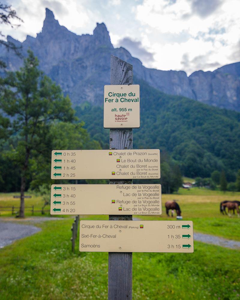
The entrance of the cirque is where you’ll start the Bout du Monde hike.
How to Get to the Bout du Monde hike
First, you’ll need to get to Sixt-Fer-à-Cheval.
The best way to reach the area is definitely by car. Here are the driving times from the main nearby cities:
- from Chamonix: 1h6
- from Geneva: 1h10
- from Annecy: 1h15
You can also get a bus, and you have 2 options:
- Bus 94 from Cluses: 2 buses a day, takes 1h, costs 6€ for one-way ticket.
- Bus 102 from Annemasse: 6 buses a day, takes 1h20, costs 6€ for one-way ticket.
For these 2 buses, you’ll need to book in advance. Go to the link above, and call the number on the page to book your ticket.
Once you’re in Sixt-Fer-à-Cheval, you’ll need to get to the Cirque du fer-à-Cheval to start the hike.
By car
It only takes 10mn to reach the cirque from the city, going straight on the D907 road. To enter the area, you’ll need to pay a parking fee from May 4th to September 22nd. It’s free from the end of September to early May.
Opening times:
- 4th-29th May & 2nd-22nd September: 10:30am-3:30pm
- 30th May to 1st September: 8:30am-5pm
Cost: 5€ for the full day
Get to the parking before the official opening time and you can park for free
By foot
If you don’t have a car, you can walk to the Cirque du Fer-à-Cheval. It takes 1h30 along the departmental road, on a low incline. I wouldn’t recommend this option, but it can be done.
Another option is to try to get a taxi in the city, that will bring you to the Cirque.
Things to Know About the Cirque du Fer-à-Cheval
Before you start to plan your trip, there are 2 main things you should know about the Cirque du Fer-à-Cheval:
- Bikes are forbidden on the paths from 12:30pm to 6pm in July/August
- Dogs are forbidden from the Chalet in March/April/May/June, and forbidden from the Buvette du Prazon in all other months
Randonnée du Bout du Monde Hike Details
The randonnée du Bout du Monde is a nice hike in the Cirque du Fer-à-Cheval. You’re hiking in one of the most epic locations, surrounded by high mountains and plenty of waterfalls. You’re in a natural reserve, and you can spot many wild animals including chamois.
It’s a very popular hike, so make sure to get an early start!
Here are the details of the hike:
Randonnée du Bout du Monde

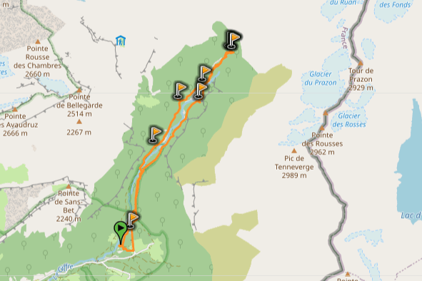
Hike distance: The distance of the hike is 10.8km / 6.7 miles including the return trip.
Hike duration: If you simply go down & back up, it will take you around 3h for the full loop. It took me 5h in total, including the many stops at the waterfalls and lunch with a view.
Hike elevation: the hike is on a slight incline for most of it, and 2/3 of the total elevation are concentrated in the final climb to the Bout du Monde.
Hike difficulty: it’s an easy hike, on a well-maintained trail for most of the way. There are a few bridges to cross, but nothing dangerous. The final climb is on a steep path which warrants a “moderate” rating, but it’s easily manageable if you just take your time. In rainy weather, you’ll probably have to cross water streaming from the waterfalls, so make sure to wear proper footwear and watch out for slippery stones.
Hiking the Randonnée du Bout du Monde
At this point during our trip to Haute-Savoie, we had already spent 5 days in Annecy. We explored the city, and hiked around the lake, including the Roc du Chère hike on the 5th day.
It was time to leave the surroundings of Annecy for a day trip! We picked the area of Sixt-Fer-à-Cheval, which looked pretty epic from the photos and only 1h away from Annecy.
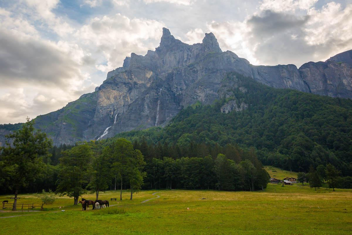
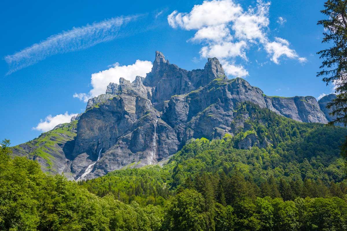
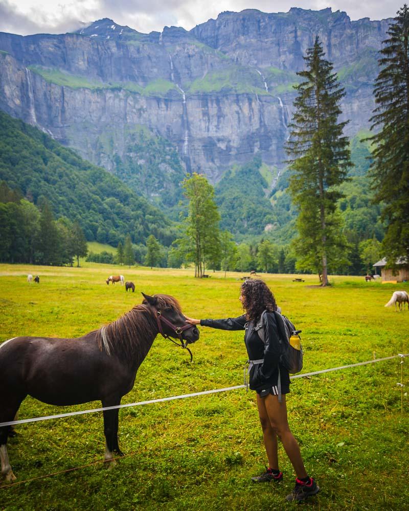
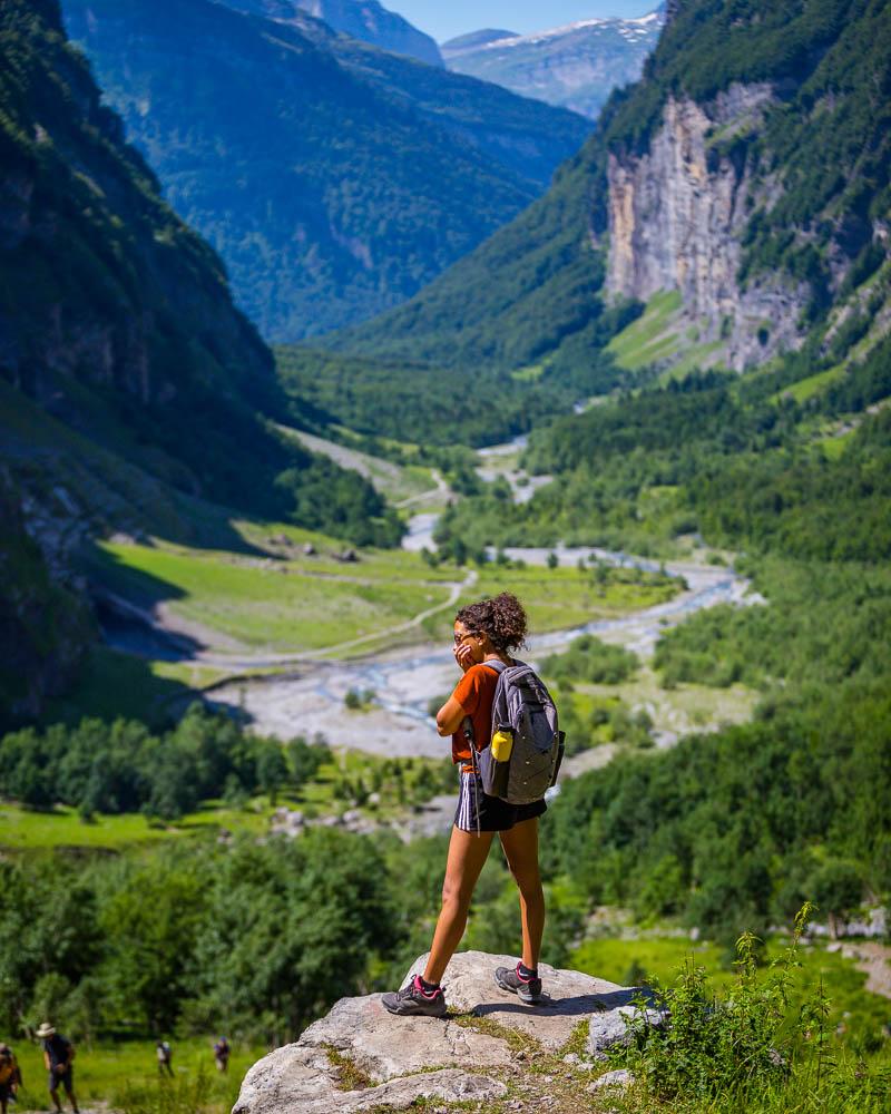
As soon as we got out of the car, we got blown away by the landscape around. The tall peak named Corne du Chamois on one side, and high vertical walls on the other side with waterfalls and snowcaps.
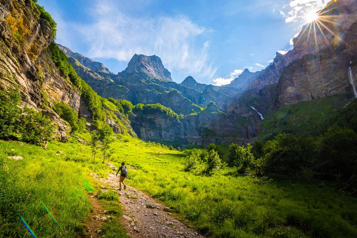
We got to the beginning of the hike at 7:30am, early enough to beat the crowds and enjoy the peace & quiet in a usually crowded area. After the mandatory stop to pet the ponies, we started the hike.
Right after the start, we got to a large body of water with the mountain reflection and the first light of the day hitting the peak.
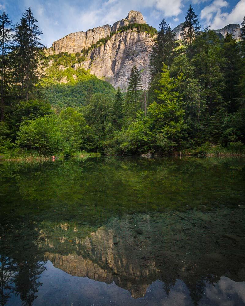
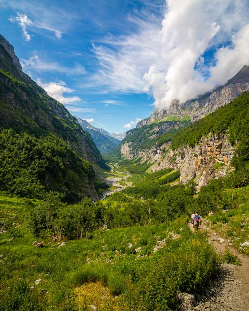
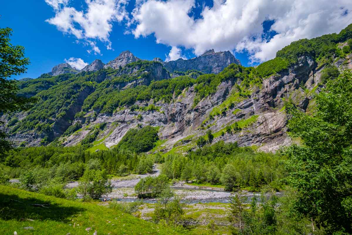
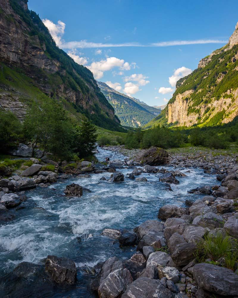
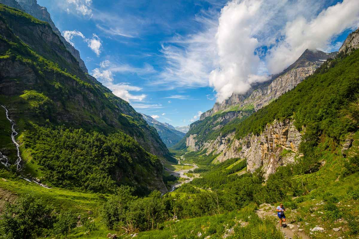
A great view to start the hike, and the rest did not disappoint in the slightest. The first part of the hike was pretty flat, on a large trail in the forest. We soon got close to the local river, the Giffre, and pretty much followed it for the rest of the hike.
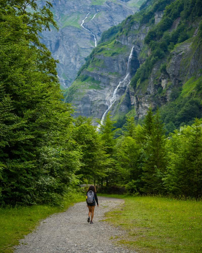
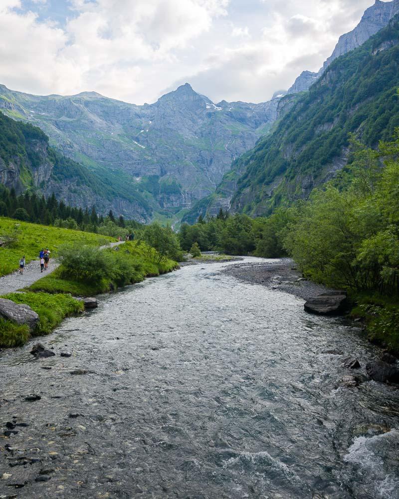
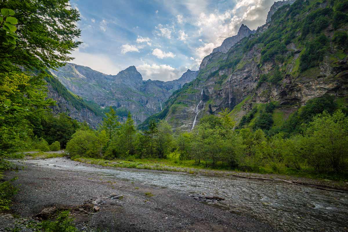
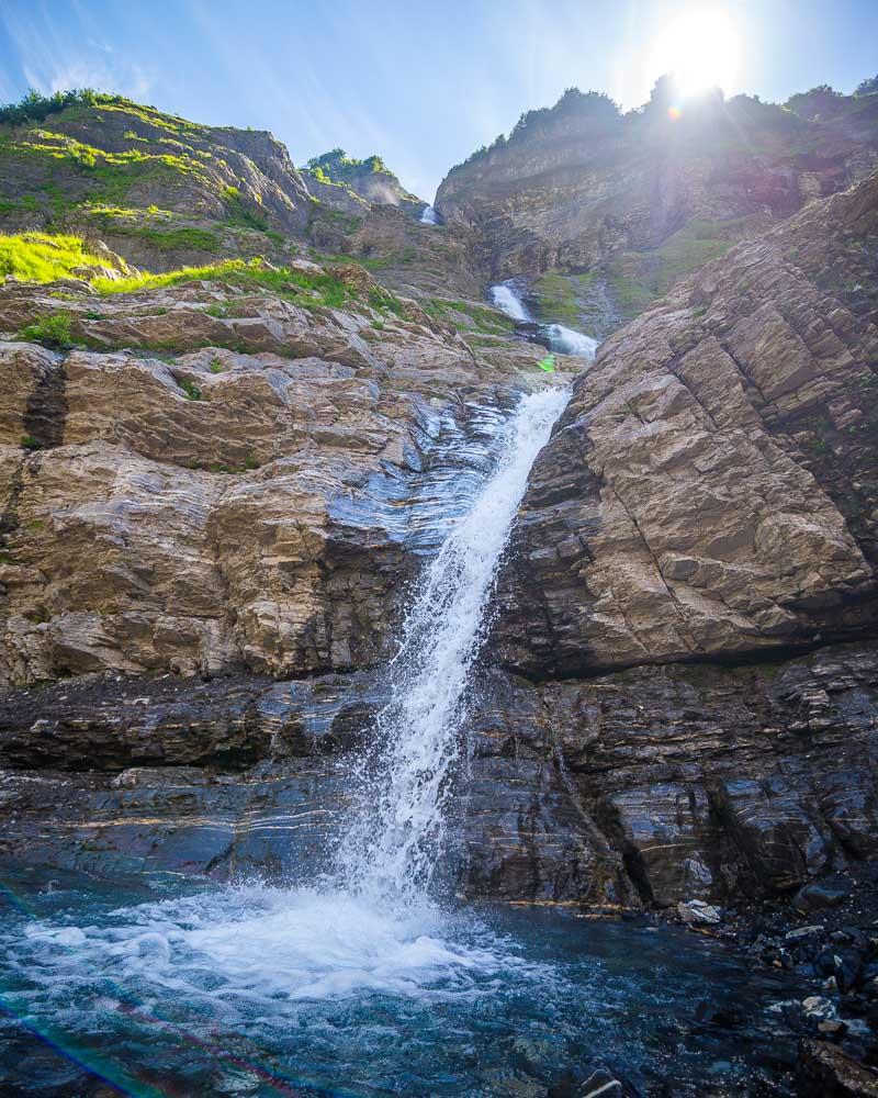
As we saw from the very start, there are a lot of waterfalls in the Cirque du Fer-à-Cheval; more than 30 in June. As we progressed on the hike, we crossed several of them and of course had to get closer!
We were there in July, and there wasn’t that much water flowing from the waterfall. Thankfully though, because otherwise we would have struggled a lot more to cross the multiple streams of water crossing the path.
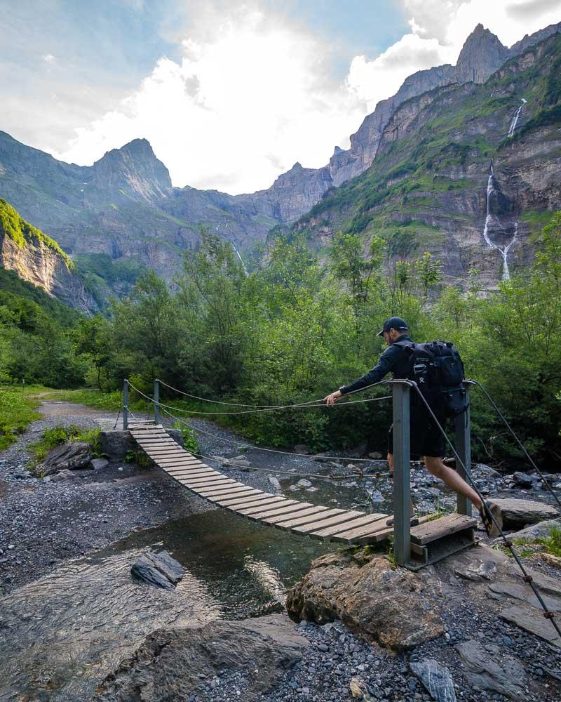
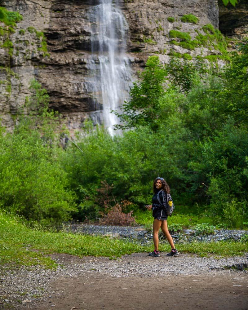
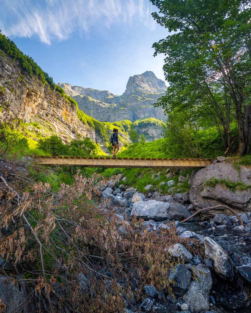
You can see me crossing on a bridge, but there are several spots where you need to cross by walking on the stones; I can easily imagine how much harder it gets after rain when the waterfalls flow heavily.
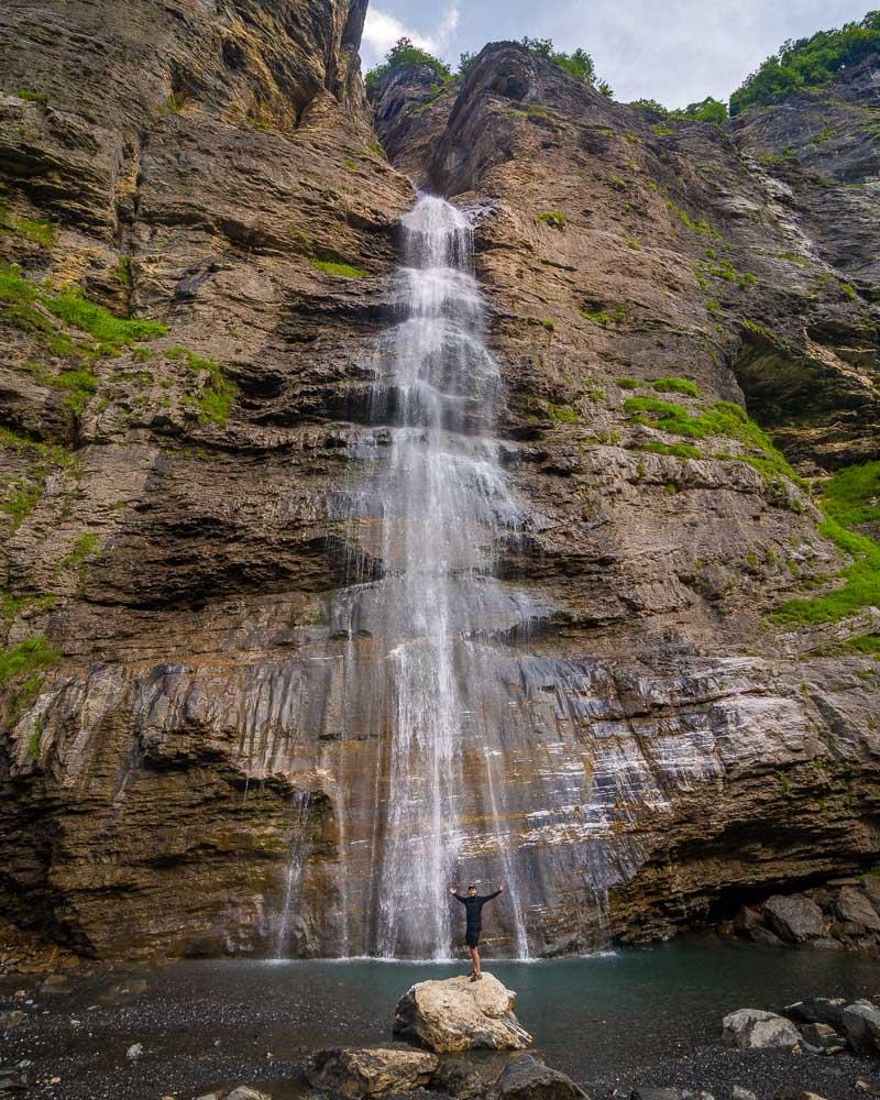
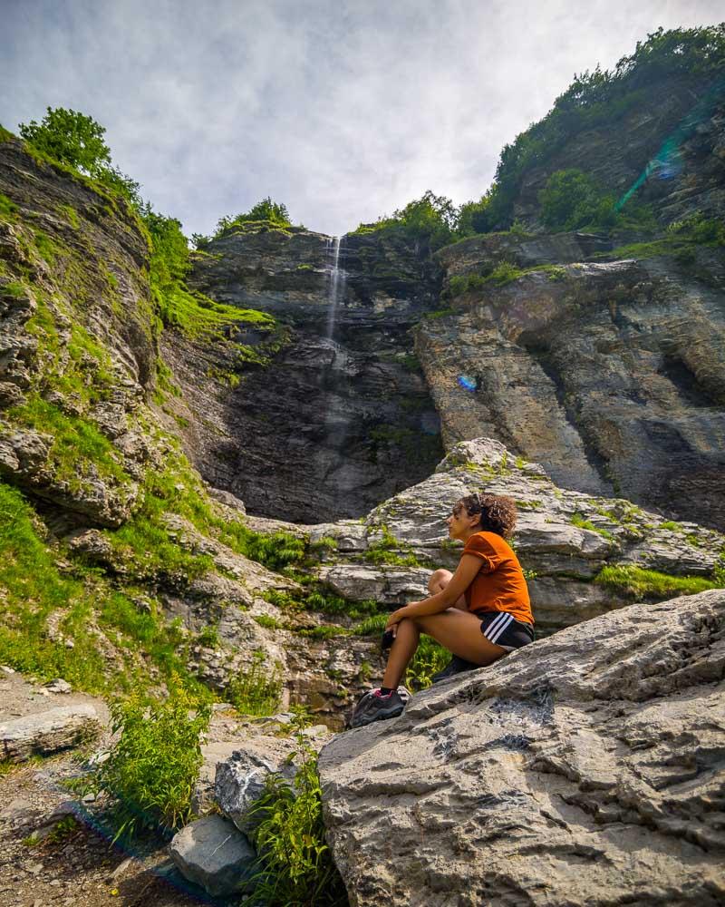
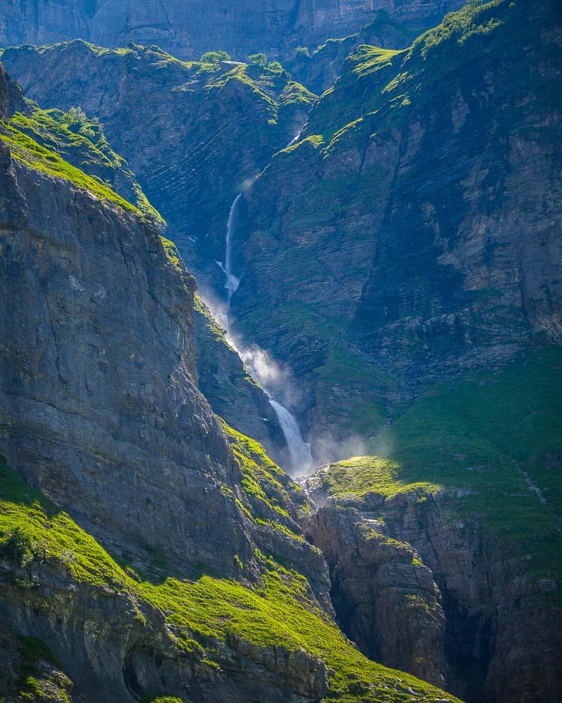
Here’s another waterfall we spotted from the hike, and you know me I had to get there!
The rest of the hike on the western side of the Giffre river was pretty easy, with very low uphill incline and a good trail. Up until we reached a rope bridge, crossing the river to the other side.
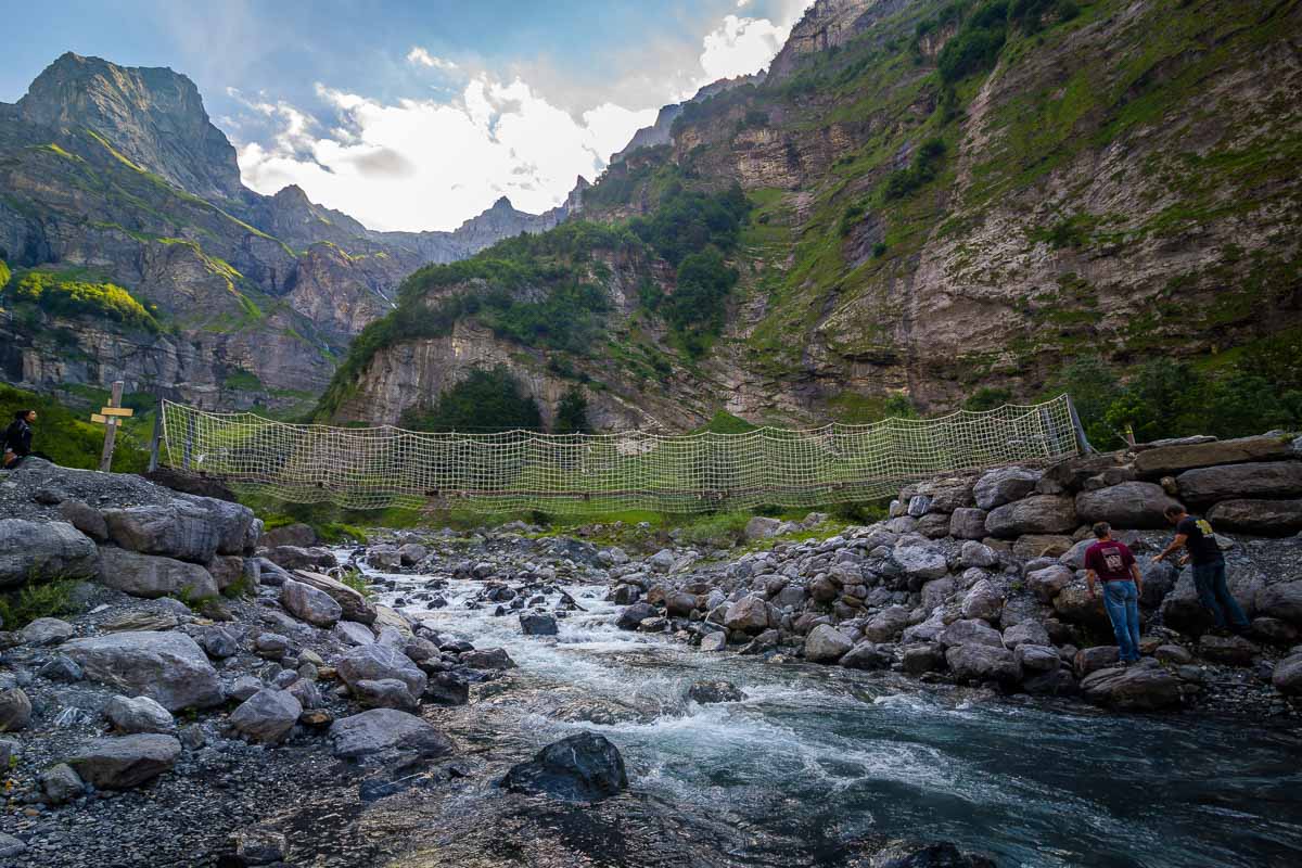
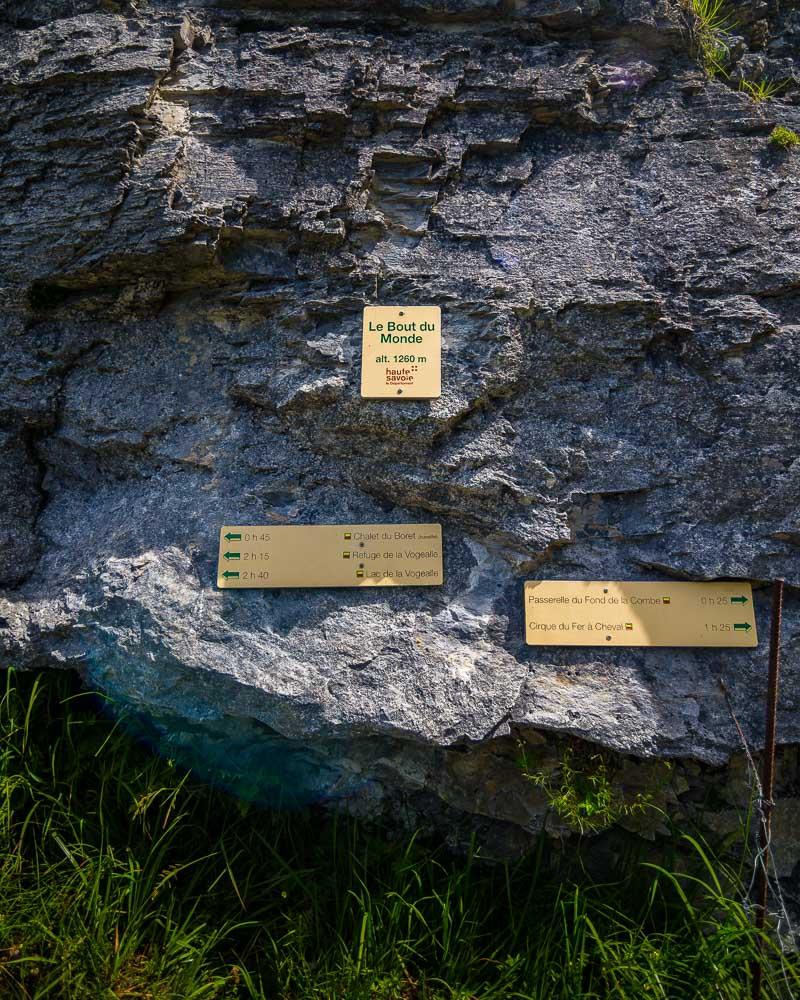
This rope bridge, named the Passerelle du Fond de la Combe, marks the start of the final climb to the Bout du Monde. This is where the trail starts to climb heavily, with always the Pic de Tenneverge mountain towering in the distance.
And finally, we reached it, the Bout du Monde! This translates in French to “the End of the World”, and it’s literally the end of France as Switzerland lies on the other side of the mountain.
Right above the Bout du Monde is the Cascade des Lanchettes, where you can climb to get some fresh water after the hard climb.
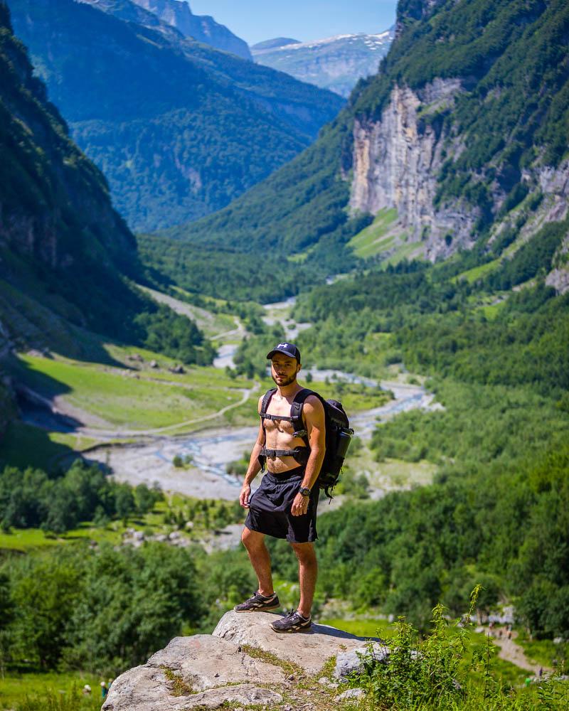
From there, the end of the hike, we had a stunning view over the valley behind us. We stayed for a while up there, taking in the view that we couldn’t see on our way up.
We hiked back down to the rope bridge, and crossed the river to the other side. You can also walk back on the same side, but we decided to take the other side to see more waterfalls along the way.
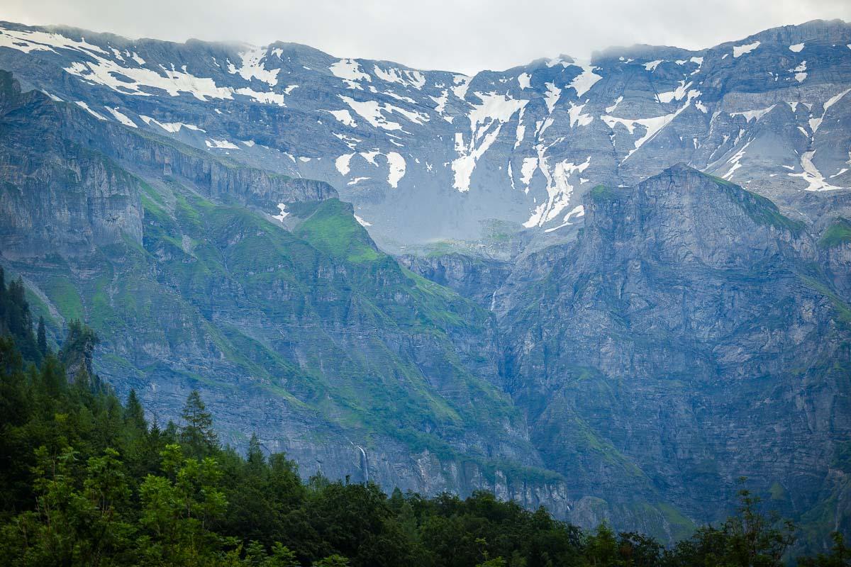
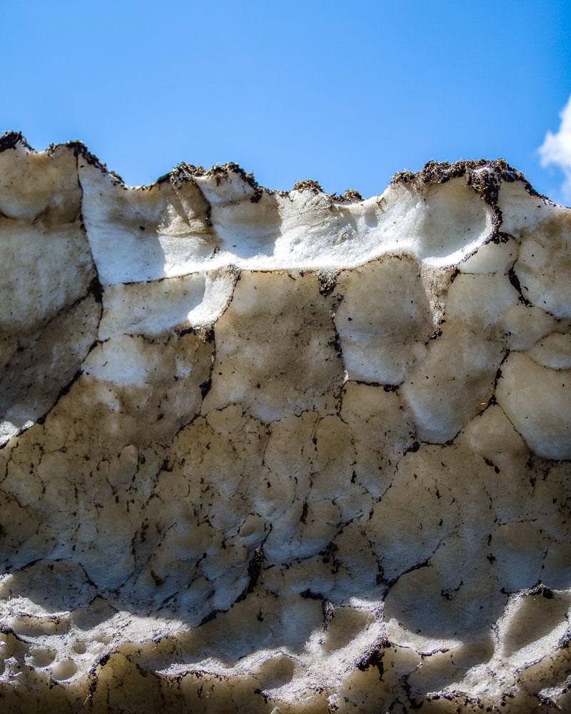
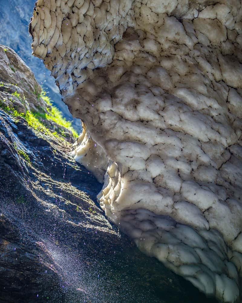
On the other side, you’ll see more waterfalls, and even a huge chunk of snow, still not totally melted from the heat.
And that was it, the end of the randonné du Bout du Monde hike! We had lunch next to a waterfall on the way back, then went back to our car in the parking lot. We were actually shocked to see how absolutely crowded the parking lot (that we left empty) had became!
We stayed for a while in the car, taking a well-deserved nap, before hiking to 2 other parts of the area in the afternoon: the Cirque des Fonts and the Cascade des Rougets.
Visit Haute-Savoie
Planning your trip to Haute-Savoie? You’ll find below a few other travel guides & key spots to see in the area.
Best hikes around Annecy:
Great outdoor destinations near Annecy:
The BIG guides:
I hope you enjoy your trip to Annecy and to France; if you have any questions, let me know in the comments below, I always reply.
Help a fellow traveler and share this guide with the buttons below!
Travel Tools
Use any of our recommended links below to book your trip. You pay the same, and we earn a small fee; a great way to support us!