Cirque des Fonts hike in Sixt-Fer-à-Cheval – Complete Guide (with map)
The Randonnée du Cirque des Fonts is a short 3h hike in Sixt-Fer-à-Cheval.
It leads to an absolutely epic location, the Cirque des Fonts. Similar to the popular Cirque du Fer-à-Cheval right nearby, this one has the advantage of being harder to reach, which means less crowds!
Let’s see everything you need to plan your hike & how to stay at the mountain refuge Refuge des Fonts.
Where is the Cirque des Fonts
The Cirque des Fonts is located in Haute-Savoie, in the Sixt-Fer-à-Cheval area. It’s located on the eastern part of the department, next to the border with Switzerland.
Location: Google Maps
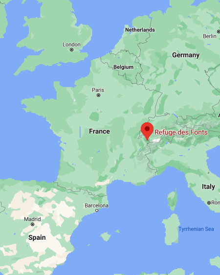
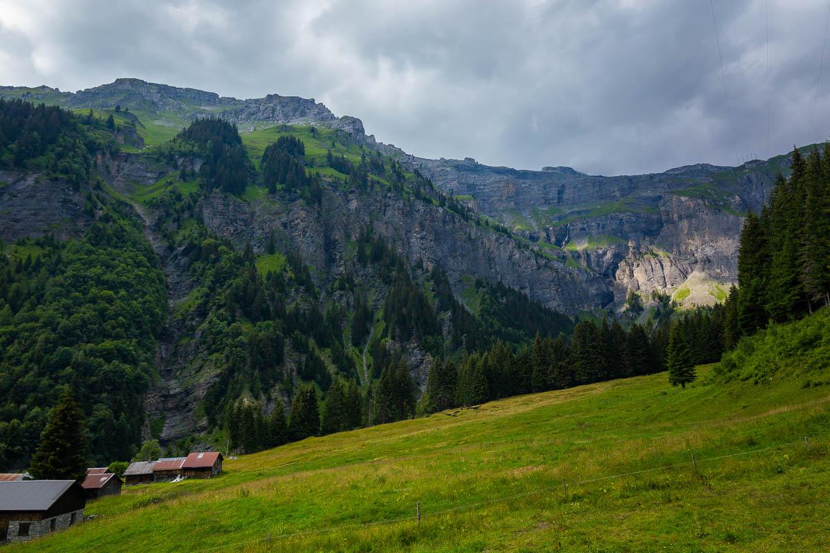
Just 10mn south from the village of Sixt-Fer-à-Cheval, the Cirque des Fonts is a large mountain cirque. It’s located below the more famous Cirque du Fer-à-Cheval, which is around 20mn drive north.
How to Get to the Cirque des Fonts hike
First, you’ll need to get to Sixt-Fer-à-Cheval.
The best way to reach the area is definitely by car. Here are the driving times from the main nearby cities:
- from Chamonix: 1h6
- from Geneva: 1h10
- from Annecy: 1h15
You can also get a bus, and you have 2 options:
- Bus 94 from Cluses: 2 buses a day, takes 1h, costs 6€ for one-way ticket.
- Bus 102 from Annemasse: 6 buses a day, takes 1h20, costs 6€ for one-way ticket.
For these 2 buses, you’ll need to book in advance. Go to the link above, and call the number on the page to book your ticket.
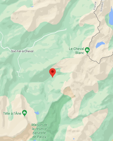
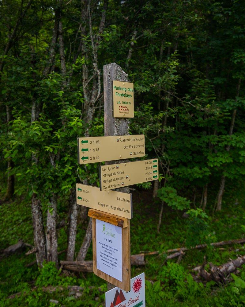
Once you’re in Sixt-Fer-à-Cheval, you’ll need to get to the Parking des Fardelays to start the hike.
By car
It only takes 8mn to reach the parking lot from the city, driving south on the D29 through Salvagny. You’ll need to drive past the Cascade du Rouget, past the parking des Fardelays, until this exact spot just seconds after the waterfall.
There you’ll be able to park your car on the side of the road, right next to the beginning of the hike.
By foot
If you don’t have a car, you can walk to the beginning of the hike. It takes 1h10 along the departmental road, on a low incline. I wouldn’t recommend this option, but it can be done.
Another option is to try to get a taxi in the city, that will bring you to the starting point at the parking lot.
Randonnée du Cirque des Fonts Hike Details
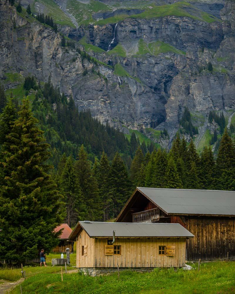
The randonnée du Cirque des Fonts will get you to the Refuge des Fonts, a nice refuge in an epic setting. It’s surrounded by high mountains, with waterfalls flowing from the heights. It’s not as beautiful as the Cirque du Fer-à-Cheval, but it’s definitely more quiet there without the crowds.
If you only have one day in the area, I’d recommend the Randonnée du Bout du Monde and the Cascade du Rouget first. But if you’re spending several days in the area, or planning to sleep in the refuge, then this hike is definitely for you!
Here are the details of the hike:
Randonnée du Cirque des Fonts

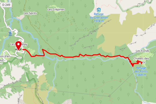
Hike distance: The distance of the hike is 7km / 4.3 miles including the return trip.
Hike duration: If you simply go down & back up, it will take you around 3h for the full loop. Plan for extra time to enjoy the location when you get to the cirque.
Hike elevation: with a total of 470m uphill climb (1,542ft), you’ll be climbing during all the hike to the cirque.
Hike difficulty: the hike is relatively easy, but it will definitely burn your calves as you go up. Most of the hike is in the forest, and some parts can easily become slippery if it’s wet. Watch your steps on the forest ground and use the many roots to secure your footing.
Hiking the Randonnée du Cirque des Fonts
We started the day very early, leaving Annecy around 6am, and drove to Sixt-Fer-à-Cheval. This allowed us to beat the crowds at the popular Cirque du Fer-à-Cheval, and we hiked to the Bout du Monde.
After having lunch in front of a waterfall on the hike back, we went back to our car and slept/chilled for a bit, from 1pm to 3pm.
Feeling refreshed, and after the mandatory coffee from the hot thermos, we drove to the parking des Fardelays for the second hike of the day.
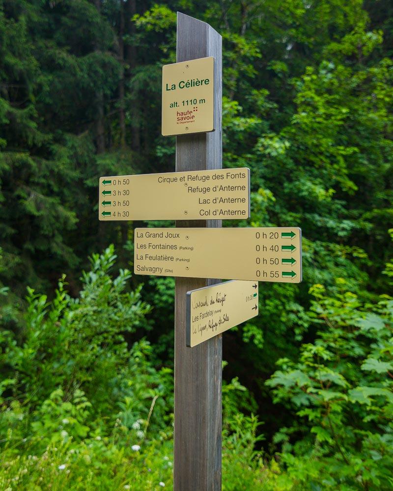
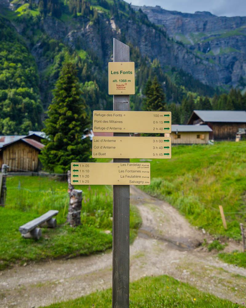
This was an unplanned hike, and we got there based on recommendation from a local guide. Luckily there were signs, pointing to Cirque et refuge des Fonts (1h25), so off we went.
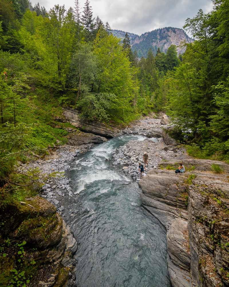
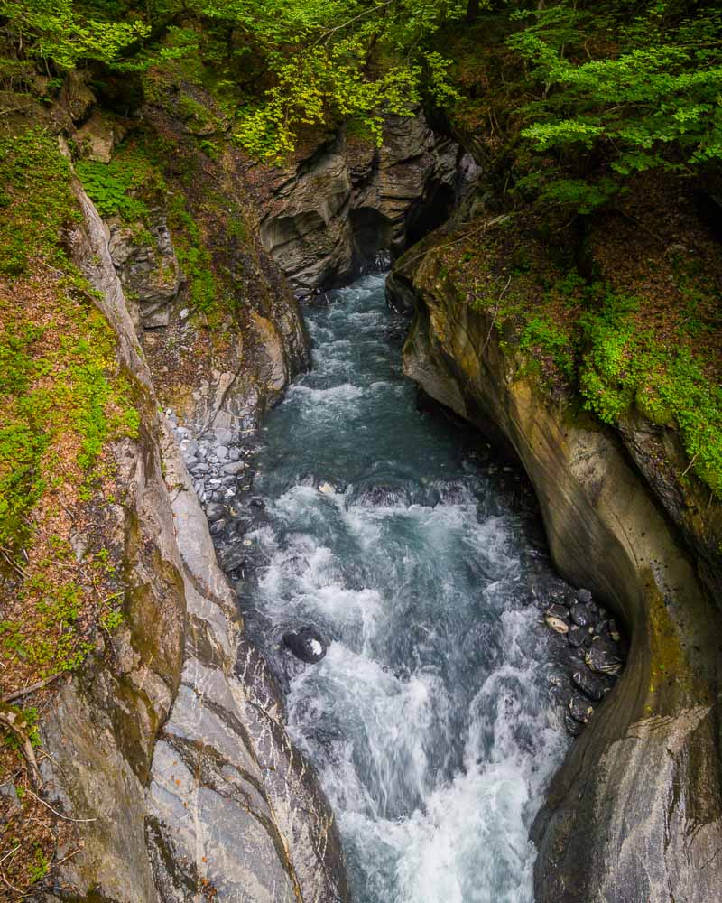
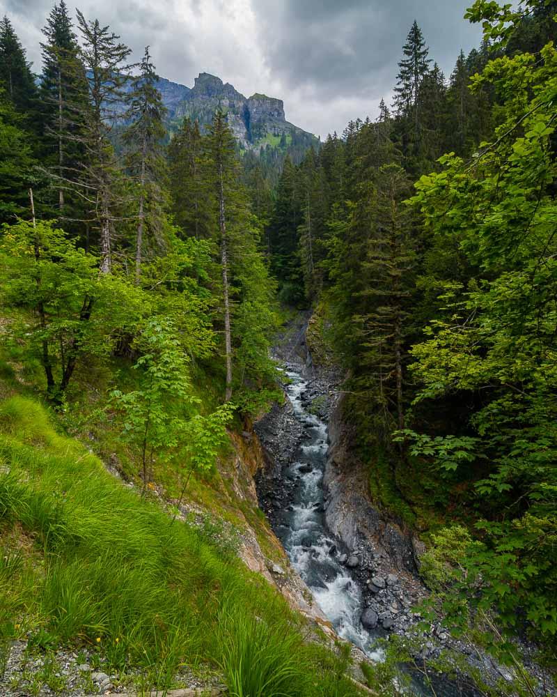
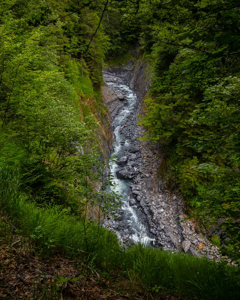
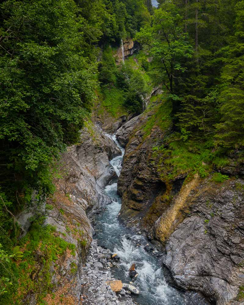
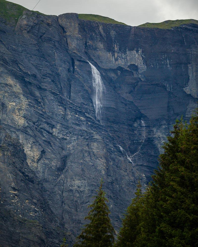
The hike starts with a nice downhill trail in the forest, and we could hear water running somewhere below the trail. And in fact, after less than 10 minutes we got to a nice wooden bridge over the river. The bridge is at the entrance of the Tine des Fonts gorges, which are pretty impressive, though not quite as much as the Gorges du Fier back in Annecy.
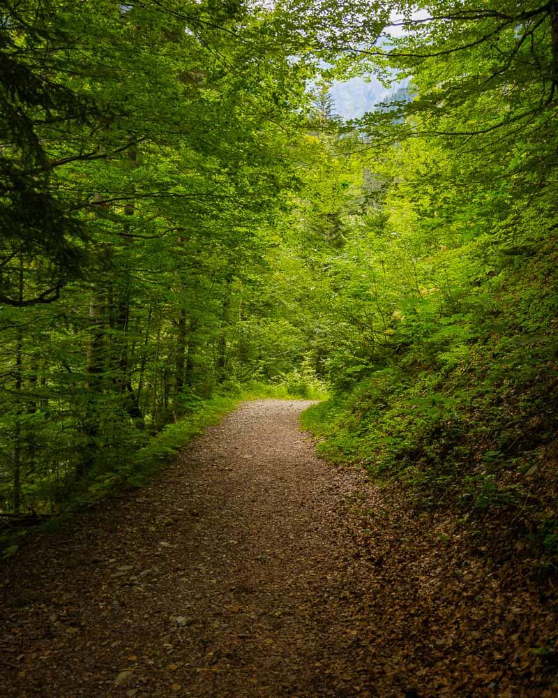
The downhill hike was only a fake hope; right after the bridge, the climb begins. The trail gets steep, and it stays this way until the very end of the hike at the Cirque des Fonts.
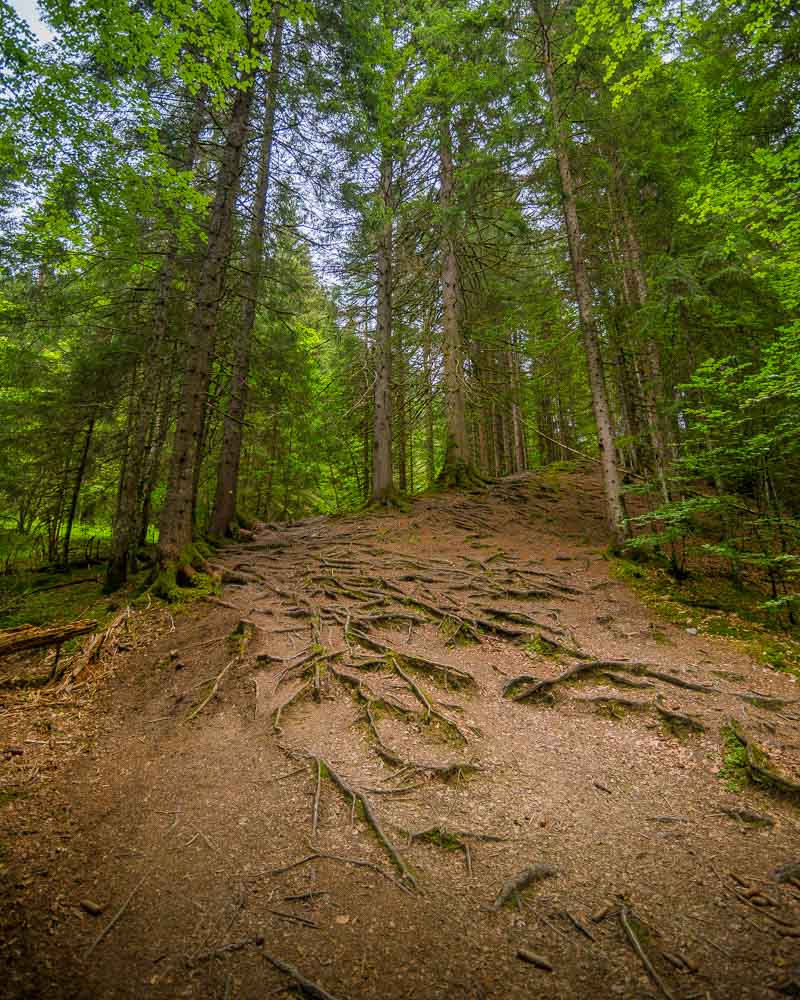
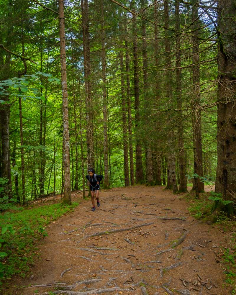
The forest climb is short, but intense. After a few minutes, we got out of the forest, and back on the main route. It’s more of a piste than a road, but it’s wide enough for cars (4×4 obviously), and easy to hike on.
At the end of the forest, we got to La Célière, with another sign for the rest of the hike.
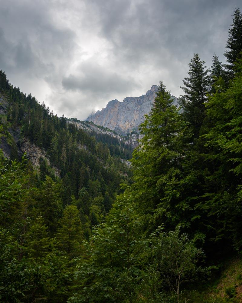
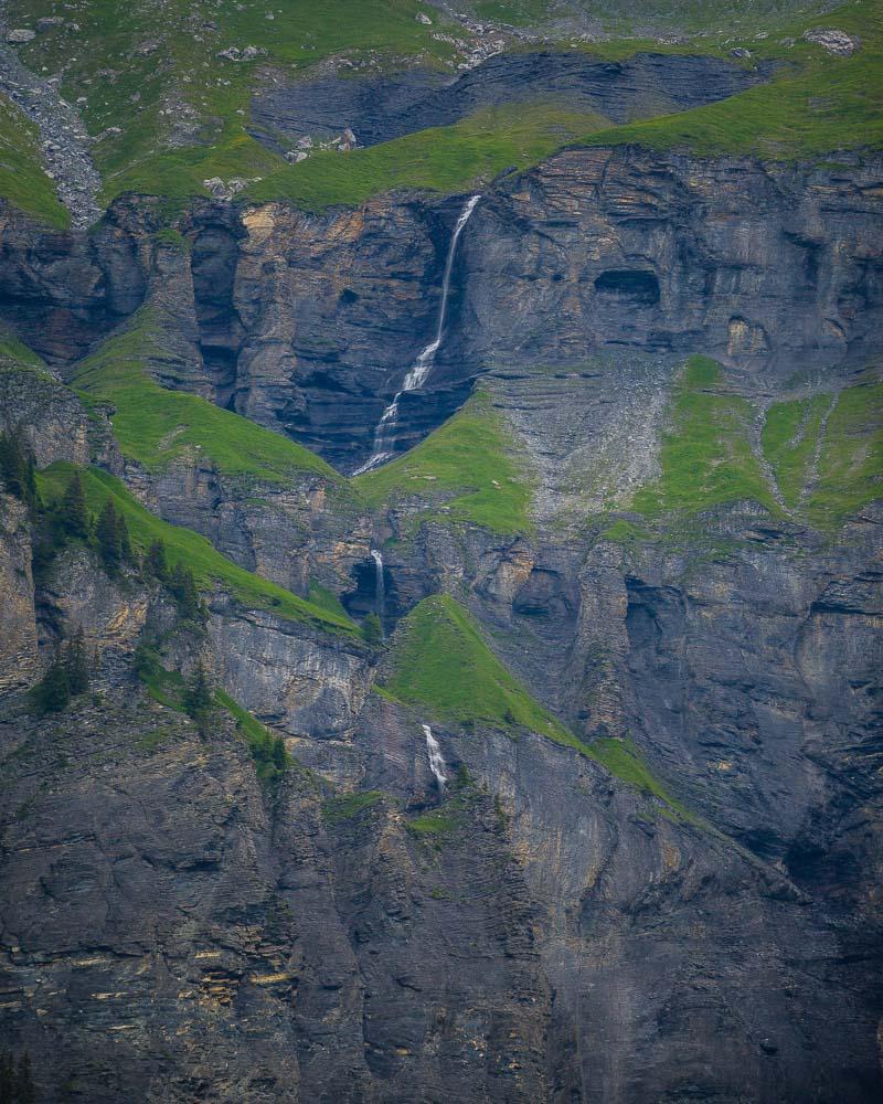
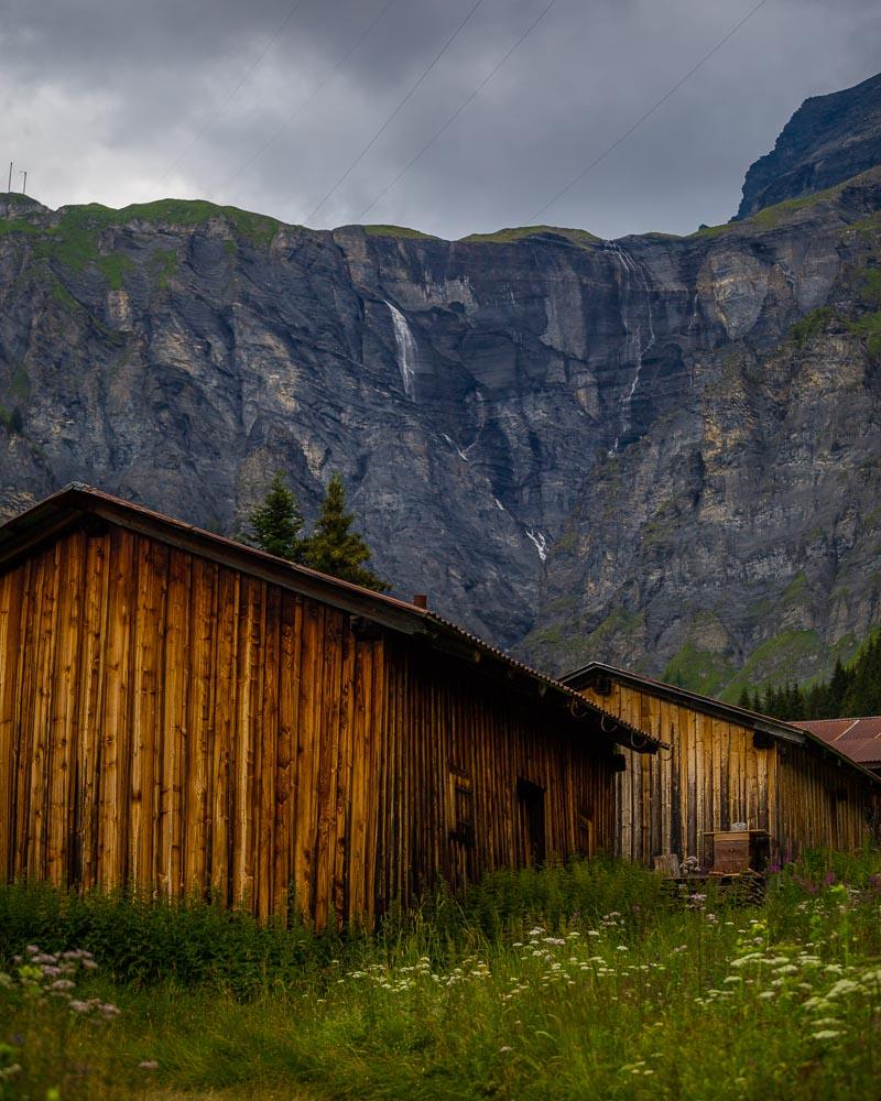
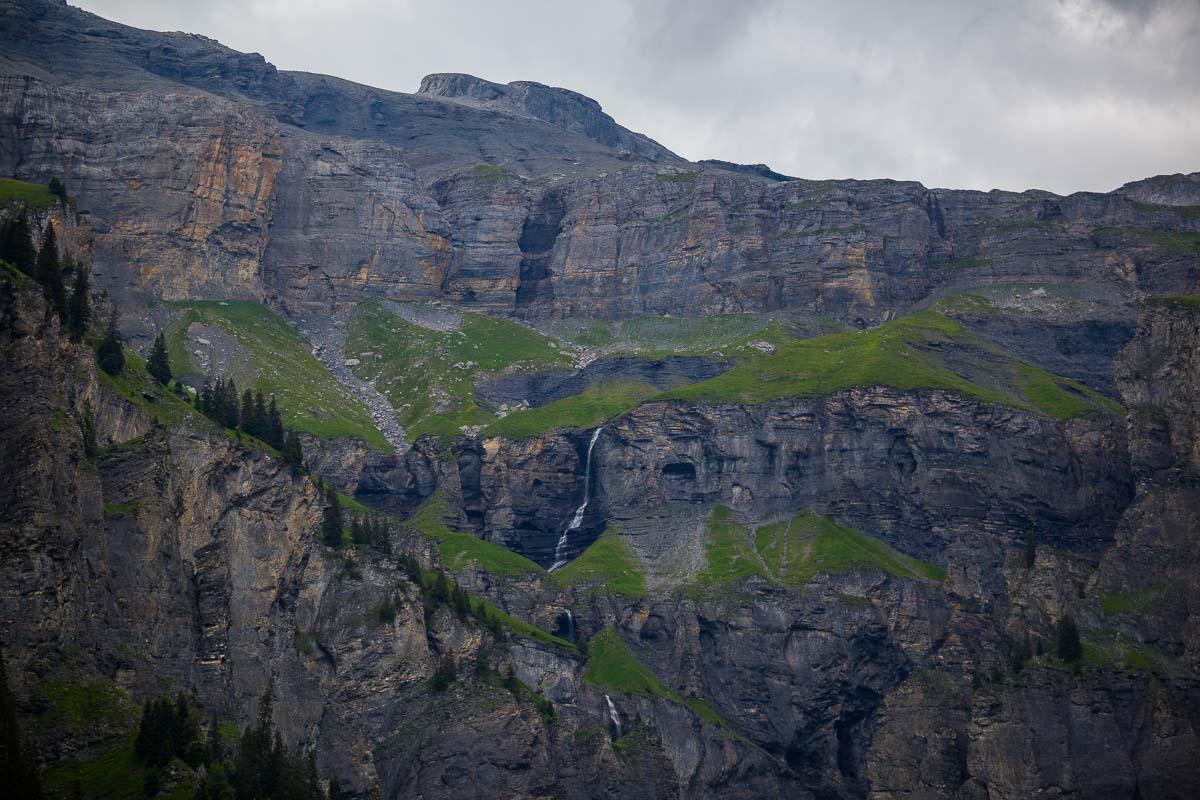
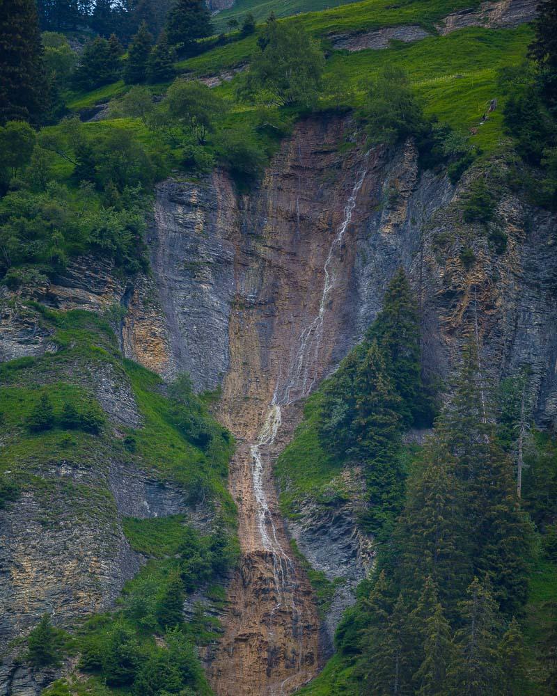
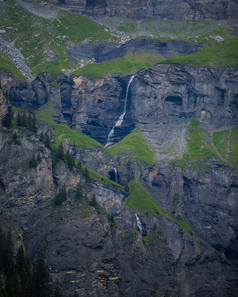
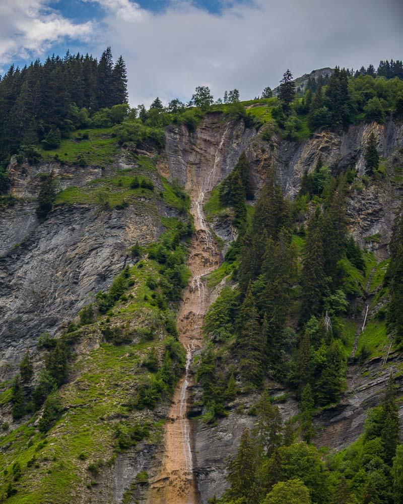
The piste follows the Giffre des Fonts river, that you can see below in the gorges. There are also several waterfalls along the way, right next to the trail.
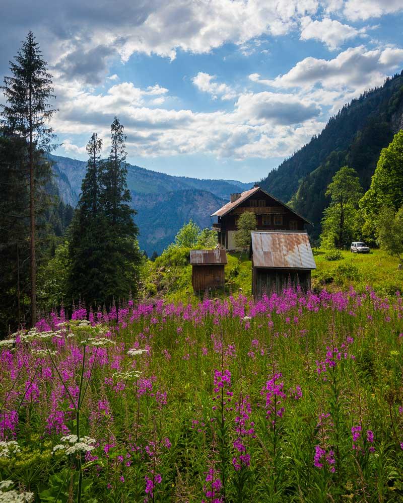
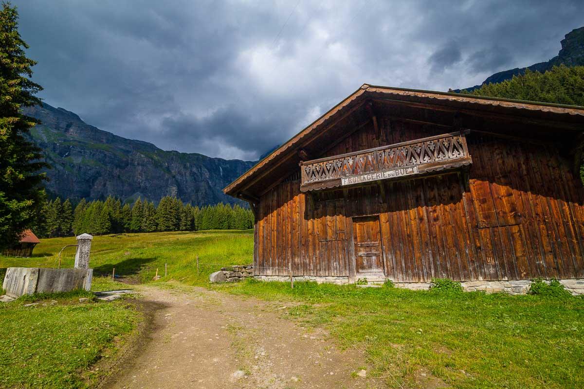
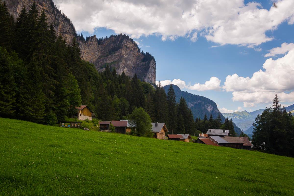
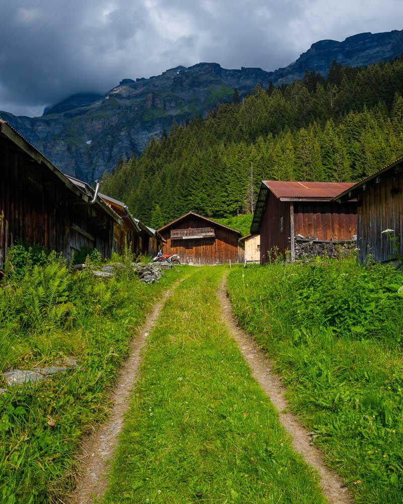
And finally, we sense the end of the hike. The route gets steeper, and climbs in switchbacks to the top. We get to the first building overlooking the valley, the Nid d’Aigle (eagle nest), built in 1858.
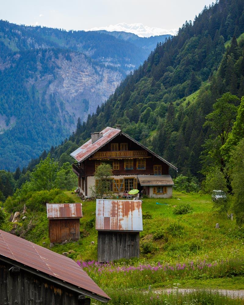
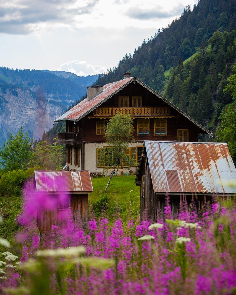
Right up the path from the house is the final destination, the Cirque des Fonts. A small village surrounded by high mountains, with several waterfalls in the distance.
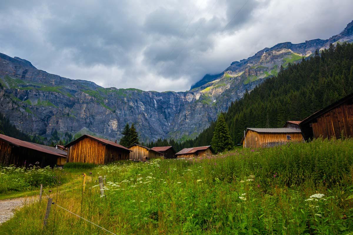
Right on the edge of the village stands the Refuge des Fonts, the local mountain refuge. We didn’t plan to stay there overnight, but it would have definitely made for a great home base to explore the area.
We sat down at one of the picnic tables in front of the refuge, and stayed there for a while, simply taking in the view and enjoying the peace & quiet up there in the mountains.
I got a nice hot coffee from the refuge, ate some of the cashew nuts I had left in my bag, and we were ready for the return hike! The way back was pretty easy, as it was 90% downhill. We got back to the car, and drove a short 2mn to get to the amazing Cascade du Rouget, right on the side of the road.
Stay in the Refuge des Fonts
The Cirque des Fonts is home to the refuge des Fonts, one of the most easily reachable mountain refuges in the area. It’s a good place for an overnight stay, and a good home base for various hikes in the area.
You’ll need to call the refuge in advance to book your stay. Here are all info about the refuge:
Opening times: from 13th June to 20th September
Night: 13€ per person
Night + dinner + breakfast: 42€ adults, 32€ kids
Payment: checks, cash
Phone: +33 4 50 34 12 41
Website: Les Fonts
Visit Haute-Savoie
Planning your trip to Haute-Savoie? You’ll find below a few other travel guides & key spots to see in the area.
Best hikes around Annecy:
Great outdoor destinations near Annecy:
The BIG guides:
I hope you enjoy your trip to Annecy and to France; if you have any questions, let me know in the comments below, I always reply.
Help a fellow traveler and share this guide with the buttons below!
Travel Tools
Use any of our recommended links below to book your trip. You pay the same, and we earn a small fee; a great way to support us!