Randonnée Lac de Pormenaz – Hike in Passy (complete guide + map)
The Lac de Pormenaz is a mountain lake in Passy, Haute-Savoie.
To reach the lake, you’ll need to hike for 2h in the mountains, climbing ladders & using steel cables. You’ll reach a pristine area surrounded by the Pormenaz mountains & the Rochers des Fiz.
Let’s see how to reach the lake!
Where is the Lac de Pormenaz
The Lac de Pormenaz is located in Haute-Savoie, in the Passy area. It’s located on the south eastern part of the department, next to the border with Switzerland.
Location: Google Maps
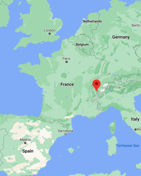
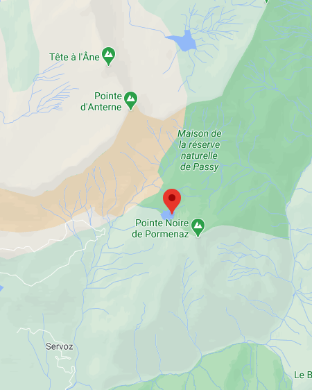
The lake is not far from the Sixt-Fer-à-Cheval area, and it’s only a short 30mn drive from Chamonix. It’s also close to another cool lake in Passy, the Lac Vert.
How to Get to the Lac de Pormenaz, Haute Savoie
You can’t just drive to the lake; it’s nestled high in the mountains, and you’ll need to hike to reach it.
The main hike starts from Plaine-Joux, or the nearby Lac Vert. You’ll need to get there first.
Here are the driving times from the main nearby spots:
- from Chamonix: 30mn
- from Geneva: 1h10
- from Annecy: 1h20
Head to Passy, on the A40 highway. Once in Passy, make your way to Plaine Joux, towards the Passy Nature Reserve entrance. From there, it’s a short 4mn drive on the Chemin des Parchets that will take you to the Lac Vert, where you can start the hike to the Lac de Pormenaz.
You can park right next to the lake, in front of the Restaurant du Lac Vert. It’s a free parking lot, but there’s a limited number of spots available (around 50). In summer, it gets crowded pretty fast.
If it’s full, don’t worry. Go back to the huge parking lot you drove through at the entrance, and park your car there. Then it’s a short hike to the Lac Vert, and it takes around 20mn to reach it by foot (details below).
This adds 40mn to the Lac de Pormenaz hike, so make sure to come early to secure a spot at the Lac Vert parking lot.
Randonnée Lac de Pormenaz Hike Details
The hike starts in front of the Lac Vert, another gem in the Passy area.
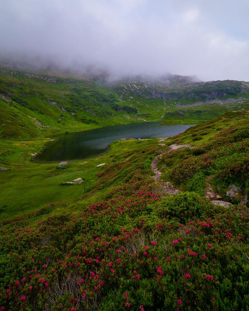
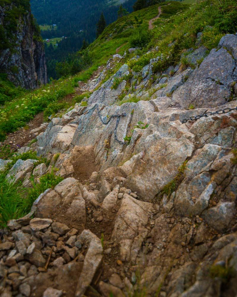
It’s starts with a slow climb, then it climbs fast on a portion with steel cables & ladders. The scenery is epic all along the hike, and the pristine area is full of local wildlife.
Here are the details of the hike:
Randonnée Lac de Pormenaz

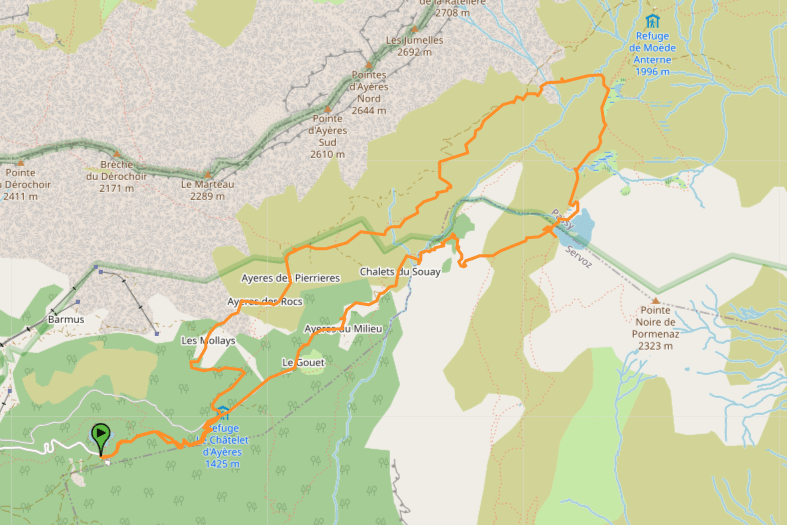
Hike distance: The distance of the hike is 13.5km / 8.4 miles including the return trip.
Hike duration: the full hike without stopping at the lake takes around 4h. Plan for 5h if you’re not a very experienced hiker, and around 6-7h with the stops at the lake
Hike elevation: with a total of 1,600m of elevation change (5,250ft), you’ll definitely feel your calves on this hike. It’s a steady incline at first, and then a very quick climb with ladders & cables.
Hike difficulty: I listed this hike as challenging for several reasons: it’s long, there’s a lot of elevation change, and there’s a tricky part with the climb on ladders & steel cables. You can avoid this tricky part by choosing another way, but it takes around 30mn longer to reach the lake.
Discovering le Lac Pormenaz
On my day out of Annecy for a day trip, I started the day by hiking to the Rocher du Vent above the Lac de Roselend.
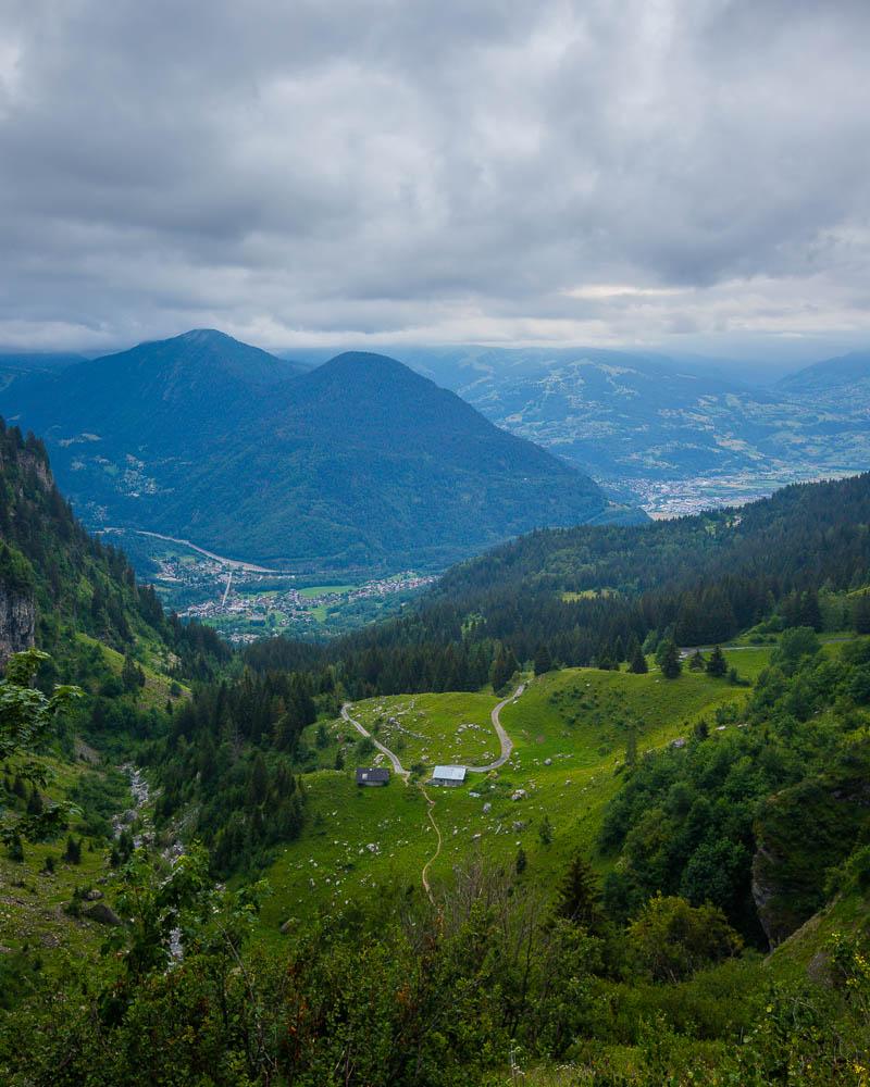
Around 1pm, I drove to my next location: Passy. I got there late afternoon, and first explored the Lac Vert, a beautiful emerald lake where you can literally drive right in front of the lake.
After taking a few photos and looking around, I was ready for the last hike of the day: the randonnée Lac de Pormenaz.
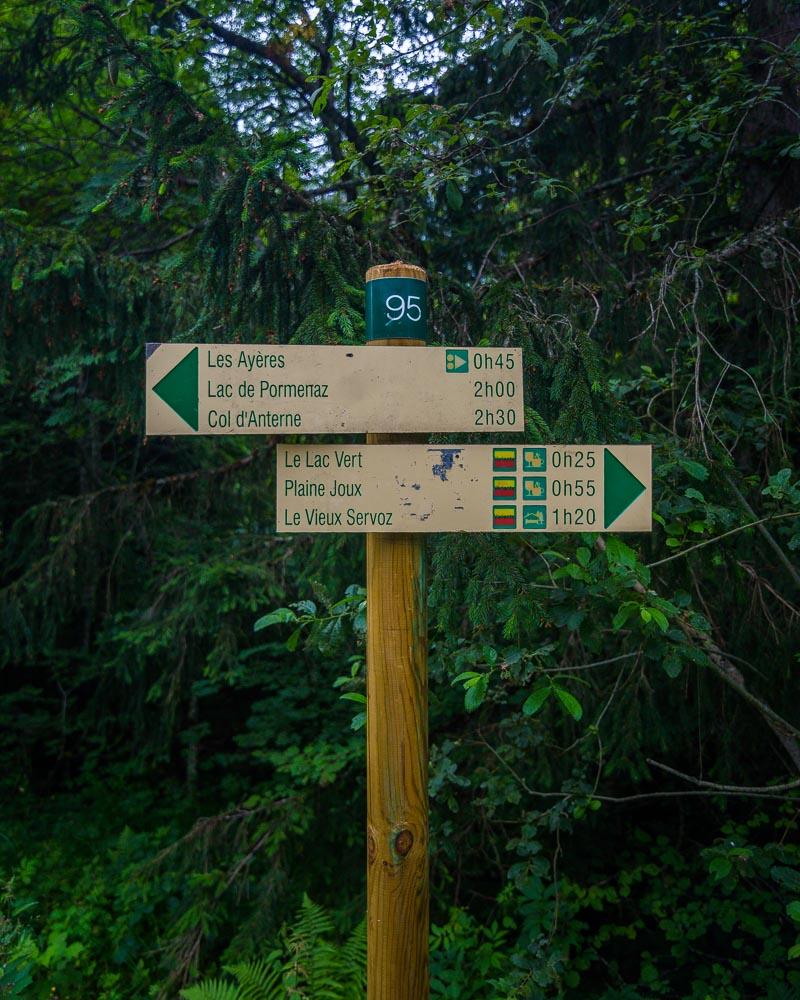
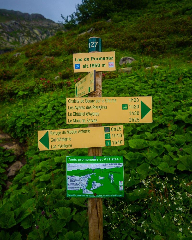
The hike starts right next to the Lac Vert, and I followed the first sign to the Châtelet d’Ayères.
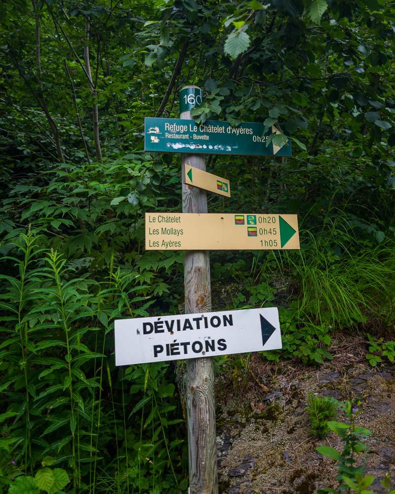
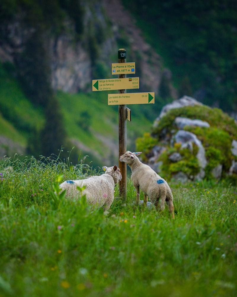
I quickly reached the Châtelet, and from there I saw the first sign pointing to the Lac de Pormenaz.
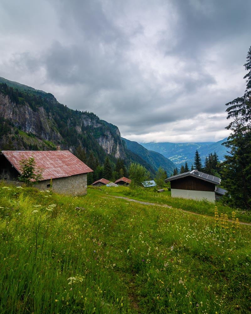
The first part of the hike was in the forest; after 20mn, I got out of the forest, on a rocky trail in the middle of the mountains.
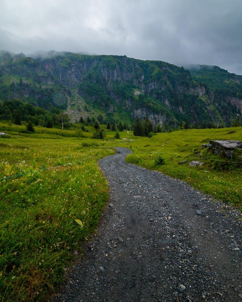
I was so blown away by the beauty of the landscape that I forgot to check my map. I actually took a wrong turn there, and I was lost for a while. Thankfully I had downloaded a hiking map before on my phone, and I was able to find my way back on the trail to the lake.
In the end, it turned out that I had just followed the longest way to the lake. It takes 30mn longer to reach the lake this way, as you don’t climb through the Chorde, which is the part with the ladder & steel cables. This is where you’ll hike on the way back if you follow the hiking map I’ve put above.
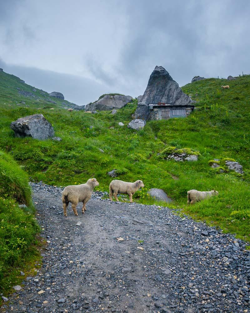
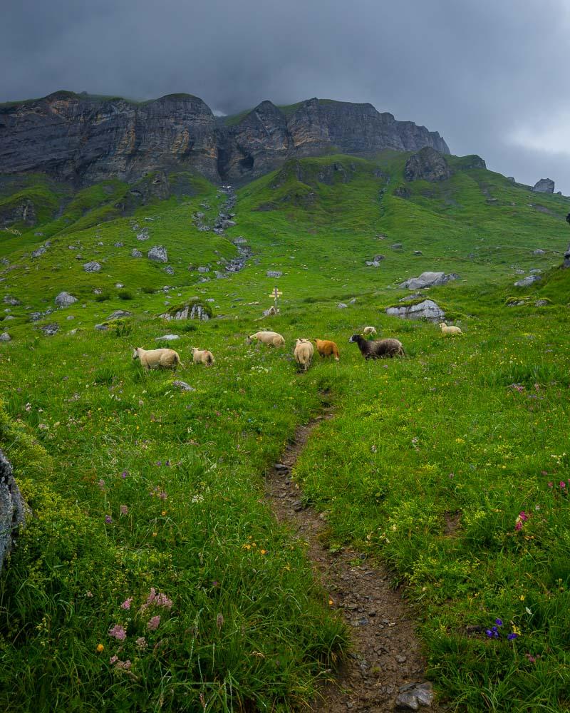
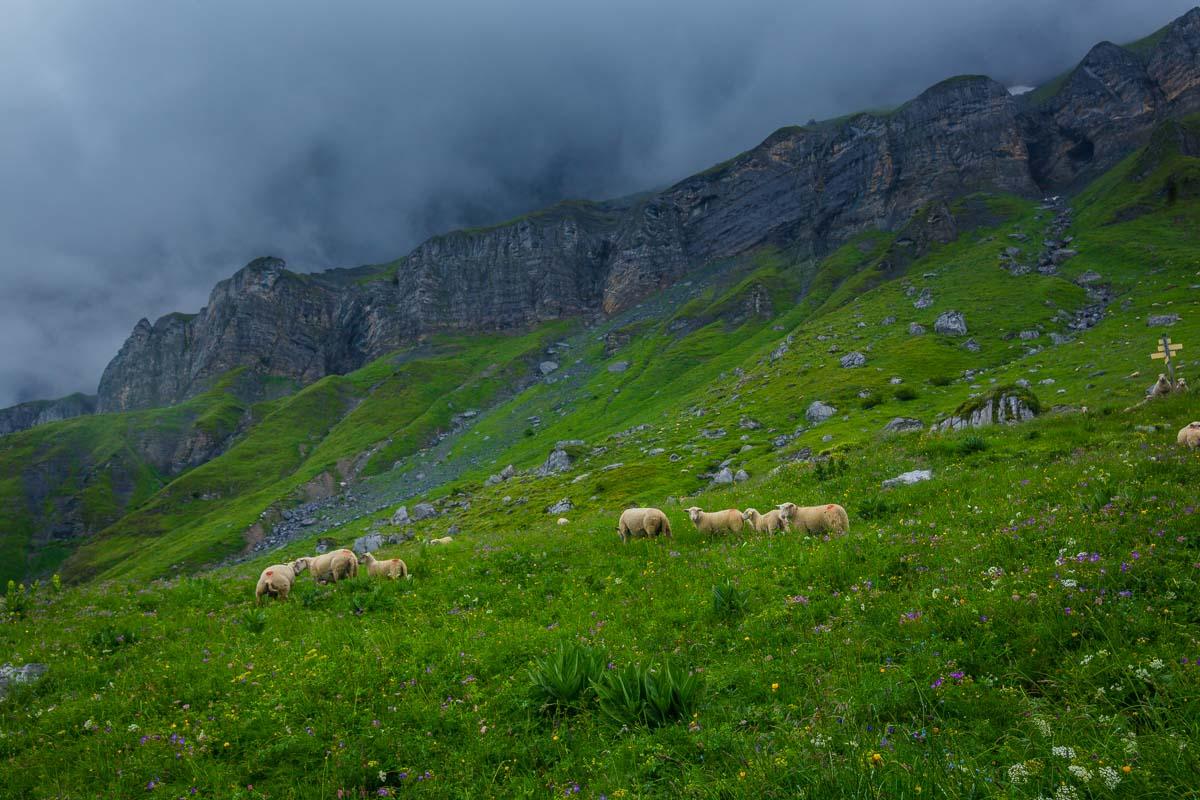
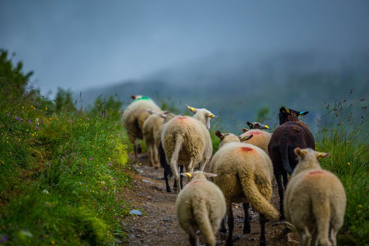
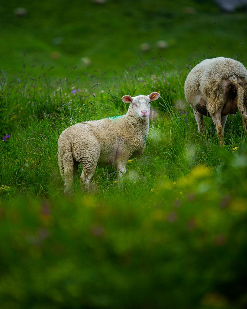
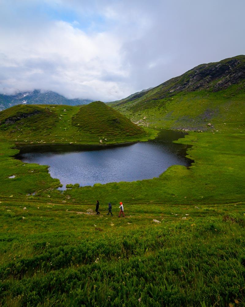
This other side of the trail got me to a place inhabited by local sheeps, and I had fun walking among the sheeps for a while on the trail. I followed the flock for a while, and eventually got to a sign. I was relieved when I read “Lac de Pormenaz” on that sign, only 55mn away!
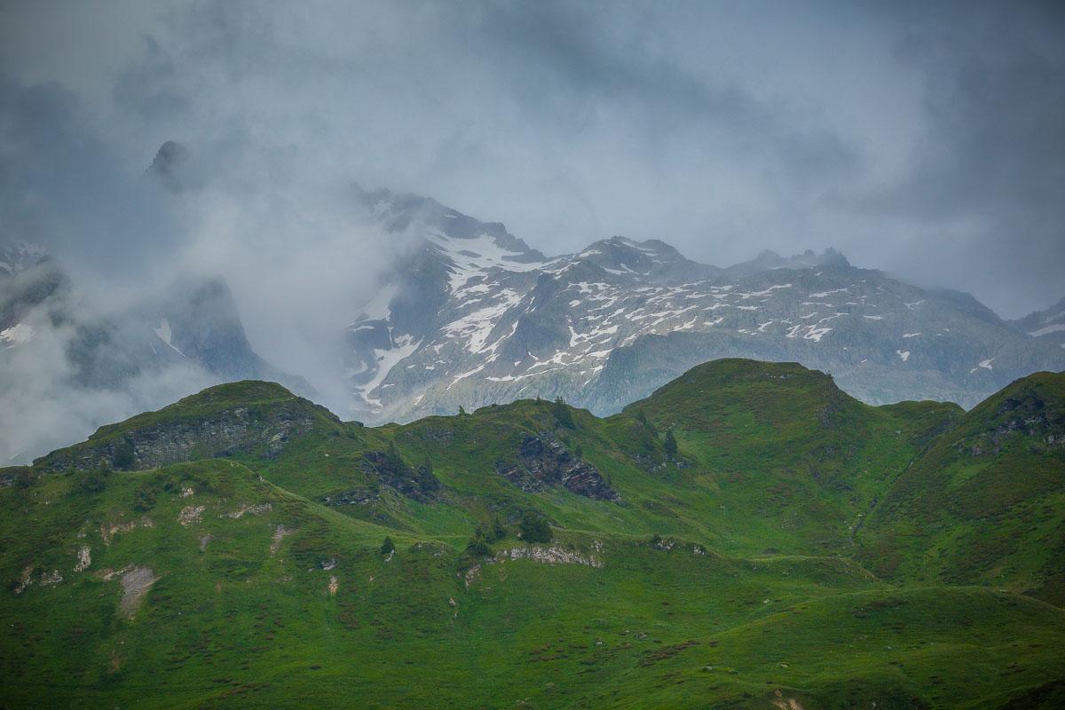
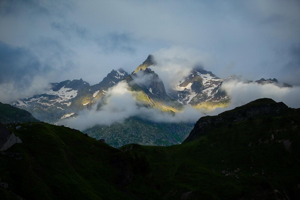
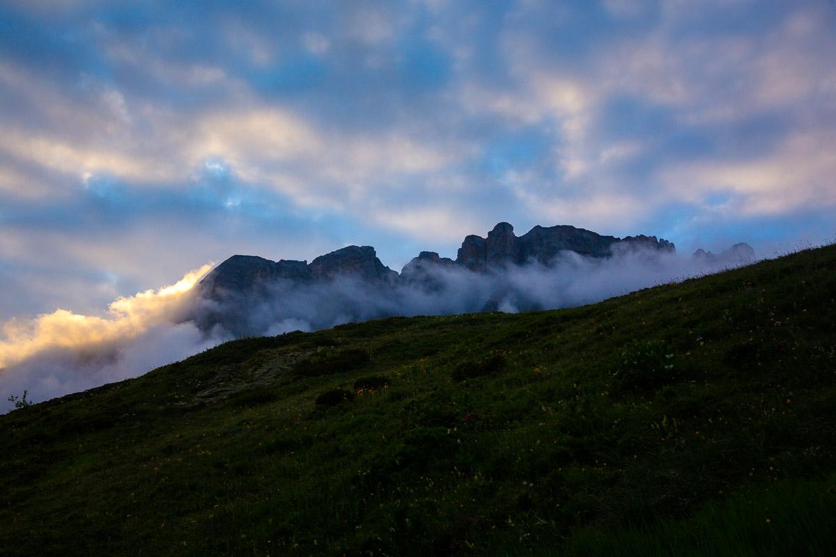
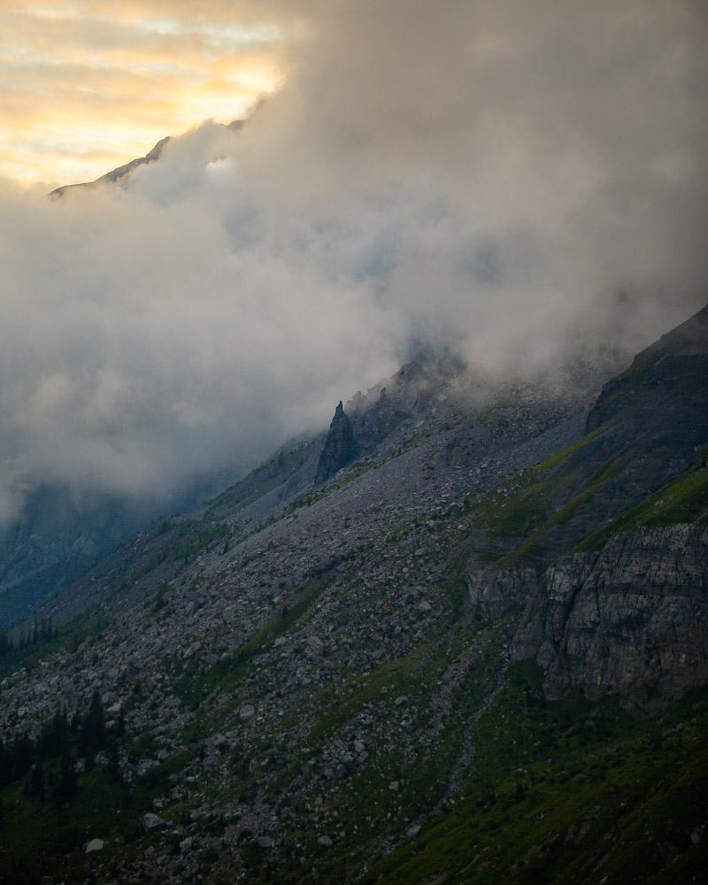
It was already 7pm, and the light was beginning to fade already. I hurried up on the trail, watching in awe as the evening light hit the snowcapped mountains in the distance.
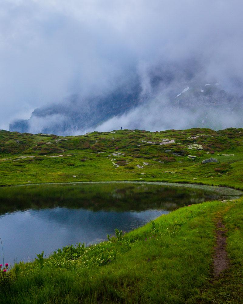
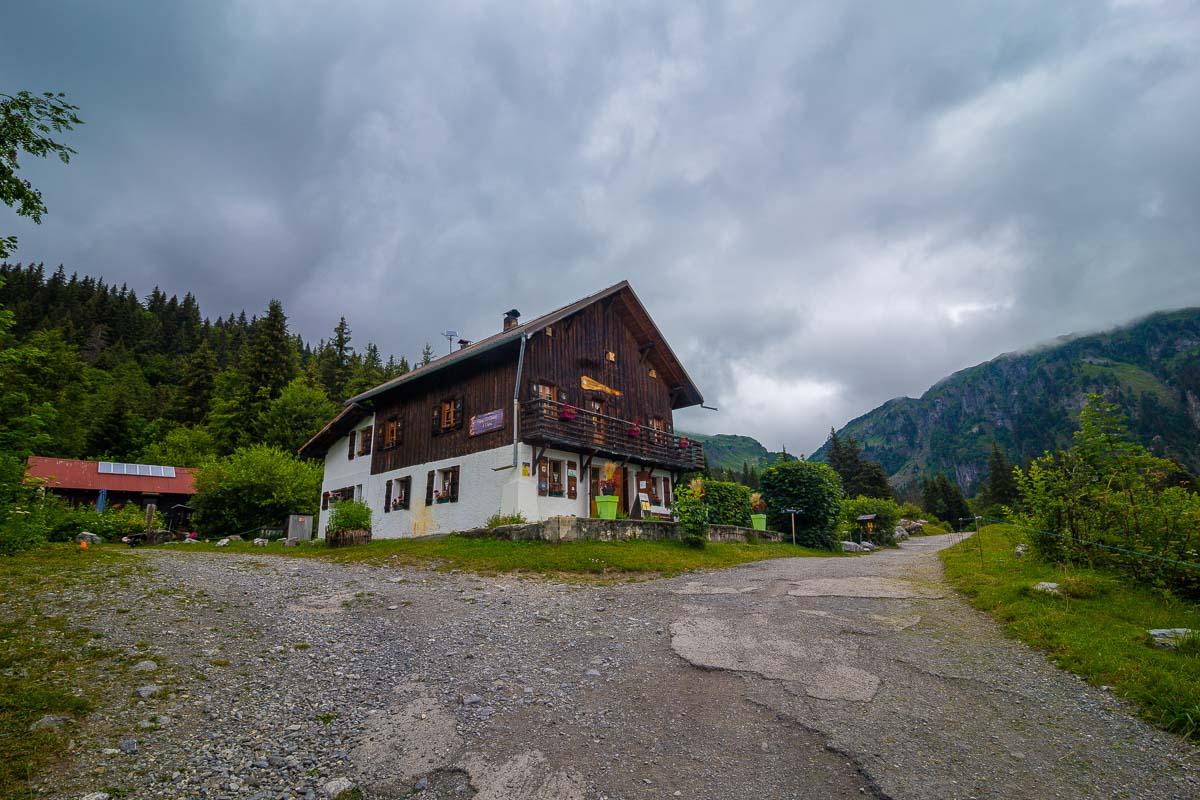
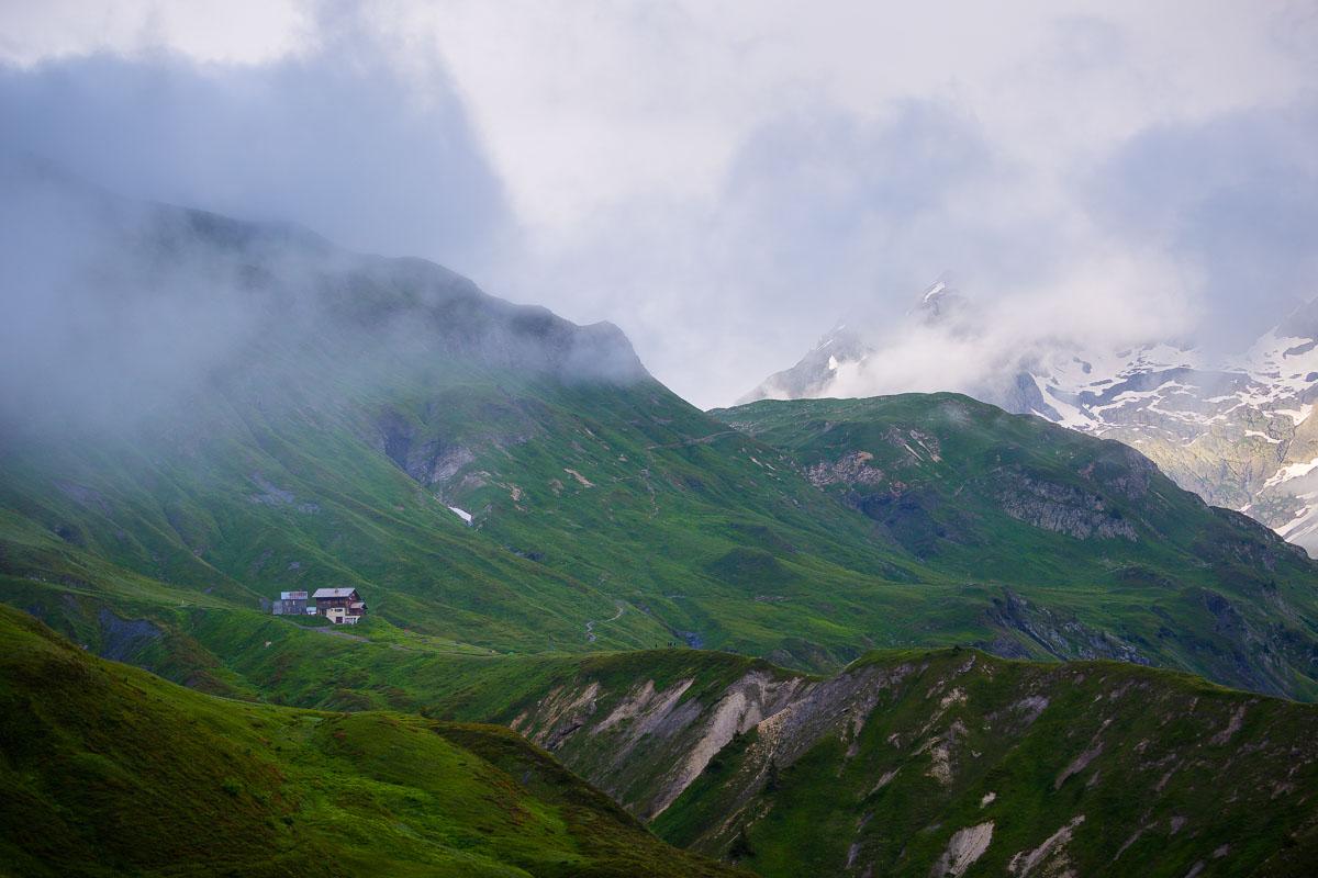
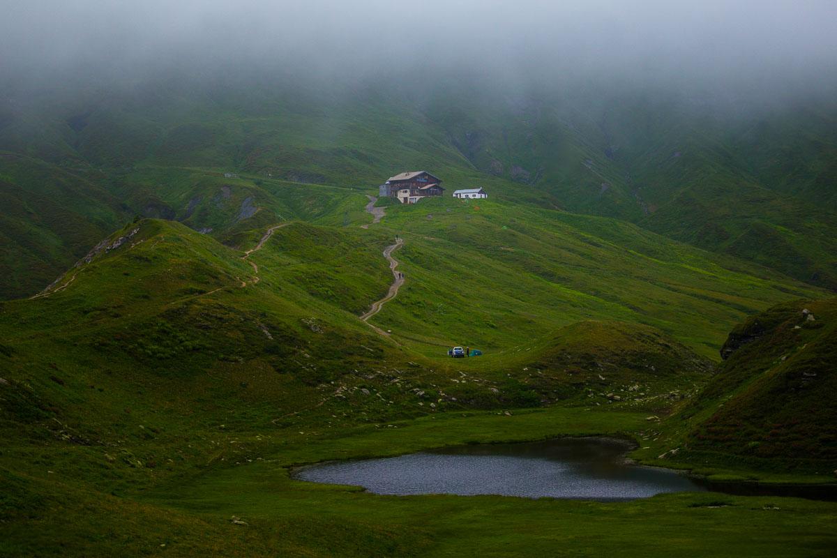
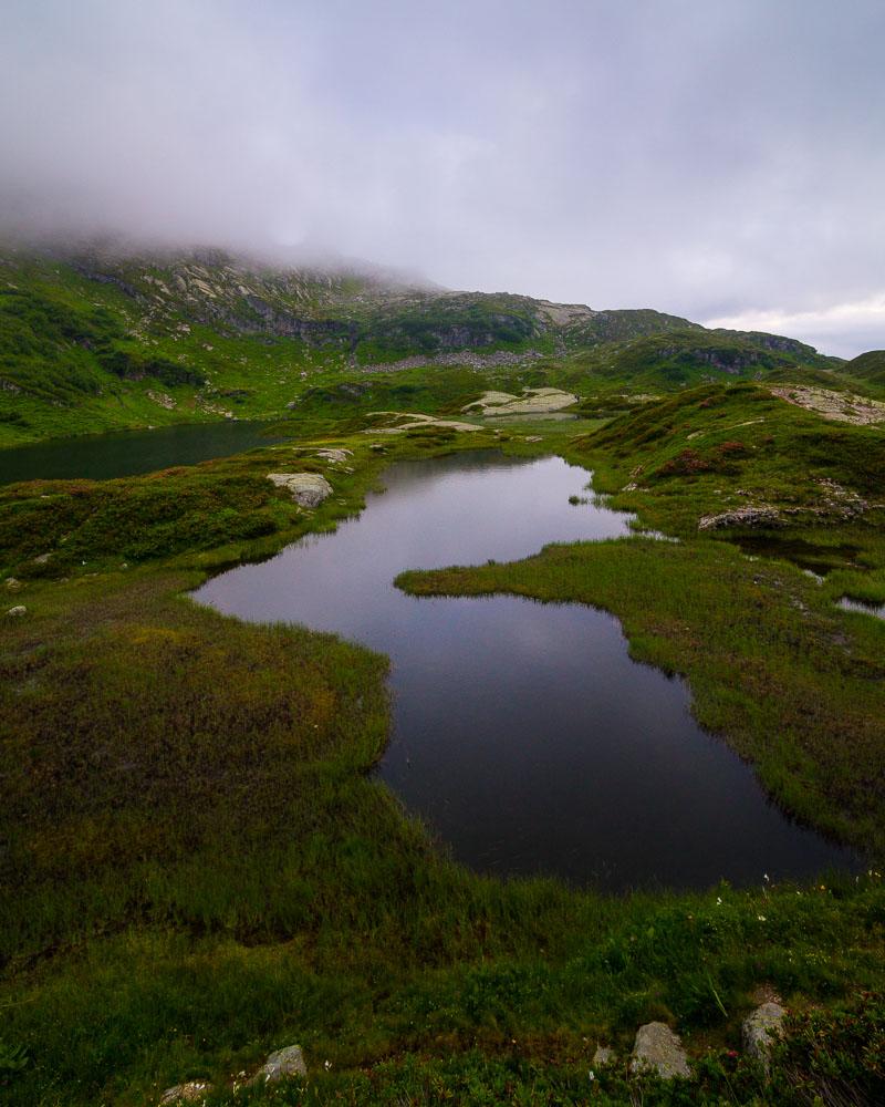
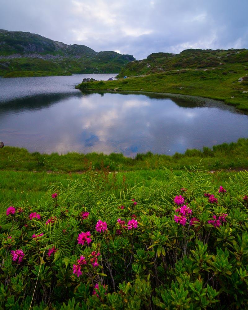
And then, only 15mn after the last sign, I saw a refuge in the distance: the Refuge de Moëde Anterne. The refuge is close to the Lac de Pormenaz, so I knew I was almost there.
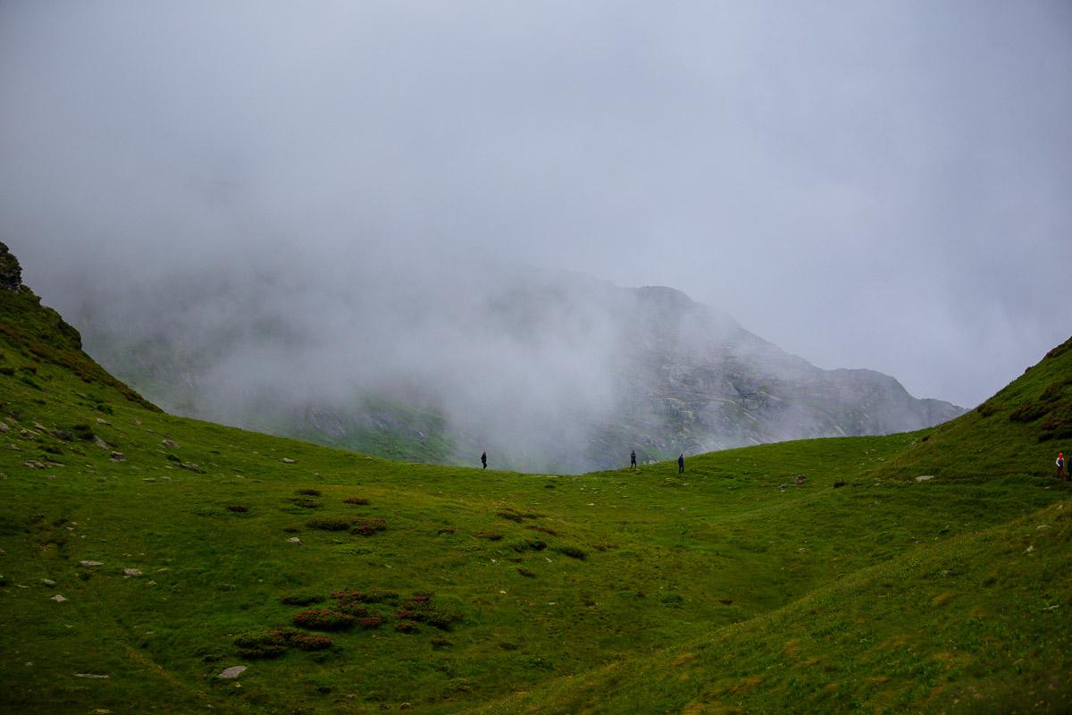
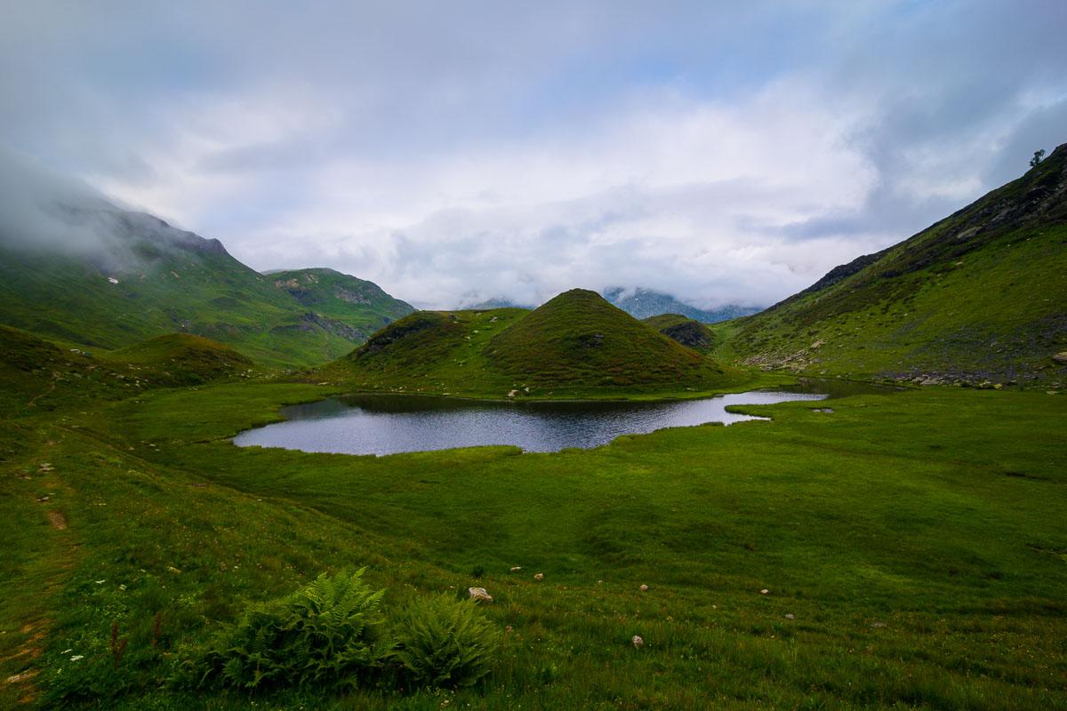
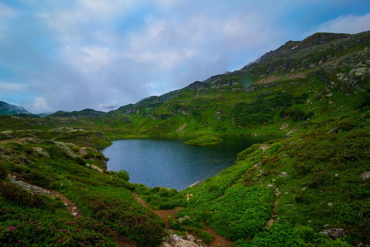
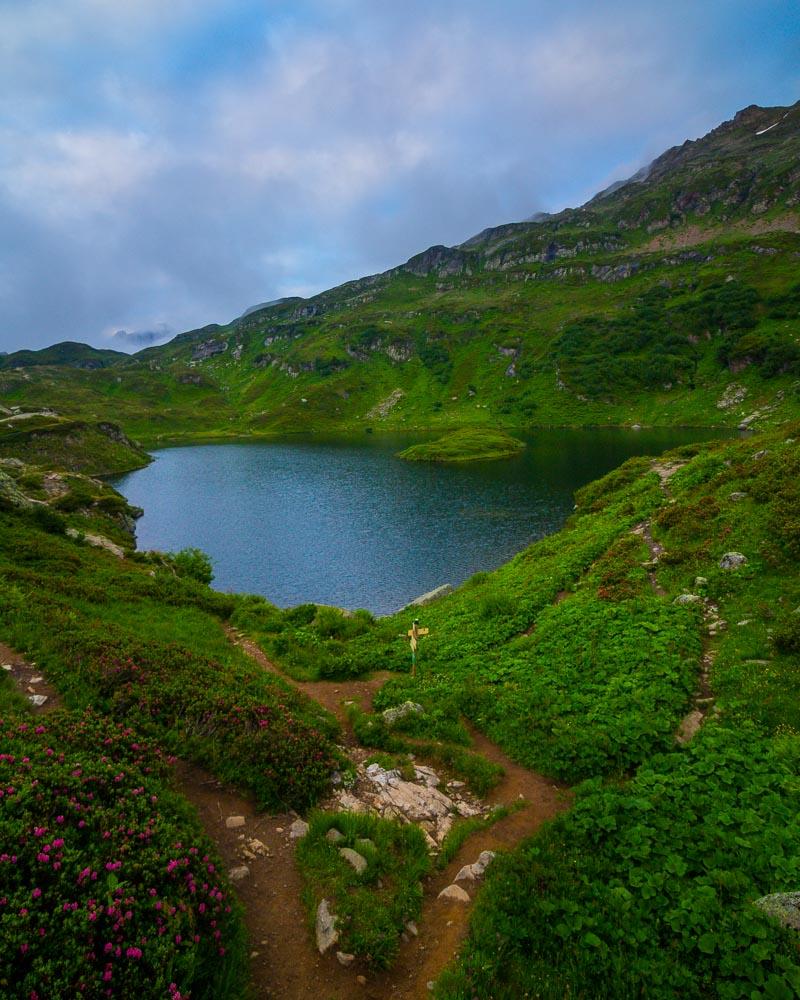
As I got closer to the refuge, I reached a first small lake, named Le Laouchet. It’s a small body of water, in front of the refuge. I finally saw some other hikers, after being alone in the mountains since I started the hike.
I followed the trail heading to the right, towards the Lac de Pormenaz. I was hurrying up as I wanted to reach the lake before it was completely dark outside.
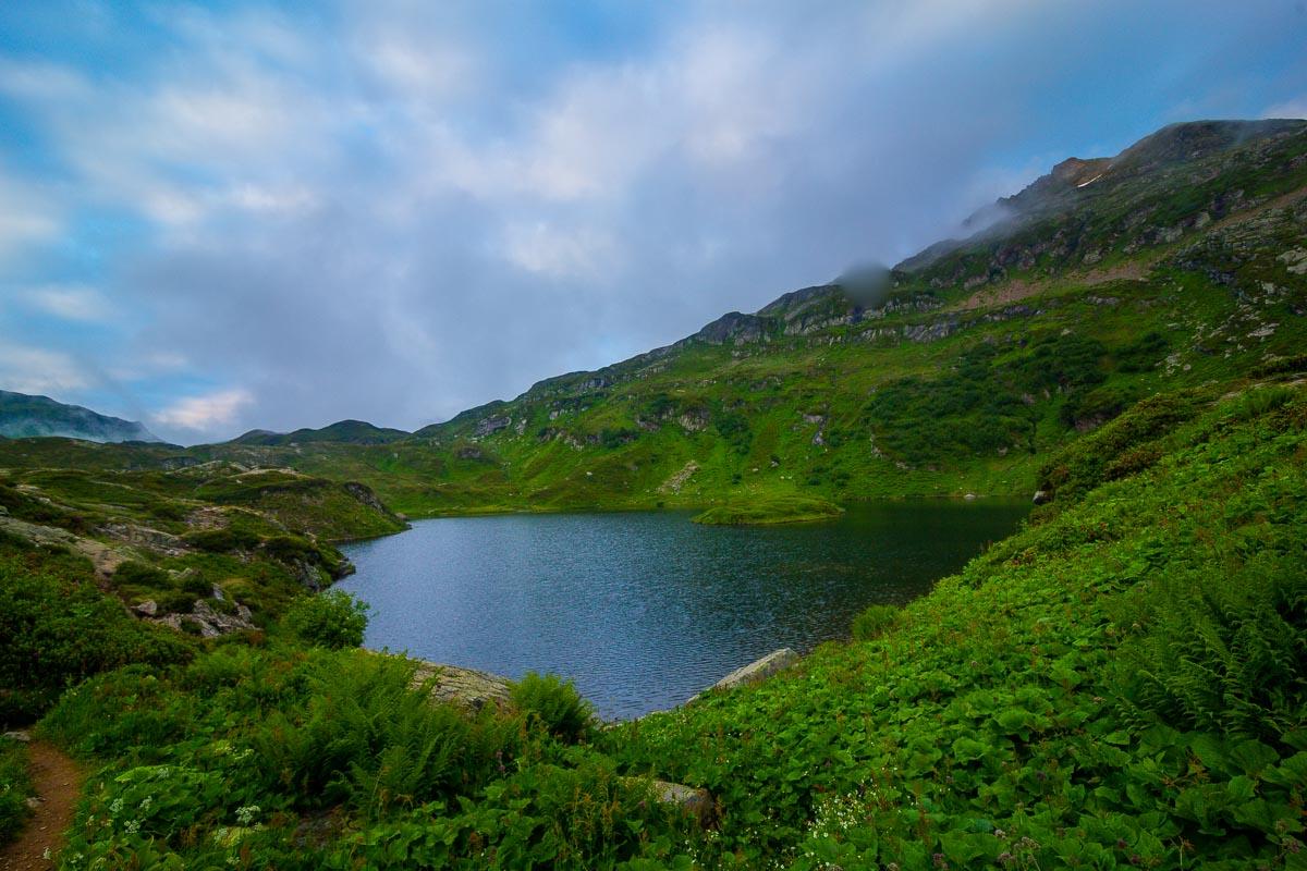
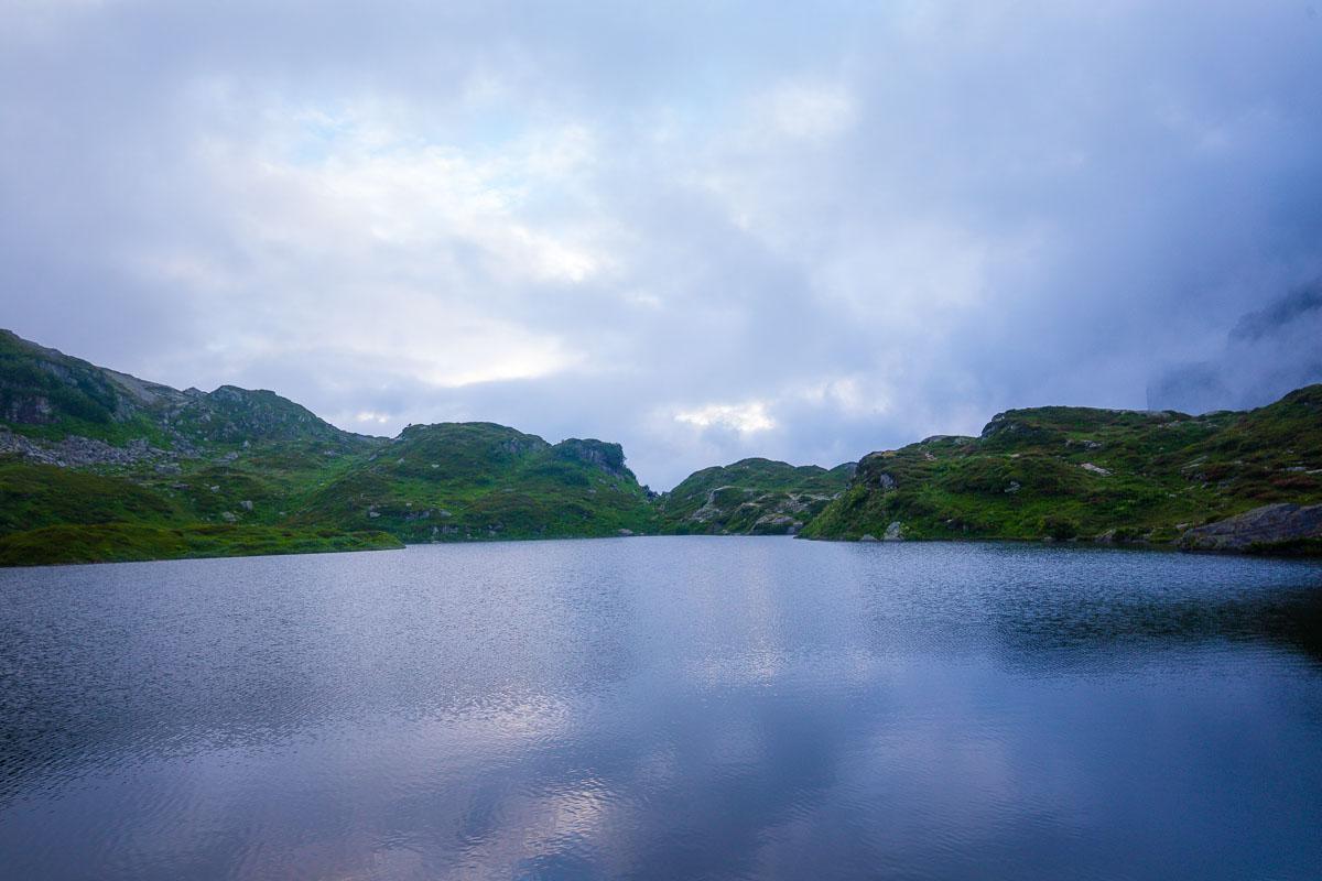
10mn later, I finally reached it: the Lac de Pormenaz.
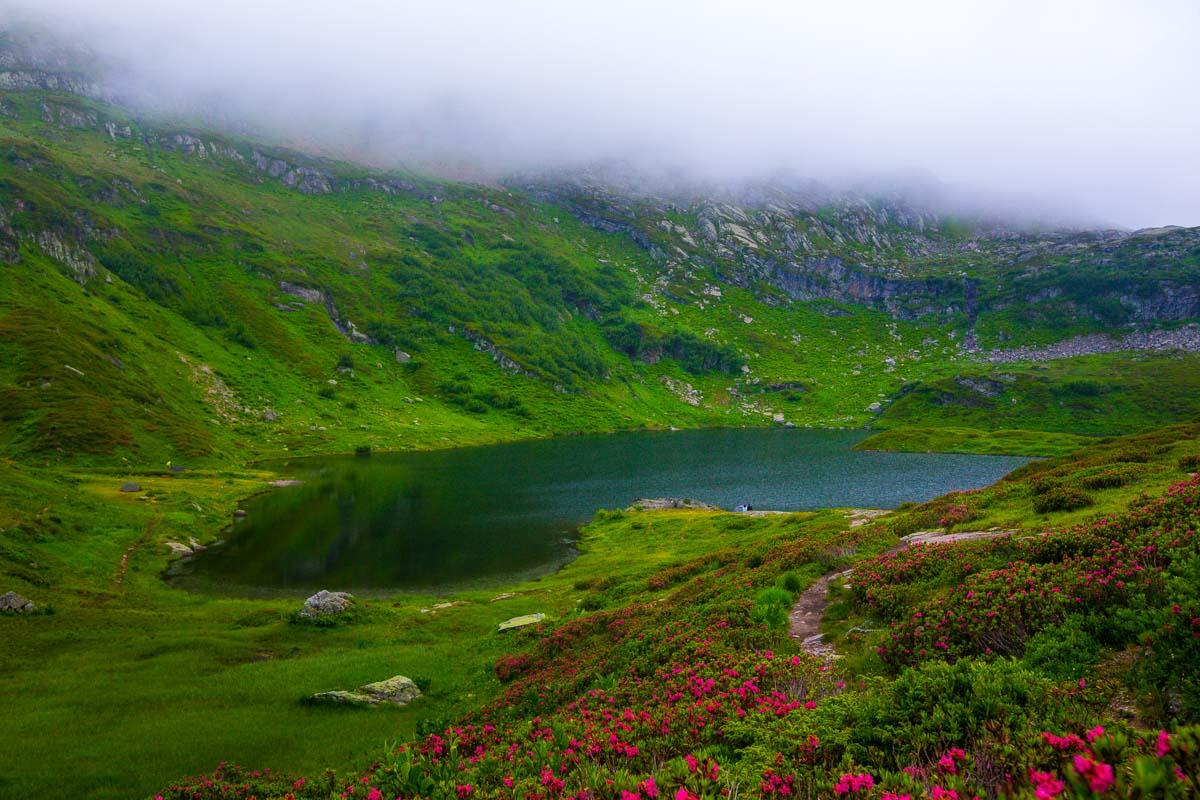
It was completely different from what I expected. All photos I had seen online of the lake were taken in sunny weather, without wind, and the lake was still. The mountains were reflecting in the lake, and you could clearly see the surroundings.
When I was there, it was a moody weather, with fog and wind, creating ripples on the lake and killing the reflection.
Don’t get me wrong though; it was a stunning sight to behold!
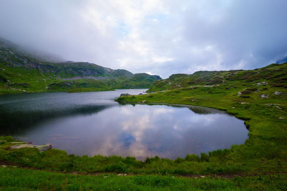
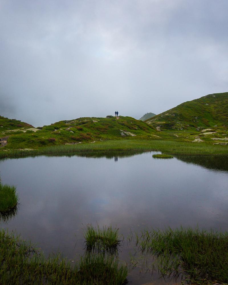
I walked around the lake, and got to what’s usually the first sight people get of the lake. There stands the Lac de Pormenaz sign, showing the way back home.
As I began to hike back down on the trail, it was already 8:15pm and the last light was hitting the tall ridge of the Rochers des Fiz.
I got down on the way I was supposed to take on the way up: the Chorde. This is the tricky part, with steel cables and ladders, where you quickly climb on the side of the mountain.
The night was setting, and I was going back down quickly; I didn’t take much pictures of the ladders. You can check it out in more details in the video below:
After this part, I watched the sun set over the valley for a couple of minutes, and even saw a magnificent ibex right next to me.
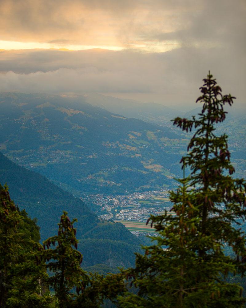
I put my camera back in my bag, strapped my bag securely on my back, and I ran all the way down to the car park. I got in my car as the last light disappeared, and begun the long 1h20 drive back to my hotel in Annecy.
Visit Haute-Savoie
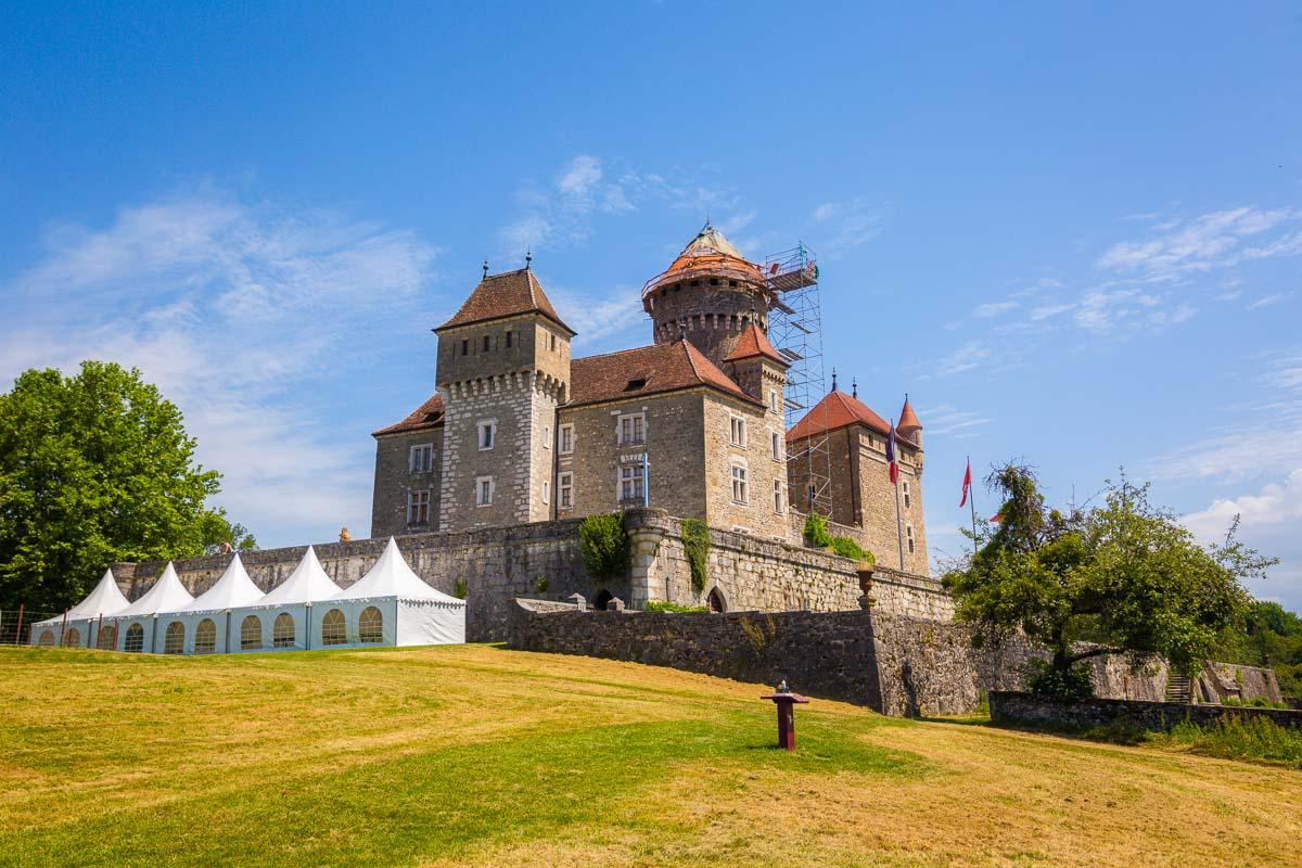
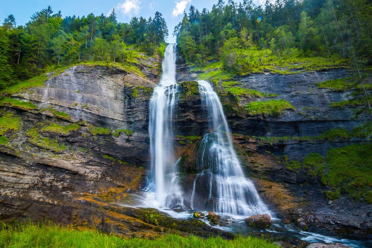
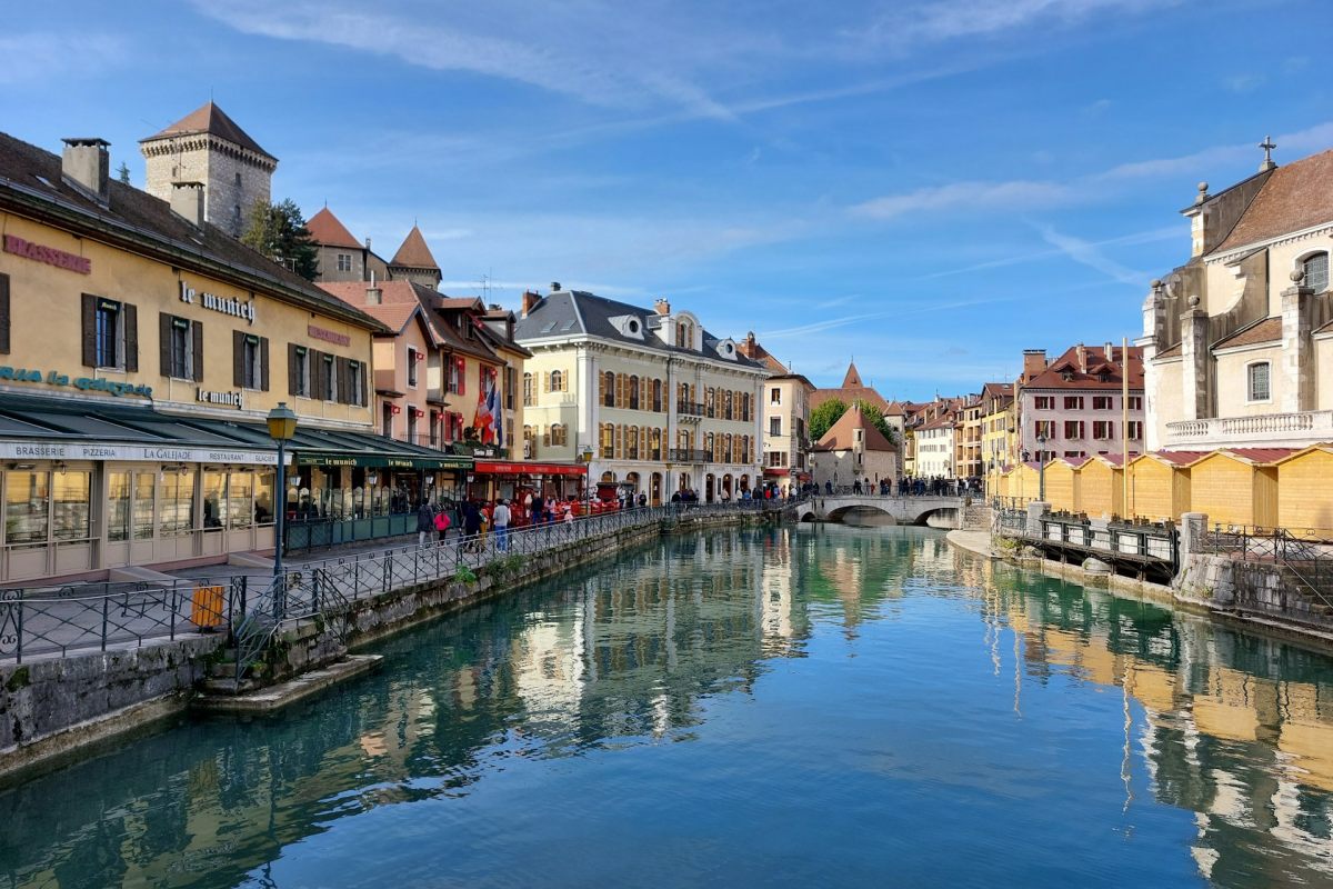
Planning your trip to Haute-Savoie? You’ll find below a few other travel guides & key spots to see in the area.
Best hikes around Annecy:
Great outdoor destinations near Annecy:
The BIG guides:
I hope you enjoy your trip to Annecy and to France; if you have any questions, let me know in the comments below, I always reply.
Help a fellow traveler and share this guide with the buttons below!
Travel Tools
Use any of our recommended links below to book your trip. You pay the same, and we earn a small fee; a great way to support us!

Pin this to Pinterest!
Enjoyed this guide? Then help a fellow traveler and pin it! They'll most definitely love you for it, 100% guarantee.