Randonnée La Tournette Hike in Annecy, France (complete guide)
La Tournette is the highest mountain around the Lac d’Annecy, at 2,351m (7,713ft).
The hike to the top is one of the best hikes in Annecy, but also one of the most difficult. It’s a true adventure to get to the summit, and it’s definitely not for the faint of heart.
Let’s see everything you need to hike La Tournette!
Where is La Tournette
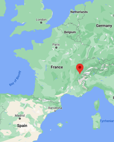
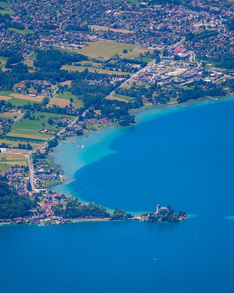
La Tournette mountain is located in Haute-Savoie, next to the Lac d’Annecy. It’s located on the south eastern part of the lake, around 50mn from Annecy city center.
Location: Google Maps
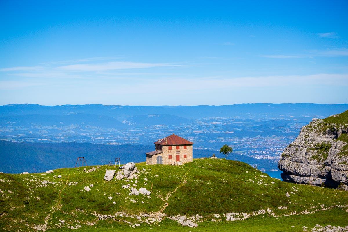
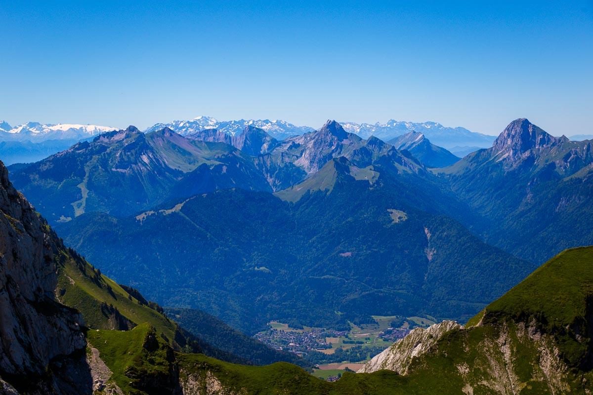
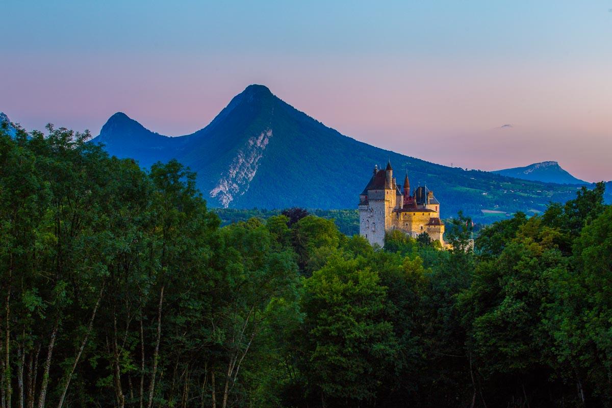
La Tournette is the highest peak of the mountains surrounding the Lac d’Annecy, and as such you can see it from almost anywhere around the lake.
It’s easy to recognize it from the little bump on its otherwise flat summit. This bump is known as “Le Fauteuil”, literally “The Armchair”.
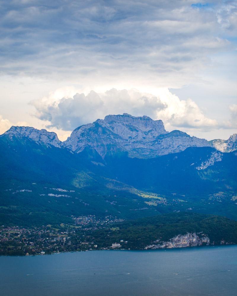
La Tournette seen from Sévrier
How to Get to La Tournette, Annecy
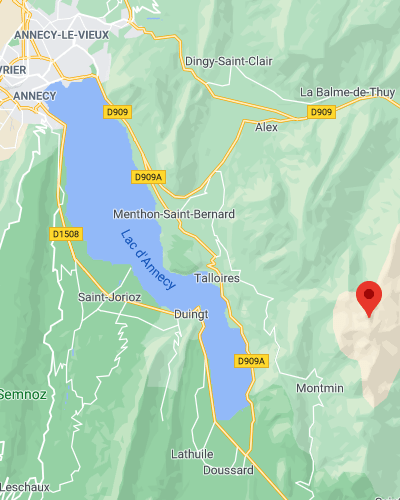
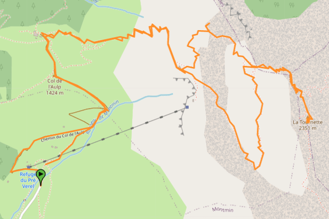
There are no buses going to La Tournette, and you’ll need a car to get to the start of the hike. From Annecy follow the D909 heading south east on the eastern shore of the lake, towards Menthon-Saint-Bernard. In Menthon, merge on the D42 towards the famous Col de la Forclaz (great view there!).
Drive through the pass, heading to Montmin. Just before reaching Montmin, you’ll see signs pointing to “Col de l’Aulp”, “Chalet de l’Aulp” and “Refuge du Pré Vérel”. Take a sharp left and follow the small road to the end.
There are 2 starting points to the hike:
Starting points
- Refuge du Pré Vérel: this is the regular starting point to the hike. It’s the end of the regular road, and there are plenty of spots to park your car on both sides of the road.
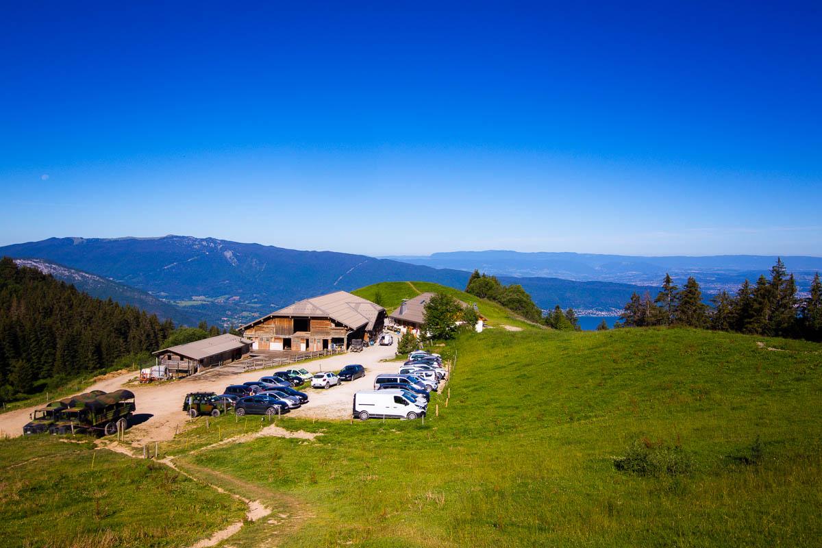
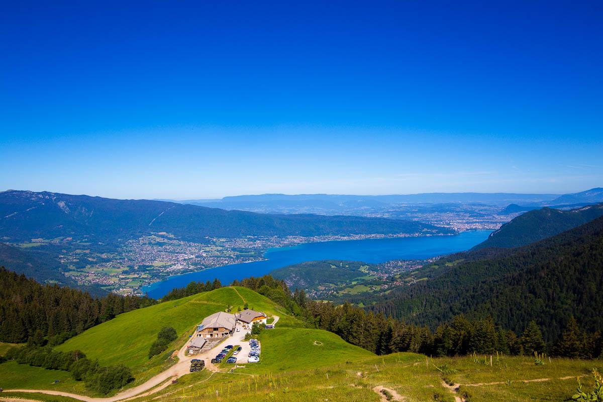
- Chalet de l’Aulp: this restaurant is located higher on the mountain, and you will reach it after hiking for 30mn if you start the hike from the regular starting point. While the regular road ends at the Pré Vérel, there’s still a road going to the Chalet de l’Aulp. It’s a rocky and dusty road, and you need to drive slowly and carefully, but you can definitely drive up there. I drove a Peugeot 307 to the top without any issue.
The parking lot at the Chalet de l’Aulp gets full pretty quickly, so you’ll need to get there early in the morning to get a spot.
Starting the hike from the Chalet de l’Aulp reduces the hike duration by 1 hour, and saves you 200m from the climb (656ft).
La Tournette Hike Details
The randonnée de la Tournette is definitely the hardest hike in Annecy, but it offers some of the most epic views of the lake and the surrounding mountains. It’s the highest mountain around the lake, and you’ll be above all other mountains when at the top.
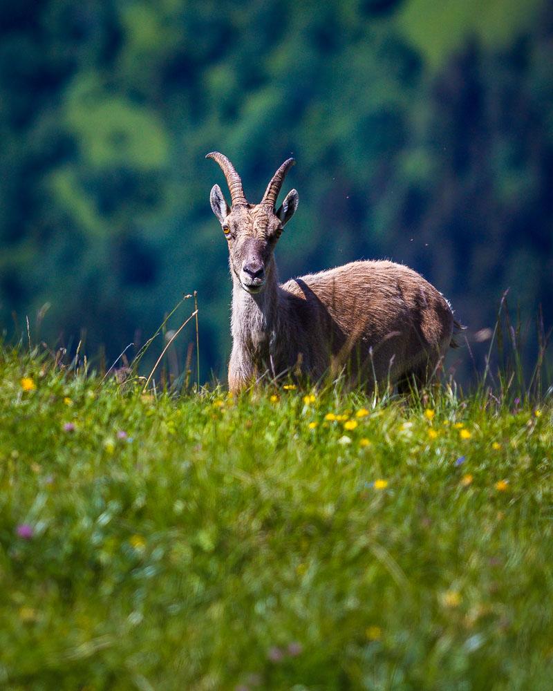
Special bonus, there are plenty of ibexes at the top!
Here are the details of the hike:
Randonnée la Tournette

Hike distance: The distance of the hike is 11.4km / 7.1 miles including the return trip.
Hike duration: If you simply go down & back up, it will take you around 6h for the full loop. If you’re not a experienced/regular hiker, plan for 8h including the stops at the viewpoints and rest at the summit.
Hike elevation: there’s almost no flat part on this hike, you’re always on a steep incline. A total 2,366m of elevation change (7,762ft), which you’ll definitely feel in your calves.
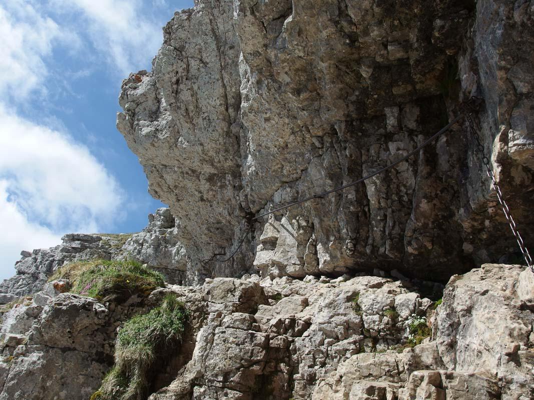
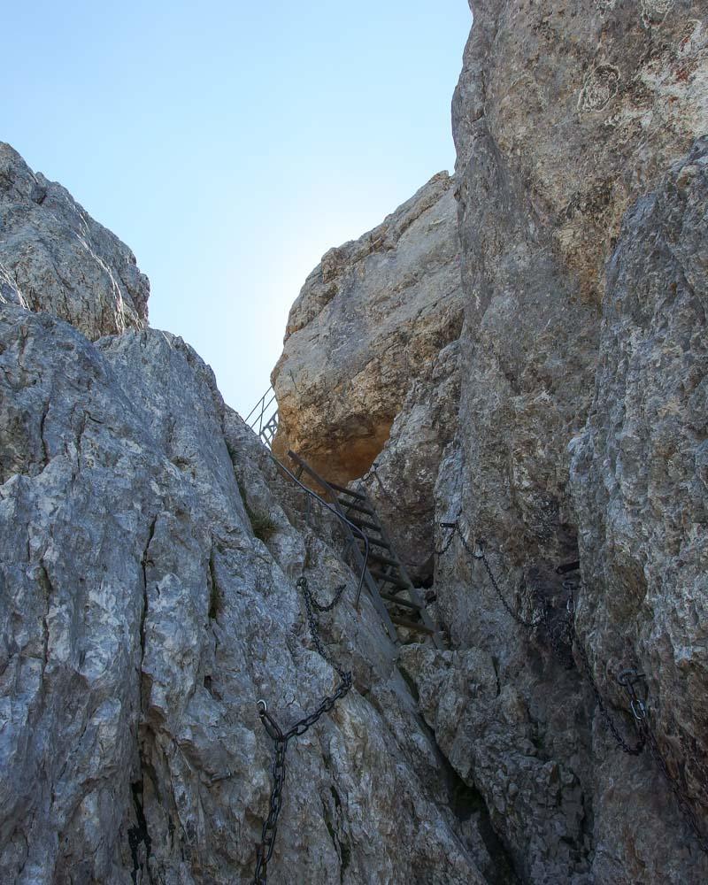
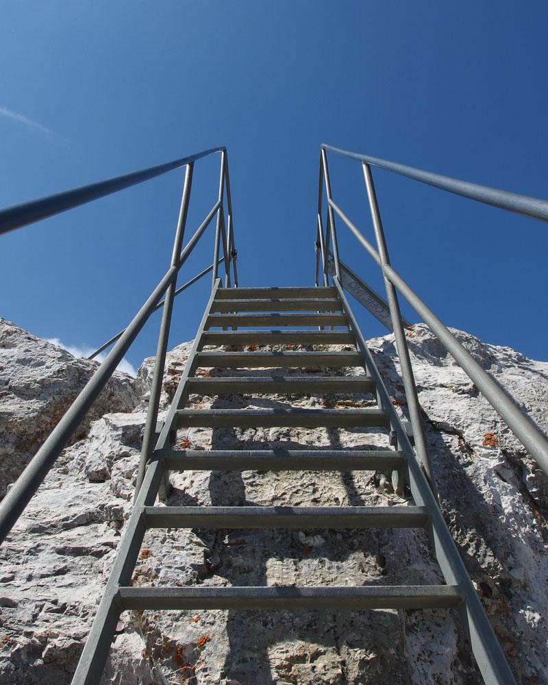
Hike difficulty: this isn’t a hike you just go on without any prior experience. It has a lot of elevation change, which requires a good physical condition. The incline is very steep on most of the trail, and there are several hard parts where falling isn’t an option. You’ll need to use your hands several times, and the climb to the summit ends with chains and a ladder. Definitely not recommended for kids or unprepared hikers.
Hiking the Randonnée de la Tournette
After a few days spent hiking in Jura, we drove to Annecy which would be our base for the rest of our trip. We got in Annecy around 2am, so it was only logical that we’d spend our first day in the city by just relaxing. We walked around the city, and visited the Basilique de la Visitation.
On the second day, we were ready to go hiking, and picked what seemed to be the most popular hike in the area: la Tournette hike.
We got a late start, but luckily thanks to Covid there wasn’t that much people around. I drove to the Refuge du Pré Vérel, and pushed my luck by driving on the rocky road to the Chalet de l’Aulp. Luckily there were a few spots left, even if it was already 9am.
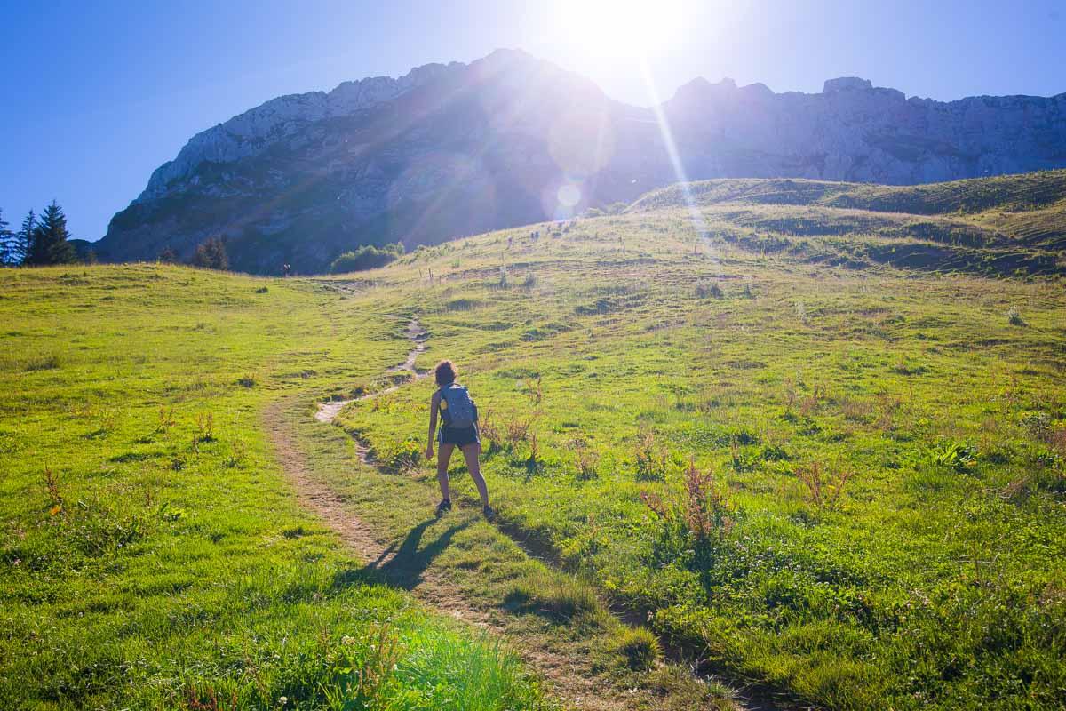
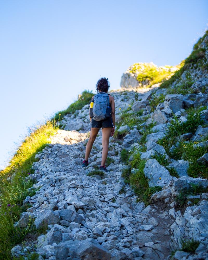
We prepped our bags, applied the obligatory sunscreen, and off we went! The hike starts right away with a steep climb, and at least you know what to expect for the rest of the hike.
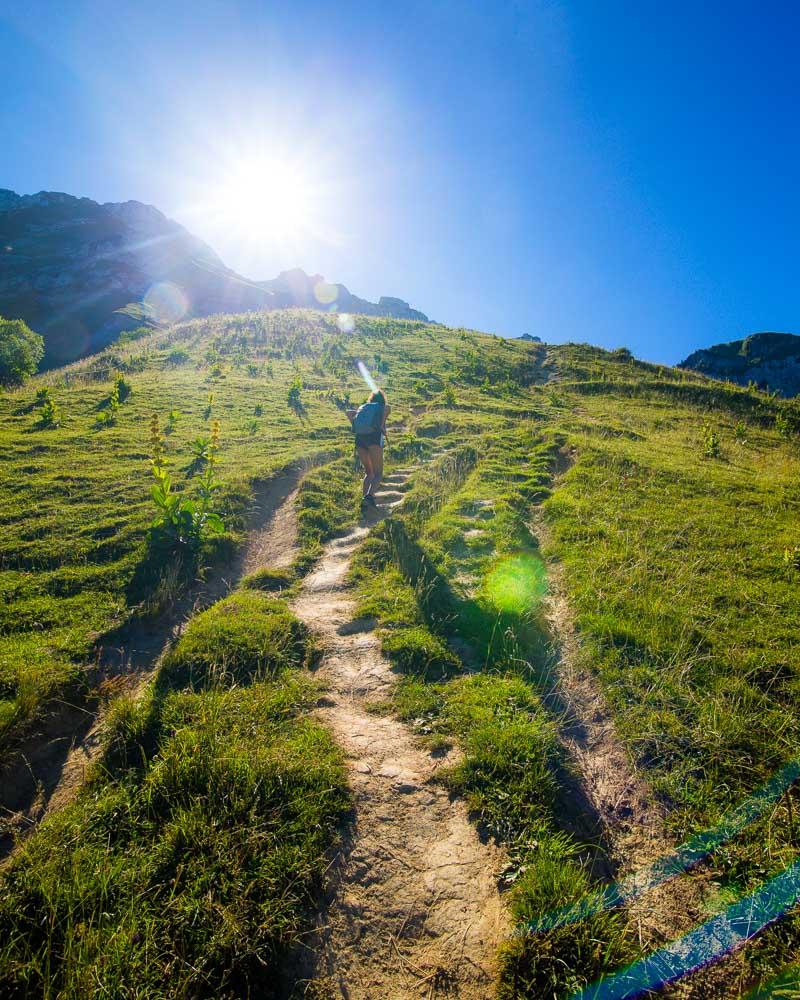
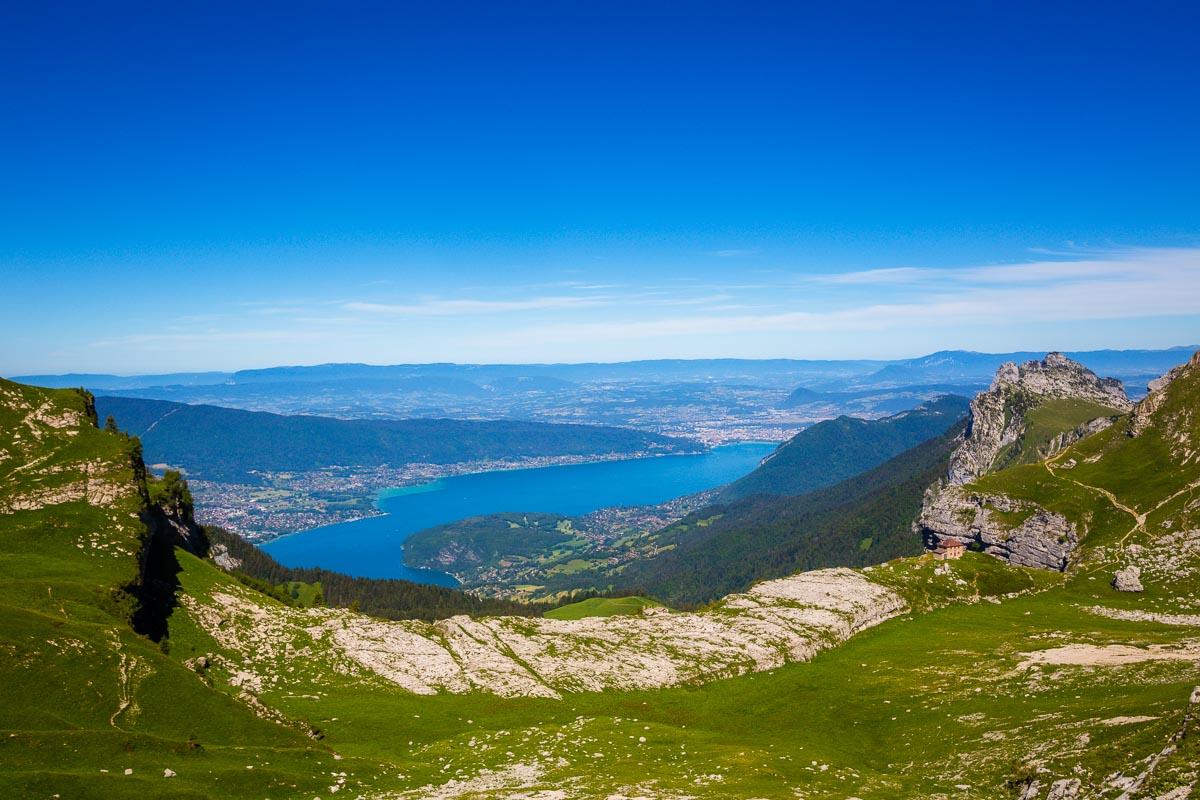
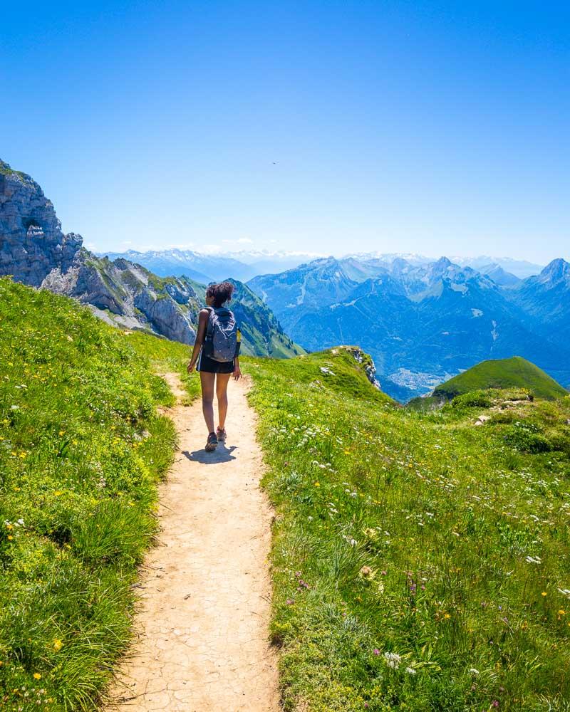
The hike just began, and we only climbed a few meters, but already we were getting beautiful views over the lake behind us.
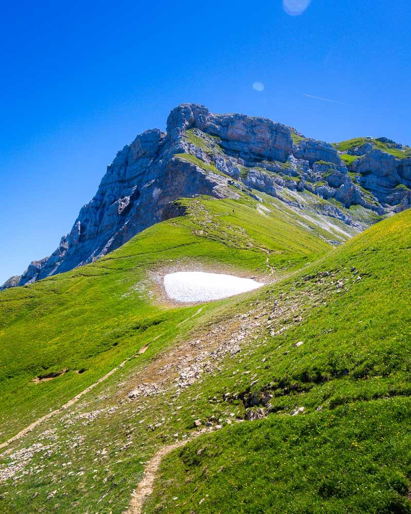
At the end of the first climb, around 1h in the hike, the dirt trail turns to loose rocks. The trail is on the side of the mountain, and we got to a very short flat section with a great view.
We didn’t stay too long there even though we’d have love to, because the sun was already hitting hard. We resumed the climb, and crossed to a small depression. There we passed by the Chalet du Casset, an abandoned shelter, and hiked down a bit to the first stop along the hike: the Refuge de la Tournette.
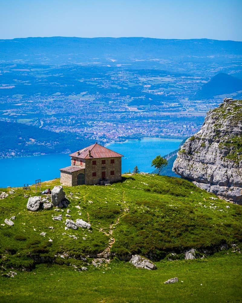
The Refuge de la Tournette is closed too, but it remains one of the landmarks on the hike. After the refuge (around 1h30 in the hike), the real climb starts.
I’m pretty sure this wasn’t the regular trail, but we cut through the loops and climbed straight up on the rocks.
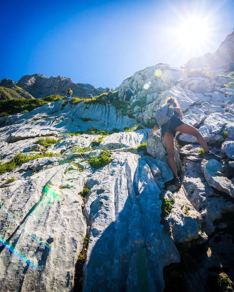
The climb from the refuge took us around 1h. We took a break where we found a small shaded spot on the trail, enjoying the view and mostly resting a bit before resuming the climb.
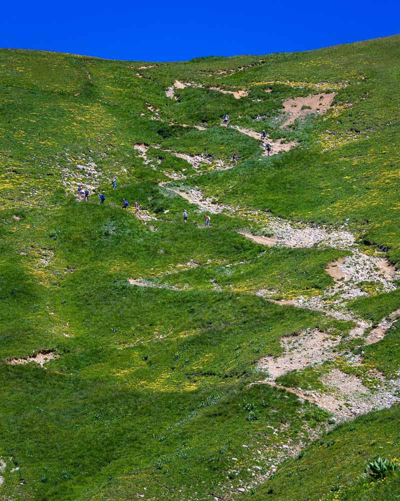
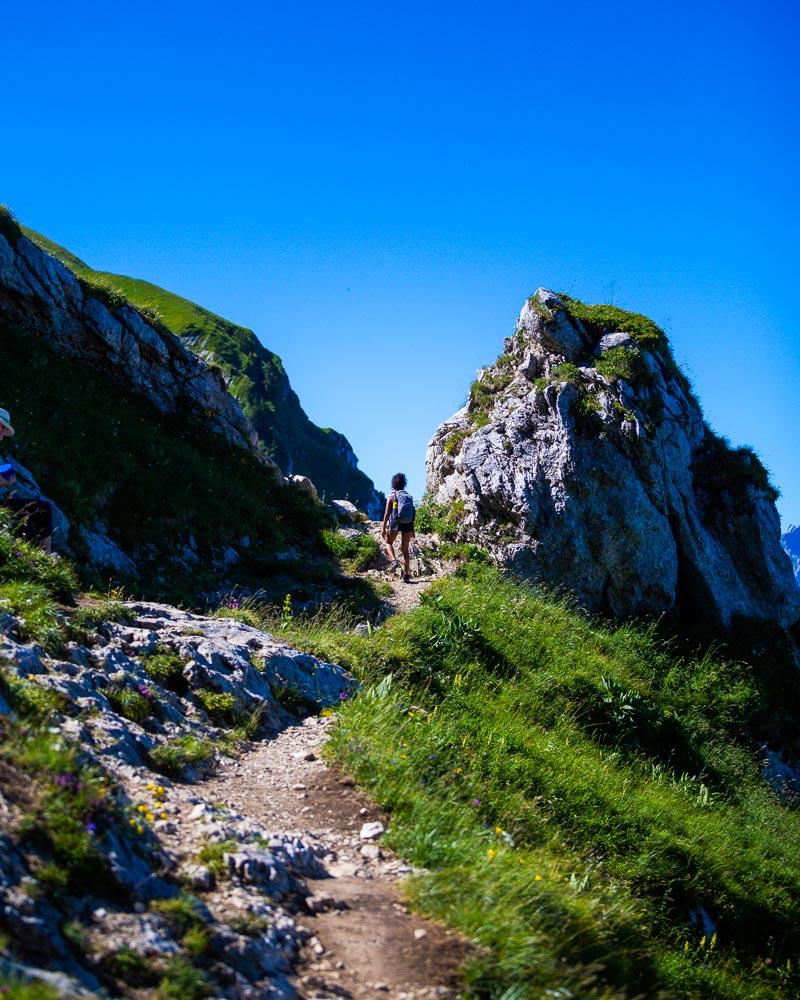
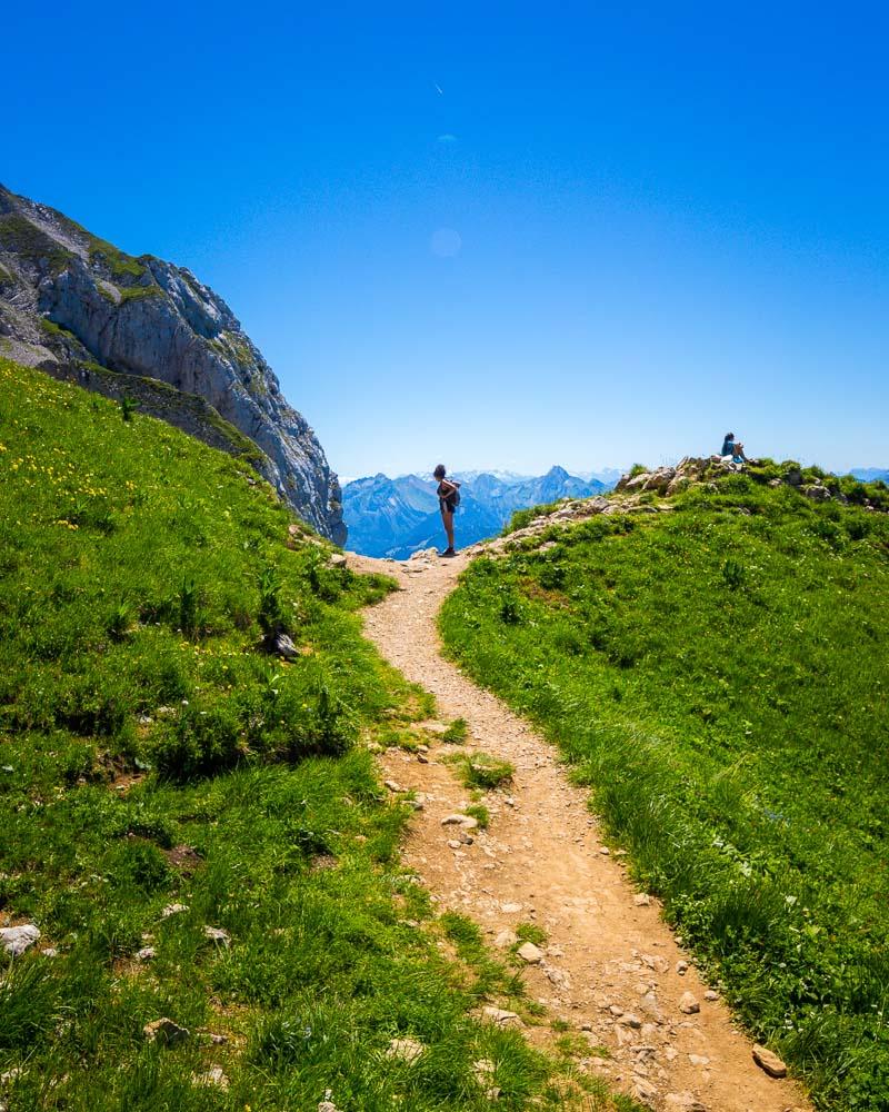
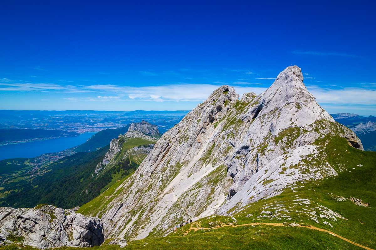
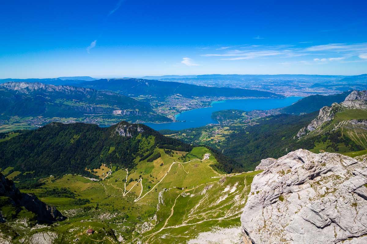
What you can see on the photo above is the trail to the Col du Varo, the last mountain pass before the summit. The trail is well-maintained, but it’s very steep. It took us around 20mn to climb to Col du Varo.
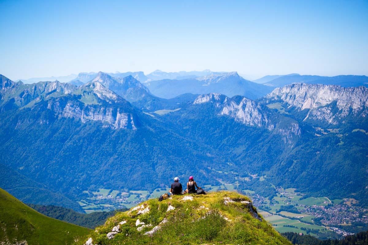
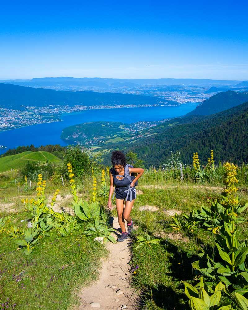
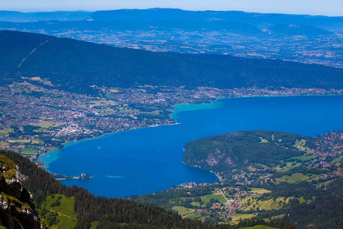
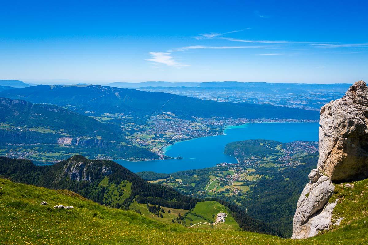
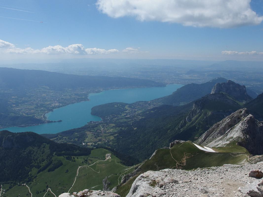
We got out on the open, on an almost flat trail with great open views over the valley, the lake and the surrounding mountains. We slowly walked on this balcony trail, towards the mountain pass.
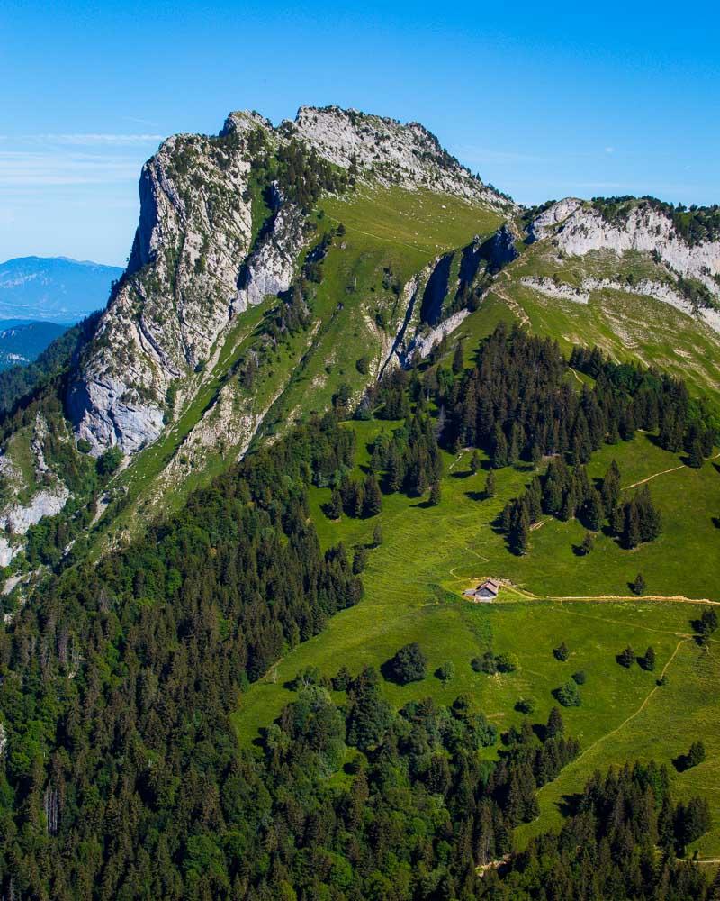
We sat down at the pass, 3h after we started the hike in Chalet de l’Aulp. In our back was a patch of eternal snow and the rest of the climb to the summit; in front of us another summit, l’Arête Pierre Chatelard.
The view from the pass is pretty epic, and even if it’s was already noon and plenty of people were around, we still got to see a wild ibex!
Final climb to the summit
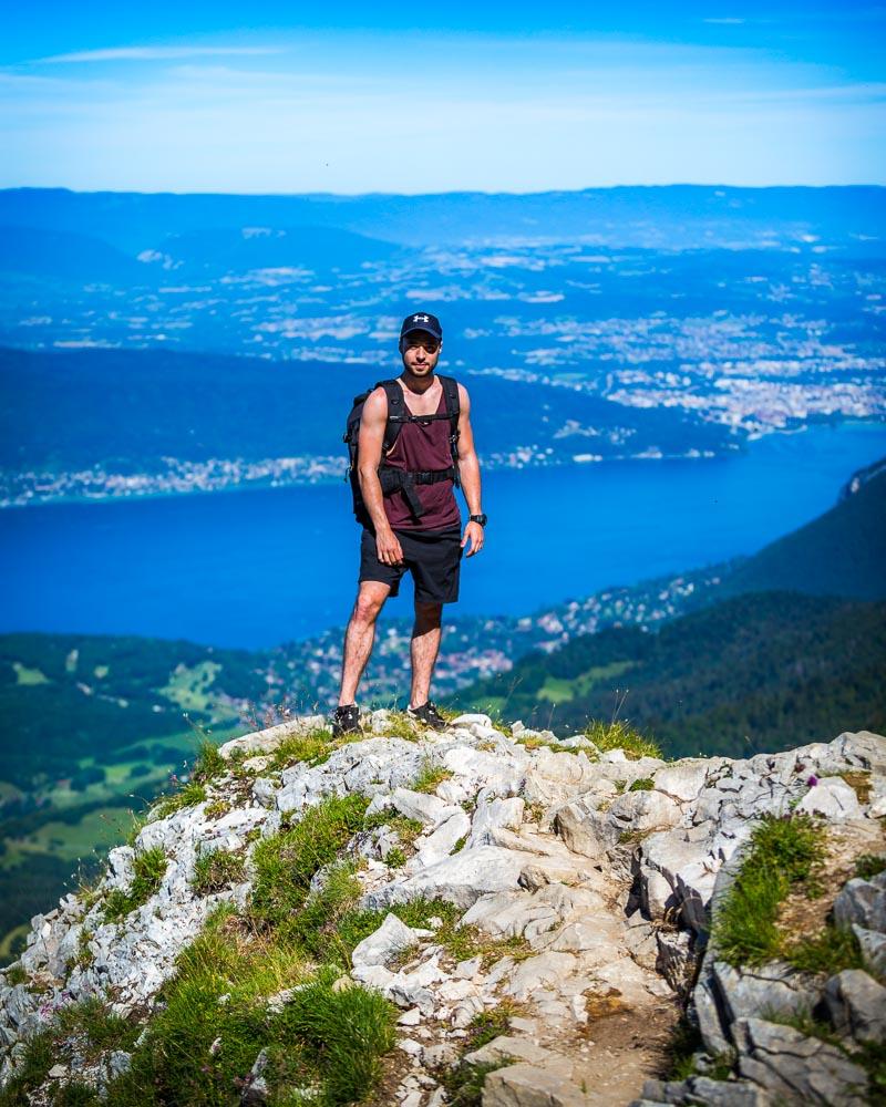
To be honest, we didn’t make it to the summit. We were not prepared for such a hard hike, and Nesrine was definitely not ready for what we went through on the hike. I’m pretty proud of her for what she achieved, going that far on a difficult hike like this one.
She didn’t feel ready for to the final climb, and as much as I wanted to keep going to experience the summit climb, I accepted her decision and we hiked back down to the refuge.
For those of you that will push to the summit, here are a few photos from local photographer Guilhem Vellut. Check out his site for more photos of the hike, including plenty of ibexes!
View from the summit by Guilhem Vellut / CC BY
Visit Haute-Savoie
Planning your trip to Haute-Savoie? You’ll find below a few other travel guides & key spots to see in the area.
Best hikes around Annecy:
Great outdoor destinations near Annecy:
The BIG guides:
I hope you enjoy your trip to Annecy and to France; if you have any questions, let me know in the comments below, I always reply.
Help a fellow traveler and share this guide with the buttons below!
Travel Tools
Use any of our recommended links below to book your trip. You pay the same, and we earn a small fee; a great way to support us!

Pin this to Pinterest!
Enjoyed this guide? Then help a fellow traveler and pin it! They'll most definitely love you for it, 100% guarantee.


Hello is it possible to make the summit without specialised equipment? Thanks for the info, be ill attempting the climb on my own
Hi Daryl! Well, I’d say you don’t need expert equipment but what you ABSOLUTELY need are: good hiking boots, a hiking hat & sun protection if you’re doing it in spring/summer (the sun is very strong up there!), enough water & snacks/food for 6-7 hours and a first aid kit. Many people use trekking poles on this hike, so bring them if you already have them. Otherwise, if you’re in good shape and used to walking, you can do it without (as we did). If you’re new to hiking, check this list here https://www.kevmrc.com/hiking-gear-list-for-beginners . It will help you with the basics you need to bring with you 🙂 Hope you enjoy this incredible hike!
Hi Kevin
I did this climb yesterday, I’m not sure if I took the same route as you but it sounds similar … you’re right up to me feels very realistic as I was surprised by the relentless of the climb … I also didn’t quite mange the summit, I got to 2100m and felt I had pushed myself enough for my first big solo climb.
I hope you fulfil your dream as a travel writer .. I throughly enjoyed reading your very detailed and helpful account … I wish I’d read it before I climbed and I might have been more prepared!!
Jo