Hiking Jura – The 17 Best Jura Hiking Trails (+ free maps)
Most Jura hiking guides are actually about hikes in Switzerland, in the Jura regional park.
This guide covers the best hikes in Jura, the French department.
Ready to go hiking Jura? Let’s go! :hike:
Where to Stay in Jura
Still in the planning phase of your Jura trip? Finding a good home base to explore the area is the first step to great travels, so let me help you out here.
Best Hotels – My Booking Selection in Jura: this list has the best hotels you’ll find in the area: great value, comfy and widely recommended all around.
Walking in the Jura – The 17 Best Jura Walks
With all of the waterfalls, lakes and mountains, Jura is a great region for hikers. You definitely can’t miss this region when hiking in France! In a hurry to see all of the best Jura walks? Here they are:
- 4 Lacs hike
- Pic de l’Aigle & Belvédère des 4 Lacs
- Belvédère du Mont des Ifs
- Cascades du Hérisson
- Cirque de Baume-les-Messieurs
- Cascade de la Billaude
- Le Crêt de la Neige
- Sommet du Mont d’Or
- Le Crêt de Chalam
- Lac Genin
- Randonnée de la Pierre qui Vire
- Lac de Bonlieu
- La Grande Traversée du Jura
- L’Echappée Jurassienne
- La Route des Lacs
- La Route des Sapins
- Balade en Arbois
Alright, now let’s see each of these hikes in more details! Keep reading below for more info on the hikes including photos, location, and all technical details.
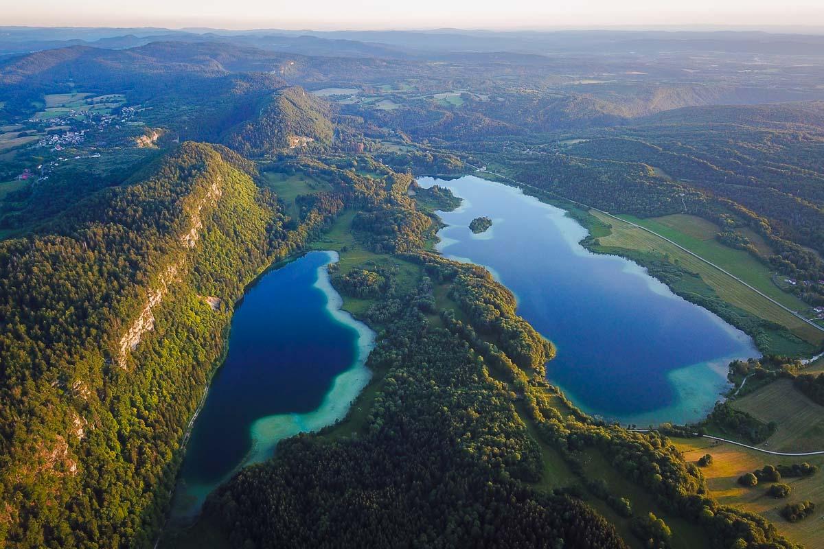
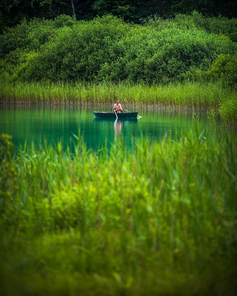
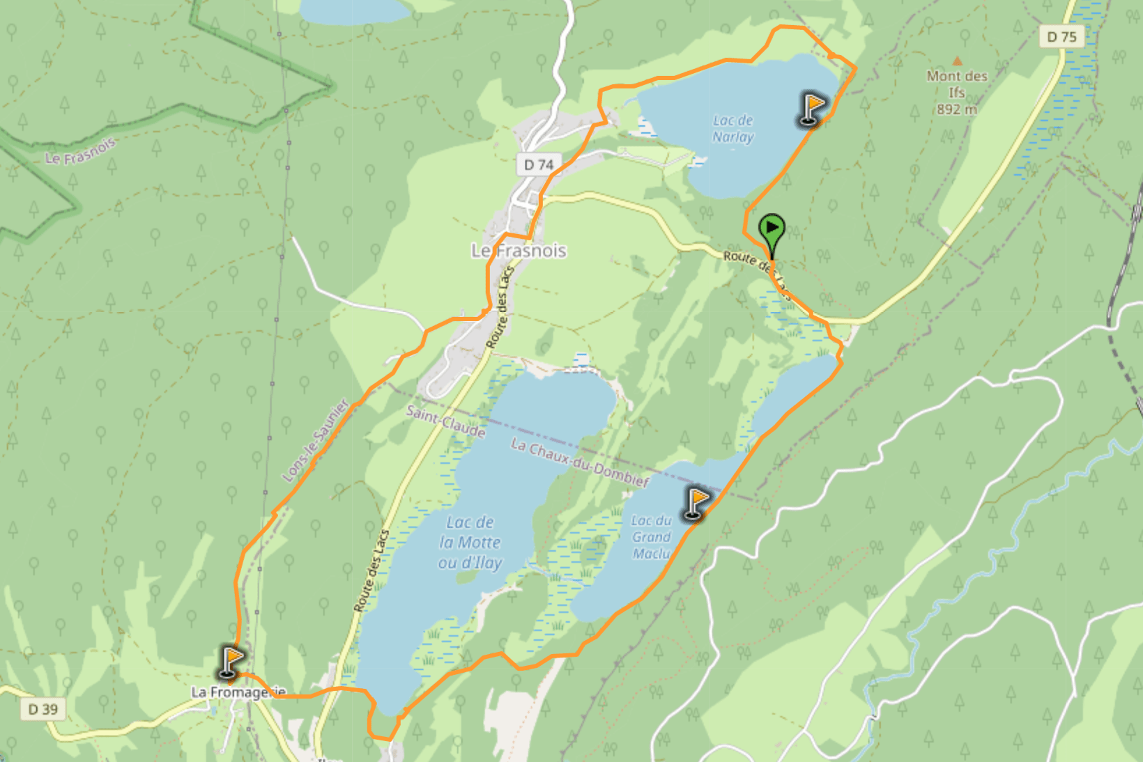
1. 4 Lacs hike
We’re starting this list with the 4 Lacs hike, which will take you on a gentle and easy hike around 4 beautiful lakes.
There’s almost no incline on the hike, and you can even do it with a stroller and kids. You’ll walk along the lakes, and find great places to jump in the water to cool off on a hot summer day.
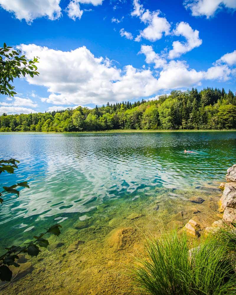
Tour des 4 Lacs

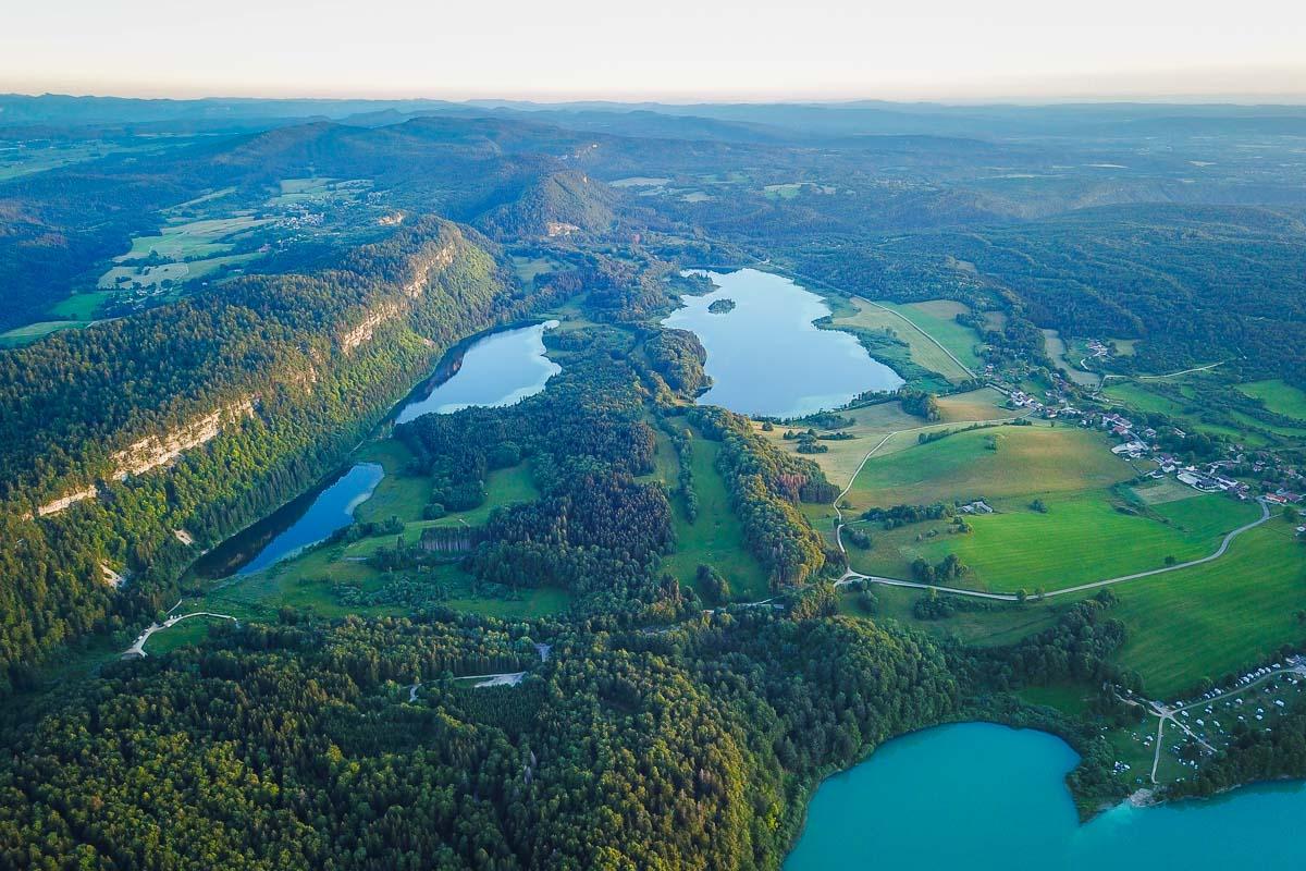
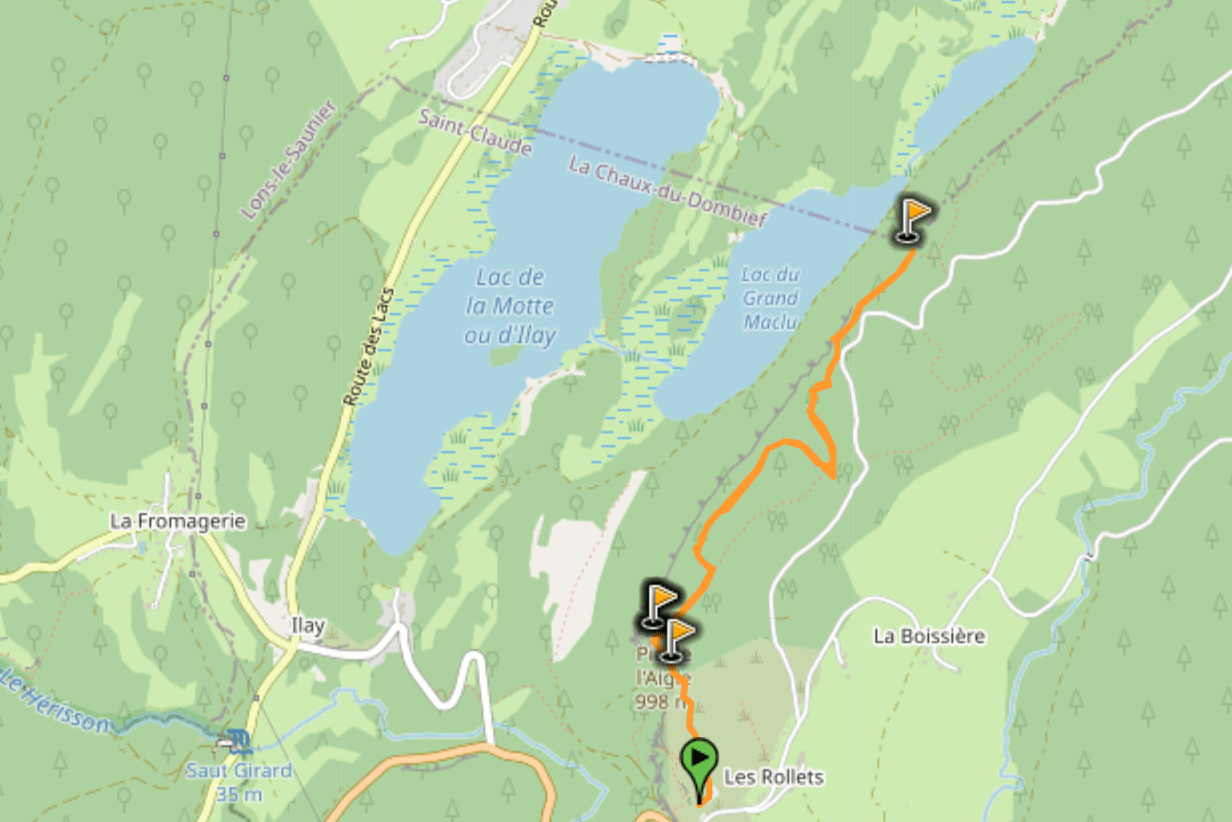
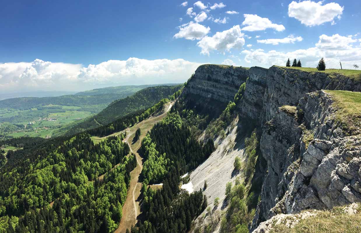
2. Pic de l’Aigle & Belvédère des 4 Lacs
The second hike on the list is in the same area as the first one. However on this one you won’t be hiking around the lakes, but climbing to hike above them.
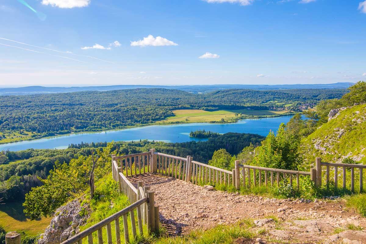
The hike starts with the climb to the Pic de l’Aigle (the viewpoint you can see on the photo above). You then walk on the ridge of the cliffs to a second viewpoint, Belvédère des 3 Lacs, and finally to a last viewpoint, the Belvédère des 4 Lacs.
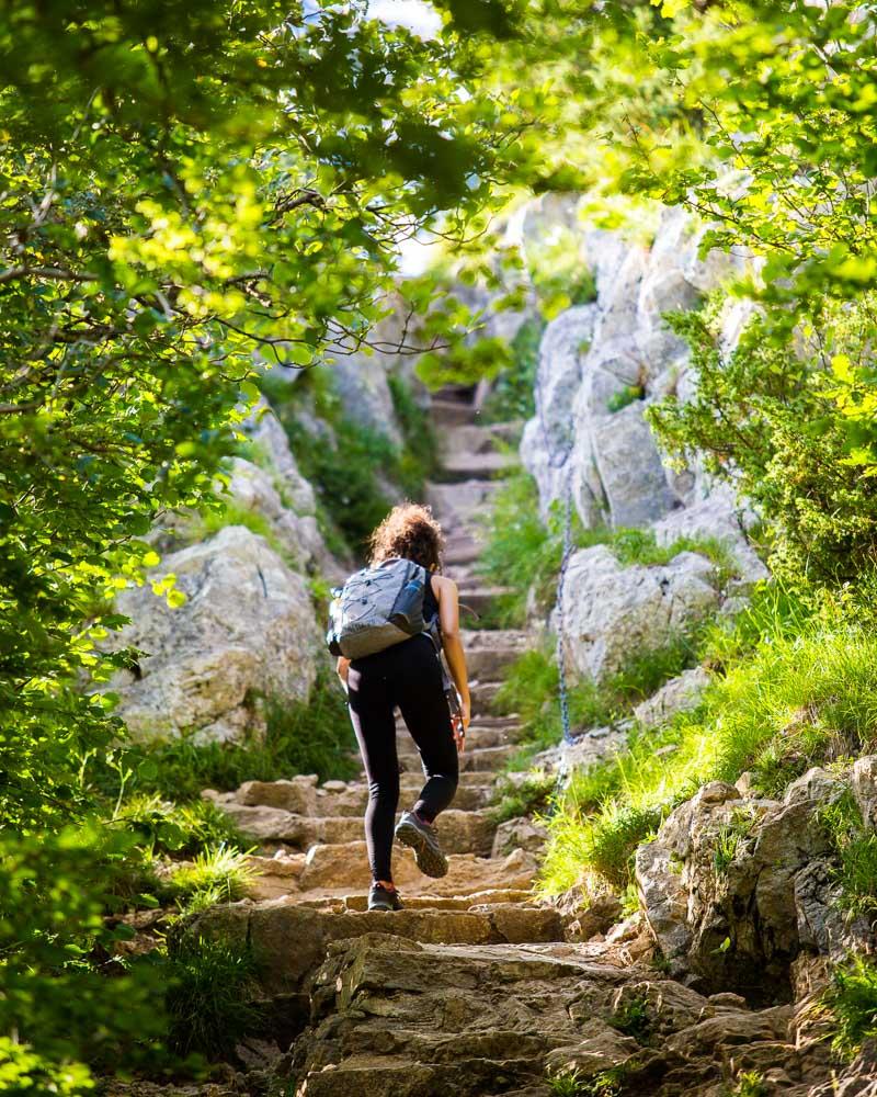
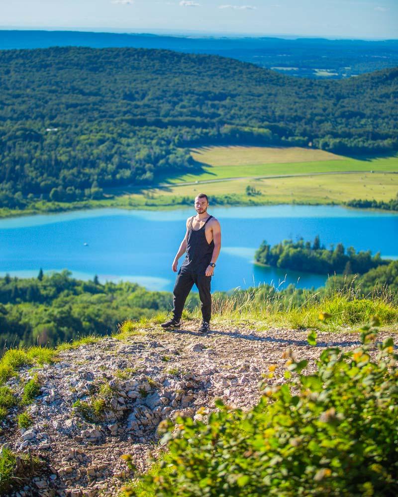
Randonnée Pic de l’Aigle

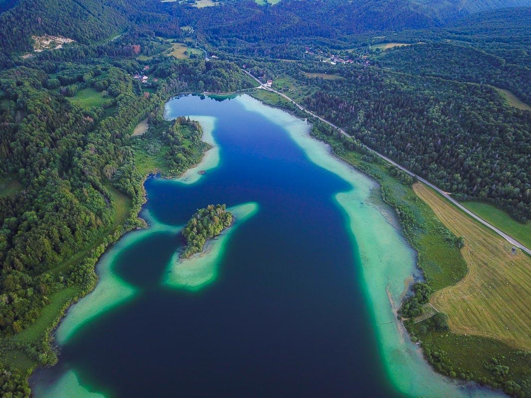
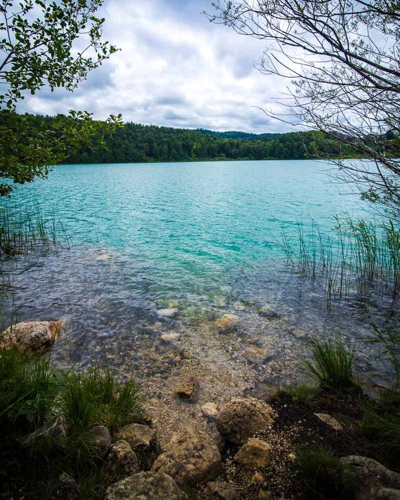
3. Belvédère du Mont des Ifs
The Belvédère du Mont des Ifs is another hike around the 4 Lacs area, just to give you a bit more choice (or you can do them all, I combined them all for a full day of hiking).
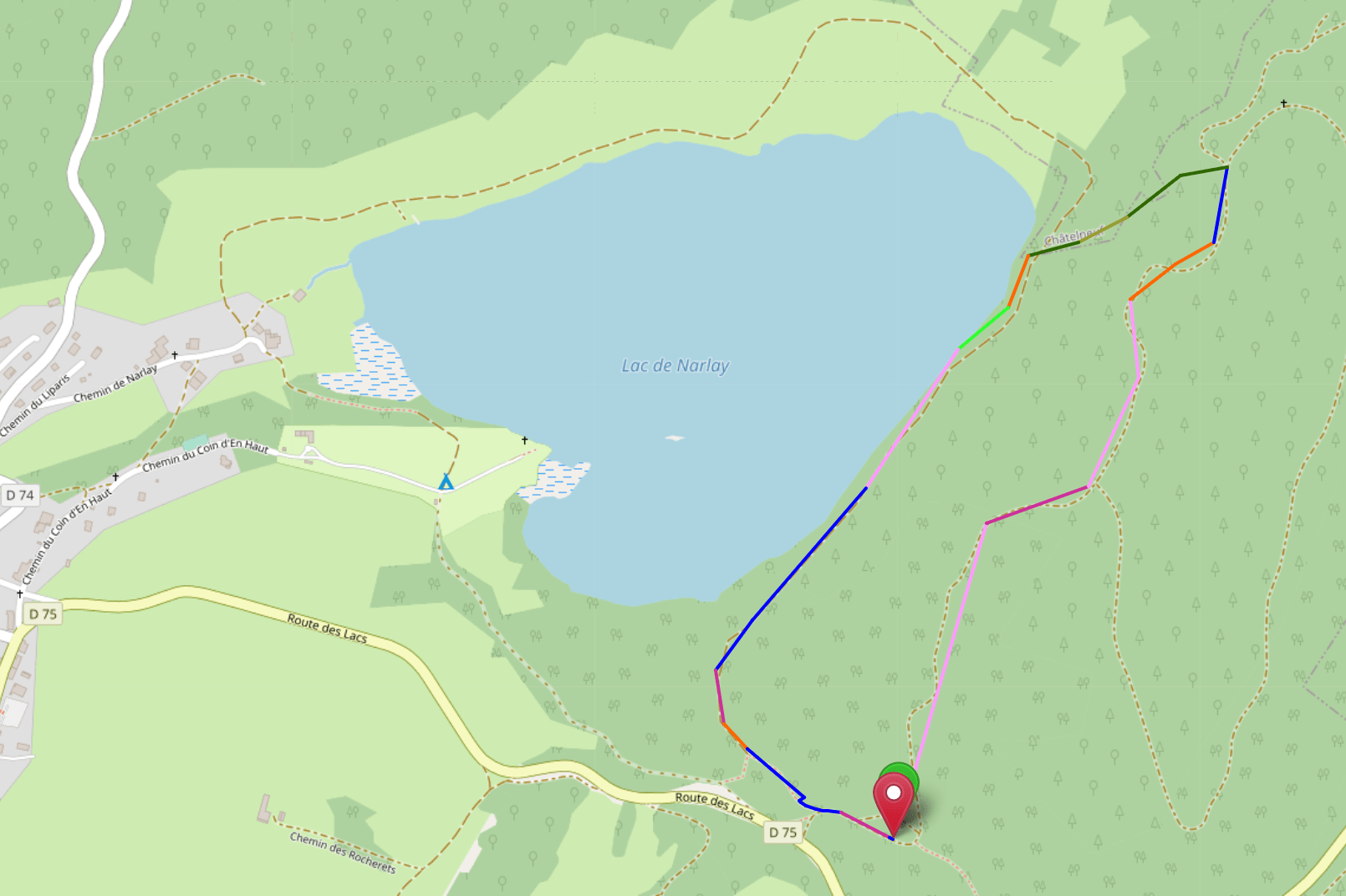
It’s a very short hike, that will take you to a nice viewpoint above one of the 4 lakes, the Lac de Narlay. After climbing to the viewpoint, you hike down to the lake, and finish the hike by strolling around the lake, back to the starting point.
Belvédère du Mont des Ifs Hike
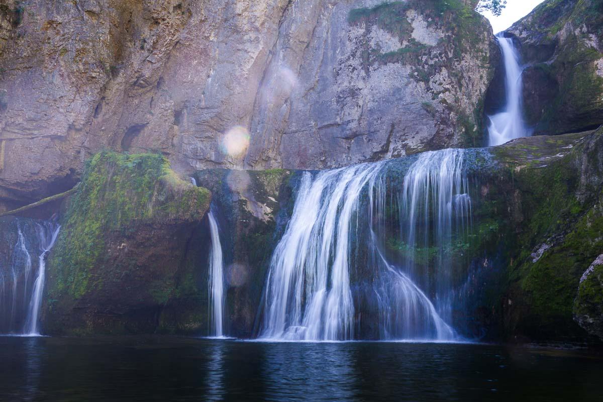
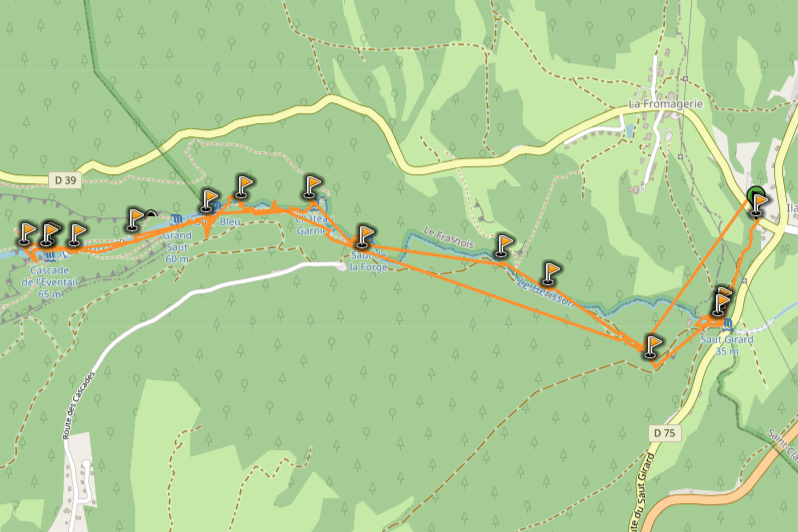
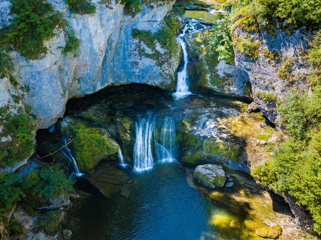
4. Cascades du Hérisson
Moving on from the lakes to go to another body of water: waterfalls. The Cascades du Hérisson are actually 7 waterfalls along the Hérisson river, and they’re probably the most famous attraction in Jura.
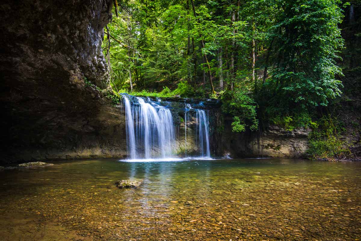
The full hike starts at the top of the falls, and goes all the way down to the last of the 7 waterfalls. Each waterfall you’ll see seems more impressive than the last, and it makes for an epic day chasing waterfalls.
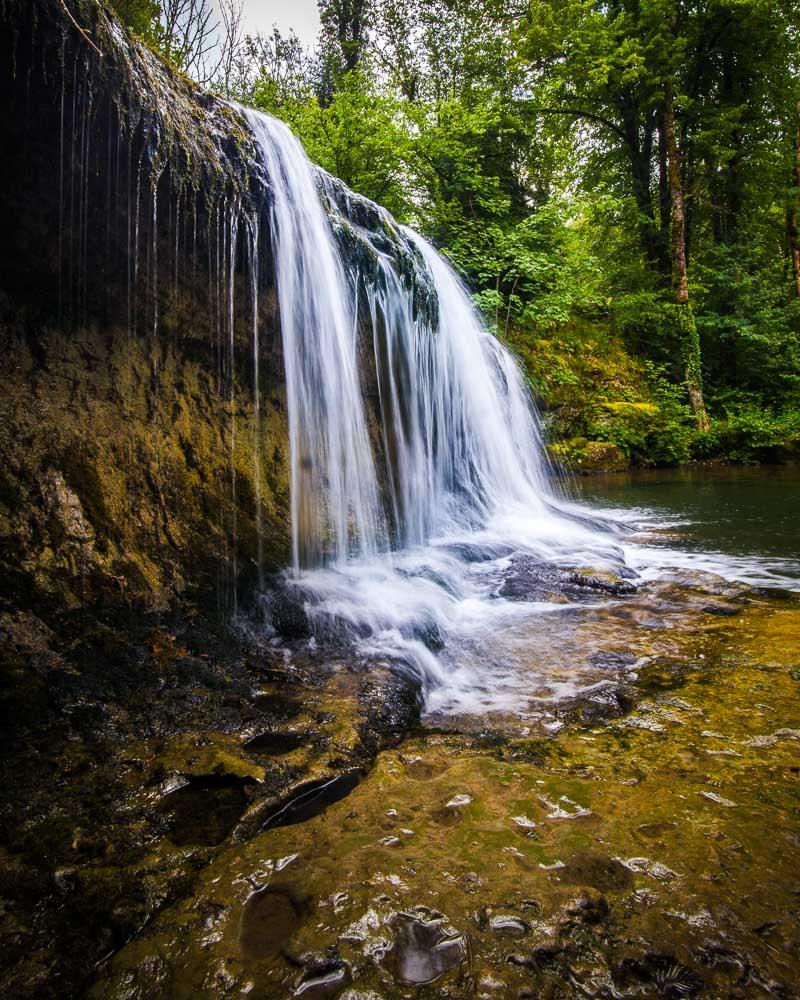
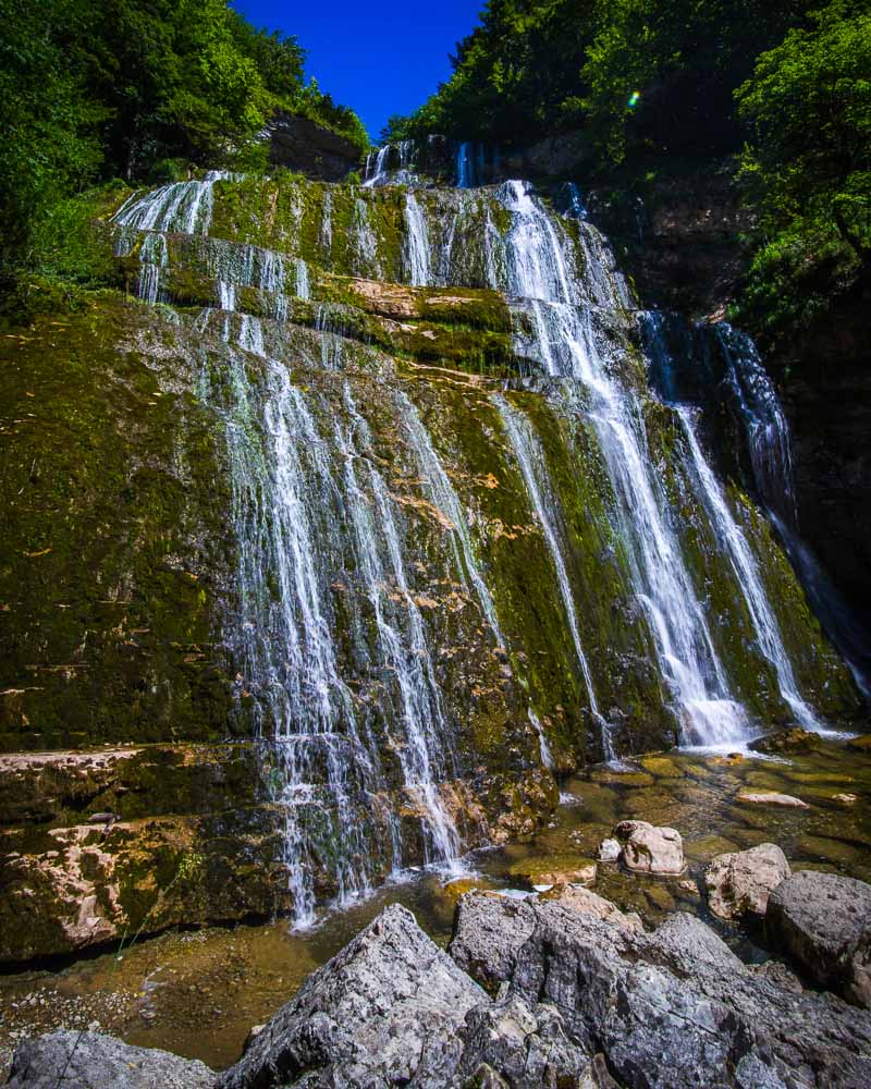
Complete Hike Cascades du Hérisson
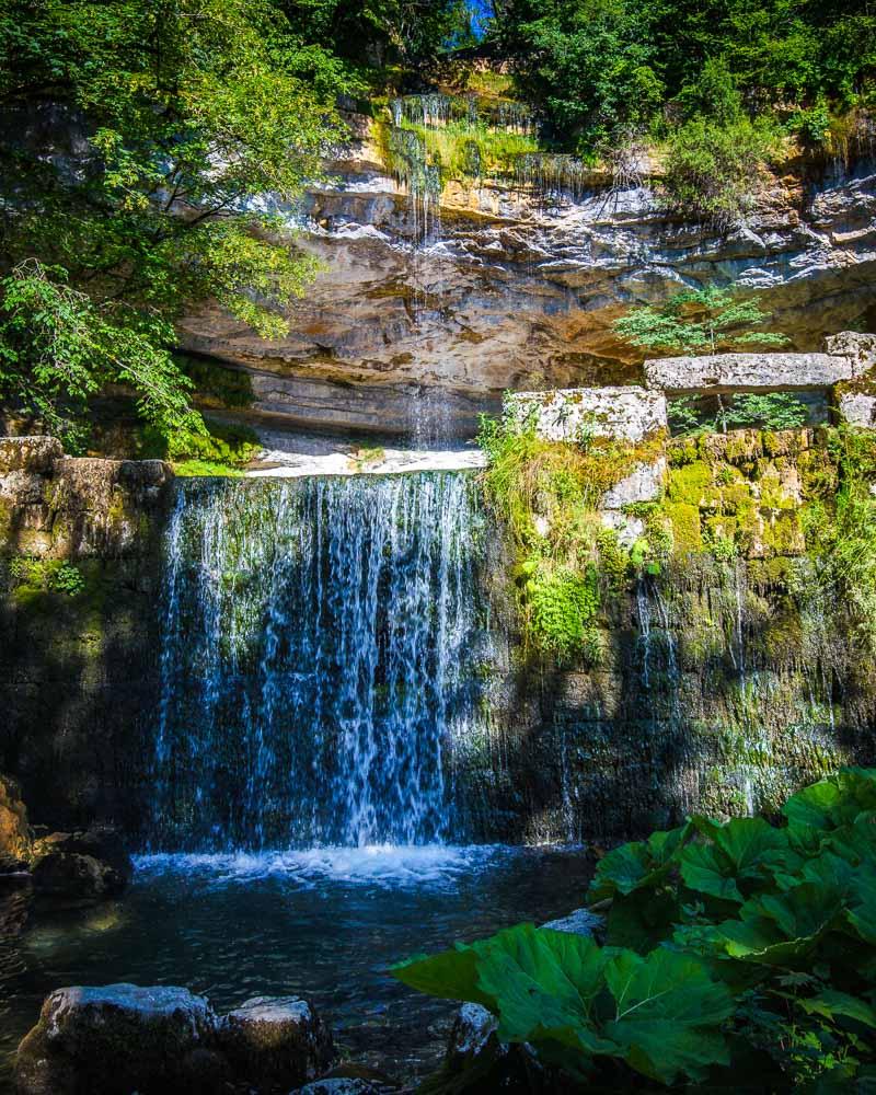
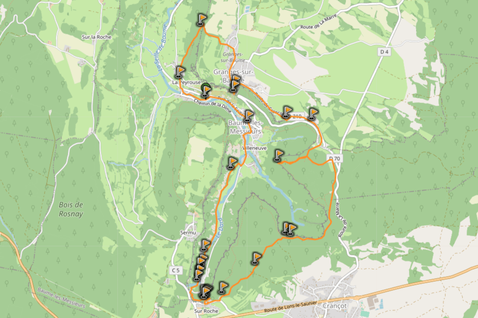
5. Cirque de Baume-les-Messieurs
Baume-les-Messieurs is a medieval village, and one of the most beautiful villages in France. It’s located in a “cirque”, a deep valley with cliffs all around.
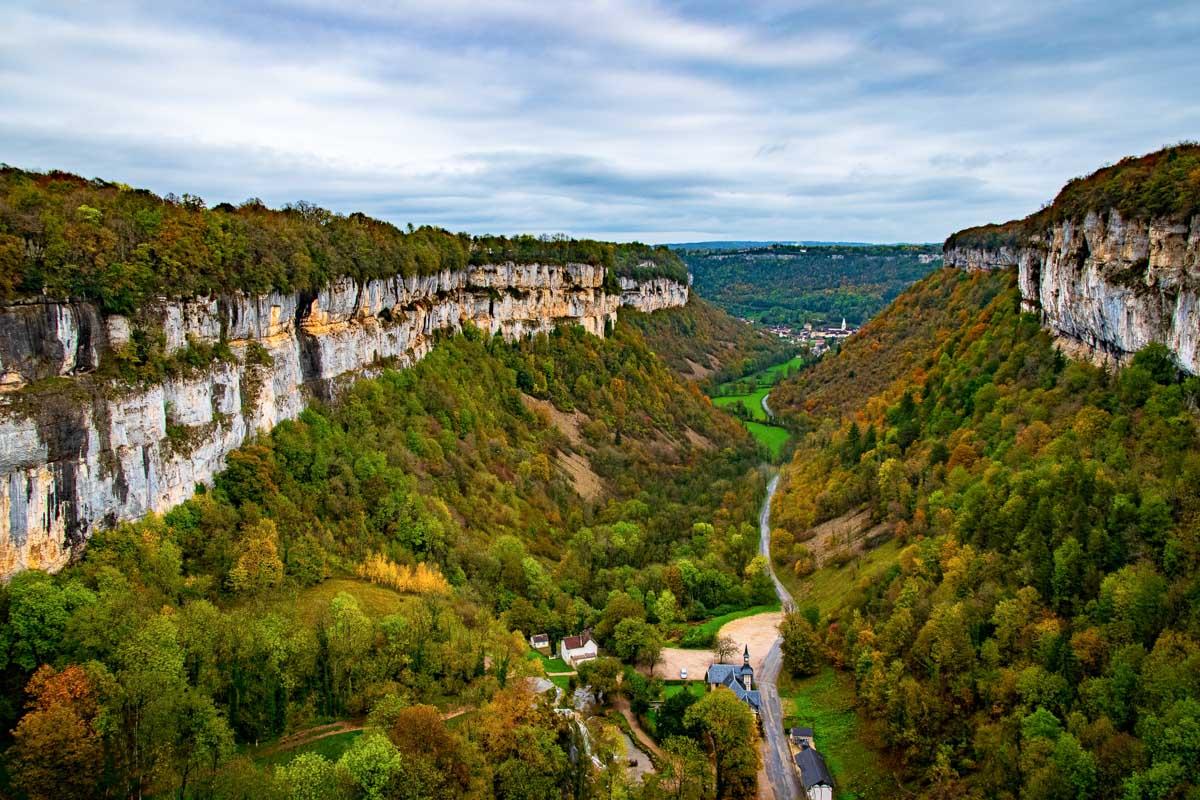
The hike takes you along the ridge of the cliffs high above the valley, and offers great view over the village and the cirque. At the middle of the hike, you’ll get down in the valley to see an epic waterfall, the Cascade des Tufs de Baume-les-Messieurs.
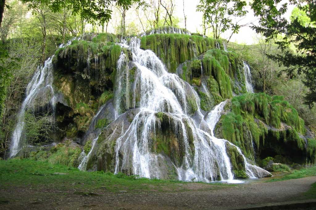
Cirque de Baume les Messieurs Randonnée
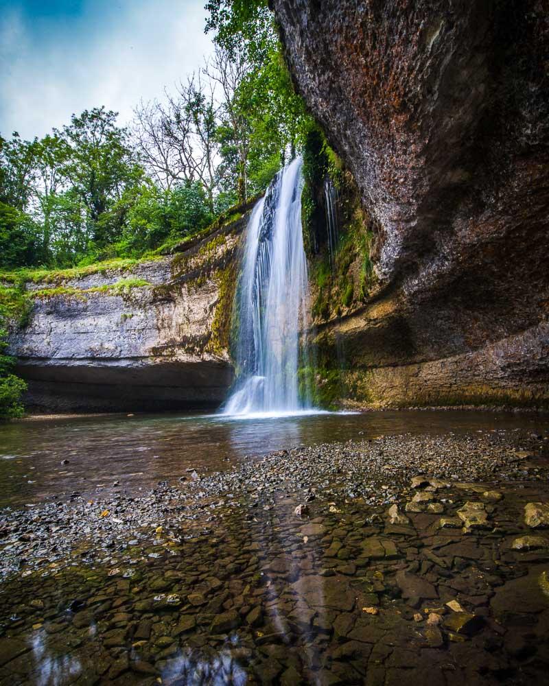
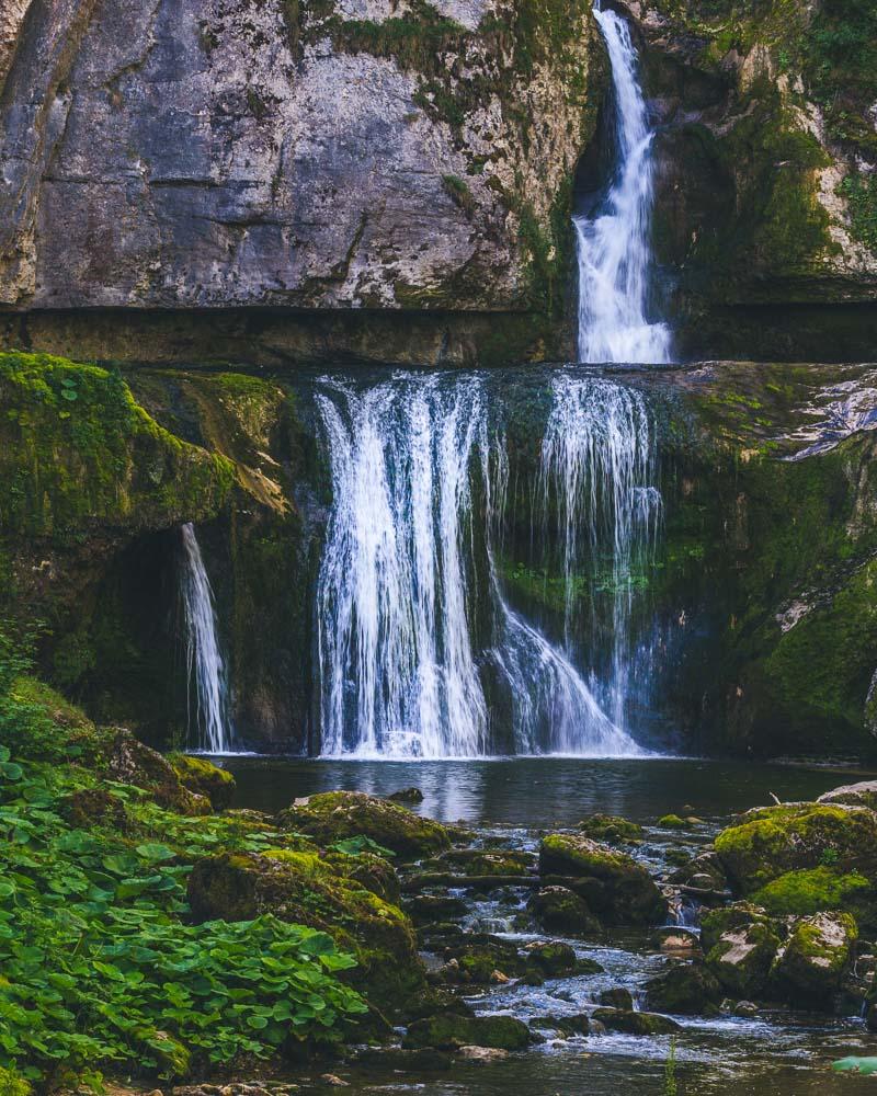
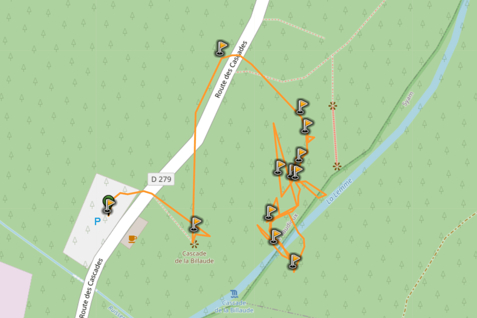
6. Cascade de la Billaude
The Cascade de la Billaude is a double waterfall in Jura, not far from the 4 lakes. You can drive right next to the waterfall, and see it from above on a viewpoint 2mn away from the parking lot.
That’s taken from a drone, not from the viewpoint
But the best view is definitely the one you’ll get from the bottom of the falls. There’s an easy hike that will take you there, with wooden steps and several viewing platforms along the way.
Once at the bottom, you can enjoy the falls and take a dip in the water.
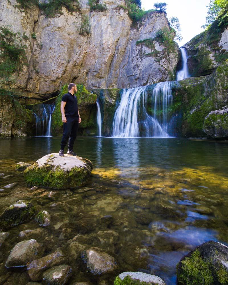
Cascade de la Billaude Hike
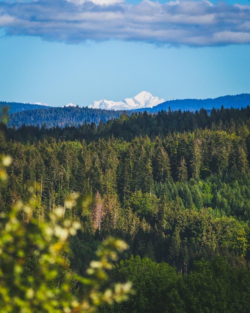
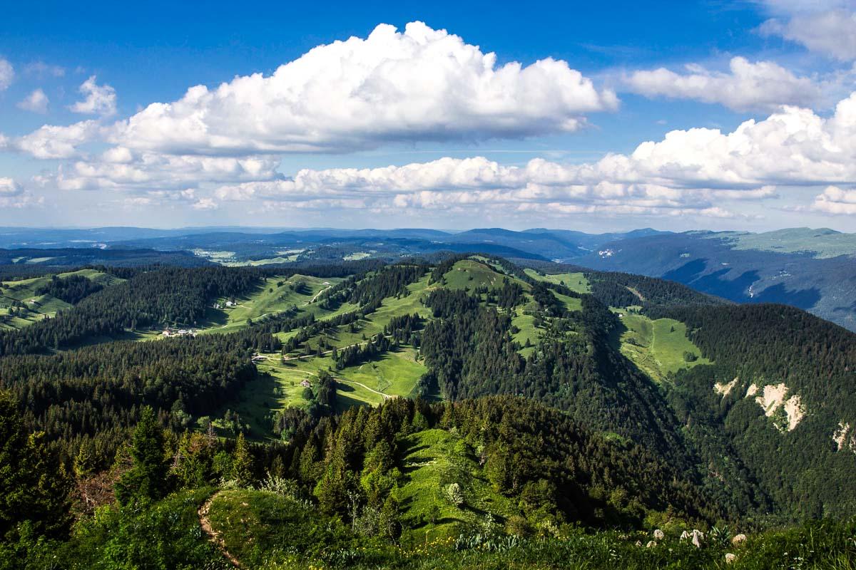
7. Le Crêt de la Neige
The Crêt de la Neige hike is not in Jura; it’s in the Ain department, but it’s literally right next to the border with Jura. It’s not far from Saint-Claude, Jura, an area with several epic waterfalls.
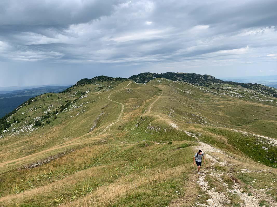
The hike is a loop that goes to 2 summit, the Crêt de la Neige and the Reculet. There’s a large portion of the hike along the ridge, with gorgeous views of the valley and the Lac Léman in the background. Oh and you’ll also see the Mont-Blanc on clear days.
Le Crêt de la Neige


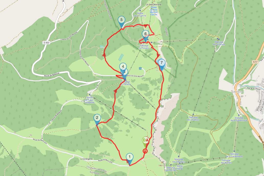
8. Sommet du Mont d’Or
The Mont d’Or is a pretty famous cheese from the Jura mountains; the names comes from a mountain, the Mont d’Or.
The ridge walk on top looks pretty epic, and getting to the top of this 1,463 meters high mountain (4,800 feet) is rewarded by a 360° view over more than 300 summits in the Alps. Getting there is an amazing experience as you’ll be able to really feel the mountain atmosphere.
Mont d’Or Summit Hike
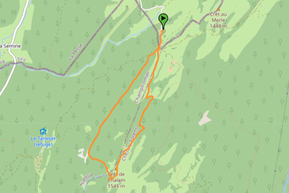
9. Le Crêt de Chalam
Le Crêt de Chalam is a summit right next to the border between the Ain and Jura, in the Jura mountains. It’s not far from the Crêt de la Neige, another hike in this list of the top hikes in Jura.
The hike starts from the parking lot of the Borne au Lion, and can thus easily be reached by car. It’s a short walk to the summit Crêt de Chalam, but the incline makes it a moderate hike. There’s no real difficulty on this hike except for the incline; the trail is well-maintained and you’ll have no trouble reaching the top, just take your time.
Crêt de Chalam
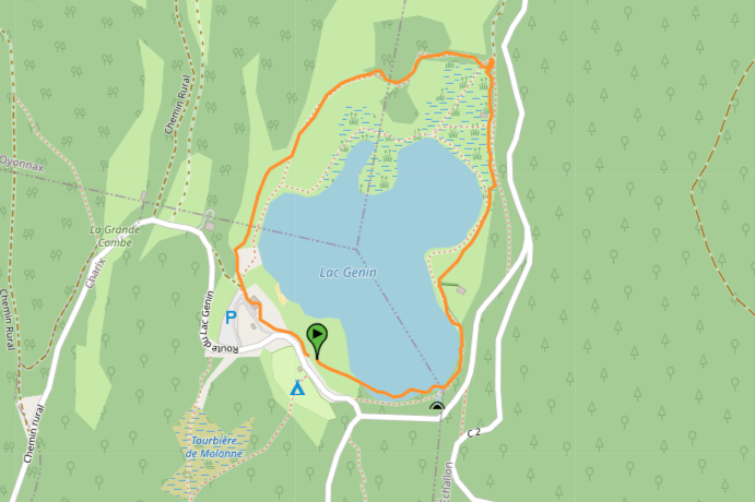
10. Lac Genin
Alright, we saw a lot of waterfalls and mountains, now let’s check out a few hikes around lakes!
The Lac Genin is located near Oyonnax, a city right south of the Jura border.
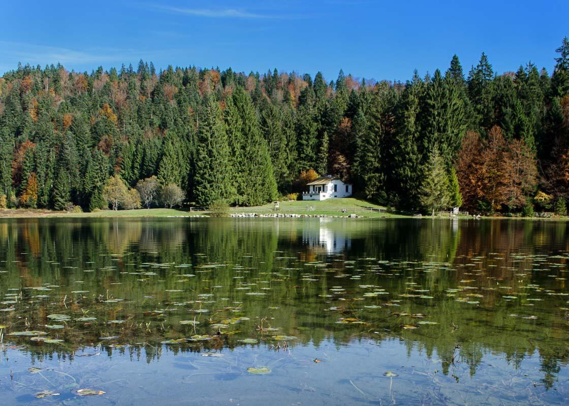
It’s known by the locals as “The Little Canada”, and it’s easy to understand why when seeing the pictures of this lake. It’s a great place to be in nature, and get a nice breath of fresh air.
The hike around the lake is short, and family-friendly.
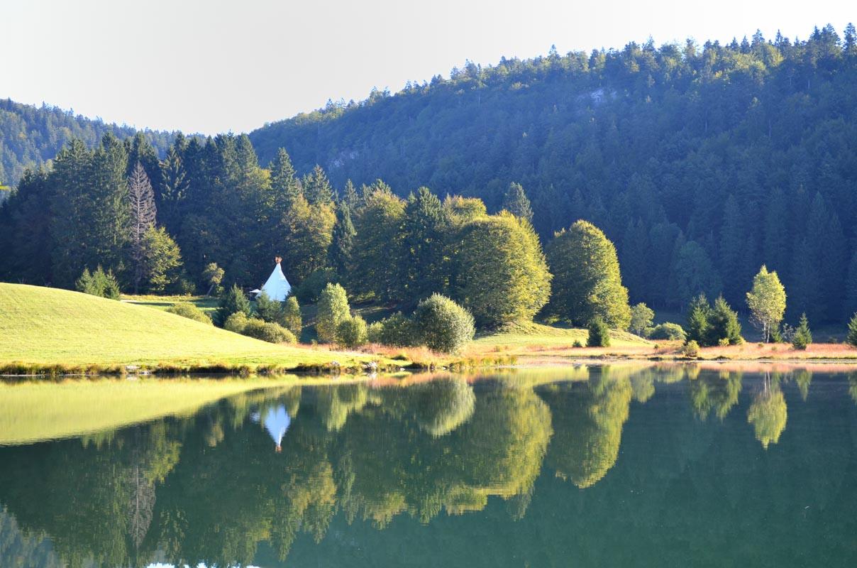
Lac Genin hike
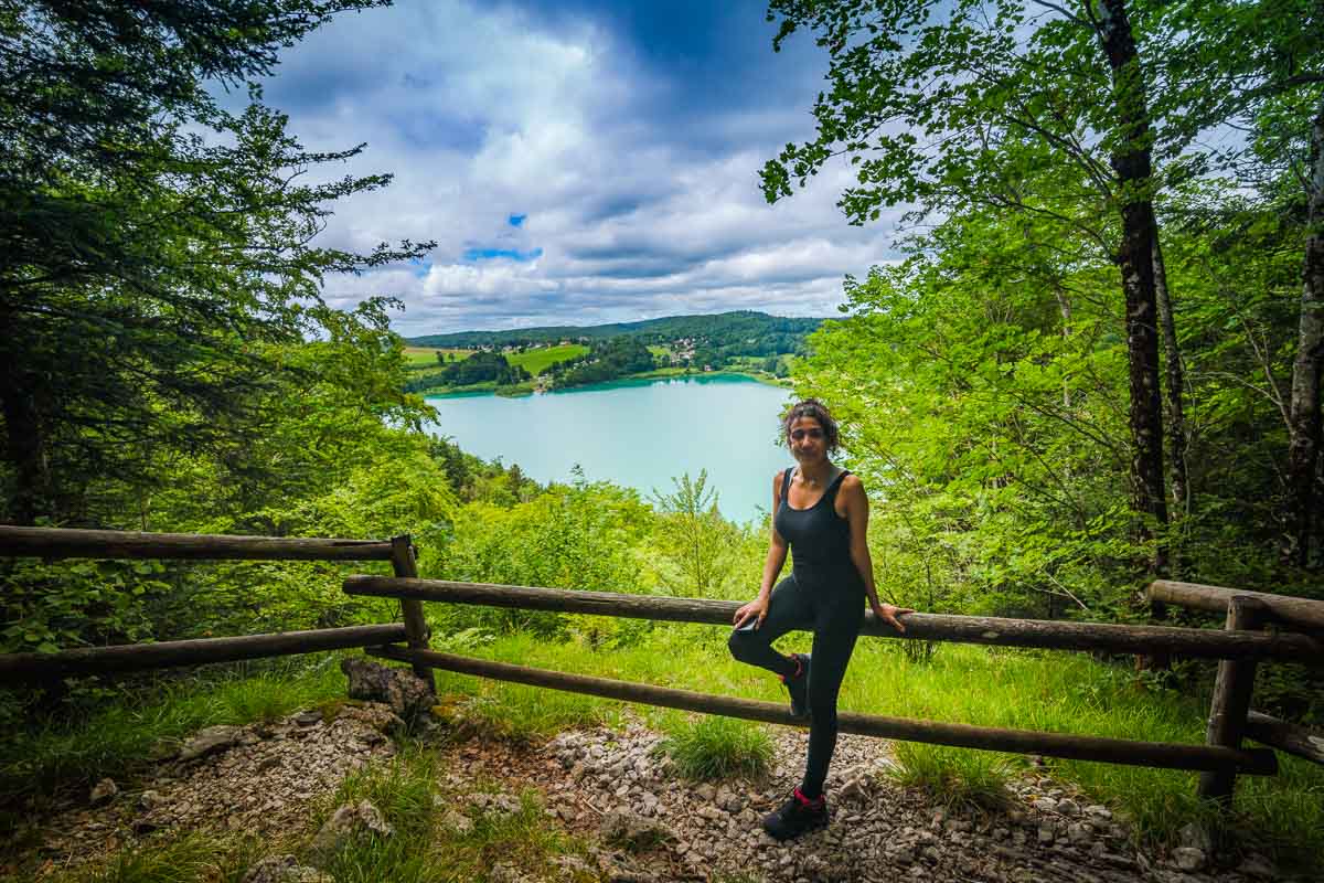
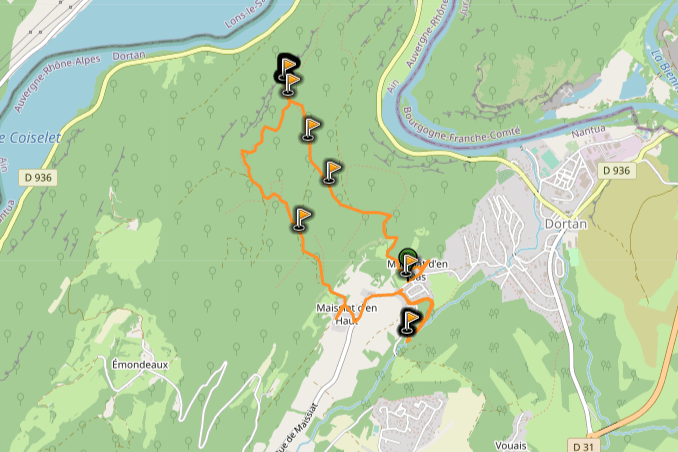
11. Randonnée de la Pierre qui Vire
We’re moving even closer to the Jura border with this next hike, the Randonnée de la Pierre qui Vire.
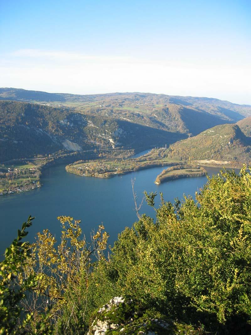
This hike offers a great view over a Jura lake, the Lac de Coiselet. But to get the best view, we’ll cross over to the next department (the Ain). The hike starts in the little village of Dortan, and gets you in the forest to a nice viewpoint over the lake (as pictured above).
It’s a rather easy hike, but I’ve listed it as “moderate” because there are a few spots right next to the cliffs where you’ll need to watch your step.
Pierre qui Vire Hike
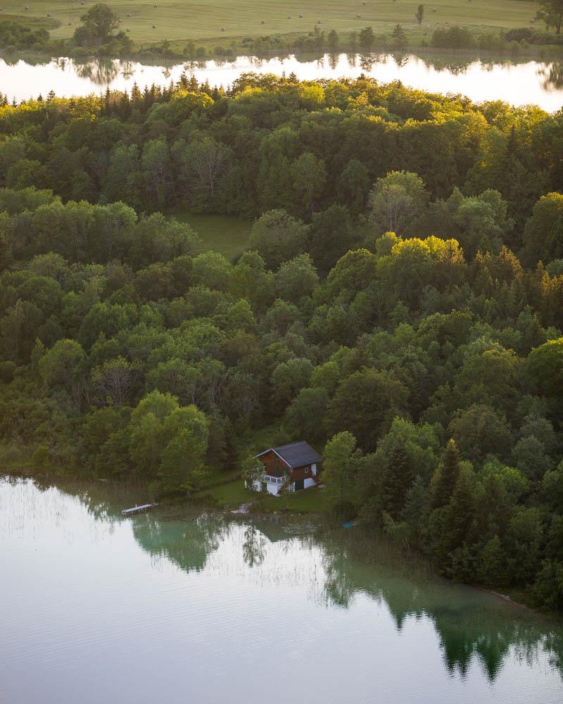
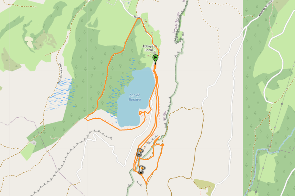
12. Lac de Bonlieu
And finally, the last regular hike on this list of the best Jura walking routes, also around a lake.
The Lac de Bonlieu is deemed as one of the most beautiful lakes in Jura, and hiking around is the best way to discover it. It’s located right below the 4 lakes and the Cascades du Hérisson, so you won’t have to move too far to get to it.
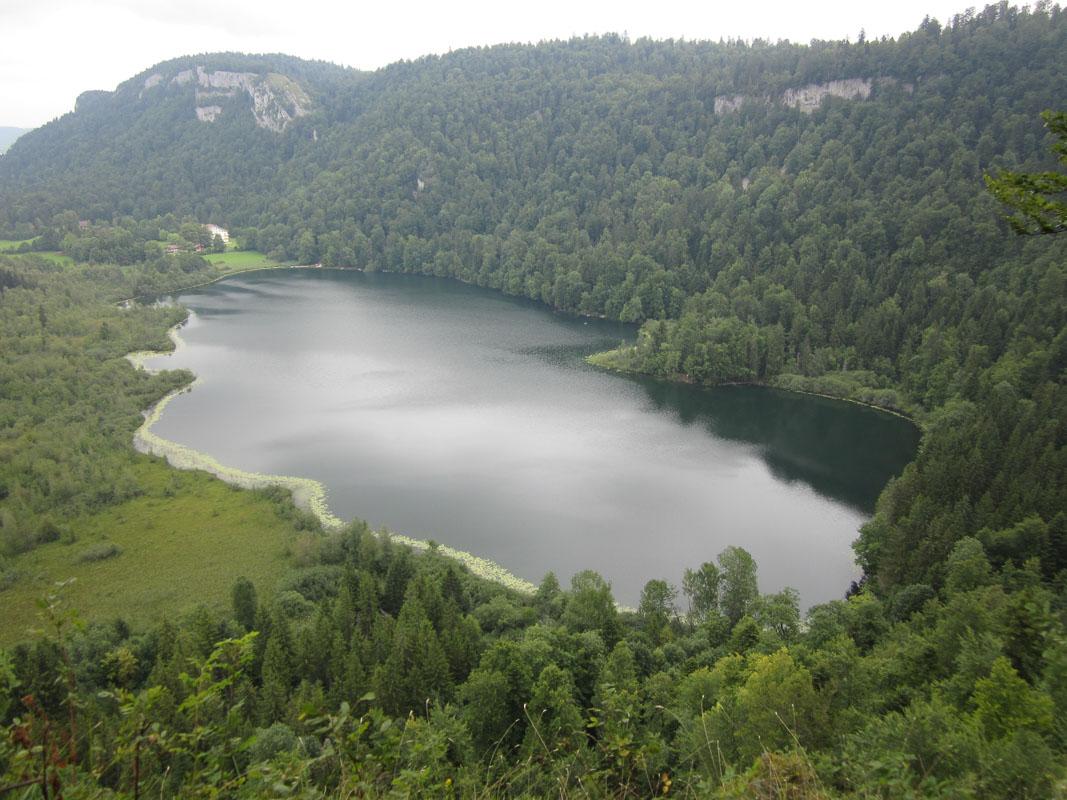
The hike starts with a climb to a viewpoint, the Belvédère de Maguenay. Then it goes back down, and loops around the lake. If you don’t want to hike too much, or don’t want to climb up, you can simply chill around the lake, then later drive to the Belvédère de la Ronde (view like the photo above).
Lac de Bonlieu Hike
Big Walking Itineraries – Multi-days Hikes
All Jura trail listed above are regular day hikes, that you can complete in less than a day.
If you’re ready to go on a big Jura hiking trip, you can join a massive multi-days hike. There are 4 big Jura walking routes, plus a bonus one that combines hiking & gastronomy.
Let’s see these routes! :hike:
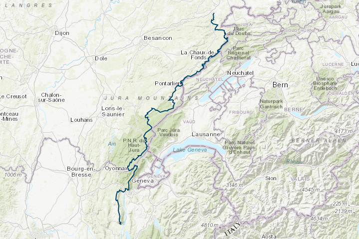
13. La Grande Traversée du Jura
La Grande Traversée du Jura, or simply GTJ, is probably the most famous walking route in Jura. It crosses 3 departments: Doubs, Jura, and Ain.
The route stretches over 400km (248 miles), and takes around 20 days to complete with 20km by leg.
Read all about it on the official website: Grande Traversée du Jura
Grande Traversée du Jura

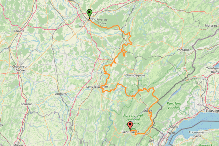
14. L’Echappée Jurassienne
Second on the list of massive hikes, we have the Echappée Jurassienne. This route is slightly shorter than the Grande Traversée du Jura, with around 17 days needed to complete it.
The entirety of the trail is in Jura, and you’ll cross the department from north west to south east. It’s the best way to hike across Jura, and of course you can hike only parts of it.
Read all about it on the official website: Echappée Jurassienne
Scroll down to the bottom of the site and click on the UK flag to switch the site to English
Echappée Jurassienne
15. La Route des Lacs
If you’re up for several days of hiking, but perhaps not as much as the 15-20 days hikes above, the Route des Lacs is a nice alternative.
This 150km hike (93 miles) will take you around the most beautiful lakes in Jura, 20 lakes in total.
Get the full PDF map here: Itineraire Route des Lacs
16. La Route des Sapins
La Route des Sapins is similar to the Route des Lacs, but will take you on a trip through forests instead of lakes.
It’s “only” 42km of trail (26 miles), and you’ll cross 21 distinct sites: forests, viewpoints, and ridges.
There’s not too much information online about this one (official site here), but the route is well signed. I’d recommend going to the local tourism office and asking about it, they most likely have plans for the route.
Special Hike for Wine Lovers
This hike has its own category, as it’s a very special one.
17. Balade en Arbois
And finally, the very last of our 17 best hikes in Jura.
La Route des Vins is a special one, which combines hiking and local gastronomy. You’ll walk through the vineyards of Arbois, the Jura wine capital.
Balade en Arbois
Visit Jura
Planning your trip to Jura? You’ll find below a few other travel guides & key spots to see in the area.
Cool waterfalls in Jura:
- Cascade de Baume les Messieurs
- Cascade des Tufs
- Cascades du Hérisson
- Cascade de la Billaude
- Gorges de la Langouette
The best hikes around:
The BIG guides:
I hope you enjoy your trip to Jura and to France; if you have any questions, let me know in the comments below, I always reply.
Help a fellow traveler and share this guide with the buttons below!
Travel Tools
Use any of our recommended links below to book your trip. You pay the same, and we earn a small fee; a great way to support us!
. Most Jura hiking guides are actually about hikes in Switzerland, in the Jura regional park. This guide covers the best hikes in Jura, the French department. Ready to go hiking Jura France? Let's go! jura tourisme | jura france travel | vacances jura | randonnée jura | france travel guide | france travel destinations | france travel amazing places nature | france hiking trails | hiking france)
Pin this to Pinterest!
Enjoyed this guide? Then help a fellow traveler and pin it! They'll most definitely love you for it, 100% guarantee.