Pic de l’Aigle, Jura – Guide to an Epic Viewpoint + Hike Details
The Pic de l’Aigle is a summit over the 4 Lacs of Jura, France.
It offers an incredible view over one of the lake, and it’s the starting point of a great hike along the ridge, high up on the cliffs.
Let’s see how to get to it, and details about the hike.
How to Get to the Pic de l’Aigle Viewpoint
The Pic de l’Aigle is located in the East of Jura, 26mn south of Champagnole and 36mn east of the department capital Lons-le-Saunier.
Location: Google Maps
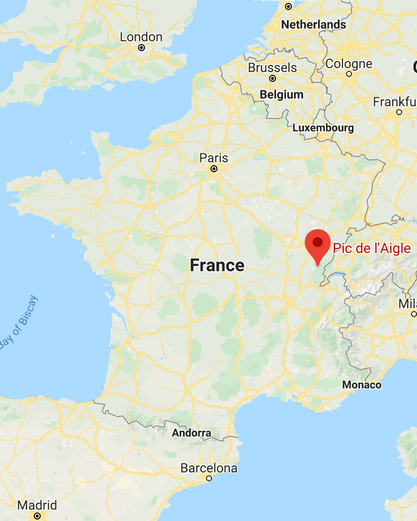
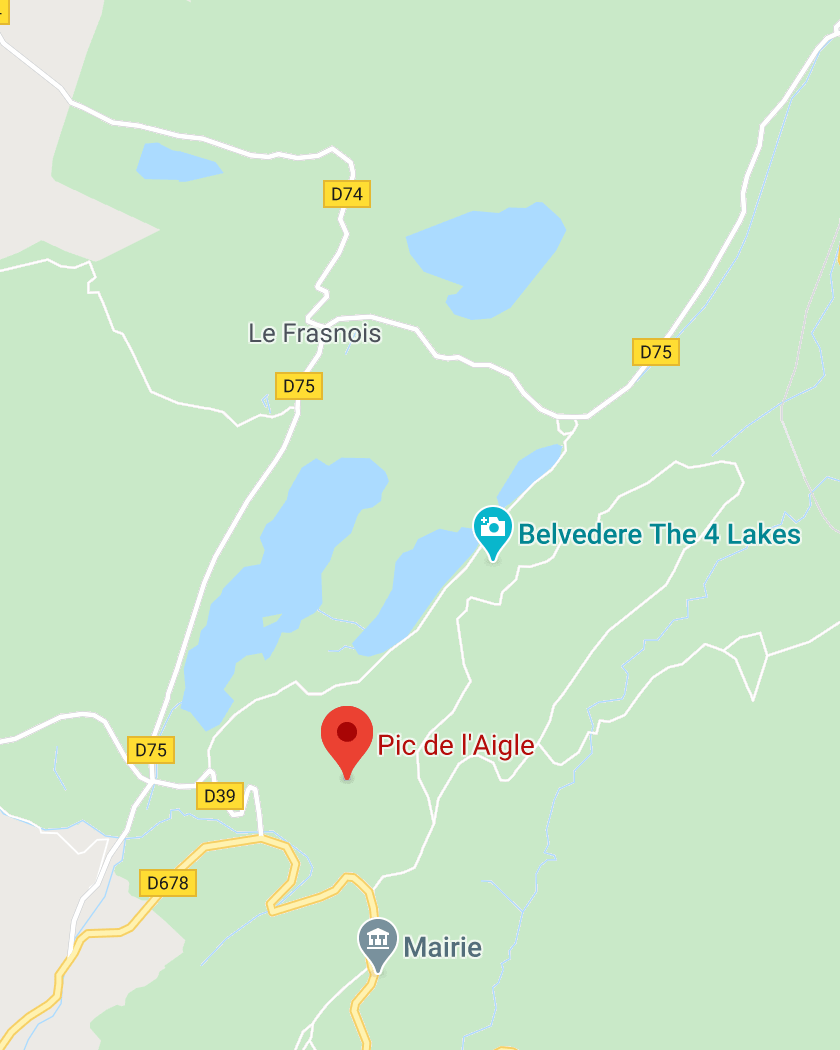
It’s not far from the Cascade de la Billaude (16mn), and the famous Cascades du Hérisson (10mn).
You can’t drive all the way to the viewpoint, but you can get pretty close. Head to this free parking lot below the 4 lakes; this will be your starting point to the short hike that leads to the viewpoint.
Pic de l’Aigle Hike Details
From the parking lot of the Pic de l’Aigle, there are 3 main hikes you can do:
- hike to Pic de l’Aigle
- return trip to Pic de l’Aigle and Belvédère des 4 Lacs
- long loop through Pic de l’Aigle, Belvédère des 4 Lacs and the lakes
Let’s see the details of the 3 hikes.
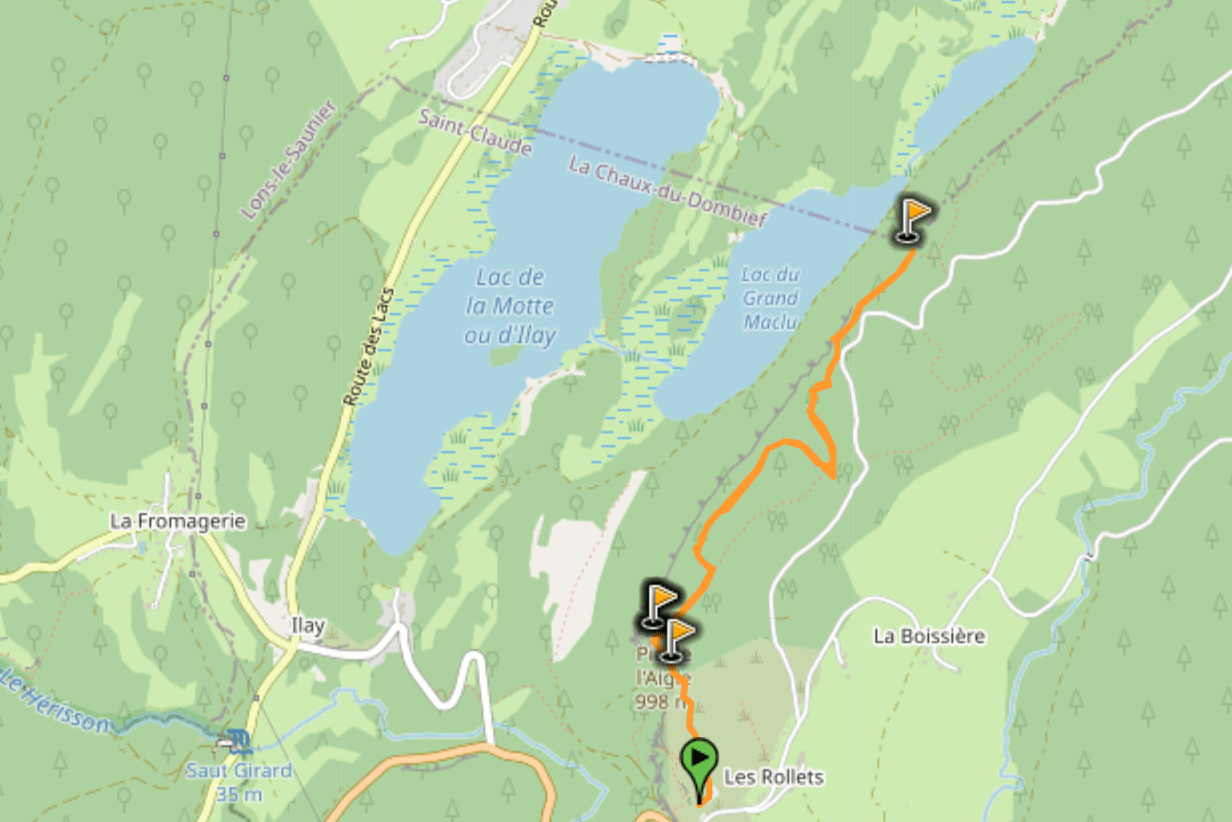
1. Hike to Pic de l’Aigle
This is the first hike (randonnée Pic de l’Aigle), and the easiest/shortest one. It will take you to the Pic de l’Aigle viewpoint, and back to the parking lot using the same trail for the return.
Hike to Pic de l’Aigle

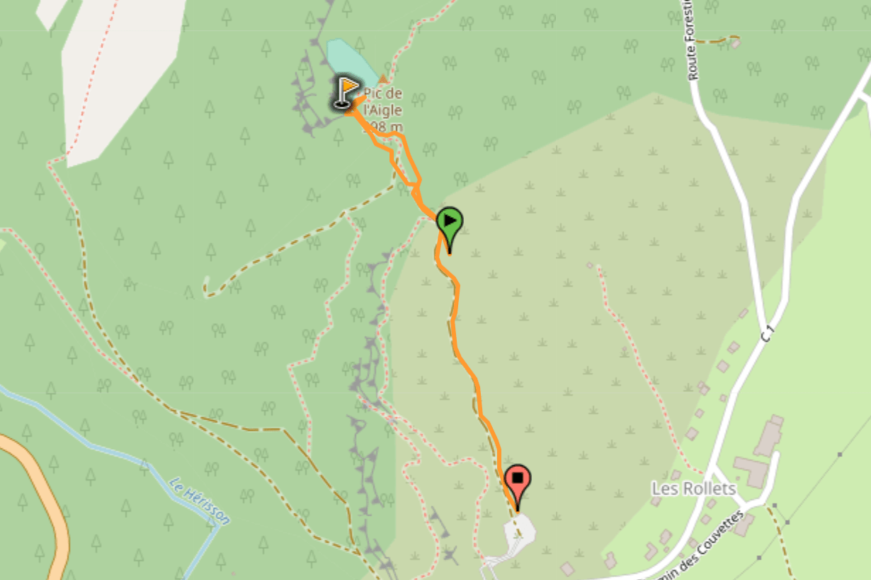
The trail on the GPX file starts a bit late, after the first few meters on the trail. For the start, just follow the signs out of the parking lot and head up on the trail, you’ll be fine.
Hike distance: The distance of the hike is 1.2km / 0.75 miles including the return trip
Hike duration: If you simply go down & back up, it will take you around 25mn
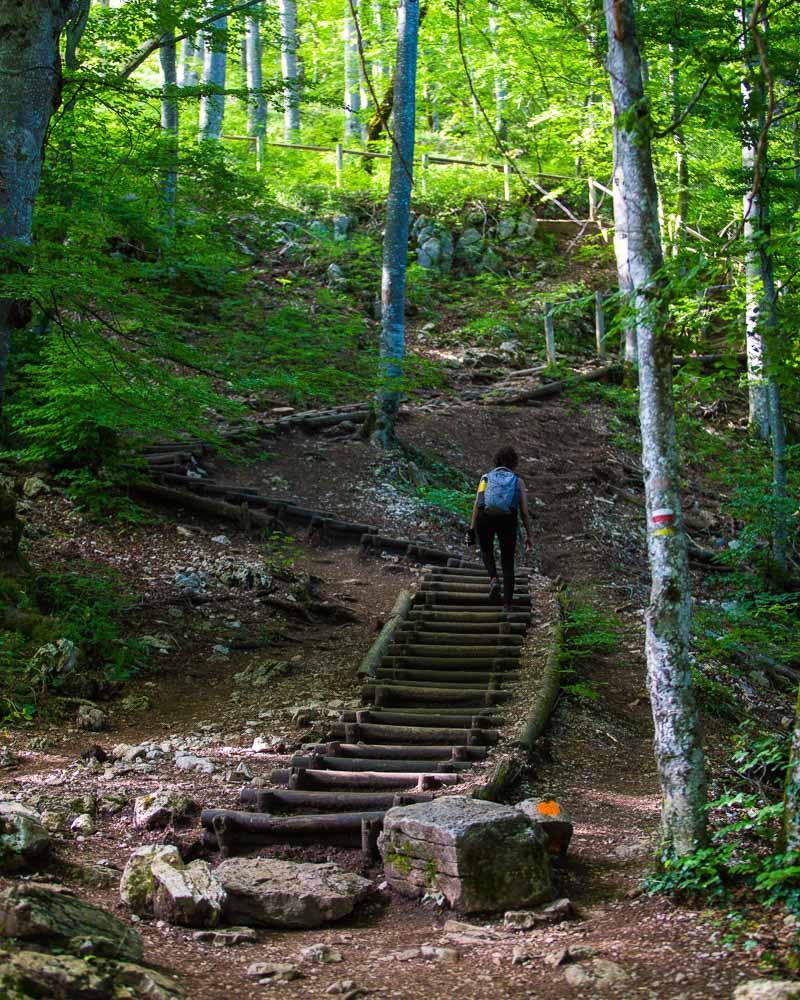
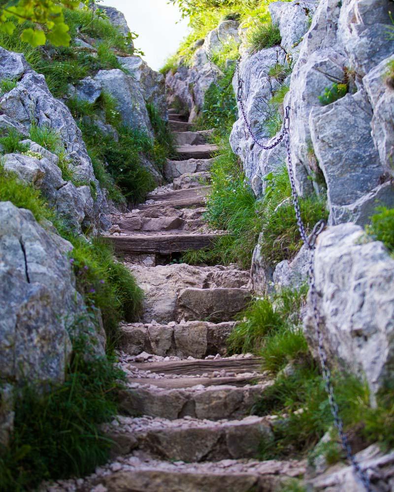
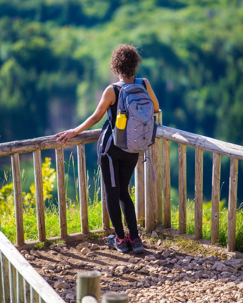
Hike difficulty: I had to list this hike as “moderate” because there’s one tricky part. The final climb to the viewpoint is a steep stair made of wooden logs and big stones. There’s a metal chain on the side of the rock to make it easier to climb, and there’s no danger there (see photos below). Other than that, it’s an easy hike
Hike elevation: 70m (230 feet) climb to the viewpoint, starting with a slow incline on the trail then steep climb with the stairs
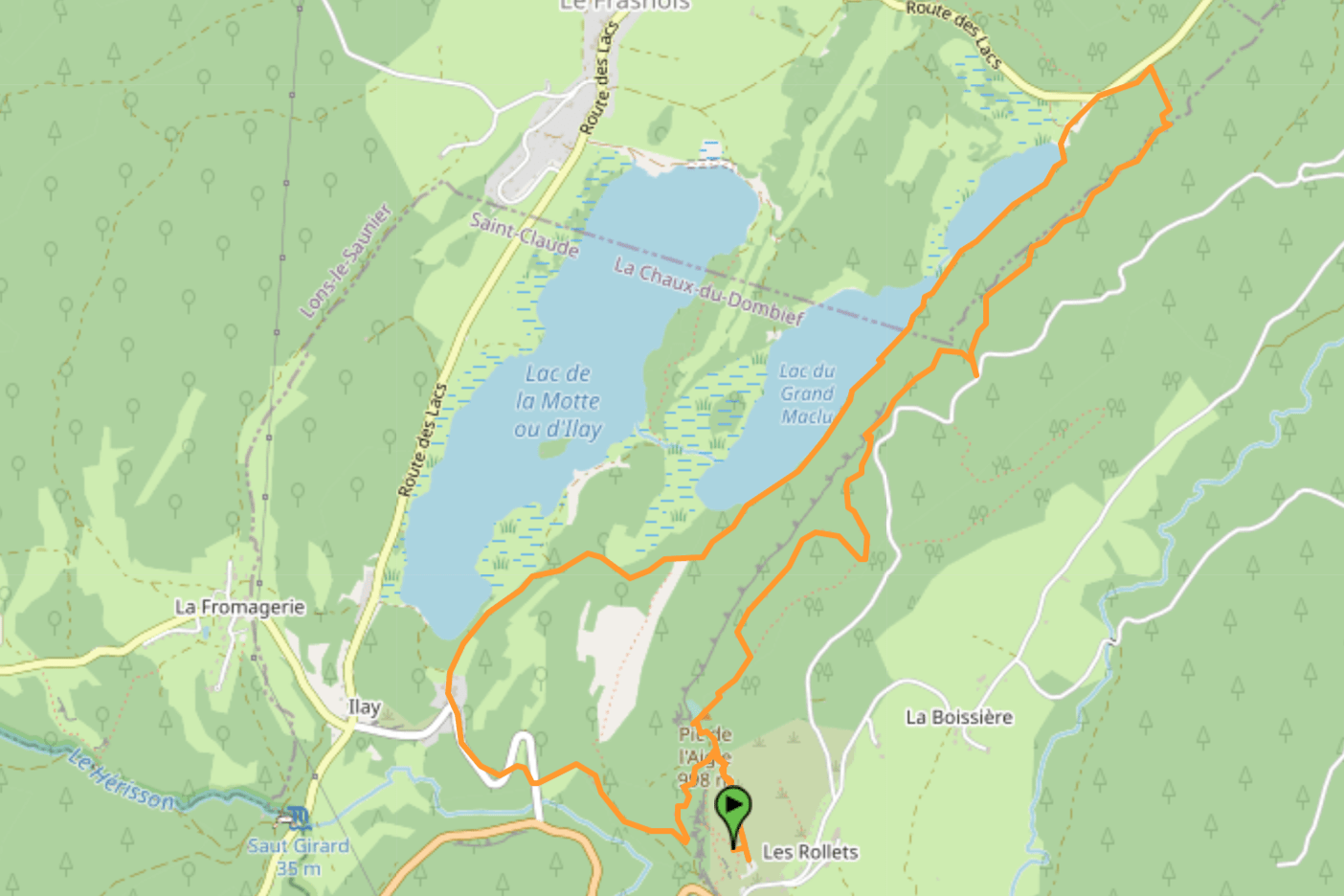
2. Hike to Pic de l’Aigle and Belvédère des 4 Lacs
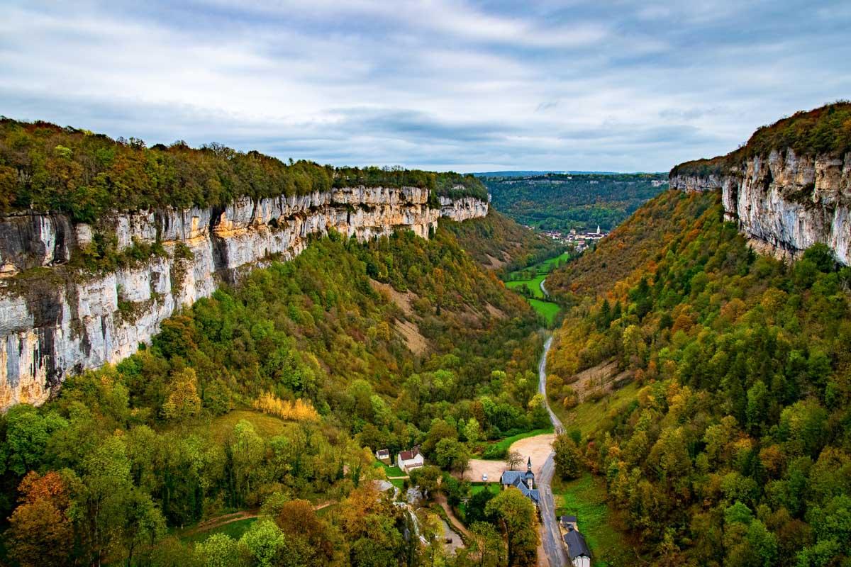
This second hike is the most popular: it starts with the same hike as above to the Pic de l’Aigle. Then from the Pic de l’Aigle it follows the ridge all the way to another epic viewpoint, the Belvédère des 4 Lacs.
Randonnée Pic de l’Aigle
Once you reach the Belvédère des 4 Lacs, you go back on the same trail towards the Pic de l’Aigle and finish off the hike at the parking lot where you came from.
3. Long Loop to Pic de l’Aigle and Belvédère des 4 Lacs +
And finally the last option, the longest of the 3 hikes. This one starts like the previous one: parking lot, Pic de l’Aigle, Belvédère des 4 Lacs. But there you don’t turn back, you keep on going, hike down to the lakes, and hike along the lakes before the final climb to the parking lot.
From the Belvédère des 4 Lacs, a steep forest trail goes down to the lake; it can get pretty slippery if the ground is wet, so be careful there.
Randonnée Pic de l’Aigle
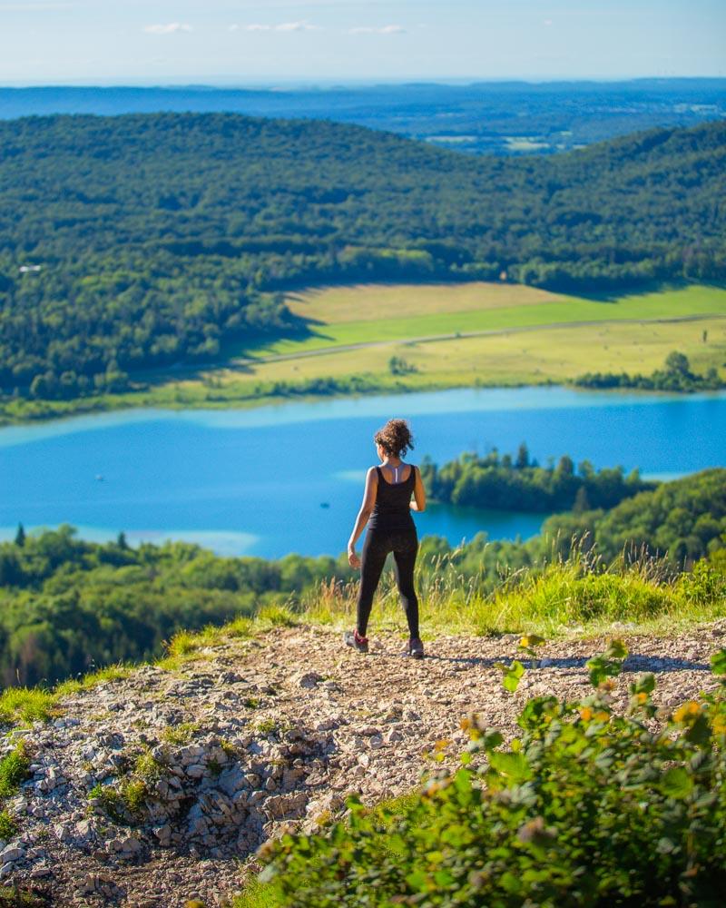
Hiking to the Pic de l’Aigle
We had a nice day around the 4 lakes area, starting by the Belvédère du Mont des Ifs hike in the morning, then we hiked around the 4 lakes. Ready to gain a new perspective above the lakes, we drove to the Pic de l’Aigle parking lot.
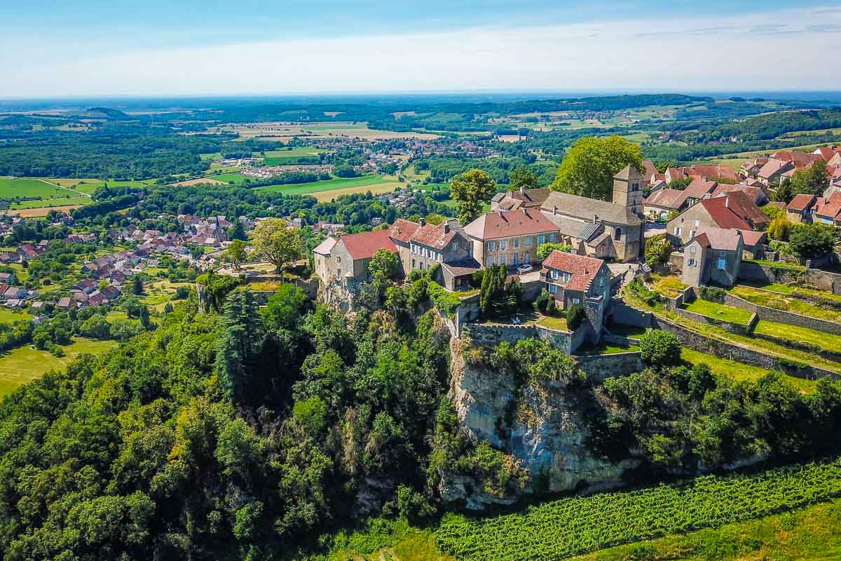
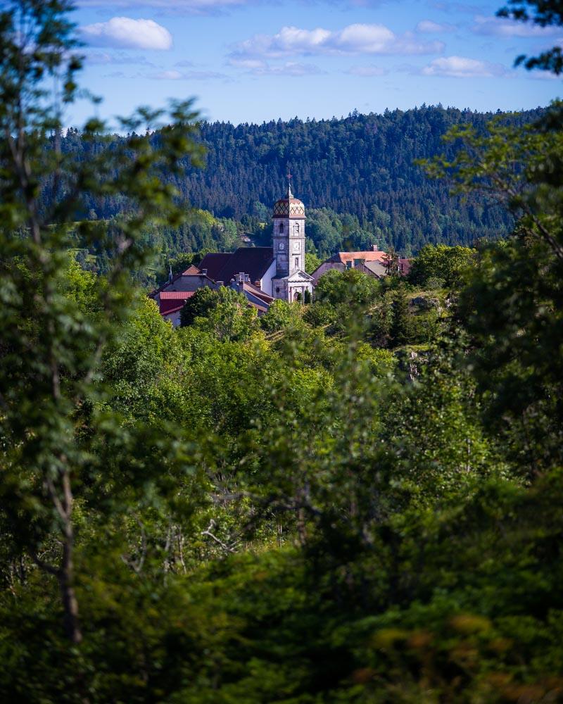
From the parking lot, the hike starts easy, on a big wide rocky path. It climbs slowly, out in the open. I turned back on the trail, and saw a nice church from the nearby village (Eglise Saint-Point). On the left of the church, I saw a massive white peak poking out above the trees: the Mont-Blanc!
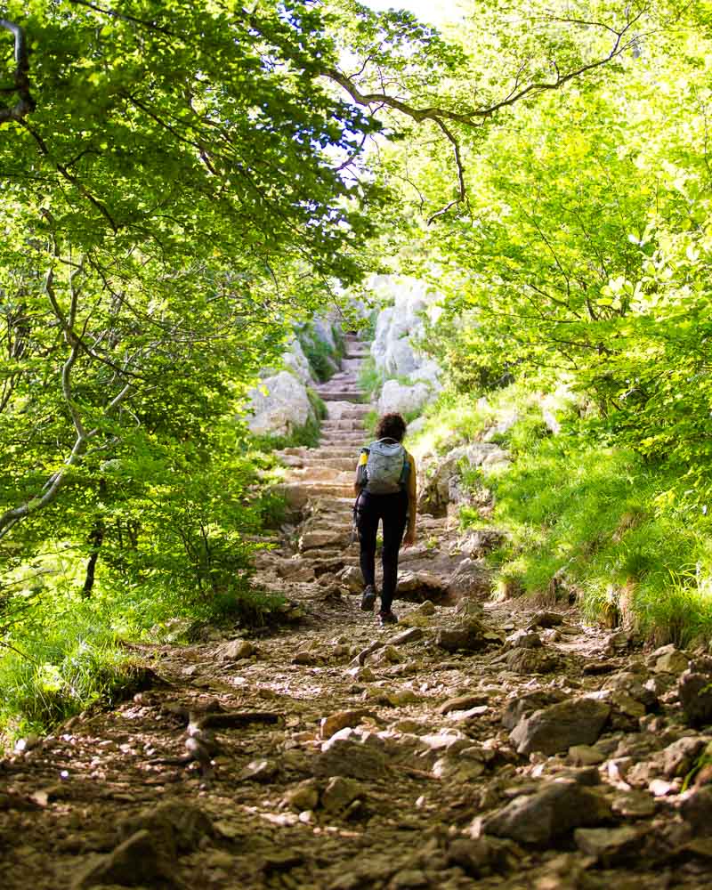
The path then entered a forest, and we quickly saw what the rest of the hike was going to be: steps all the way to the top! First, stairs made of wooden logs, getting the muscles working. Then you walk on a steep incline, with tree roots and big stones.
And finally, the last part of the climb: stairs made of stones, very steep, with a metal chain on the side to help you climb.
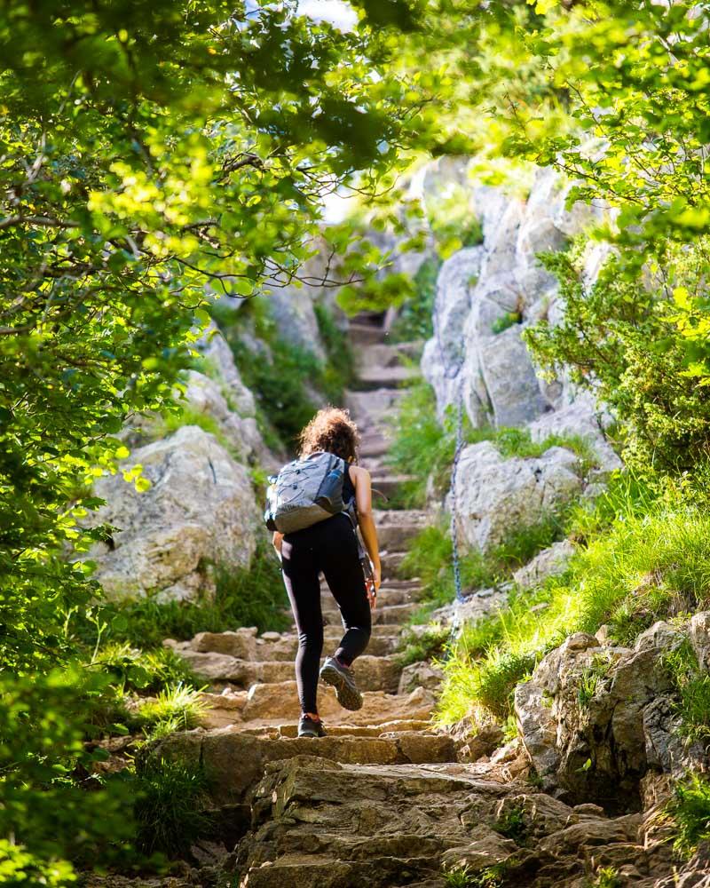
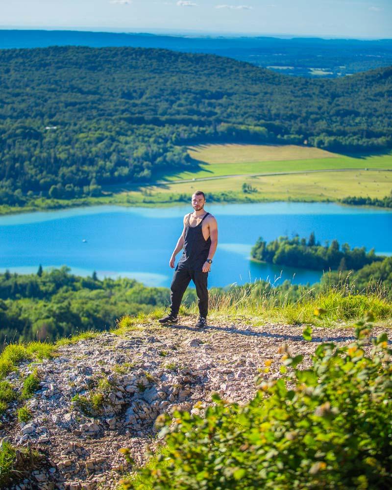
Yes, that’s steep. But the reward at the top was absolutely worth it!
You can see from the smile on Nesrine face that she quite enjoyed the view.
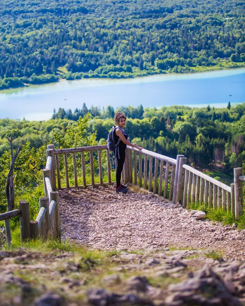
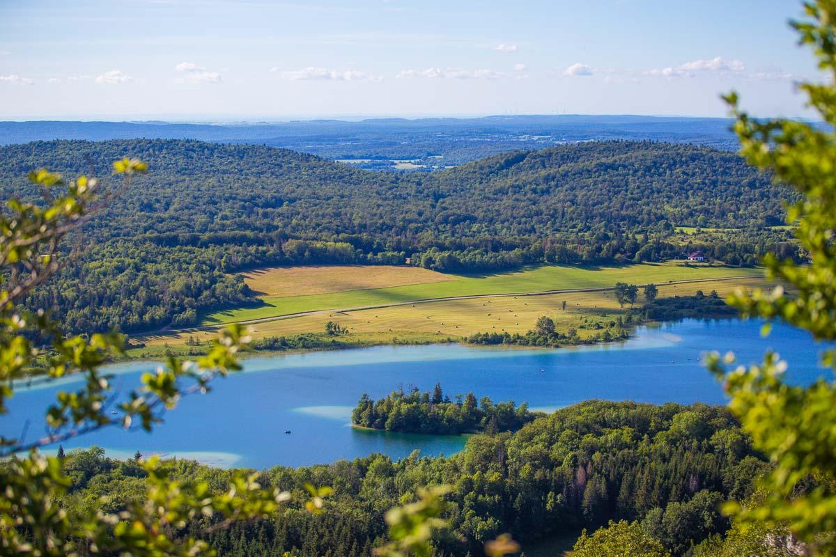
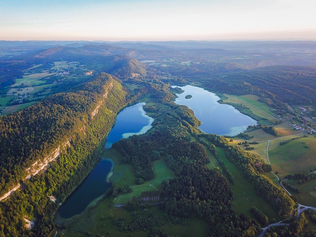
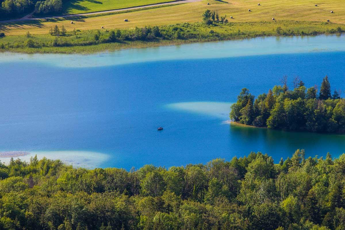
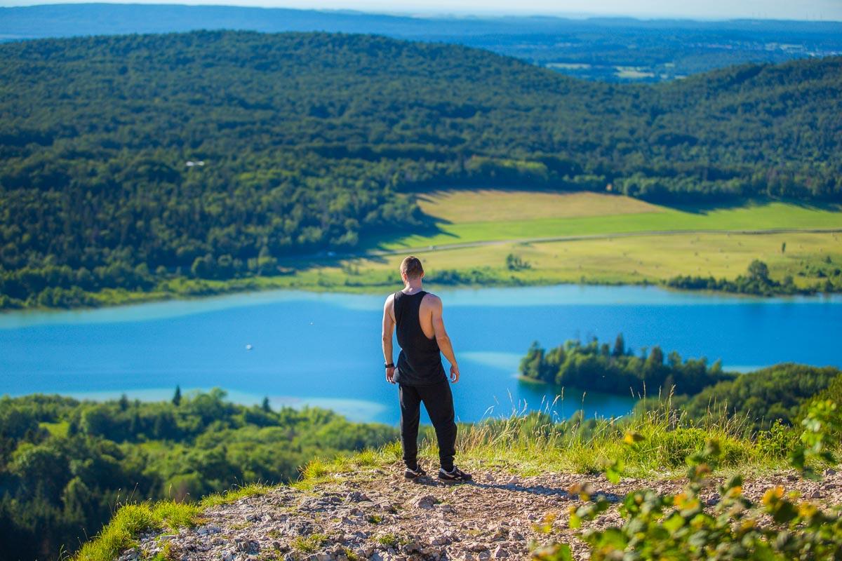
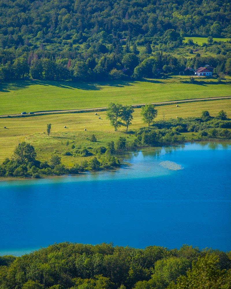
The viewpoint offers an incredible view over the Lac de la Motte (Lac d’Ilay). Even though there are 4 lakes in the same area, you can only see one from this viewpoint, but it doesn’t really matter, the view is epic!
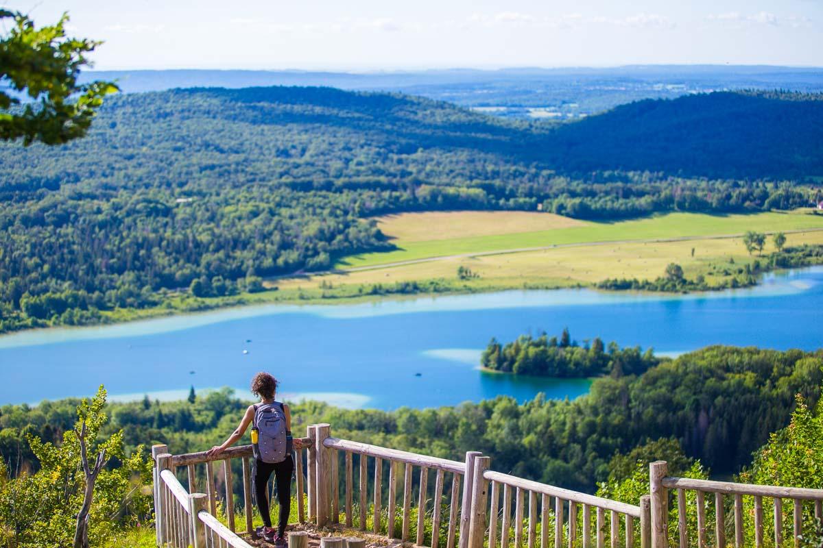
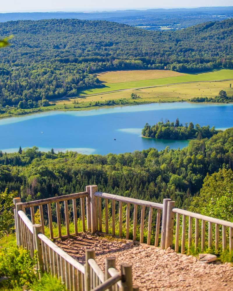
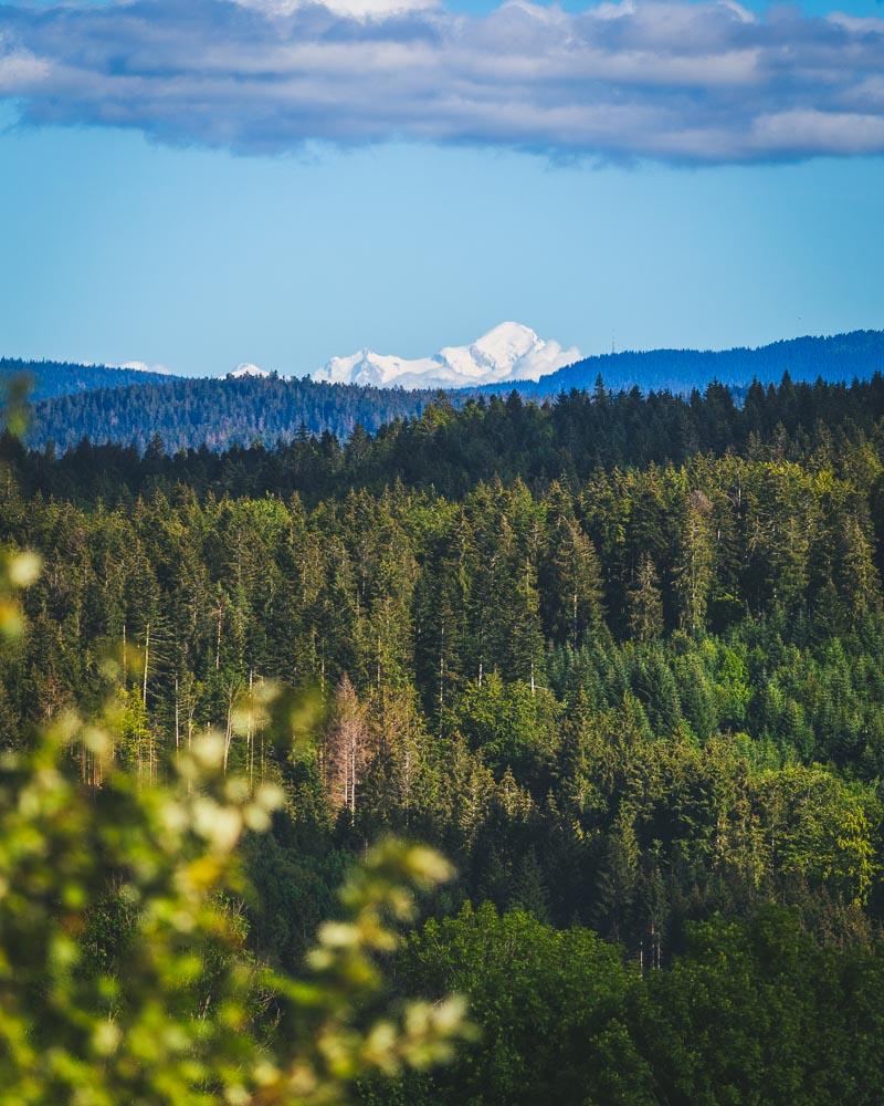
Behind the viewpoint there’s an orientation table where you can see all the peaks surrounding you. On clear days, you can see the Mont-Blanc in the distance, but clouds had covered it by the time we got up there.
We stayed for a while up there, simply enjoying the view, taking photos, and watching 2 paragliders take off right next to us to fly above the lakes.
From the Pic de l’Aigle you can hike to the Belvédère des 3 Lacs and Belvédère des 4 lacs, 2 other viewpoints from where you have views over the rest of the lakes (see different hikes above). It was getting quite late in the day, and we had already hiked a ton that day, so we decided to go back to the car and drive to the Belvédère des 4 Lacs (yes, you can drive right up to it).
-
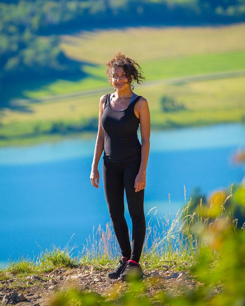
- Nesrine looking way happier than me
-
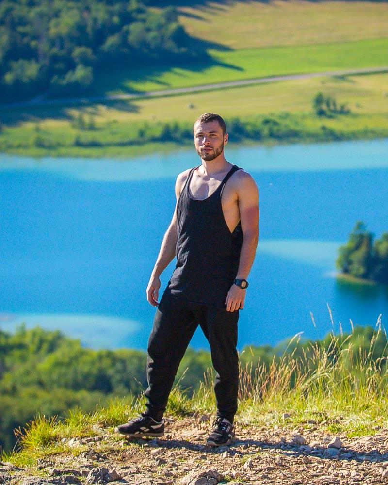
- Yes I got sunburns on my arms
Visit Jura
Planning your trip to Jura? You’ll find below a few other travel guides & key spots to see in the area.
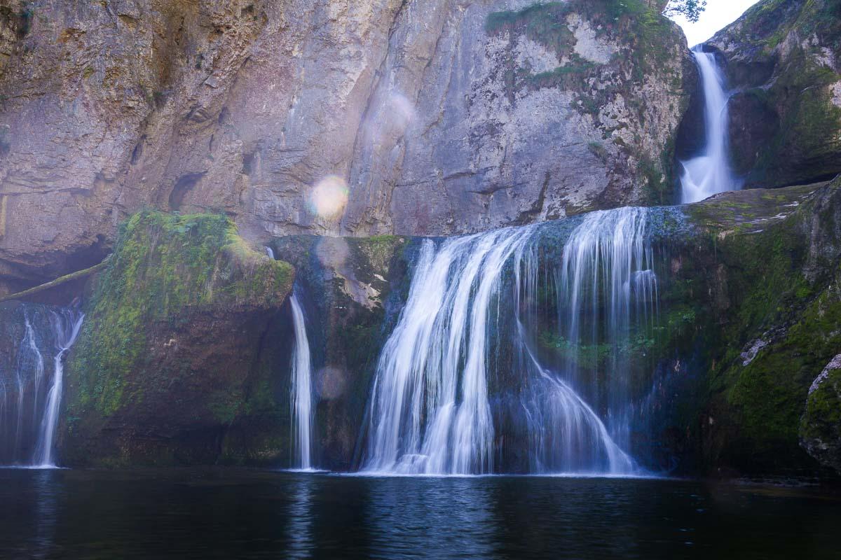
Cool waterfalls in Jura:
- Cascade de Baume les Messieurs
- Cascade des Tufs
- Cascades du Hérisson
- Cascade de la Billaude
- Gorges de la Langouette
The best hikes around:
The BIG guides:
I hope you enjoy your trip to Jura and to France; if you have any questions, let me know in the comments below, I always reply.
Help a fellow traveler and share this guide with the buttons below!
Travel Tools
Use any of our recommended links below to book your trip. You pay the same, and we earn a small fee; a great way to support us!

Pin this to Pinterest!
Enjoyed this guide? Then help a fellow traveler and pin it! They'll most definitely love you for it, 100% guarantee.