Belvédère du Mont des Ifs, Jura – Hike to Viewpoint
The Belvédère du Mont des Ifs is a viewpoint over the Lac de Narlay, part of the 4 Lakes.
Getting to the viewpoint is a short hike, and offers a stunning view over the turquoise lake.
Let’s see how to get to it.
How to Get to Belvédère du Mont des Ifs
The Belvédère du Mont des Ifs is located in the East of Jura, 23mn south of Champagnole and 50mn east of the department capital Lons-le-Saunier.
Location: Google Maps
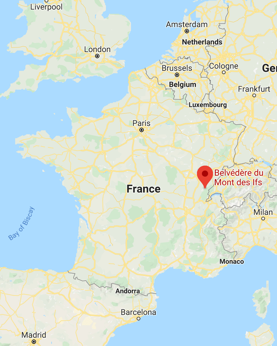
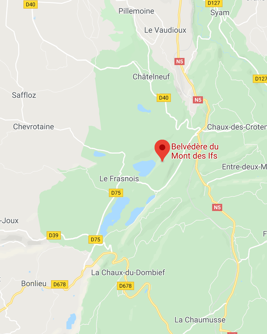
It’s not far from the Gorges de la Langouette (15mn), and the famous Cascades du Hérisson (20mn).
You can’t actually drive all the way to the viewpoint. You’ll need to head to this free parking spot, from where you’ll be able to start the hike. The parking lot is right on the side of the road, and it’s huge so you won’t have trouble finding a spot.
Belvédère du Mont des Ifs Hike Details
Getting to the viewpoint requires a short hike, with a low incline, on a large trail. You can either do a loop and go down from the viewpoint to the lake (with a steep descent), or head back on the dirt road to the parking lot.
Here are the details of the hike:
Belvédère du Mont des Ifs Hike

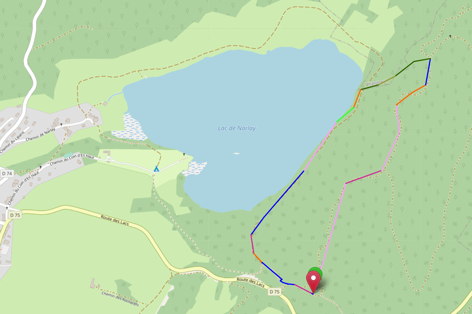
Hike distance: The distance of the hike is 2.52km / 1.6 miles including the return trip.
Hike duration: If you simply go down & back up, it will take you around 35mn.
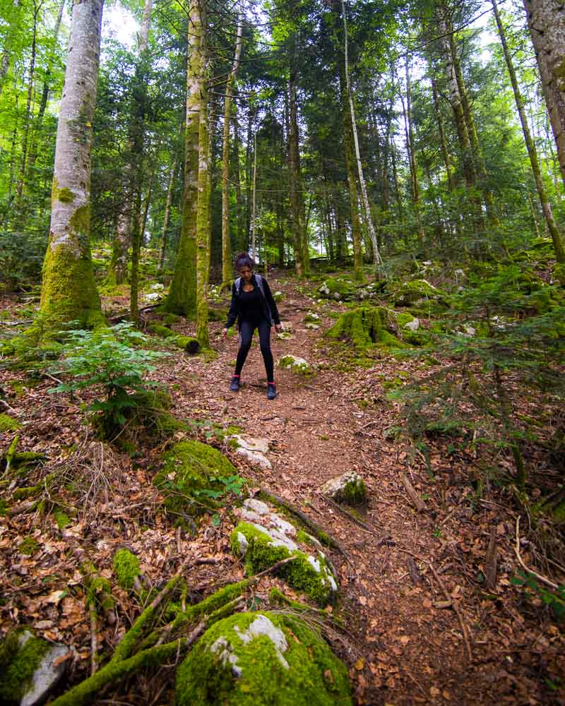
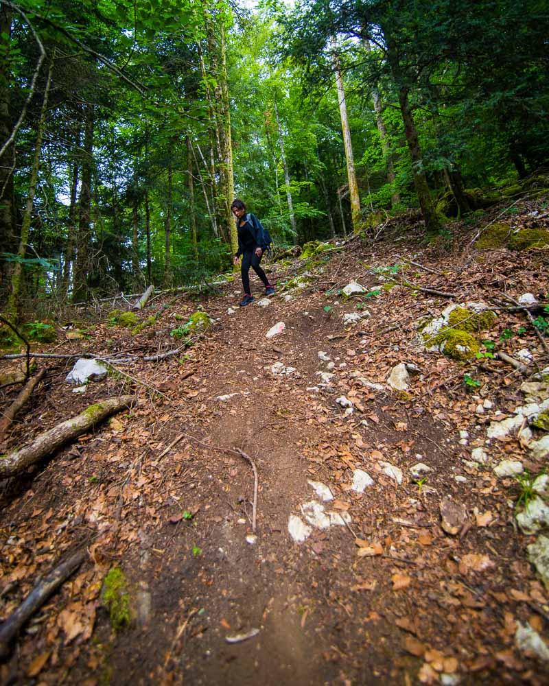
Hike difficulty: the way to the viewpoint is extremely easy, on a very large trail, with a slight elevation that will get your calves working. The way down from the viewpoint to the lake is on a steep trail, and uneven terrain. You walk on tree roots & big stones, so you’ll need to be careful there. This short passage (5mn) is the only reason this hike is rated as “moderate”.
Hike elevation: 85m (279 feet) slow uphill climb to the viewpoint, then steep 85m (279 feet) decline back to the lake.
Hiking to the Belvédère du Mont des Ifs Viewpoint
We got to the parking lot early morning ready to start the 4 lacs hike. But before starting I saw a viewpoint on the map, named “Belvédère du Mont des Ifs”, and decided to first check it out. There was no photo on the Google Maps location so it was a bit of a gamble, but that’s what adventure is about right?
The trail starts easy, on a large dirt trail in the forest. It then turns into a dirt road, and starts to climb a bit.
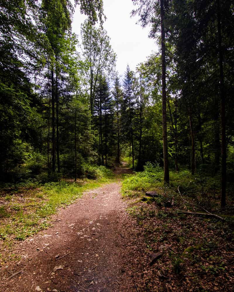
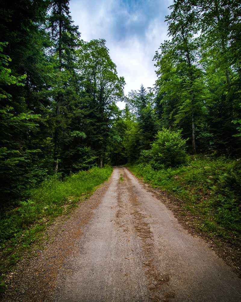
There’s no difficulty at all on the way to the viewpoint, and you can’t get lost. There’s one road that you just follow straight to the viewpoint.
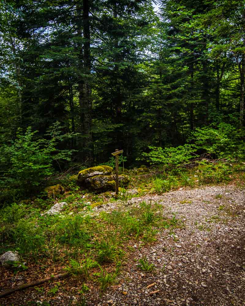
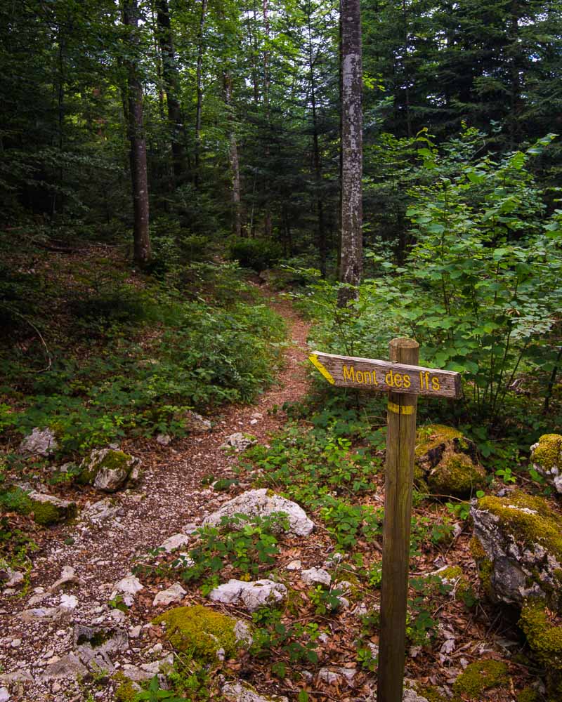
When approaching the viewpoint on the map, start to look around for signs. There’s a wooden sign on the side of the road, and this is where you’ll need to leave the main road to reach the viewpoint.
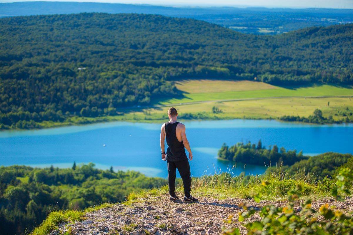
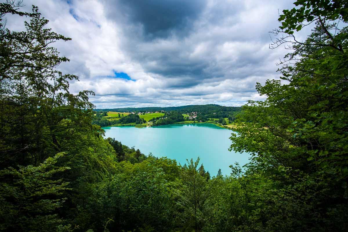
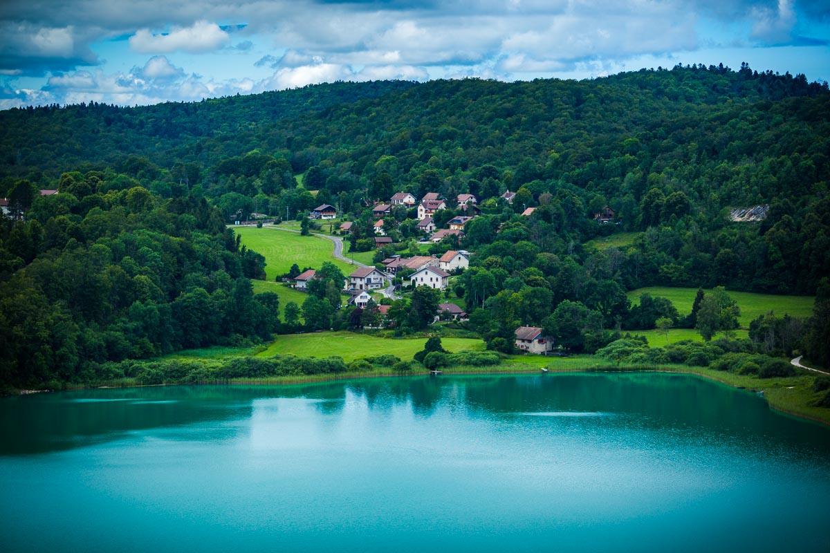
All along the hike to the viewpoint, there’s no view on the lake, and I was wondering what kind of view to expect up at the viewpoint. After walking for a few meters on the trail, we finally reached an opening in the trees, with the viewpoint.
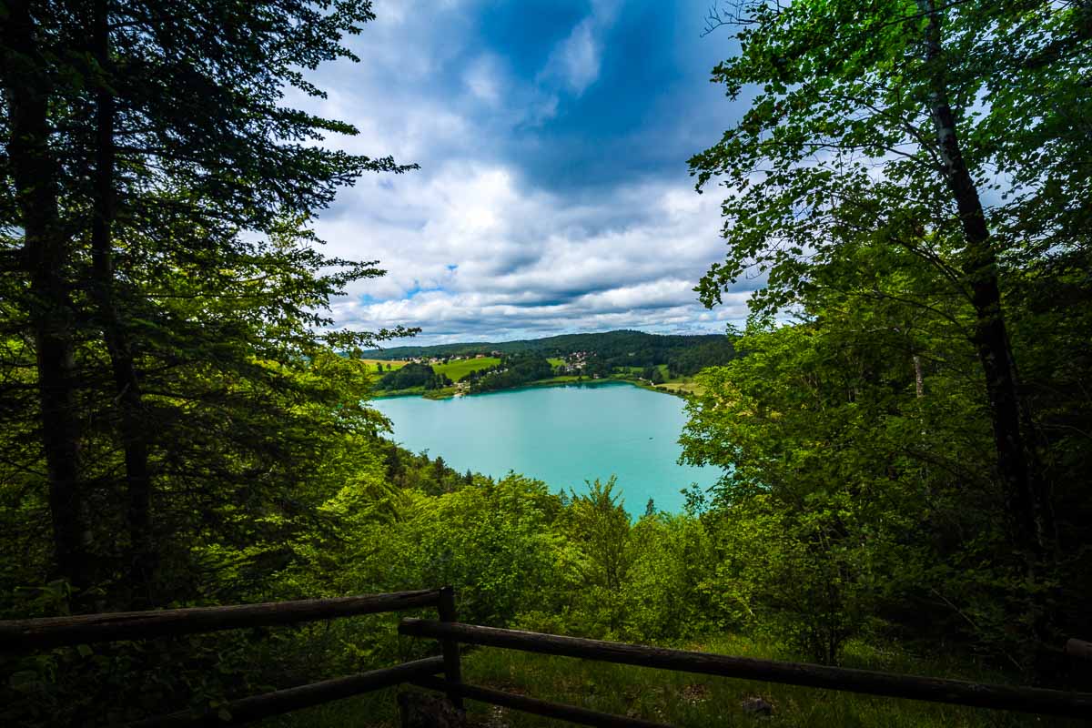
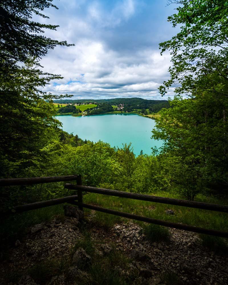

We had zero expectations, and we were really happy to find such a great view over the Lac de Narlay. There was no one else than us, and we sat down on the rocks to enjoy the view. The perfect spot to sip some hot coffee from my thermos.
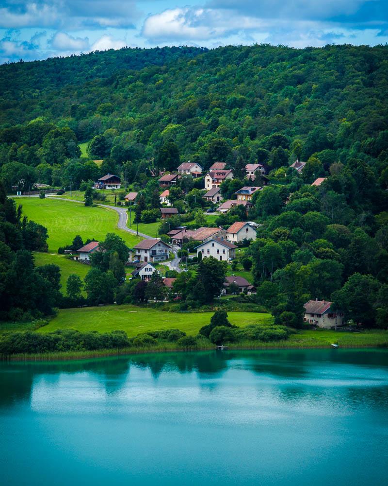
From the viewpoint you can see the Camping Lac de Narlay on the other side, a campground with direct access to water.
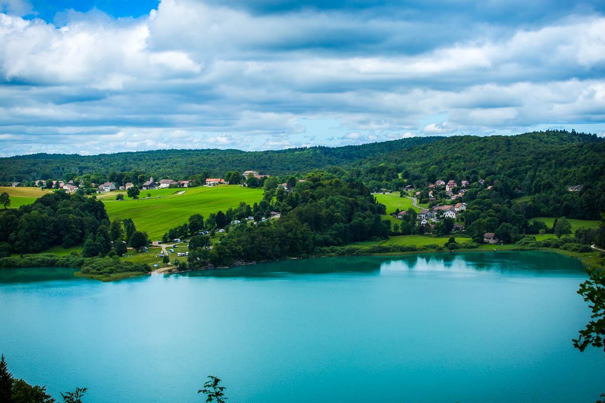
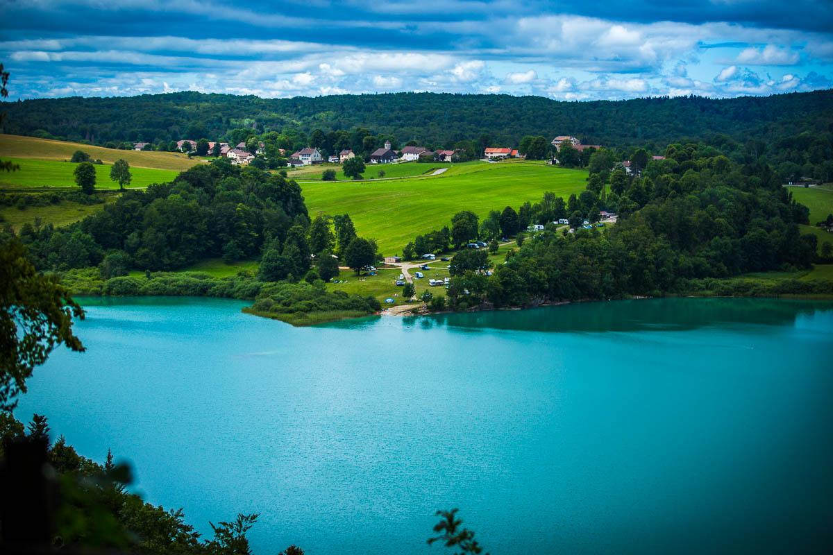
You can also see the village (part of Le Frasnois), and part of the hiking trail going around the lake.
Return from the Viewpoint
From the viewpoint, you have 2 options to go down:
- a steep trail that goes to the lake
- go back from where you came from
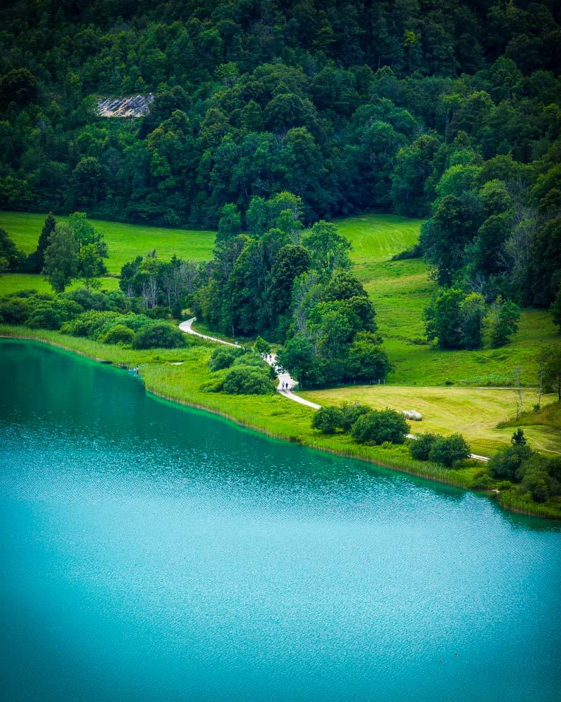
Steep trail to the lake
This option is the one included in the GPX file and on the hike map above. It’s a steep trail in the forest, where you walk on uneven terrain, with stones and tree roots. It’s nice because it allows you to finish the hike by walking along the lake, but it definitely requires caution. This part is why I rated the hike “moderate”.
This is also the best way to continue to the 4 lakes hike, as the trail along the lake is part of the hike.
Go back from where you came from
If you’re not going to hike the 4 lakes hike, or if you don’t feel confident going down the steep trail, don’t worry. Simply go back from where you came from on the main road, and follow it down to the parking lot.
Visit Jura
Planning your trip to Jura? You’ll find below a few other travel guides & key spots to see in the area.
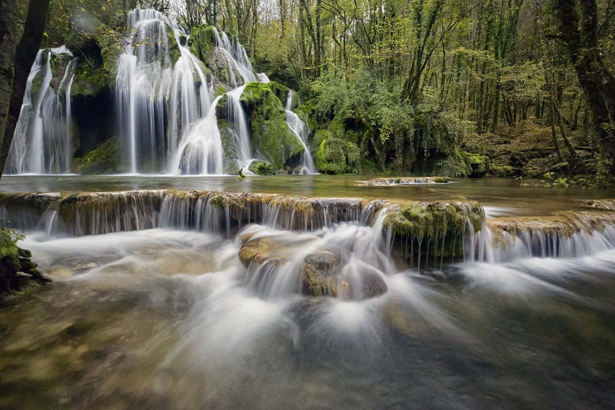
More cool waterfalls in Jura:
The best hikes around:
The BIG guides:
I hope you enjoy your trip to Jura and to France; if you have any questions, let me know in the comments below, I always reply.
Help a fellow traveler and share this guide with the buttons below!
Travel Tools
Use any of our recommended links below to book your trip. You pay the same, and we earn a small fee; a great way to support us!

Pin this to Pinterest!
Enjoyed this guide? Then help a fellow traveler and pin it! They'll most definitely love you for it, 100% guarantee.