Gorges de la Langouette Waterfall Hike in Jura, France (complete guide)
The Gorges de la Langouette are a natural gorge with the Saine river flowing down the canyon, 47 meters below (155 feet).
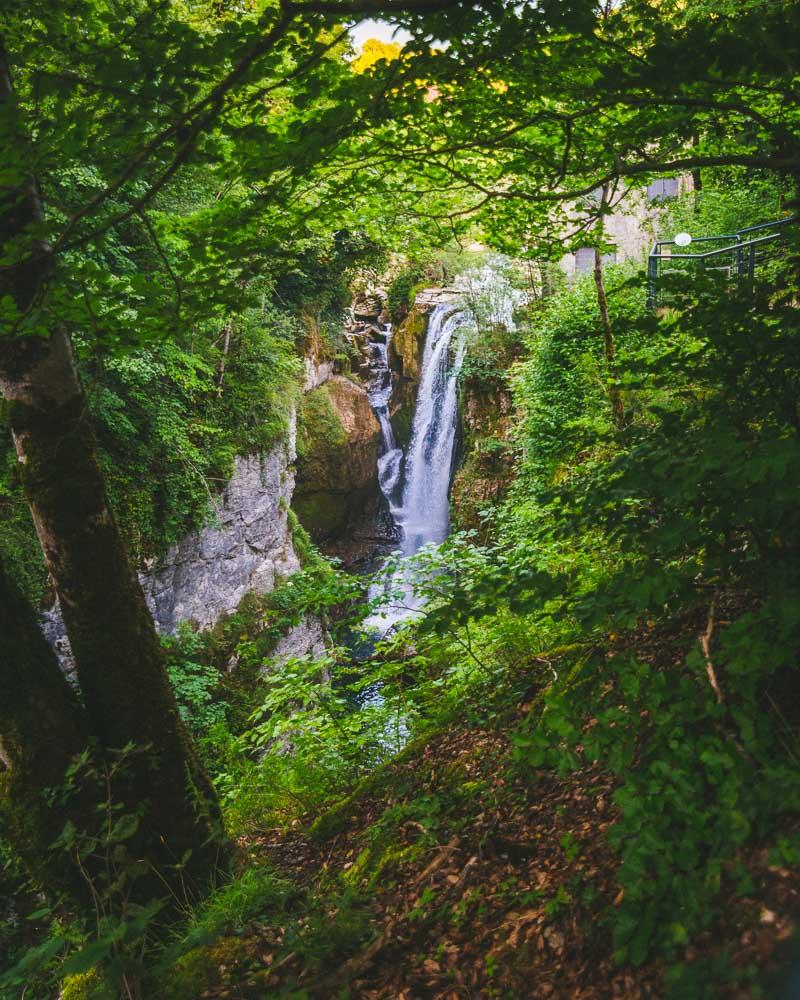
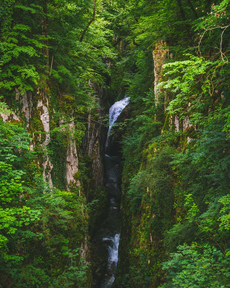
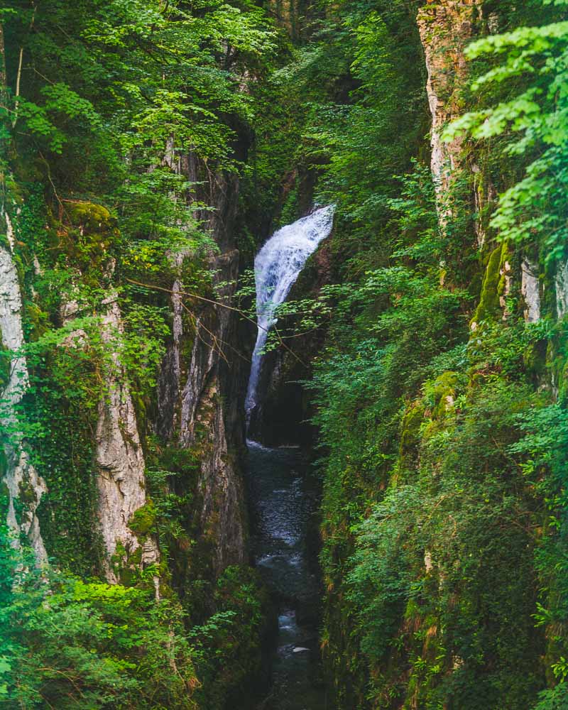
The hike takes you along the gorge, with views of several impressive waterfalls, including the Cascade de la Langouette.
Let’s see how to get to it.
How to Get to Gorges de la Langouette
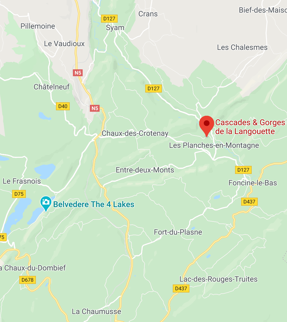
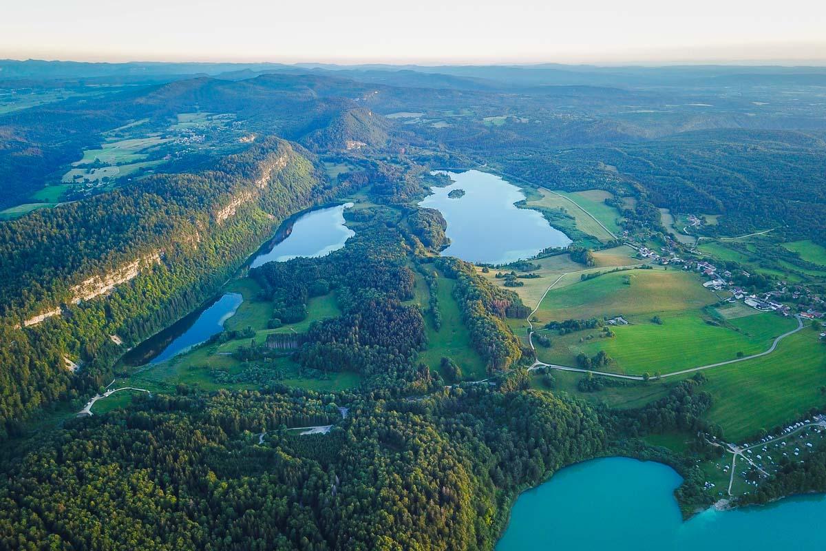
The Gorges de la Langouette, also known as the Cascade de la Langouette, is located in the East of Jura, north east of the 4 lakes.
Location: Google Maps
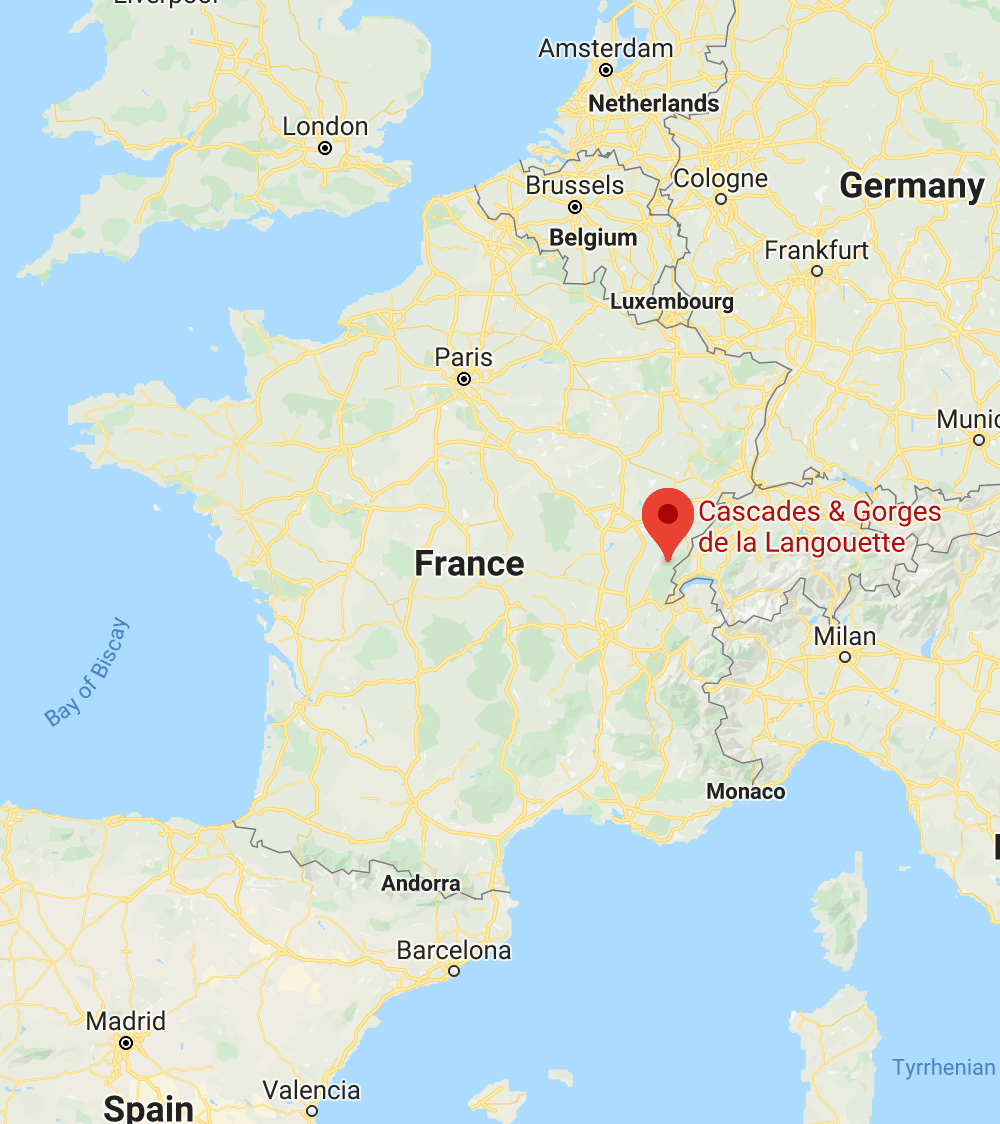
It’s around 20mn drive from Champagnole, and 50mn from the department capital Lons-le-Saunier.
When you get to the location, cross the small bridge over the river. There’s a small parking lot right after the bridge, with around 10 spots. If it’s full, there’s another parking lot in the village in front of the city hall.
Gorges de la Langouette Hike Details
The Gorges de la Langouette hike is a short trail going along the river gorge, where the Saine river flows. Along the hike you’ll see several waterfalls, from the safety of viewing platforms.
Here are the details of the hike, named “randonnée Gorges de la Langouette”:
Gorges de la Langouette Hike

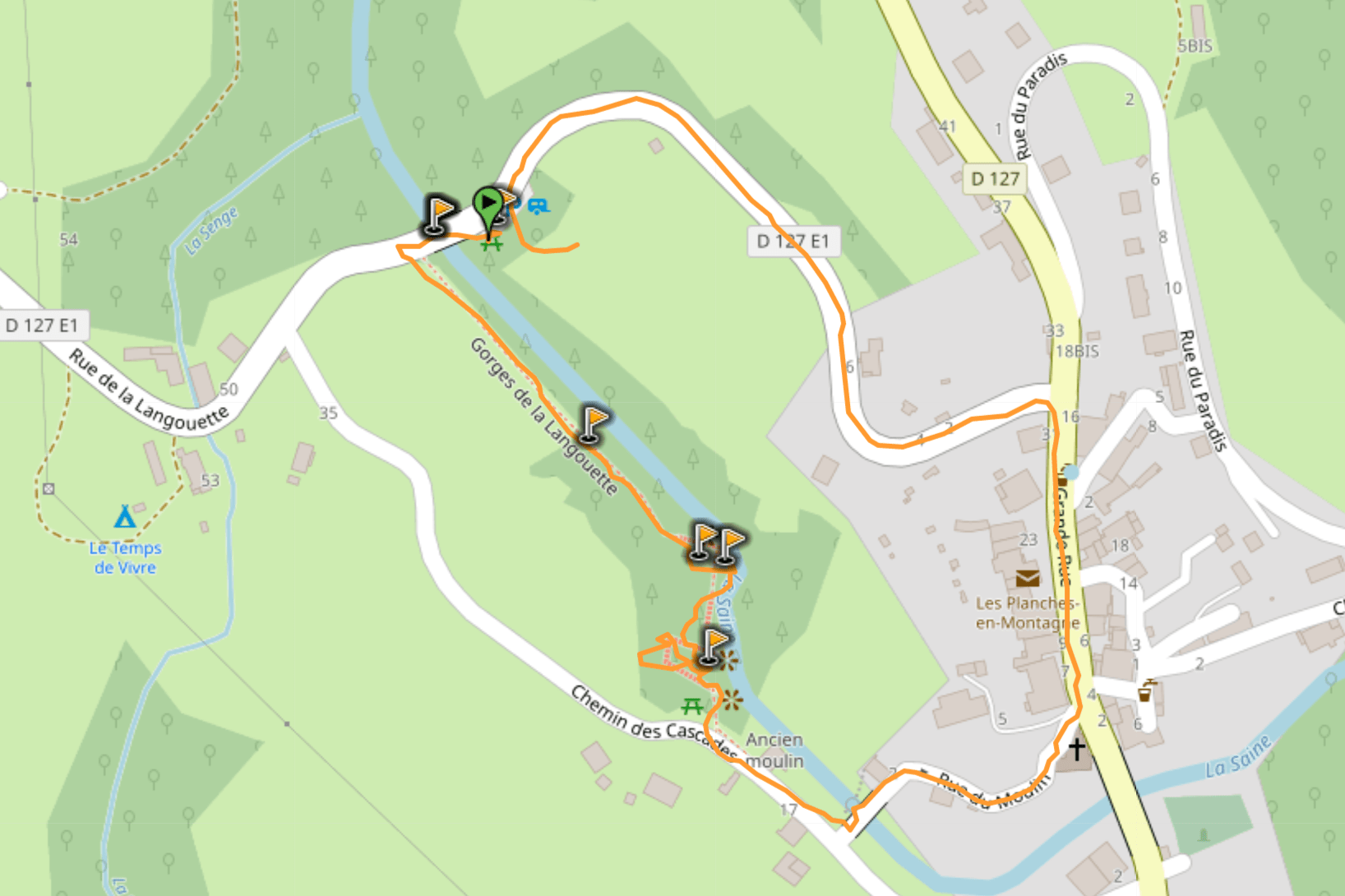
Hike distance: The distance of the hike is 1.4km / 0.8 miles including the return trip (it’s a loop).
Hike duration: If you simply go down & back up, it will take you around 30mn. Plan around 1h for the whole experience, including stops at the viewpoints.
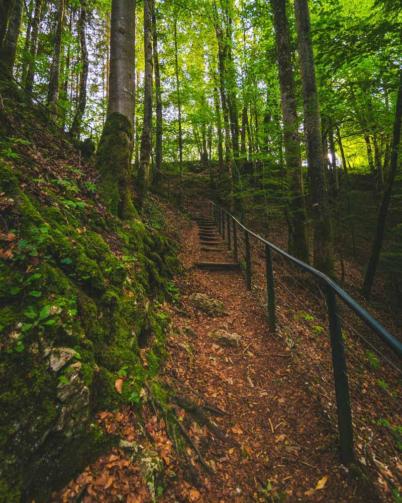
Hike difficulty: pretty easy hike on a well-maintained trail. There are wooden stairs, metal stairs, railings, and viewing platforms.
Hike elevation: almost no elevation on this hike, you stay on the same level above the gorge. Cumulated elevation change is 66m (216 feet).
Hiking to the Cascade de la Langouette
I recommend starting the hike from the top, next to the parking spot at the bridge, and not from the village. This way you’ll start by seeing the “less impressive” waterfalls, and hike your way towards the most impressive ones at the end.
I had spent the day at Château Chalon, a beautiful medieval village; I drove 45mn at the end of the day to reach my Airbnb, and the sun was already beginning to set. My host recommended the Gorges de la Langouette, nice waterfalls just 10mn away from the house; I packed my gear and off I went, leaving Nesrine home to relax after a long day.
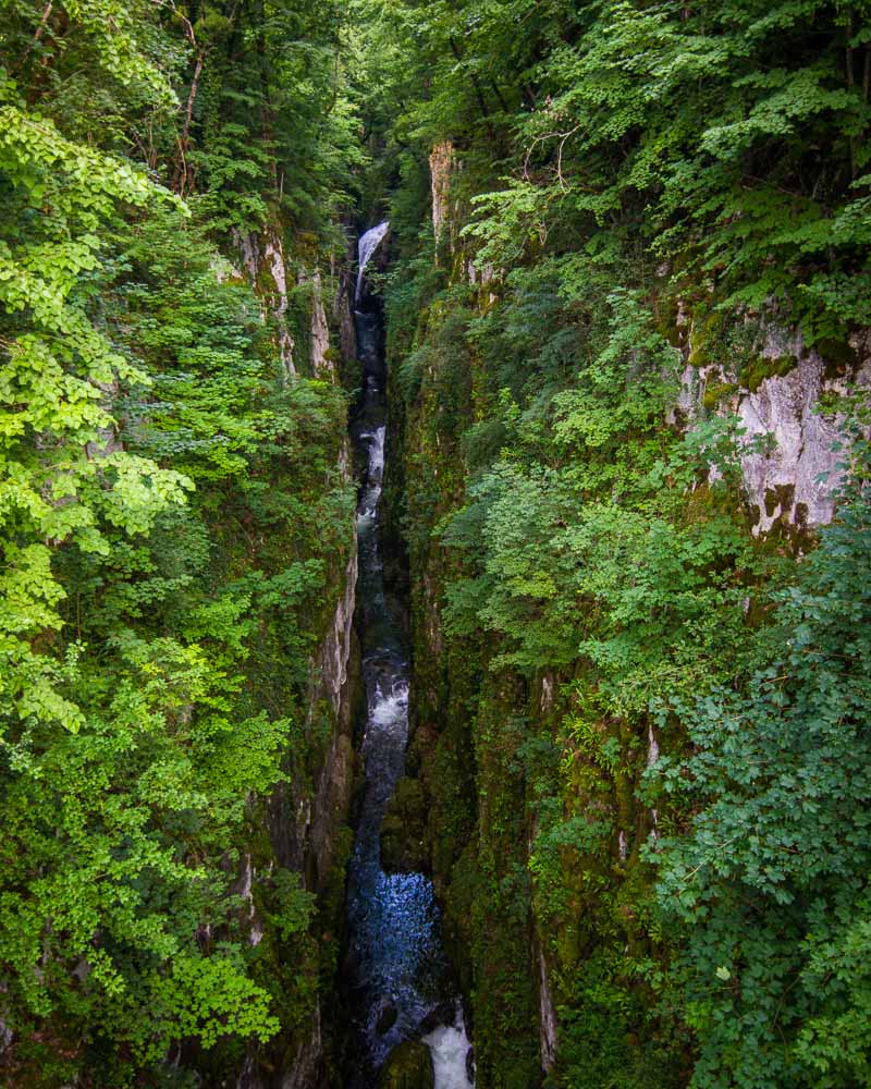
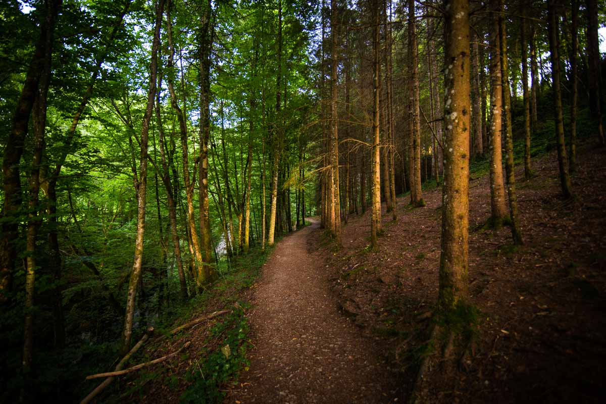
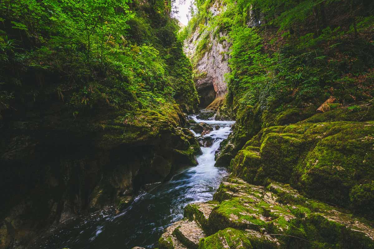
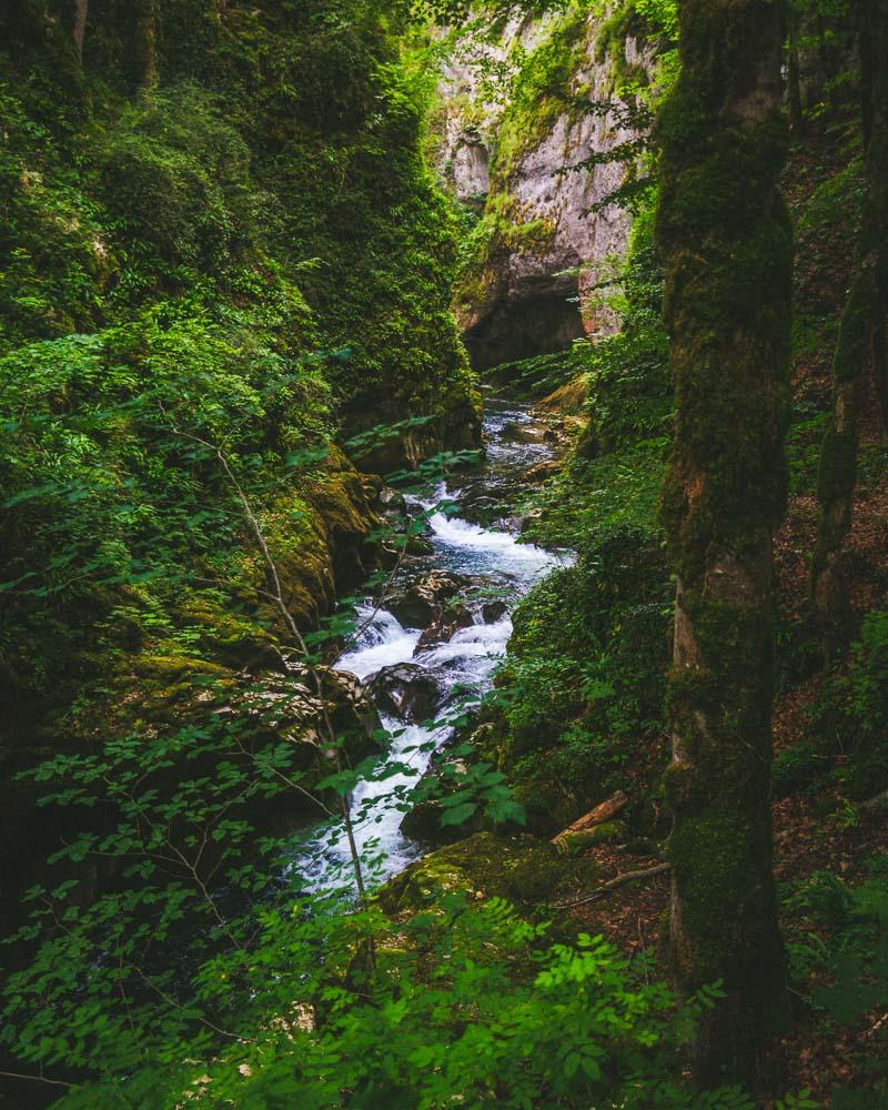
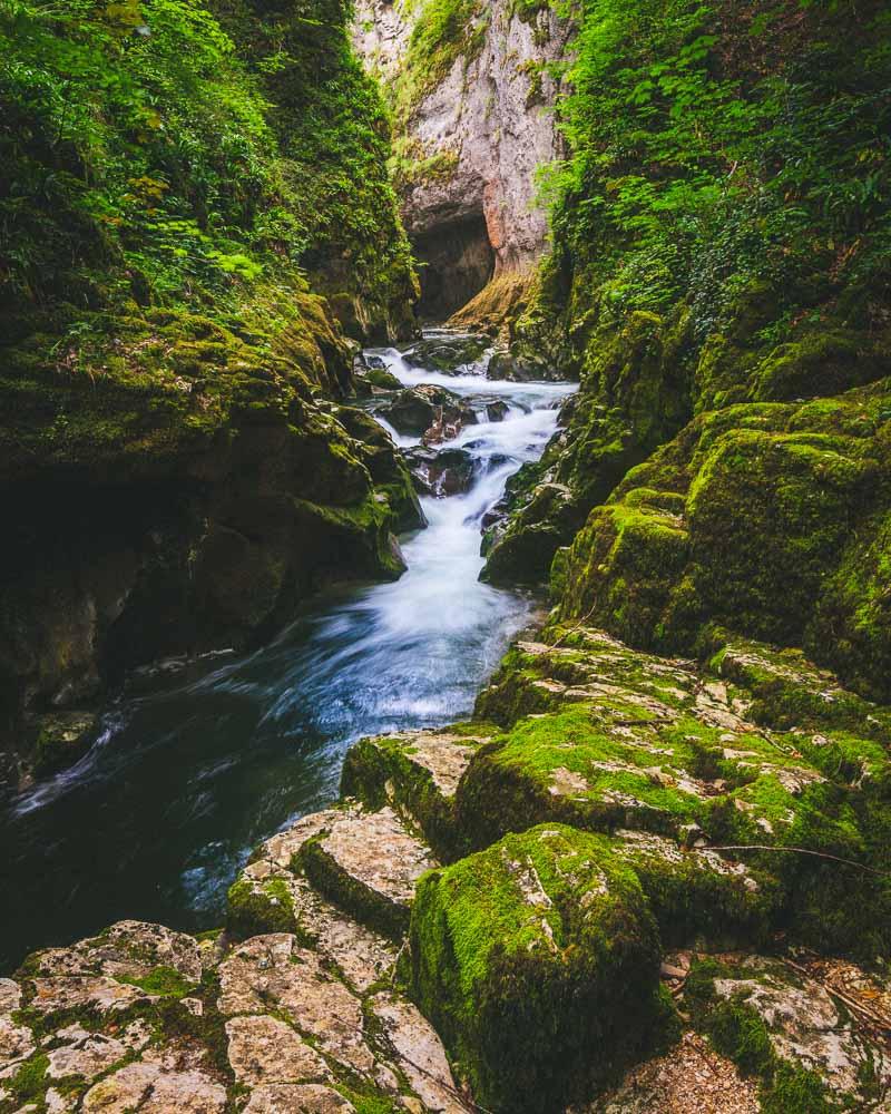
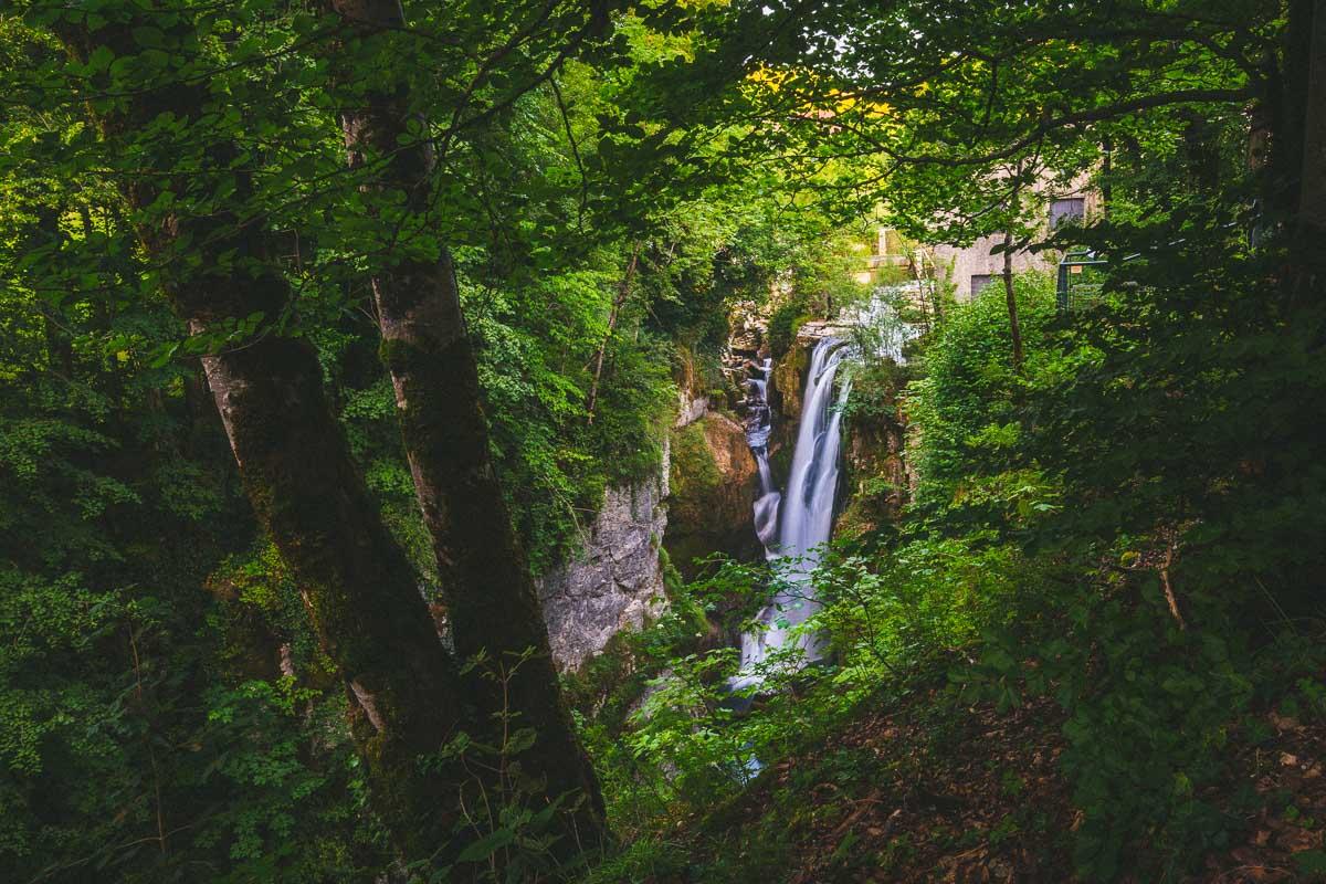
After parking right after the bridge, I walked on the bridge where I got my first view of the Gorges. A narrow gorge, surrounded by lush vegetation, with a first waterfall in the distance.
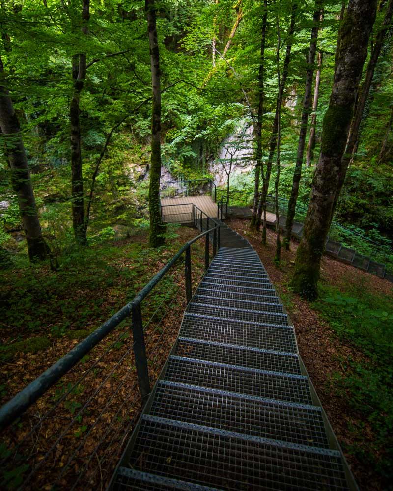
I took a few shots then crossed the bridge and climbed the stone steps starting the trail along the gorges. The hike enters a forest for the first few minutes, then it turns into metal steps leading to a first viewing platform.
From the viewing platform I was above the first waterfall that I saw from the bridge. Sadly I couldn’t get any good photos, but the view is nice and it’s quite impressive to see the flow of the water there.
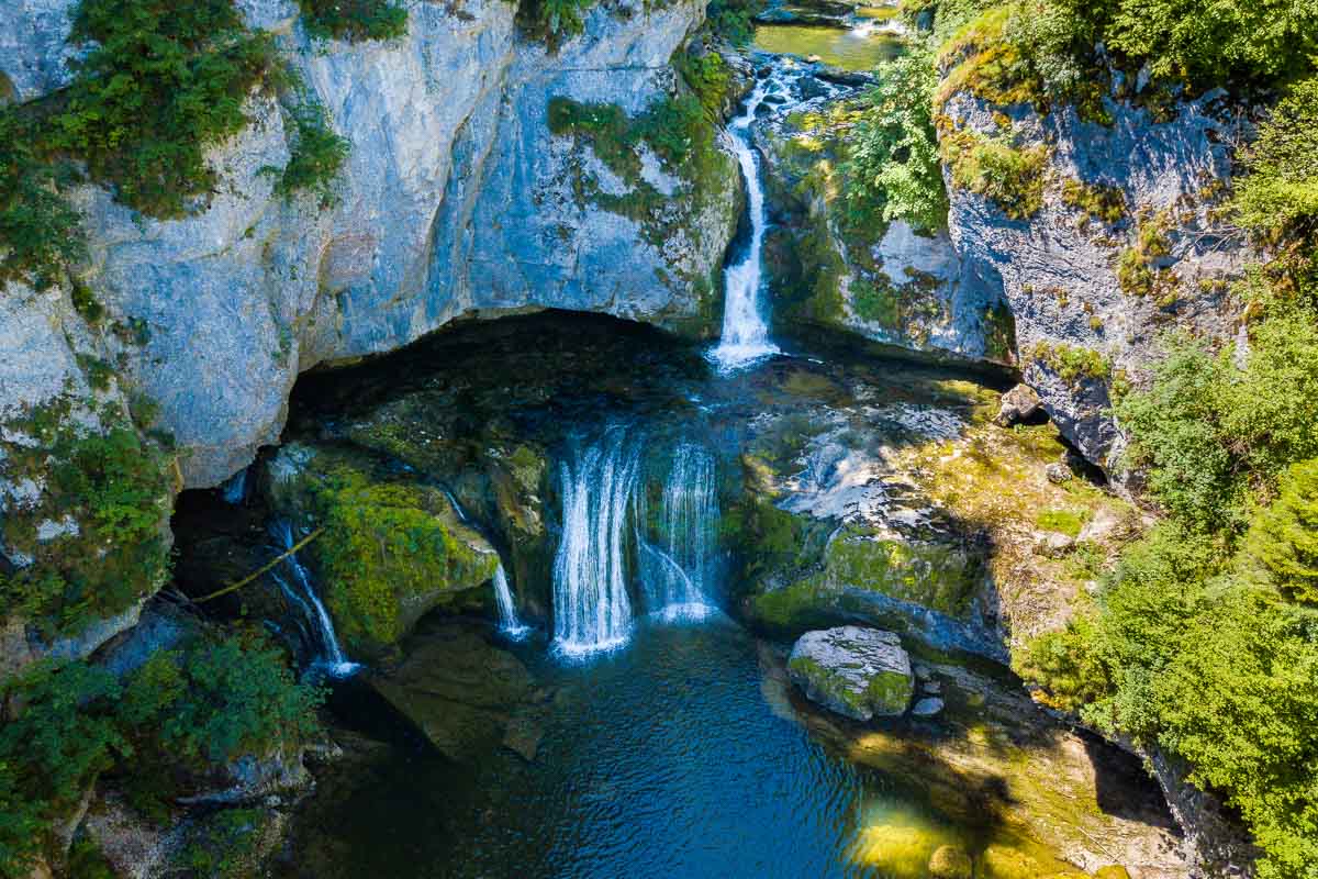
I kept on going and walked down the stairs to the right, getting to the lowest point of the hike. I was almost at the bottom of the gorge, but couldn’t get any good picture from the trail. I climbed the railing to get on the other side, and could get to the water.
It was in summer and it hadn’t rained for a while, so I felt safe going down there. Be careful when you’re there, as it can get slippery very quick.
I stayed down there only a short moment, worried about the light already starting to disappear. I went back on the trail, and climbed the wooden steps to the next viewing platform.
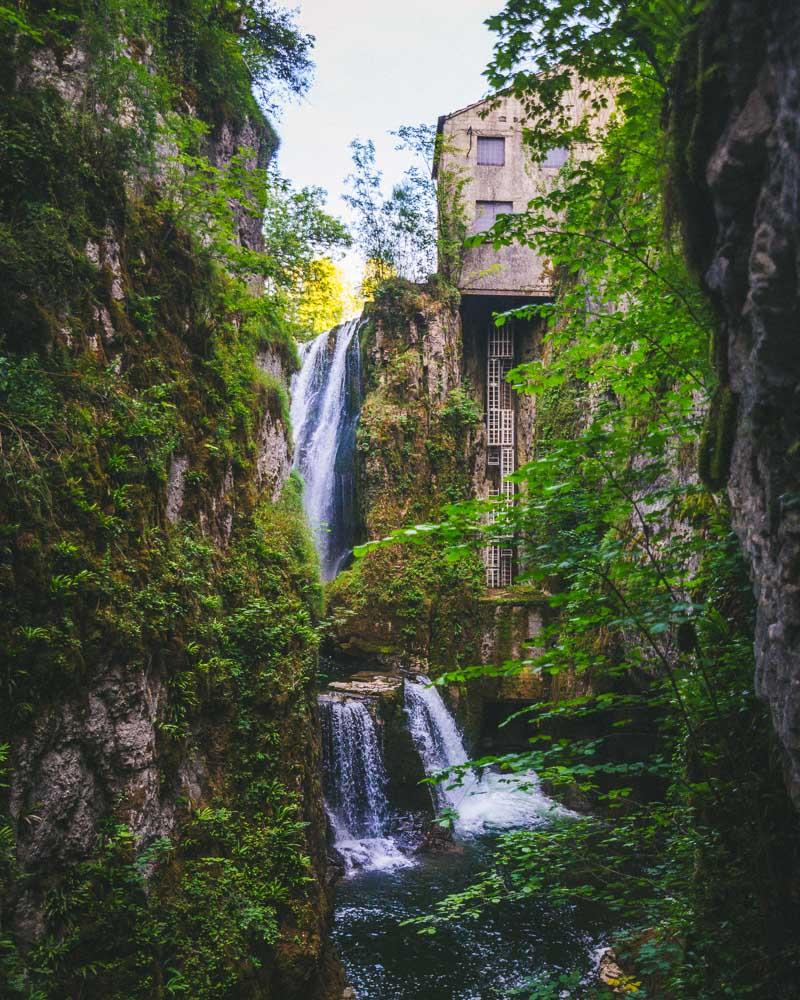
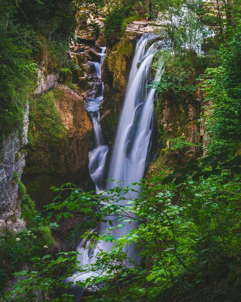
The viewing platform offers the best view of the hike: facing the double waterfalls, with the house on the cliff.
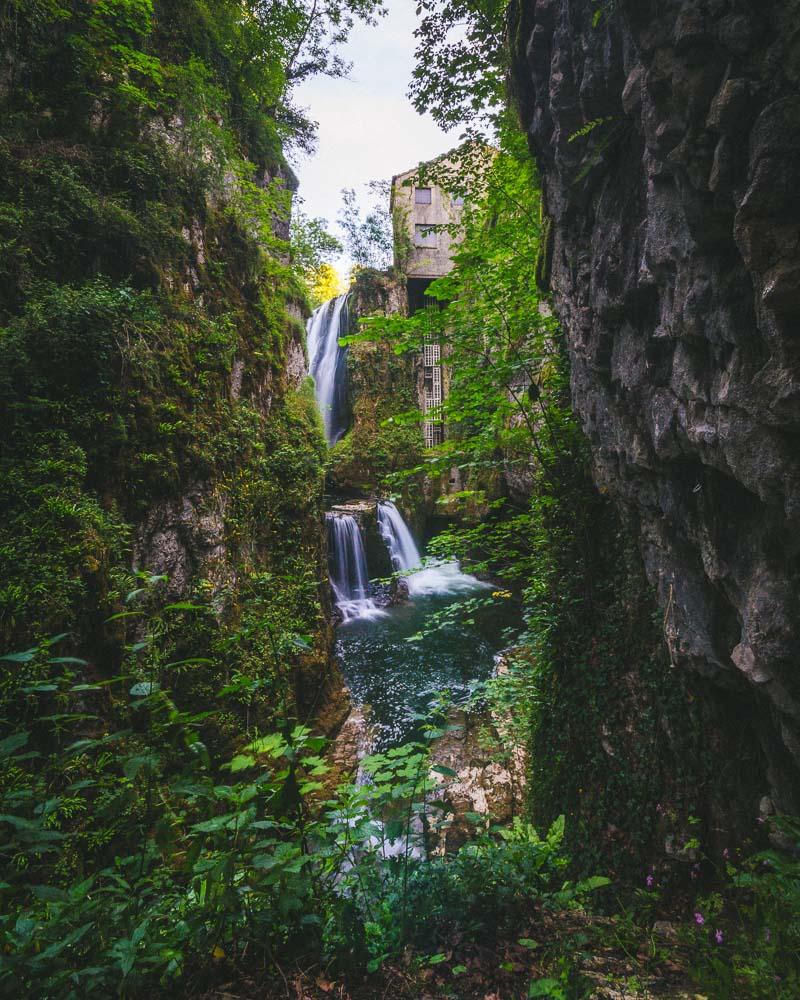
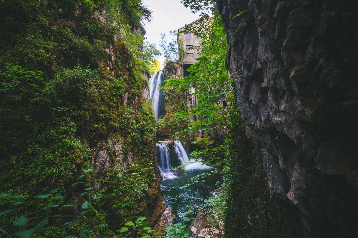
The house was once a sawmill, harnessing the energy of the waterfalls. Now the energy is used to produce electricity.
And finally, I made my way to the last part of the hike, going to the highest point of the trail.
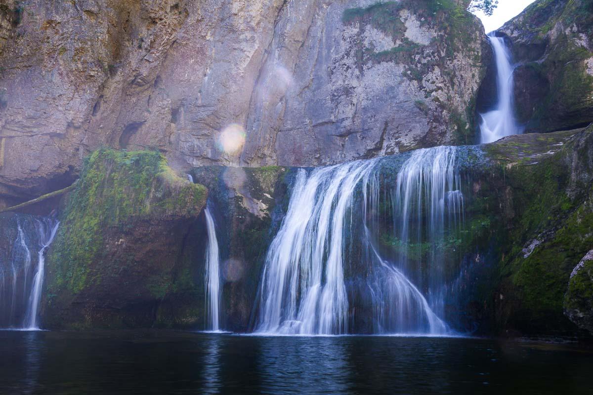
The final climb (very short climb) got me to the same level as the house on top of the waterfall. From there I had a great view of the waterfall below. There’s a last viewing platform right above the waterfall (you can see it on the right of the photo below).
After this waterfall, the trail exits the forest, and I got to an old watermill. It’s the end of the hike, and there’s no other waterfall to see after this one.
There you have 2 options for the return:
- cross the bridge at the watermill, walk through the village, and walk on the road back to the starting point
- turn back on the trail
The “official” hike takes you through the village and back on the road. It’s nice because you discover the village, but after that you’re walking on the road.
I recommend just turning back on the trail, it’s the shortest way back and you’re not really missing anything after the final waterfall.
Visit Jura
Planning your trip to Jura? You’ll find below a few other travel guides & key spots to see in the area.
More cool waterfalls in Jura:
The best hikes around:
The BIG guides:
I hope you enjoy your trip to Jura and to France; if you have any questions, let me know in the comments below, I always reply.
Help a fellow traveler and share this guide with the buttons below!
Travel Tools
Use any of our recommended links below to book your trip. You pay the same, and we earn a small fee; a great way to support us!
. The hike takes you along the gorge, with views of several impressive waterfalls, including the Cascade de la Langouette. jura tourisme | jura france travel | vacances jura | randonnée jura | france travel guide | france travel destinations | france travel amazing places nature | france hidden gem | france cascades | france hiking trails | hiking france
)
Pin this to Pinterest!
Enjoyed this guide? Then help a fellow traveler and pin it! They'll most definitely love you for it, 100% guarantee.


thanks for your beautiful sight and your useful info.
it fits our family’s traveling taste perfectly
we plan on traveling to the jura this august, got almost a month for jura & haut savoia, starting mid august.
i think i’ll wait for the masses to leave the montblan at the end of august an go then, crossing my fingers for a clear september up there.
if you can recommend 2 quiet places for ‘star’ day hikes – don’t be shy.
1 week in jura and 1 week elsewhere – also an option.
have a great spring!
michal bahat