Mont Baron & Mont Veyrier Hike in Annecy, France
The Mont Baron & Mont Veyrier are 2 mountains in Annecy, on the eastern shore of the lake.
You can hike to Mont Baron, then go on a scenic balcony walk to reach Mont Veyrier. And of course, it offers a panoramic view of the lake and the mountains around.
Ready to hike? Let’s see all you need to know for this Mont Baron & Mont Veyrier hike! :hike:
TABLE OF CONTENTS
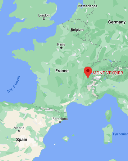
Where are the Mont Baron & Mont Veyrier
The Mont Baron and Mont Veyrier are on the city of Veyrier-du-Lac, right next to Annecy in the Haute-Savoie department. Veyrier-du-Lac sits on the eastern shore of the Lac d’Annecy, 10mn away from Annecy city center.
Location: Google Maps
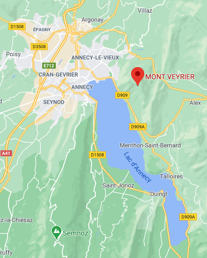
Most of the village is located on a thin piece of land along the lake; in the back rises the Mont Veyrier/Mont Baron mountains. It’s across the lake from Sévrier, a similar village with a mountain in the back where you can hike to 3 epic viewpoints.
How to Get to Le Mont Baron, Annecy
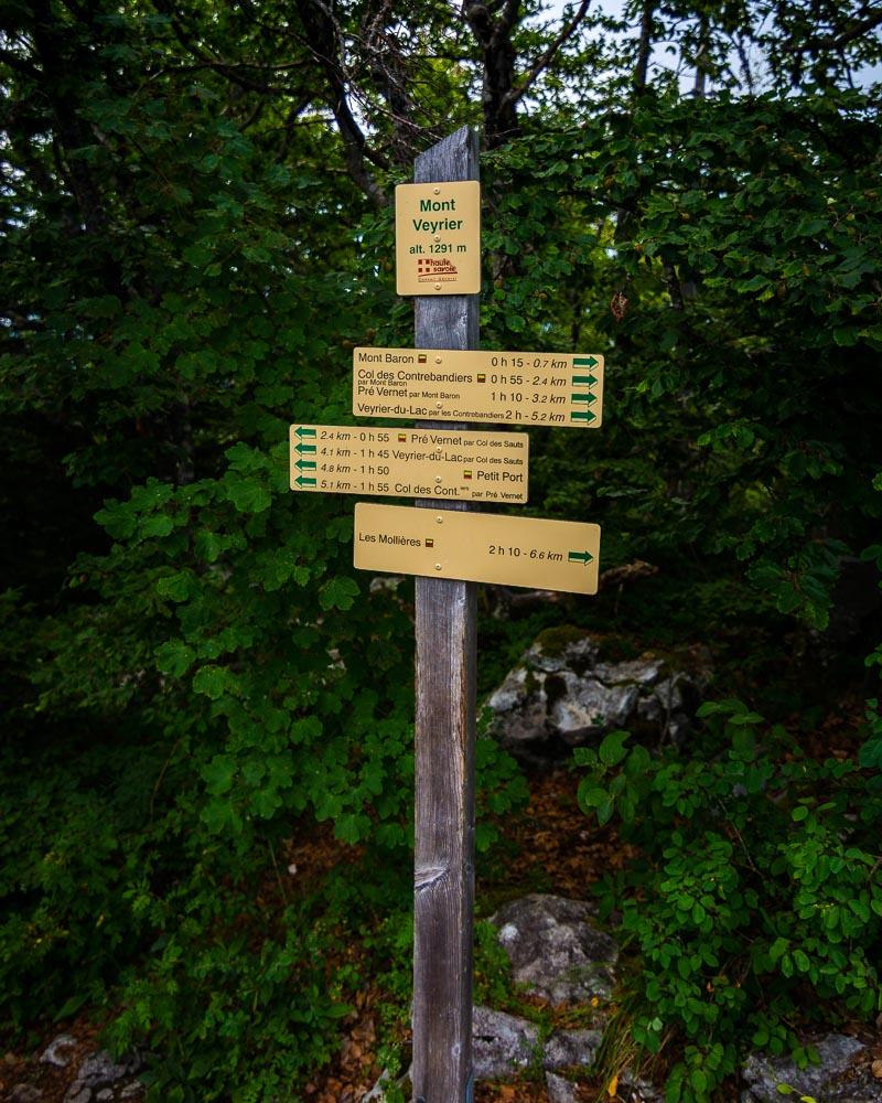
There are 3 different starting points to the Mont Baron hike, depending on which variation of the hike you want to do. I’ll list the 3 starting points below, and you can see the 3 hikes by scrolling down on the page.
Starting points
- Annecy-le-Vieux: the longest hike starts in Annecy-le-Vieux, on the shore of the lake. You can easily walk there, or take the Bus 14 to the “Petit Port Chavoire” stop
- Col du Pré Vernet: starting point high on the mountain, that you’d reach in 1h if you started the hike from the shore in Annecy-le-Vieux. You need a car to get there, and you can park your car along the road, right next to the trail
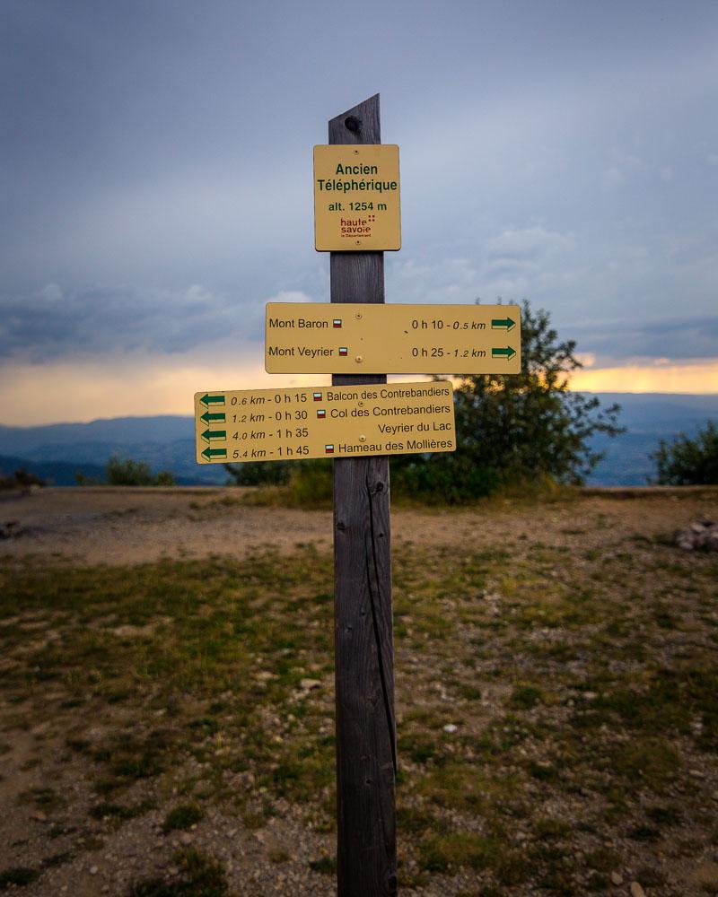
- Col des Contrebandiers: the closest starting point to Mont Baron, which offers the shortest hike to the summit. You’ll also need a car to get there, and there are a few spots to leave your car (+/- 15); it gets quickly crowded in summer because it’s the easiest hike
Mont Baron & Mont Veyrier Hike from Annecy-le-Vieux (longest)
This first hike is the longest of the 3. It starts in Annecy-le-Vieux, on the lake shore. If you don’t have a car, this is the best hike because you can literally walk to the starting point from Annecy, or take the bus to it.
Here are the details of the hike:
Randonnée Mont Veyrier & Mont Baron

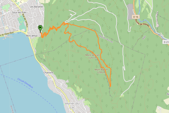
Hike distance: The distance of the hike is 10km / 6.2 miles including the return trip.
Hike duration: If you simply go down & back up, it will take you around 5h for the full loop. If you’re not a experienced/regular hiker, plan for 7h including the stops at the viewpoints.
Hike elevation: there’s a first 400m (1,312 feet) climb to the first pass, then a 330m (1,082ft) climb to the summit. A total of 2,142m of elevation change (7,082ft), which is a lot.
Hike difficulty: this isn’t a hike you just go on without any prior experience. It has a lot of elevation change, as you climb from the lake to the summit, and there are several tricky parts where you’ll climb on rocks and balcony parts with no protection from the side of the mountain.
Hike from the Col du Pré Vernet (intermediate)
This second hike is almost the same as the first one, except that you start from a mountain pass, the Col du Pré Vernet. This reduces the total elevation change by half, and makes it a shorter hike.
Here are the details of the hike:
Mont Veyrier & Mont Baron from Col du Pré Vernet

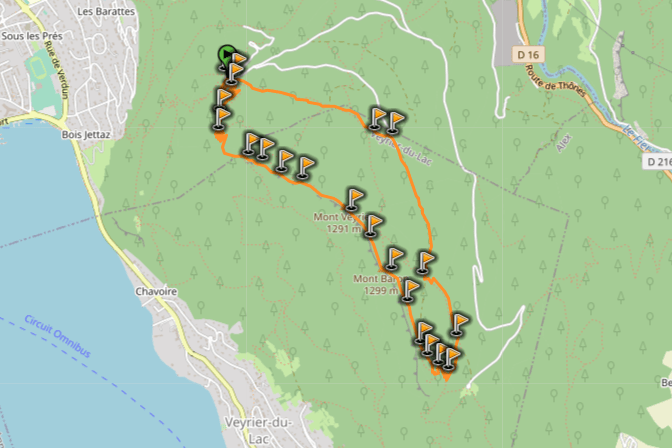
Hike distance: The distance of the hike is 7.03km / 4.37 miles including the return trip.
Hike duration: If you simply go down & back up, it will take you around 3h30 for the full loop. You can plan around 5h including stops at the summit and navigating the tricky parts.
Hike elevation: there’s a 1,068m (3,504 feet) total elevation change, which will definitely get your calves burning.
Hike difficulty: because there’s only half the climb from the previous hike, this one is “only” rated as challenging. There are still a few tricky parts, where you’ll climb on rocks and balcony parts with no protection from the side of the mountain.
Hike from the Col des Contrebandiers (shortest)
And finally the last of the 3 hike, which is the shortest. Unlike the other two, you don’t start the hike close to Annecy, but on the other side of the mountain. The hike starts from a mountain pass, the Col des Contrebandiers, and it’s the easiest way to reach the Mont Veyrier and Mont Baron summits.
Here are the details of the hike:
Mont Veyrier & Mont Baron hike from Col des Contrebandiers
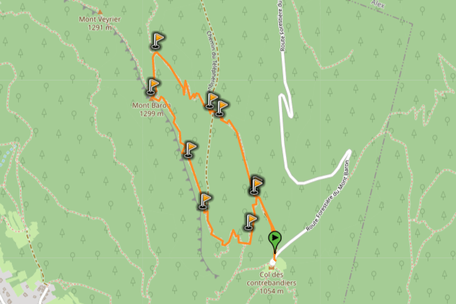
Hike distance: The distance of the hike is 3.7km / 2.3 miles including the return trip.
Hike duration: If you simply go down & back up, it will take you around 2h for the full loop
Hike elevation: there’s way less climbing than the 2 other hikes, but still a 277m (909ft) climb to the summit.
Hike difficulty: relatively short hike without too much elevation change, that I would usually rate as “moderate”. However, there’s one tricky part on the climb, where you’ll need to use a cable on the side to climb a rock. It’s not that hard, but it’s a tricky part and pushes this hike to a “challenging” rating.
Hiking Mont Baron & Mont Veyrier, Annecy
We started our stay in Annecy by a long & hard hike, the Randonnée de la Tournette. The next day, we hiked along the Gorges du Fier, and visited the Château de Montrottier. We got back to our Airbnb at the end of the day, and we were pretty exhausted.
Nesrine decided to stay inside and get some rest; I had some energy left, and decided to go climb Mont Baron & Mont Veyrier! I didn’t have much time left to sunset, so I chose the easiest of the 3 hikes: the one from the Col des Contrebandiers.
I drove up to the mountain pass, left my car in the empty parking lot, and started the climb on the forest trail.
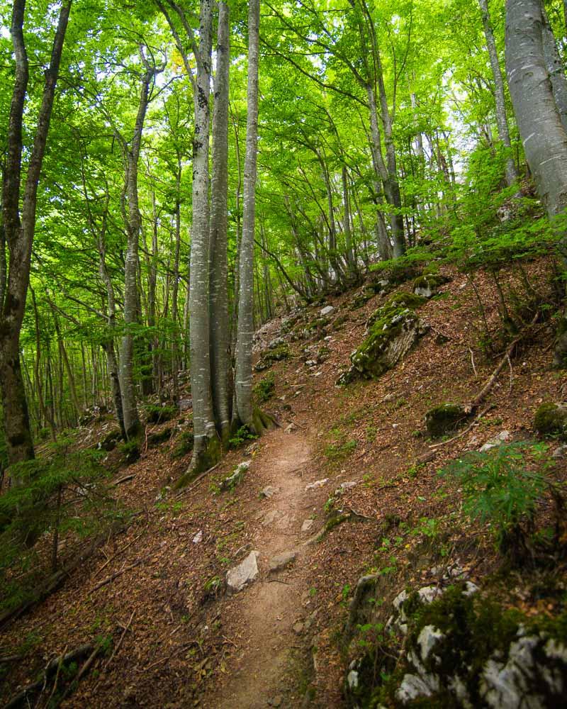
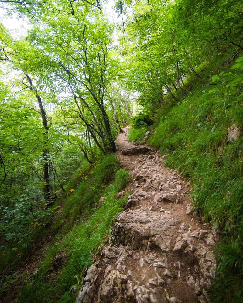
After a quick 20mn climb, I left the forest and got out in the open. The trail got pretty steep, with loose rocks, so I had to watch my step at each point.
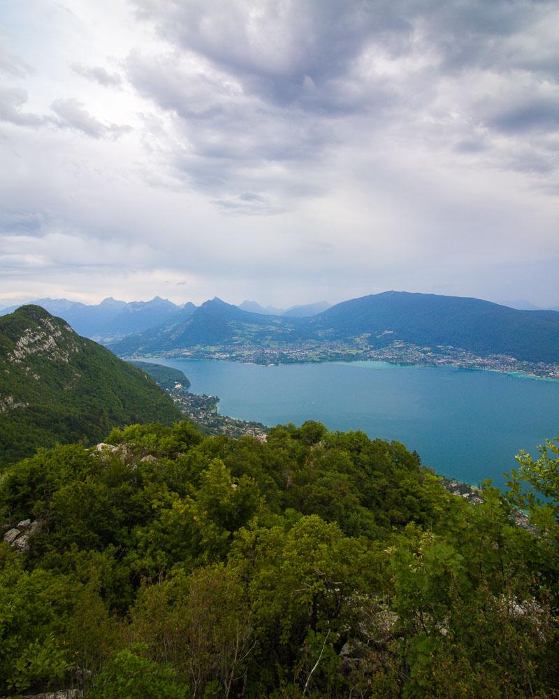
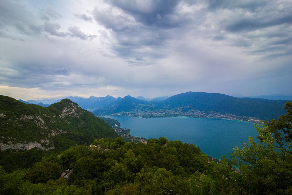
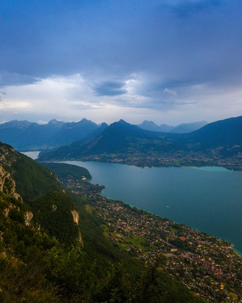
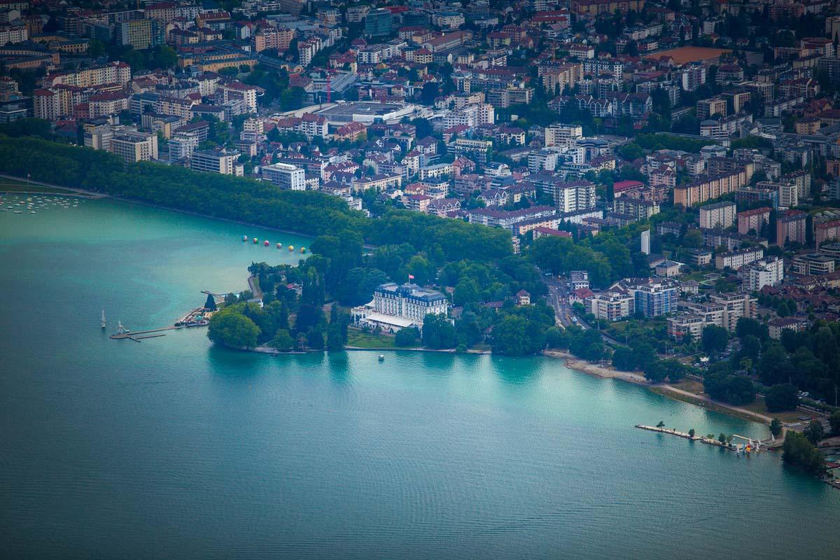
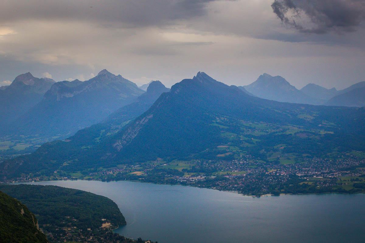
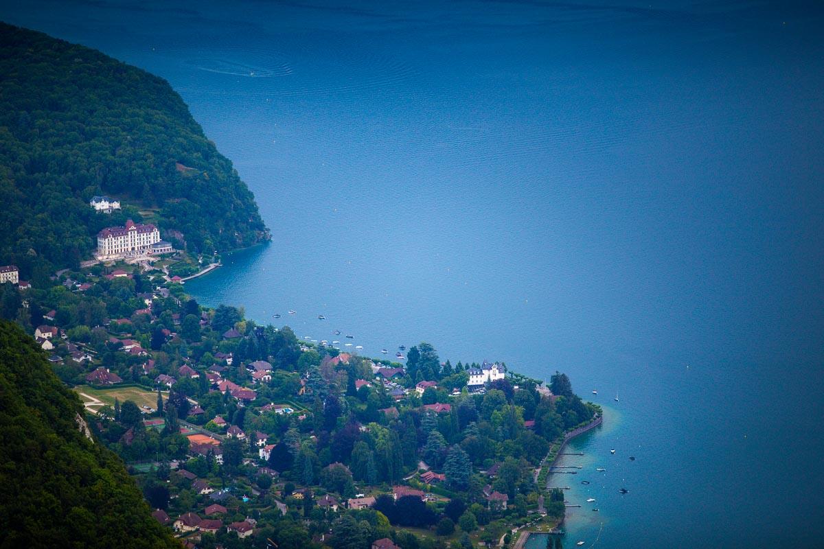
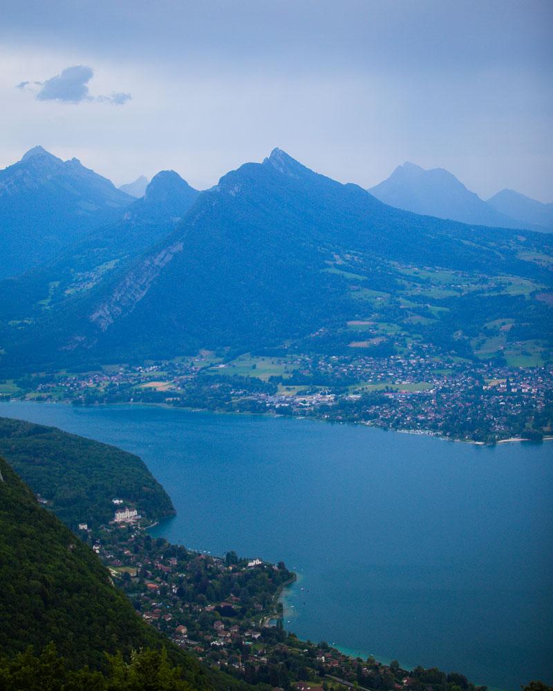
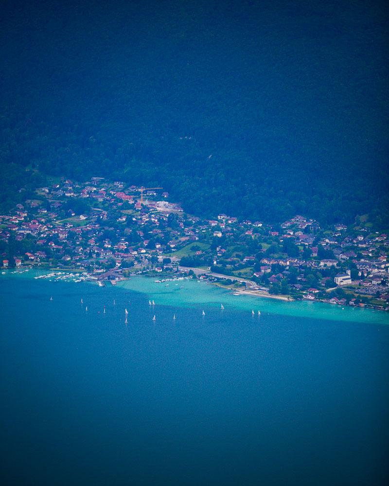
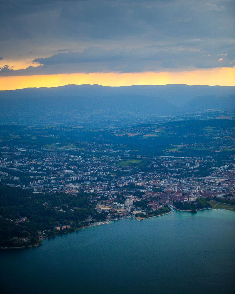
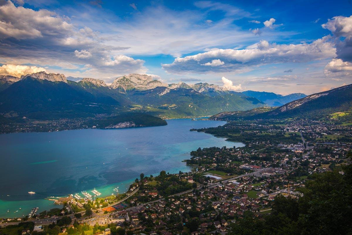
I wasn’t at the top yet, but the view over the lake and the surrounding mountains was already pretty epic. I could see the village of Menthon Saint-Bernard right below, and Saint-Jorioz on the other side of the lake, with a lot of sailing boats near the shore.
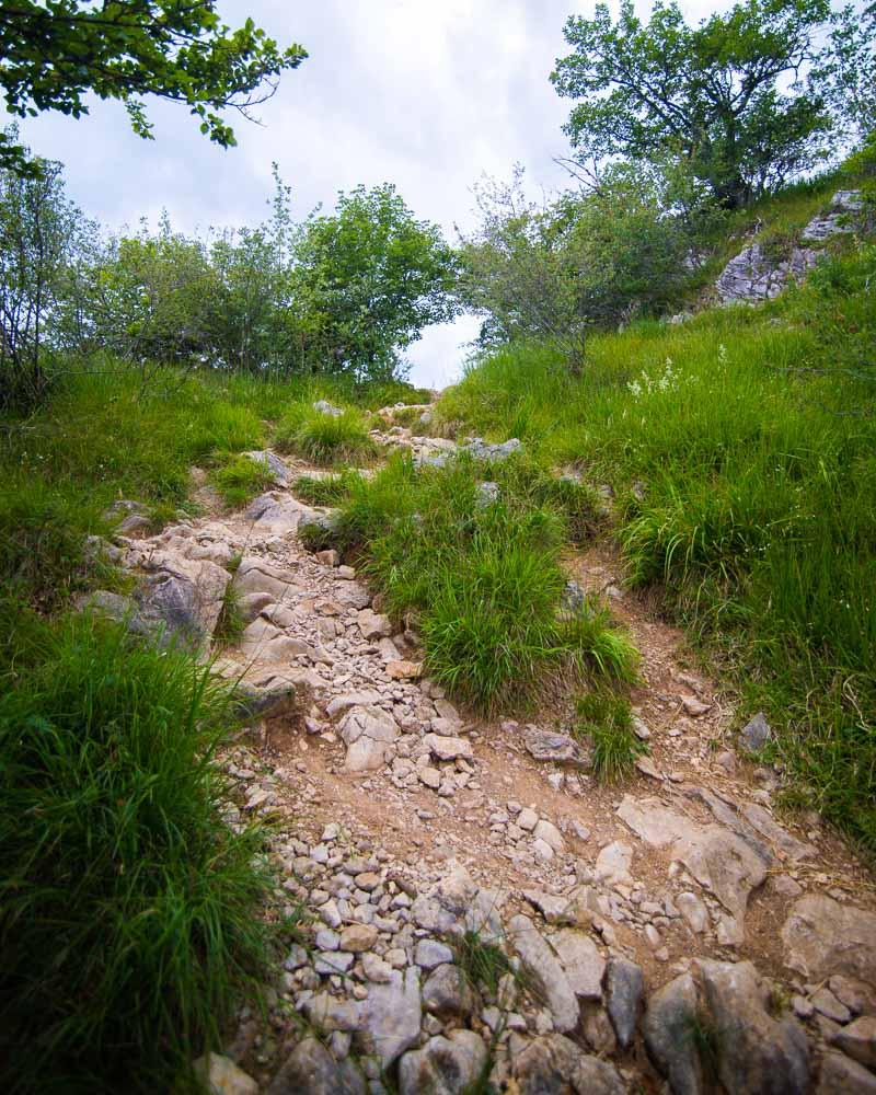
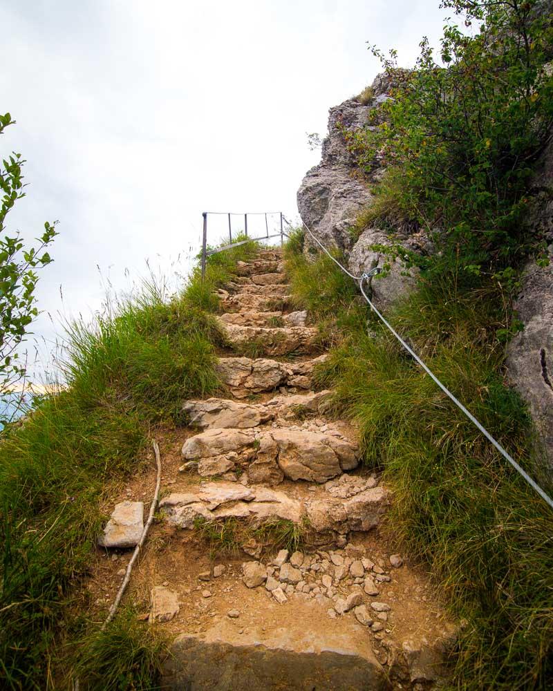
After taking a few photos, I kept climbing, and reached the tricky part of the hike. It’s a rock that you need to climb with the aid of a steel cable on the side, and 2 metal steps. Nothing too complicated, but it’s good to know it’s here before starting the hike.
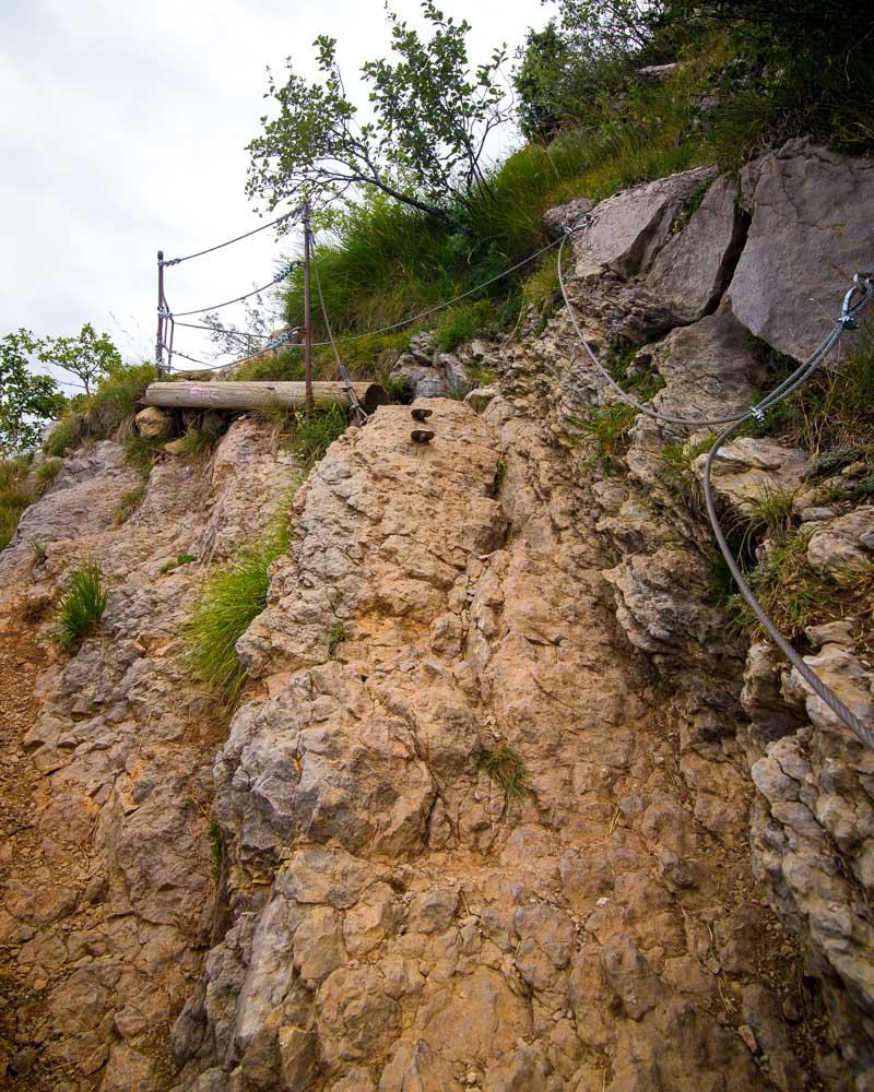
I climbed this part, and it turned to a full on staircase made with huge stones. It’s straight on the side of the mountain, with the steel cable still on the side for safety.
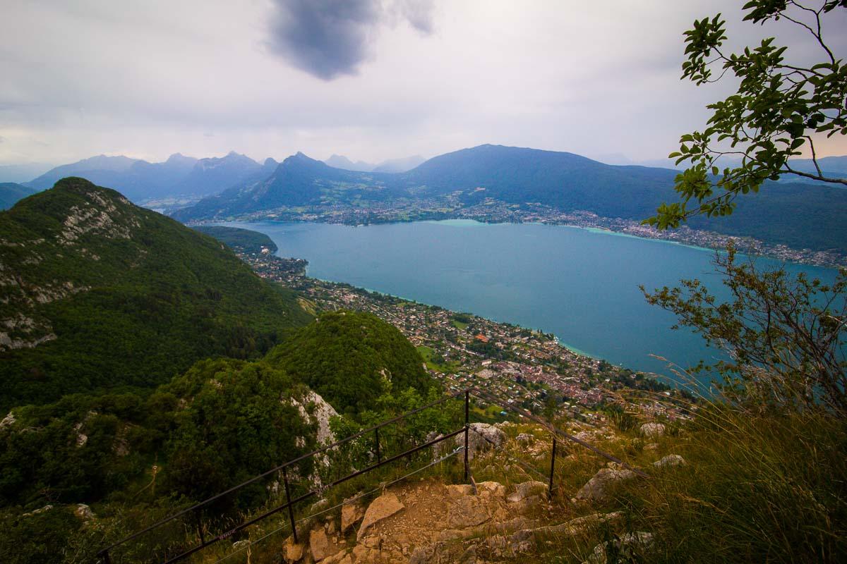
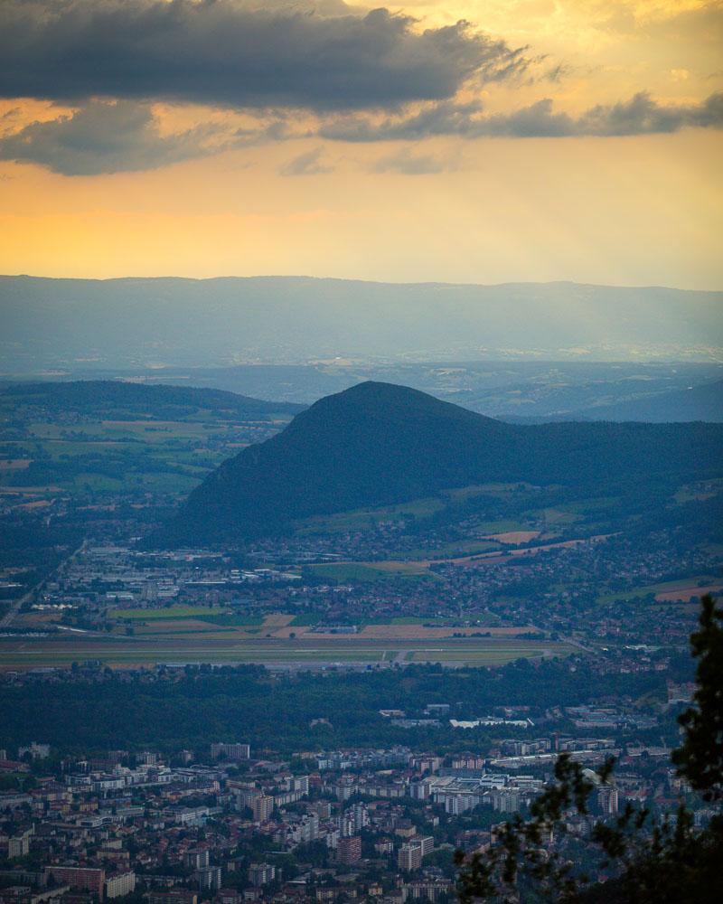
After this climb, I was out on top of the mountain. It wasn’t the summit yet, but an open area with a lot of space where people usually come to hang out. There used to be a cable car going up there, but it was taken down after a passenger death.
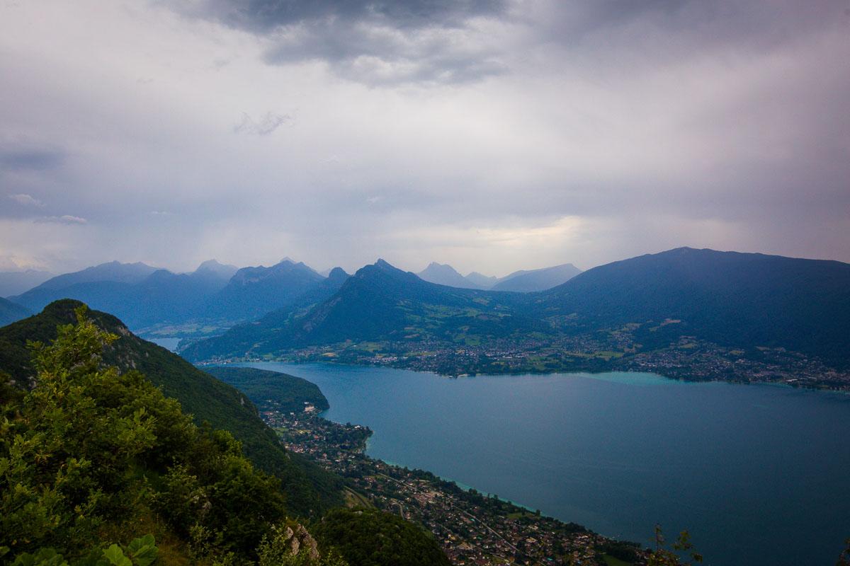
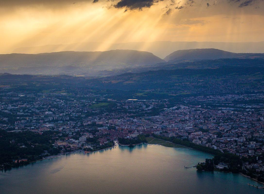
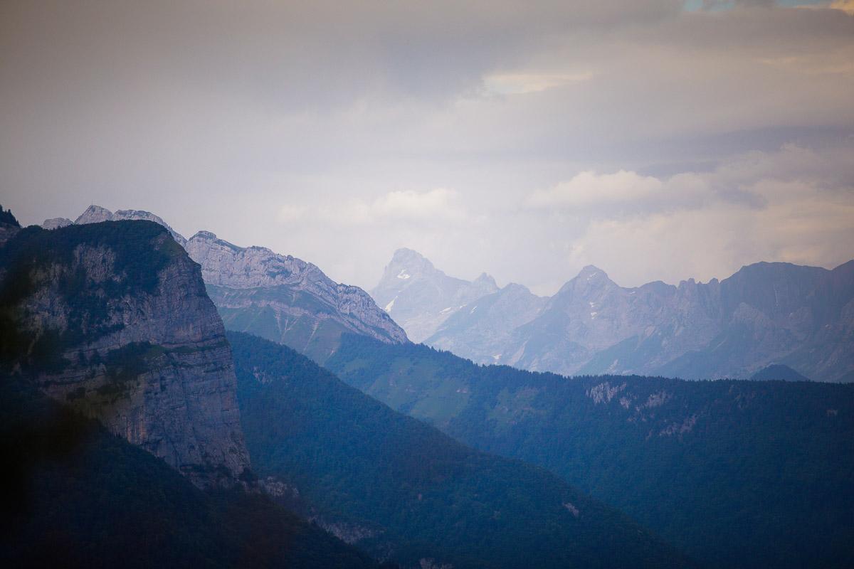
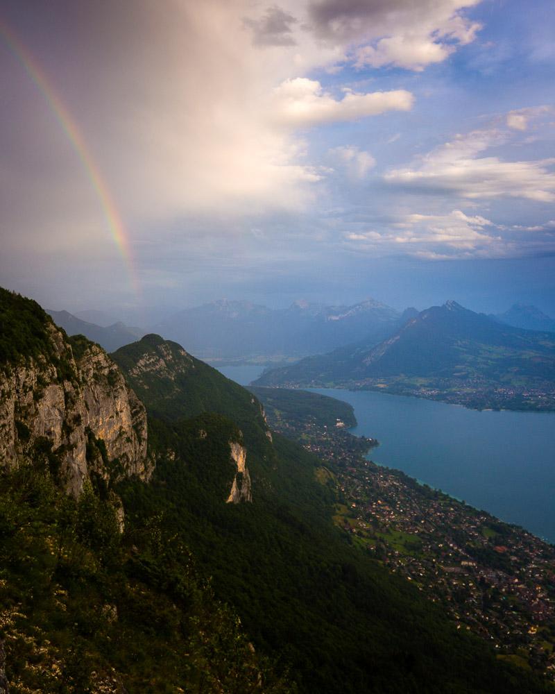
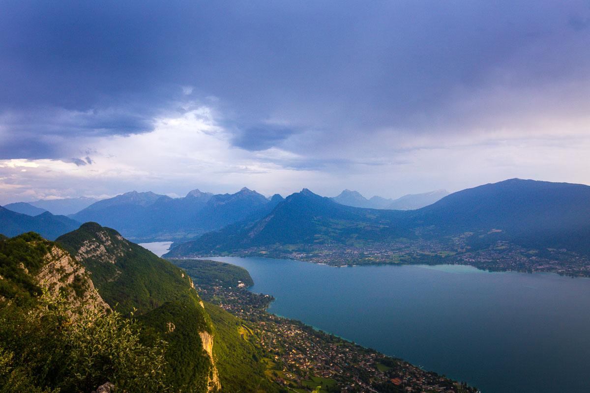
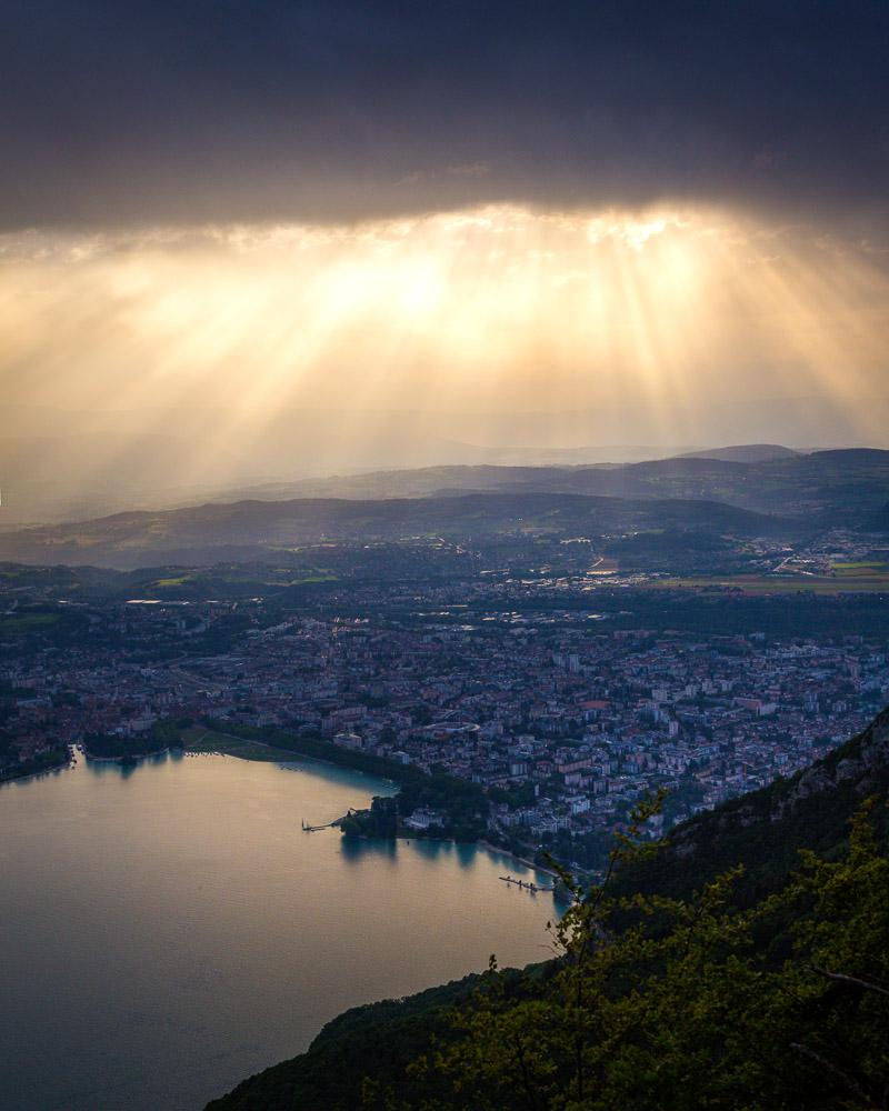
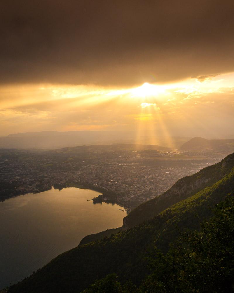
At this point, the weather started to turn. Rain began to pour down, and big storm clouds formed in the sky. It was a beautiful sight, with the warm sunlight filtering through the clouds. However the downside was that the clouds covered the Mont-Blanc, that you can normally see from up there.
The Mont-Blanc in the clouds
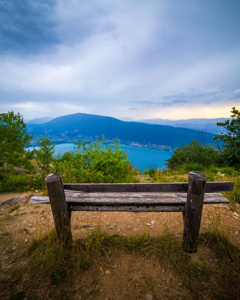
I moved forward on the trail, to reach the first summit: Mont Baron, at 1,299m (4,261ft). There’s a sign at the summit, and a bench perfect to sit down, relax and enjoy the view.
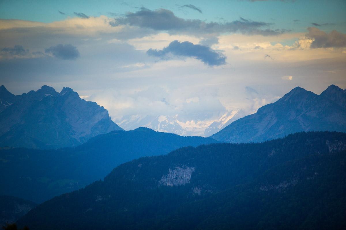
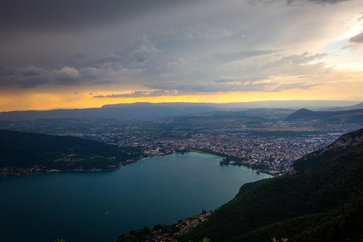
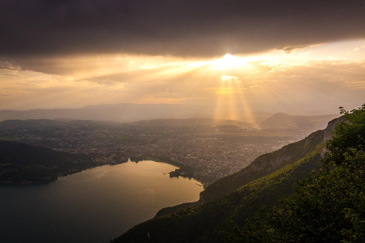
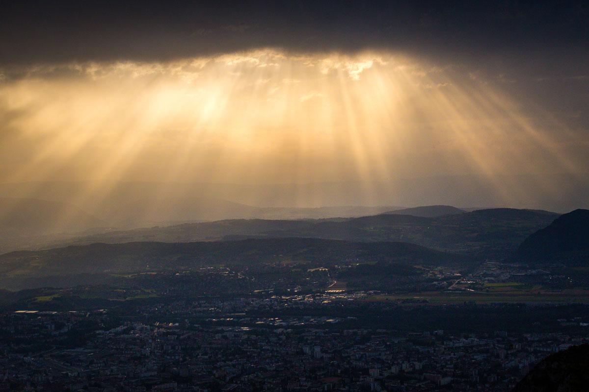
From the Mont Baron summit, Mont Veyrier is only 15mn away. The trail in between the 2 summits is called the Sentier des Crêtes, literally “Ridge trail”. While on this ridge trail, I was met with beautiful after-storm weather, and of course I had to stop to take a few photos.
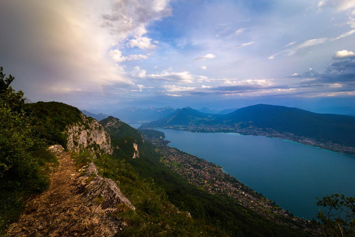
You can see the trail on the left of the image
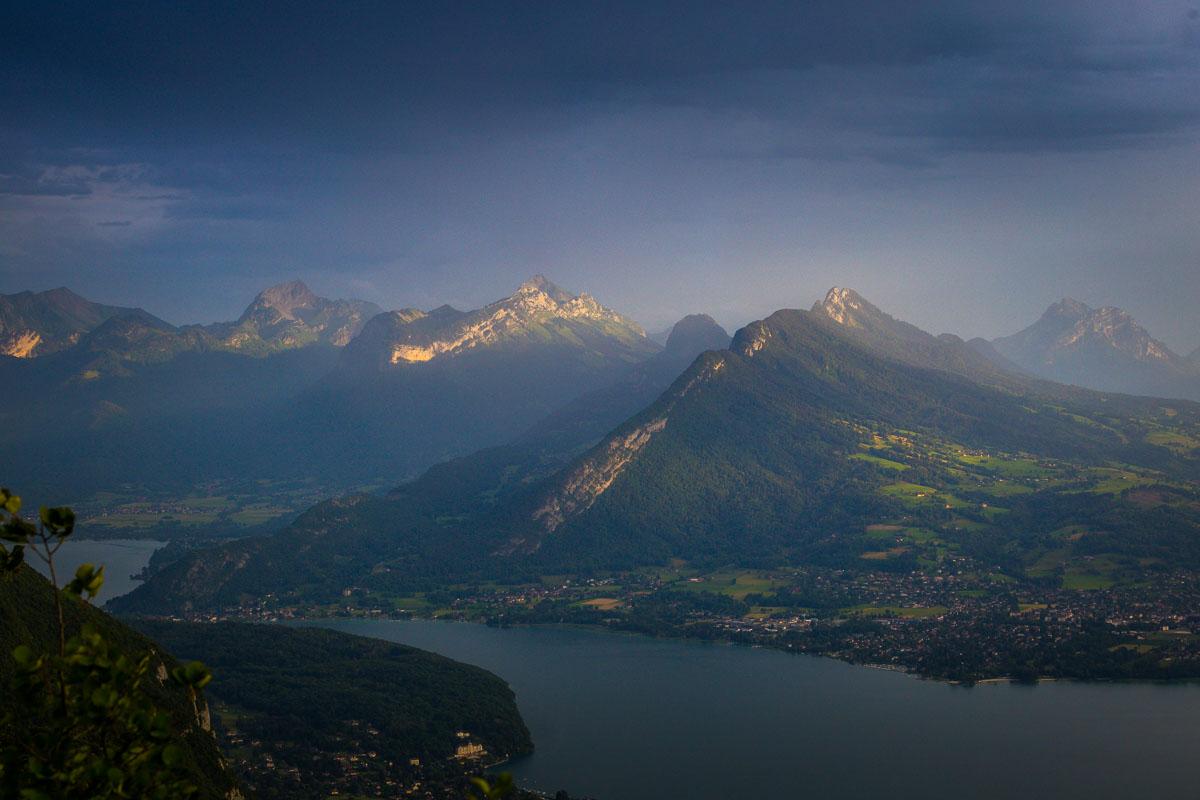
I finally reached the last summit, Mont Veyrier at 1,291m high (4,235ft), right as the sun was setting. I stayed at the summit for a while, watching nature put on a show.
As always when you choose to watch the sunset on top of the mountain, you have to hike back down in the dark. Always make sure you have a headlamp in your bag, because the light disappears quickly and it’s night before you realize.
I ran down to my car, under the rain, with my headlamp lighting the way. A good adventure overall, and definitely one of the best hikes in Annecy!
Visit Haute-Savoie
Planning your trip to Haute-Savoie? You’ll find below a few other travel guides & key spots to see in the area.
Best hikes around Annecy:
Great outdoor destinations near Annecy:
The BIG guides:
I hope you enjoy your trip to Annecy and to France; if you have any questions, let me know in the comments below, I always reply.
Help a fellow traveler and share this guide with the buttons below!
Travel Tools
Use any of our recommended links below to book your trip. You pay the same, and we earn a small fee; a great way to support us!

Pin this to Pinterest!
Enjoyed this guide? Then help a fellow traveler and pin it! They'll most definitely love you for it, 100% guarantee.


Hello! Would you recommend this hike (from Col des Contrebandiers) with a baby carrier? Thank you
Thanks for this post! I was researching hiking trails around Annecy, and there are so many to choose from. But this post is very informative, the photos speak for themselves. And I like that you presented 3 varying levels of difficulties. Checked out La Tournette, I think it is too challenging for me, so will likely go for this Mont Baron-Mont Veyrier.
Hello Jeremy, you’re welcome! Yes indeed there are plenty of hikes to choose from around Annecy, and most of them offer pretty great views. La Tournette is definitely not for everyone, the Mont Baron hike offers similarly good viewpoints, and it’s a lot less difficult. Enjoy your time in Annecy!