Circuit des 3 Croix de Sévrier Hike in Annecy
The Circuit des 3 Croix de Sévrier is a hike on the mountains above Sévrier, right next to the Lac d’Annecy.
It starts with a steep climb, and lead you to 3 big crosses, each offering an epic view over the lake and the mountains.
Keep on reading to find out everything about this hike! :hike:
Where is Sévrier
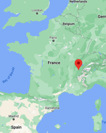
Sévrier is a city located in the south west of Haute-Savoie, not far from the border with the Savoie department. It’s on the shore of the Lac d’Annecy, 10mn south of Annecy.
Location: Google Maps
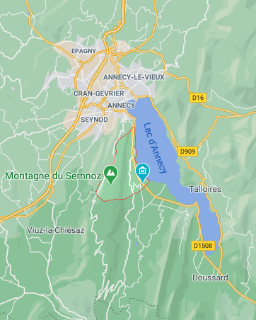
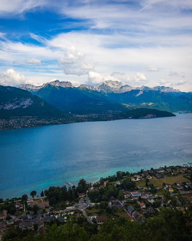
It’s on the western shore of the lake, between Annecy up north and the Semnoz mountain down south. Most of Sévrier is on the shore of the lake, but there’s also a large forest up on the mountains, 800 meters above the village (2,624 feet).
How to Get to Sévrier & Start of the Hike
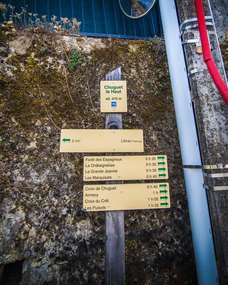
You can drive to Sévrier, by following the D1508 south from Annecy. There are 2 free parking lots next to the start of the hike: Parking Chemin de la Liaz and City Hall Parking.
Annecy gets pretty crowded in summer, and the traffic is usually pretty bad on the roads around the lake. Best to leave early to avoid traffic, or just get ready to be stuck for a while (not that bad with the view of the lake, but still).
If you’re not driving, you can take the bus 50A or 50B from Annecy to the stop “LETRAZ Sévrier”. It takes around 12mn, and costs 1.50€ for the trip. From the bus stop it’s a 5mn walk to the hike.
Depending on where you leave your car/come from the bus, the first part of the hike will be in the city. Make your way to this spot, which is where you’ll leave the city and start the trail in the forest. There are signs even in the streets, pointing to the start of the hike.
Circuit des 3 Croix de Sévrier Hike Details
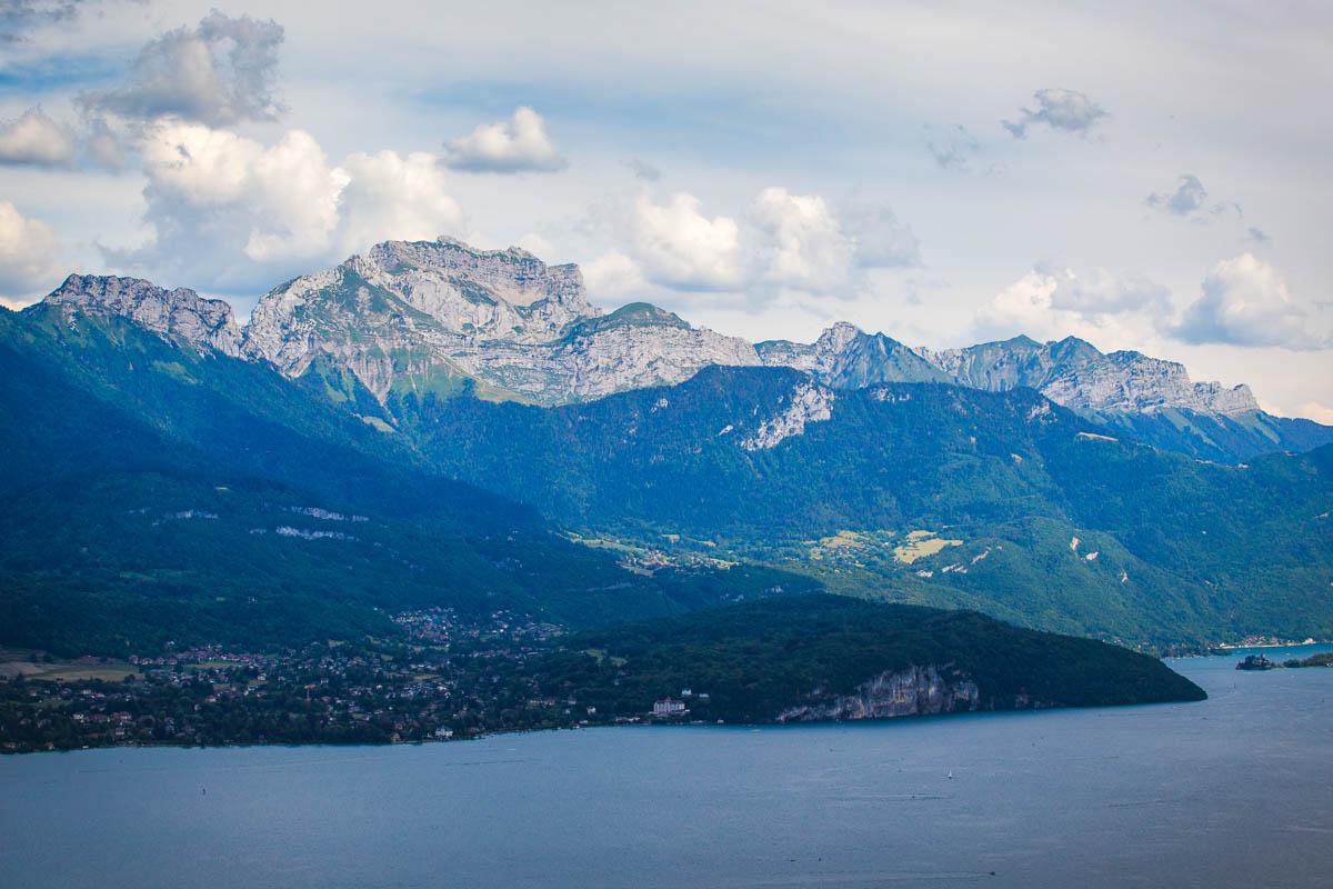
The Circuit des 3 Croix de Sévrier will lead you up on the mountains above Sévrier. You’ll get an epic view over the Annecy Lake, from 3 different viewpoints.
Here are the details of the hike:
Circuit des 3 Croix de Sévrier

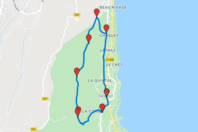
Hike distance: The distance of the hike is 5.86km / 3.64 miles including the return trip.
Hike duration: If you simply go down & back up, it will take you around 2h35 for the full loop
Hike difficulty: the first climb to get to the top of the mountain is pretty steep, for around 45mn. The walk on top in the forest is easy and relaxing, on good trails. The trail back down is very steep too, and can quickly become dangerous if the ground is wet (hence the challenging rating).
Hike elevation: there’s a 332m (1,090 feet) climb at the start that will get your blood pumping, then flat hike on top and quick decline to go back to the village.
Hiking the Circuit des 3 Croix, Annecy
We had spent the previous day away from Annecy, in Sixt-Fer-à-Cheval. It was a full day of hiking, with the Hike to the Bout du Monde in the morning, and the Cirque des Fonts & Cascade du Rouget in the afternoon. We got home to our Airbnb in Annecy quite late, and exhausted.
We wanted to explore the area around Annecy a bit more, but nothing too difficult because we were still tired from the day before. The Circuit des 3 Croix hike in Sévrier seemed like a good fit, a short 2h30 hike offering epic views of the lake.
I parked the car in Parking Chemin de la Liaz, and we walked in the street to reach the start of the hike there.
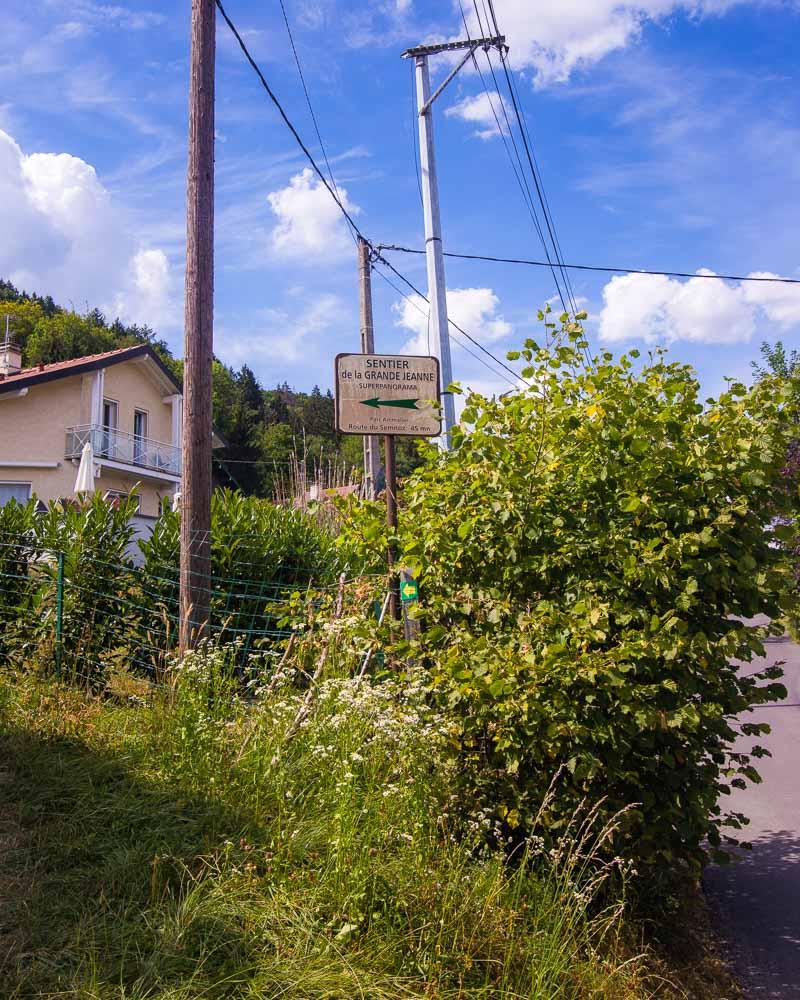
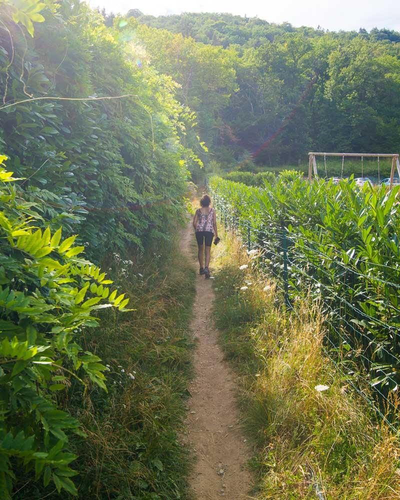
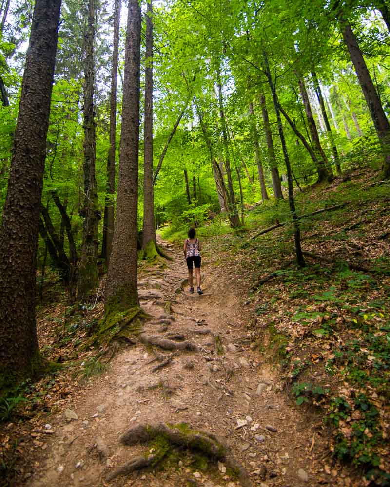
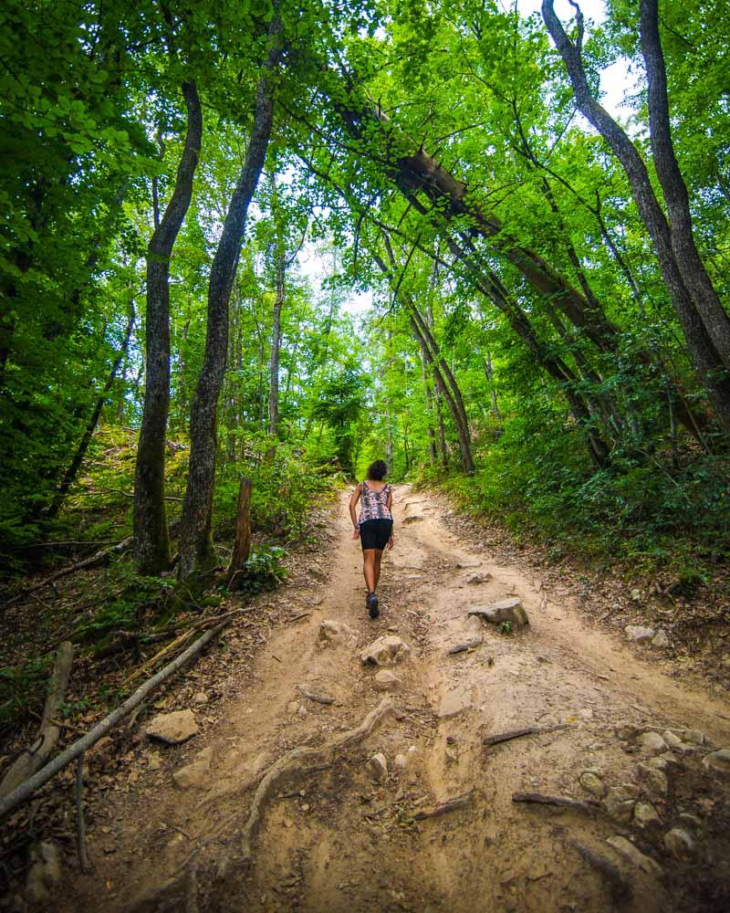
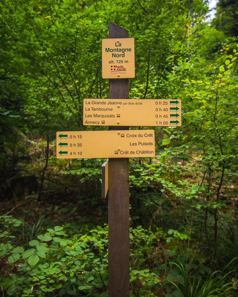
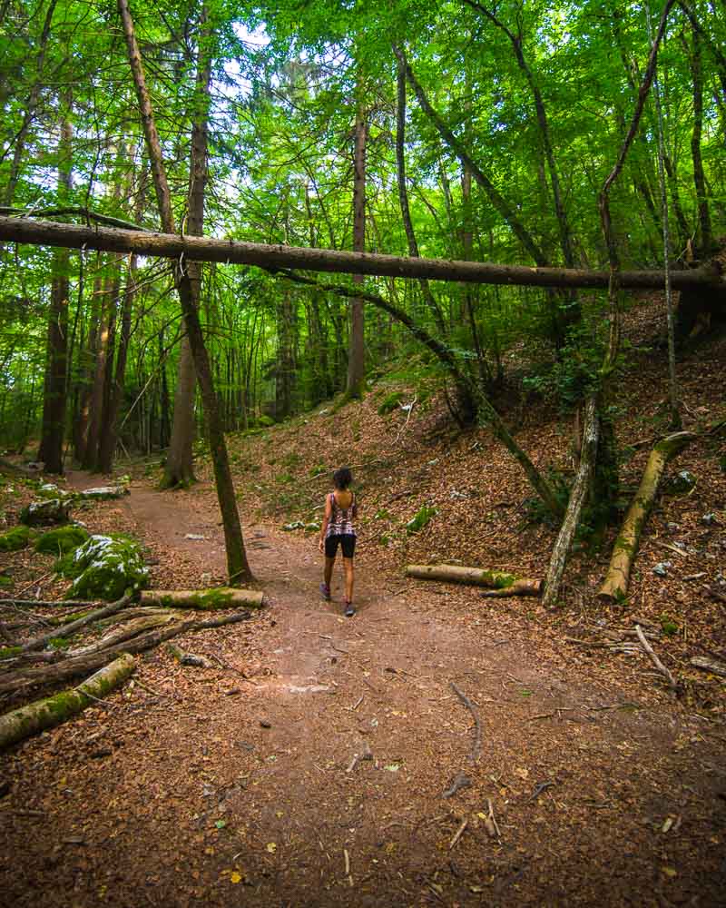
At the sign “Sentier de la Grande Jeanne”, we left the streets to start the hike in the forest. A small trail in between 2 houses lead us towards the forest, and we begun a steep climb.
Croix de Chuguet
We reached the Forêt des Espagnoux sign, which indicated 25mn left to the first Croix.
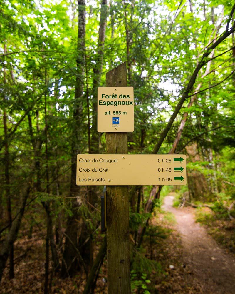
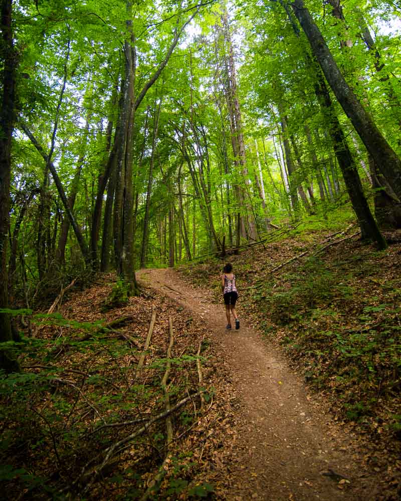
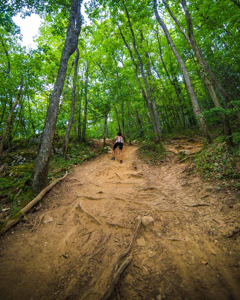
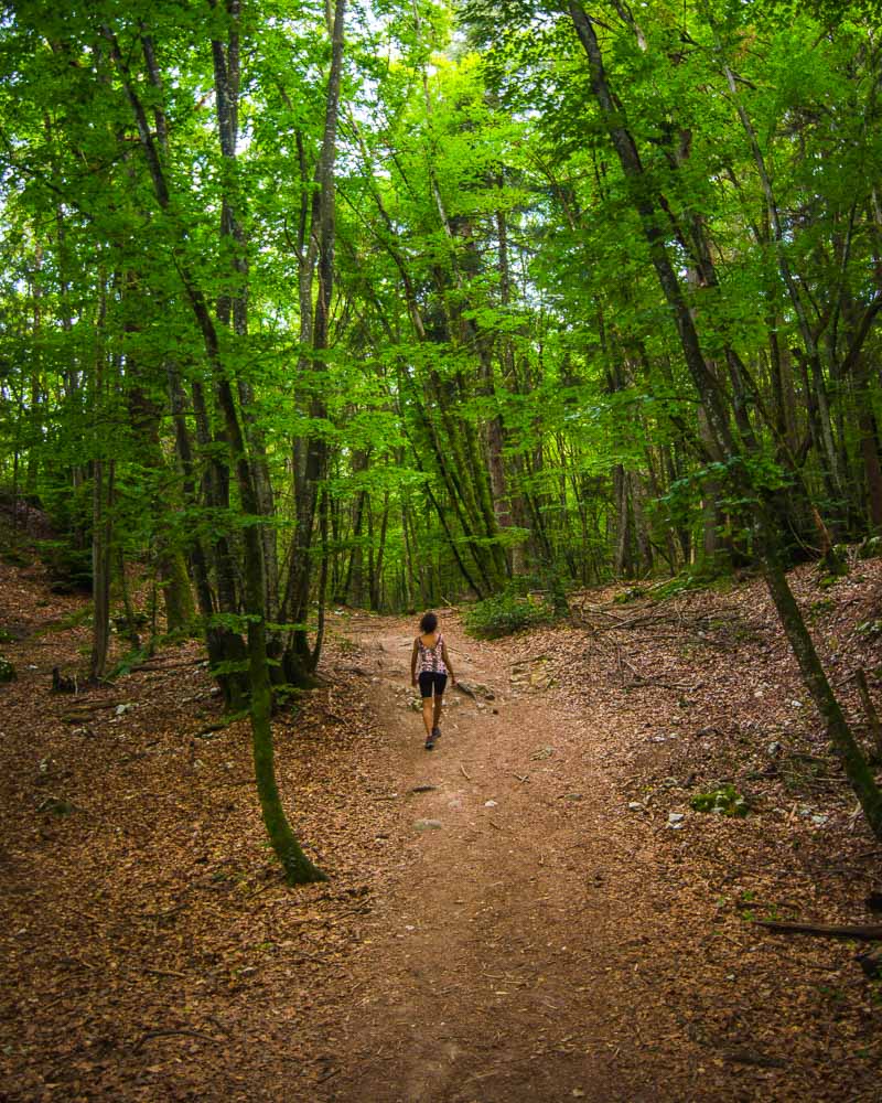
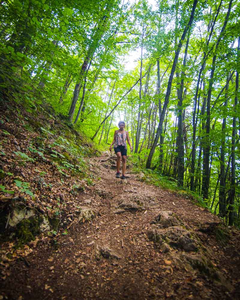
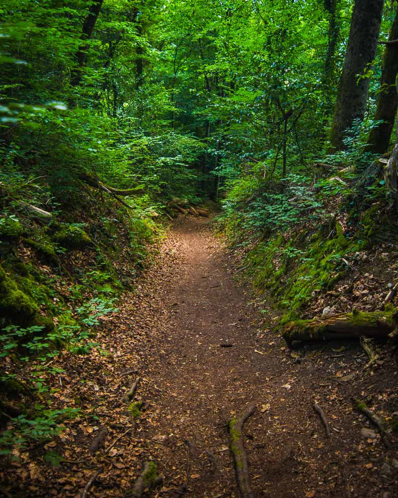
It keeps climbing at this point, on a forest trail. The trail is easy to follow, and the 2 difficulties are the incline and the tree roots popping off here and there.
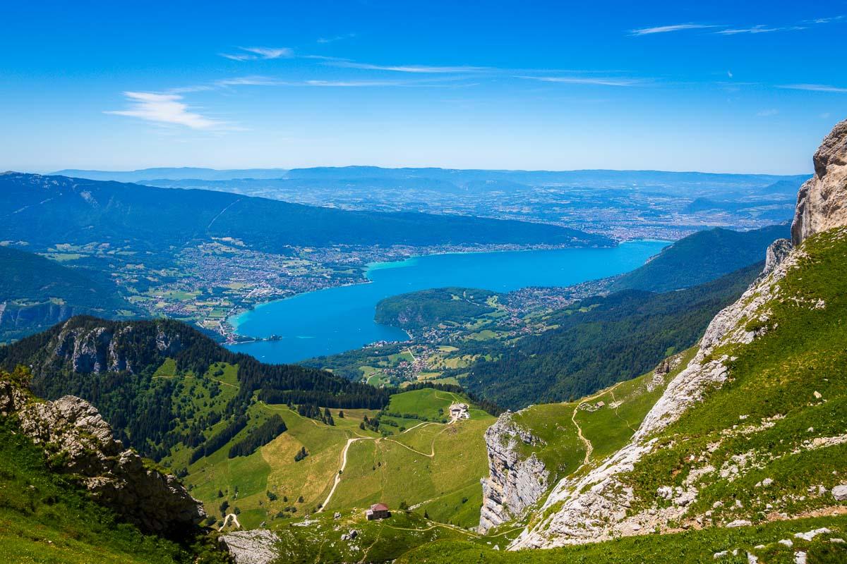
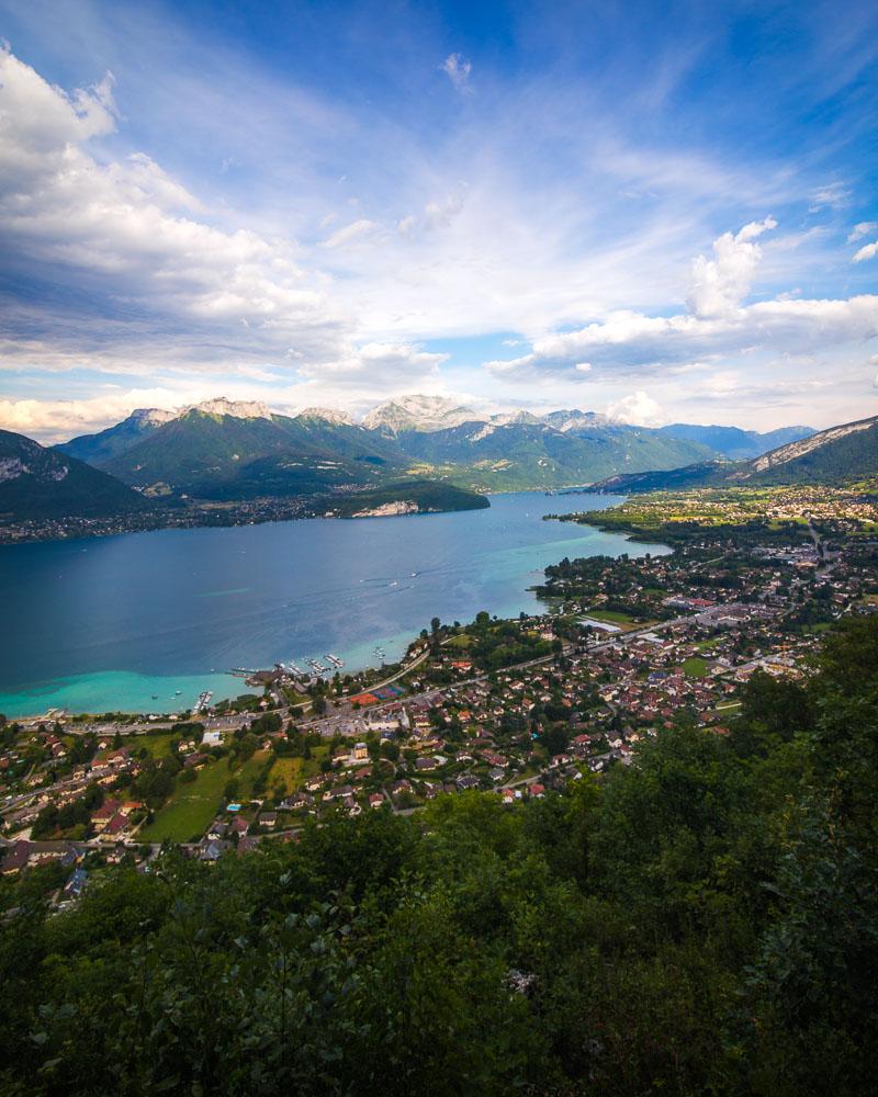
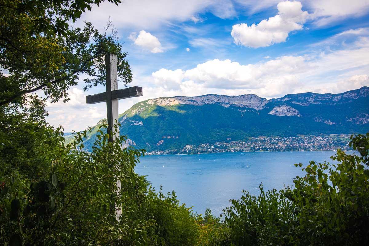
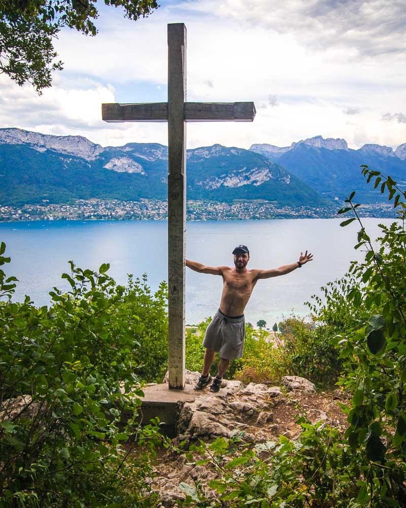
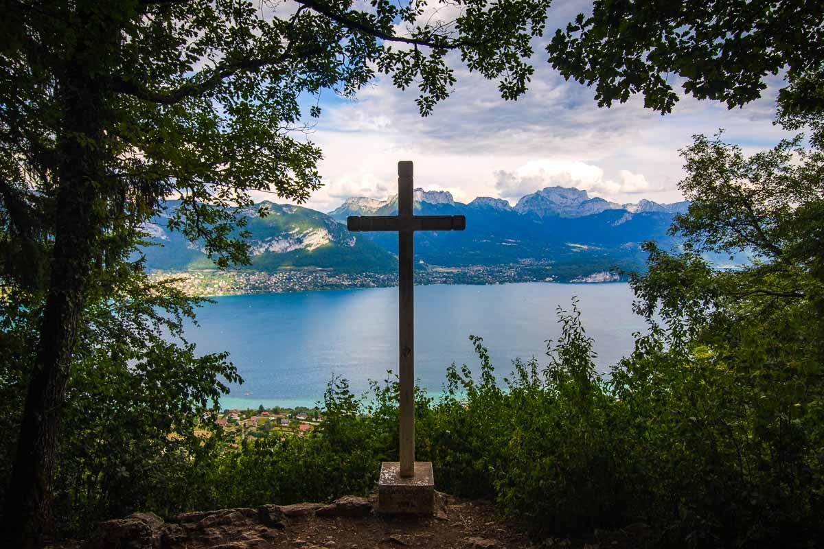
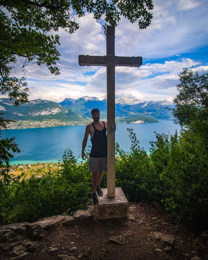
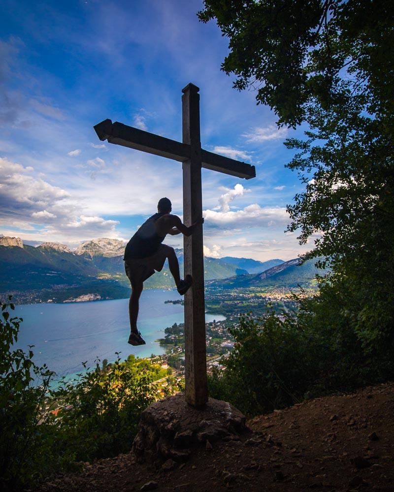
We quickly got to the first viewpoint, at the top of the mountains, the Croix de Chuguet. It was the end of the climb, and the reward for a steep climb in the forest.
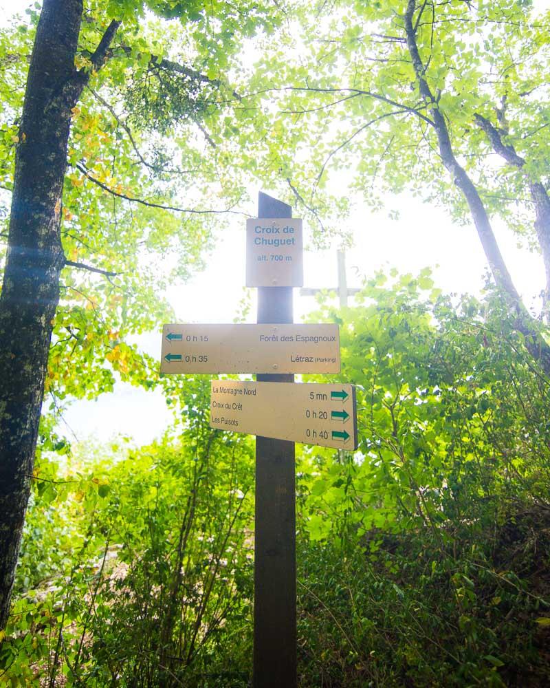
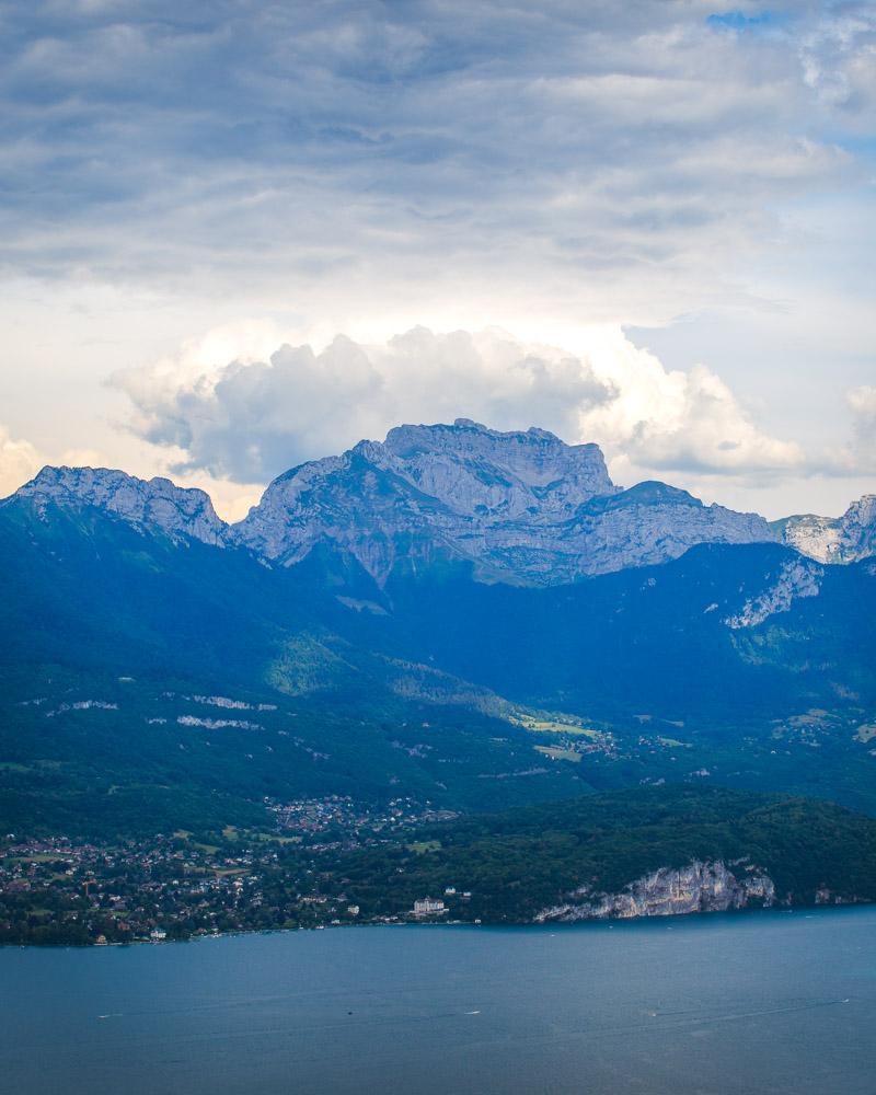
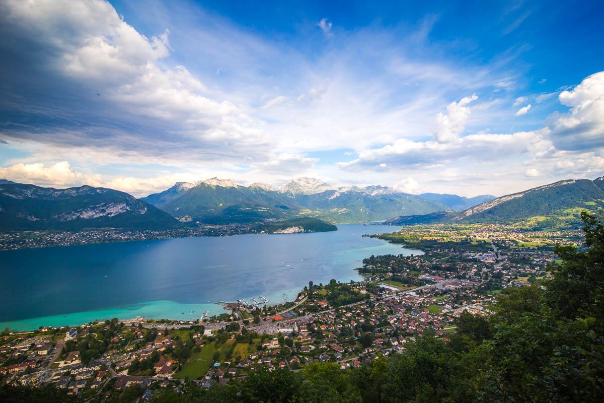
The forest opens up to an epic viewpoint over the Lac d’Annecy, facing the Tournette mountain. A massive cross stands there, a landmark for local hikers. This is the Croix de Chuguet, which translates to “Chuguet Cross”.
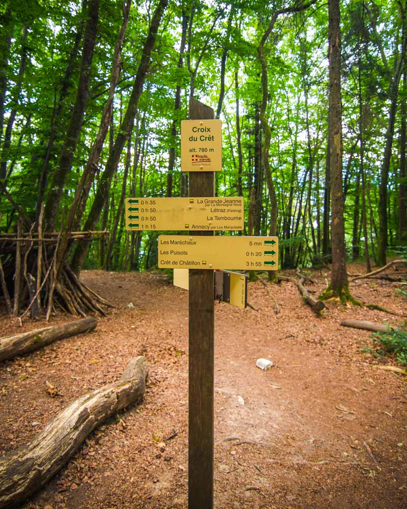
Croix du Crêt
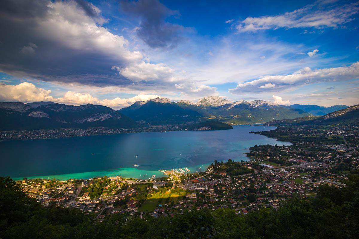
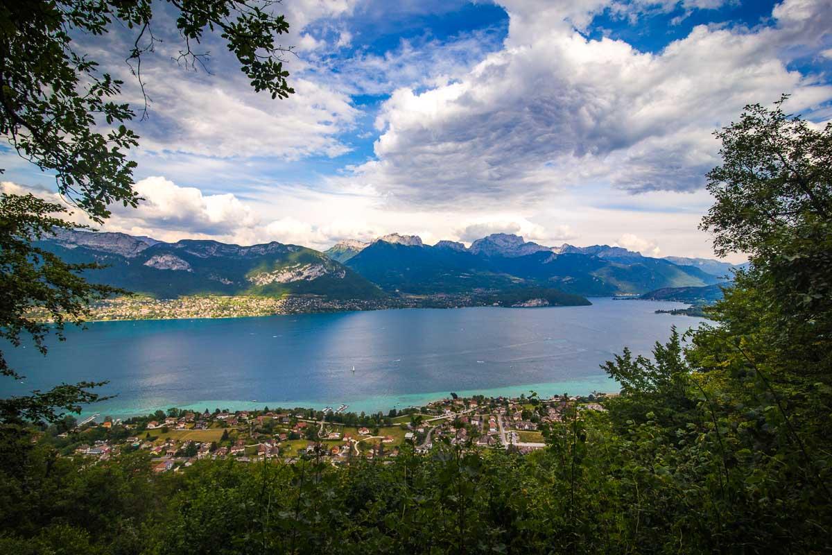
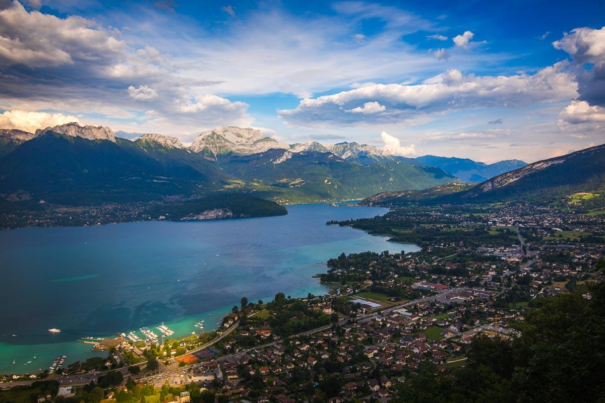
The second cross is the Croix du Crêt. It’s just a bit higher than the first cross, and we hiked along the ridge with a low incline to reach it.
Unlike the first cross that is right on the trail, the Croix du Crêt is down from the trail. Make sure to watch the map when you get close to the location; when you’re on the right spot on the trail, take the trail leading down towards the lake. This will get you to the viewpoint.
And what a view indeed! Here are a few photos of the view at the Croix du Crêt:
Croix du Chef-Lieu Sevrier
Alright, that’s 2 out of 3 crosses! Now on our way to reach the final cross. We hiked back up from the Croix du Chuguet to the trail, and went on a gentle stroll in the forest towards the last viewpoint.
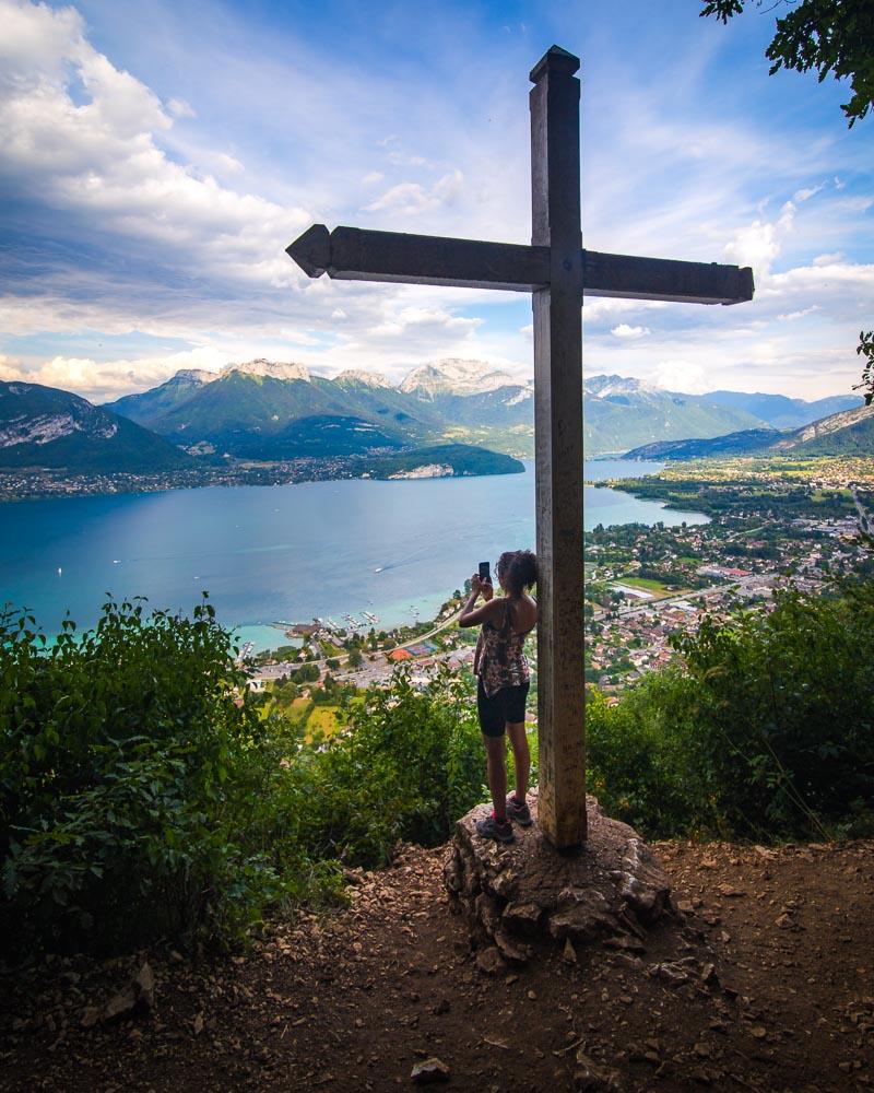
This last viewpoint is right on the trail, so you won’t have any issue finding it. The Croix du Chef-Lieu Sevrier is the last of the 3 crosses, and just like the 2 other ones, offers an unobstructed view over the lake.
You can see the lake and the mountains aroud, as well as the Sevrier village below you.
After enjoying the view from up there, it was time to walk all the way back down to the village. The last part of the hike is very steep, and this is the part that made me rate the hike as challenging.
The trail is steep, and you can easily fall. It’s on forest soil, and can get slippery very quick on wet weather. Take your time, go low on your legs, and watch your step!
When you get down to the village, you can head to the beach for a refreshing dive in the lake, or go see the gorgeous Eglise Saint-Blaise. And if you’re hungry like us, stop at the Pizza du Lac right next to the parking spot for some amazing pizzas!
Visit Haute-Savoie
Planning your trip to Haute-Savoie? You’ll find below a few other travel guides & key spots to see in the area.
Best hikes around Annecy:
Great outdoor destinations near Annecy:
The BIG guides:
I hope you enjoy your trip to Annecy and to France; if you have any questions, let me know in the comments below, I always reply.
Help a fellow traveler and share this guide with the buttons below!
Travel Tools
Use any of our recommended links below to book your trip. You pay the same, and we earn a small fee; a great way to support us!

Pin this to Pinterest!
Enjoyed this guide? Then help a fellow traveler and pin it! They'll most definitely love you for it, 100% guarantee.