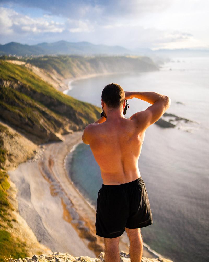
Hiking Asturias – 21 Best Hikes in Asturias (+ free maps)
Planning to go on a big Asturias hiking trip?
Or simply looking for a few epic hikes to do while you’re in Asturias?
Either way, I’ve got you covered. You’ll find in this guide 21 of the very best hikes in Asturias, Spain (with photos & free maps).
Where to Stay for the Best Asturias Hiking Trails
Ready to go hiking Asturias? You’ll find below the 3 places I recommend for your stay; click on the place to find the best hotels in the area.
- Picos de Europa National Park: THE best place to stay for hiking in Asturias!
- Somiedo Natural Park: a personal favorite of mine after Picos de Europa: plenty of hikes, away from the crowds
- Ribadesella: with 3 hikes on this list nearby, the coastal town Ribadesella is definitely a nice place to stay
Your Asturias Hiking Guide: 21 Best Hikes in Asturias
Asturias is a heaven for outdoors lovers. If you love hiking, you won’t regret traveling to this region of Spain, trust me. In a hurry to see all of the hikes? Here they are:
- Poncebos to Bulnes
- Sotres
- Ruta del Cares
- Lagos de Covadonga
- Full circuit Poncebos – Bulnes – Sotres – Tielve – Poncebos
- Ruta Puertos de Aliva in Fuente Dé
- Horcados Rojos Summit
- Vega de Ario
- Brez Canal de Arredondas
- Ordiales Scenic Balcony Trail
- Lago del Valle
- Lagos de Saliencia
- La Pornacal from Villar de Vildas
- Puerto de Somiedo to El Cornón
- Cabo Vidio Loop
- Llanes to Playa de Poo
- Bufones de Pria Loop
- Ruta de la Cascada de Seimeira
- Ruta de las Xanas
- Tabayon Waterfall Trail
- Xiblu Waterfall Hike
Alright, now let’s see each of these hikes in more details! Keep reading below for more info on the hikes including photos, location, and all technical details.
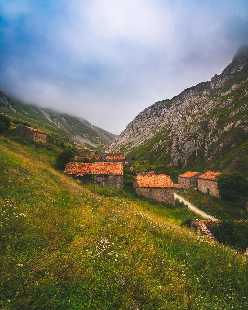
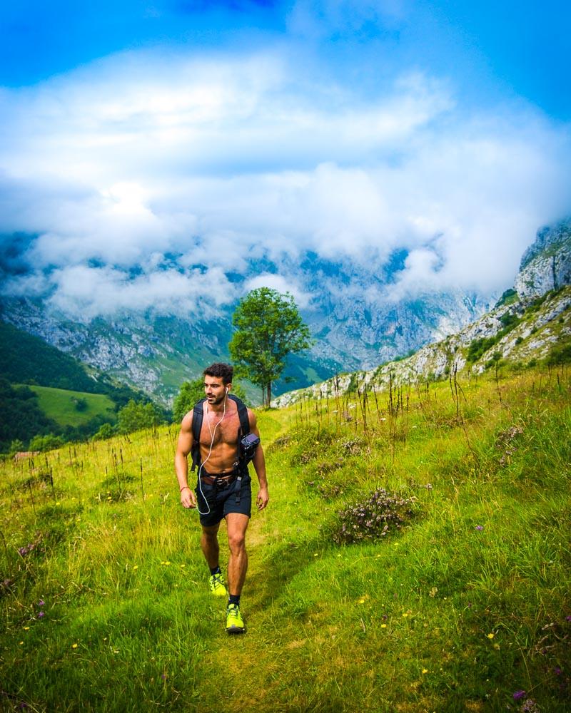
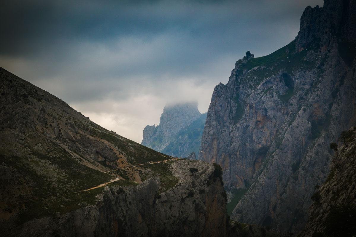
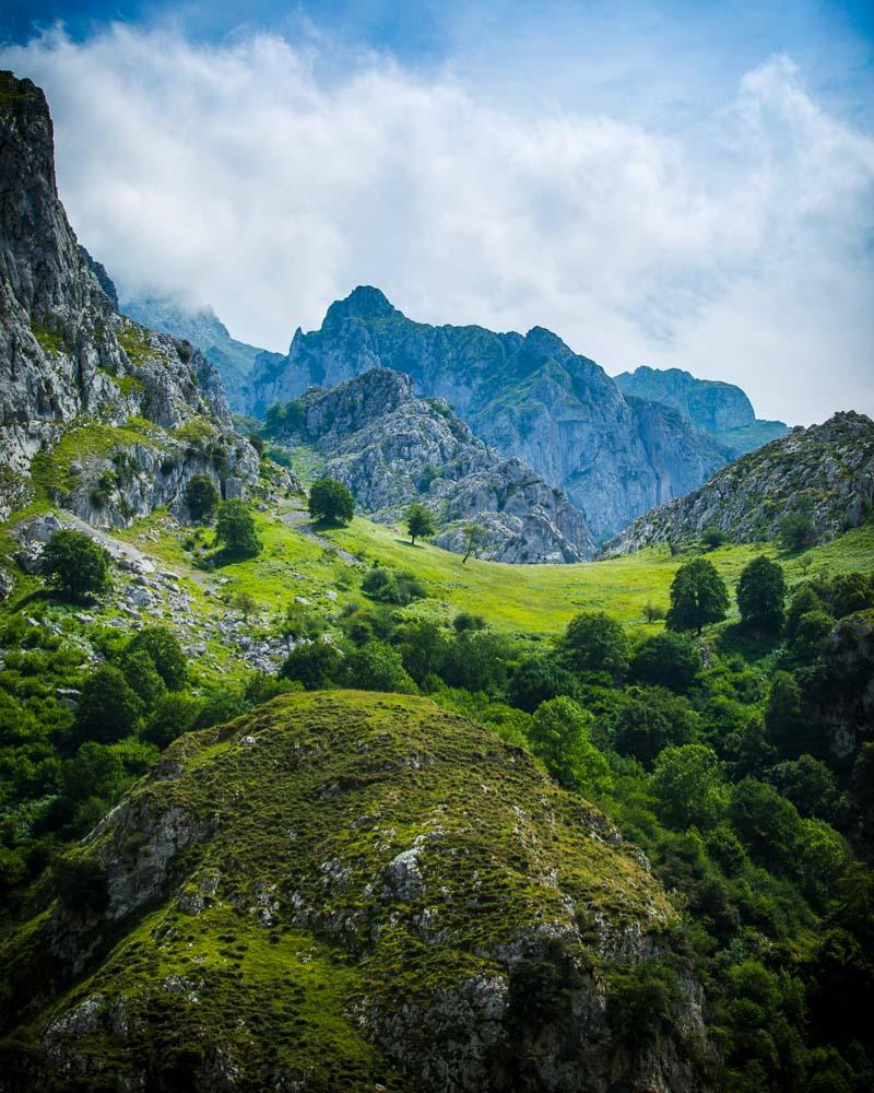
1. Poncebos to Bulnes
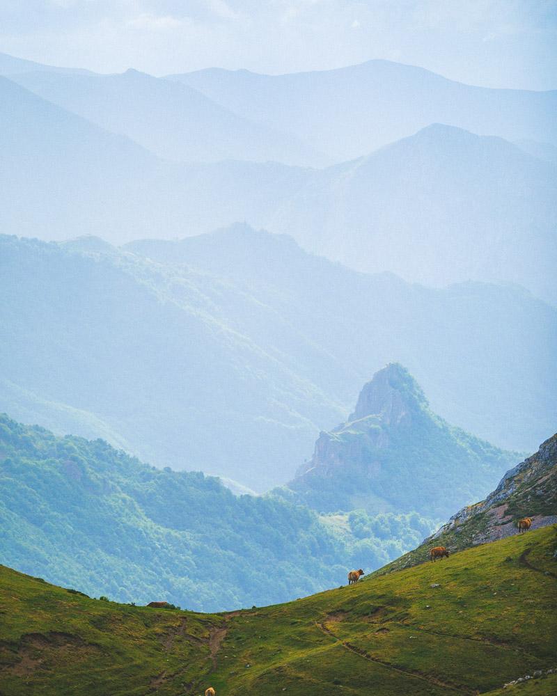
The first Asturias hike on this list obviously had to be in Picos de Europa, the best place for hiking in the region.
Bulnes is a small mountain village, with a traditional feel, located in the mountains.
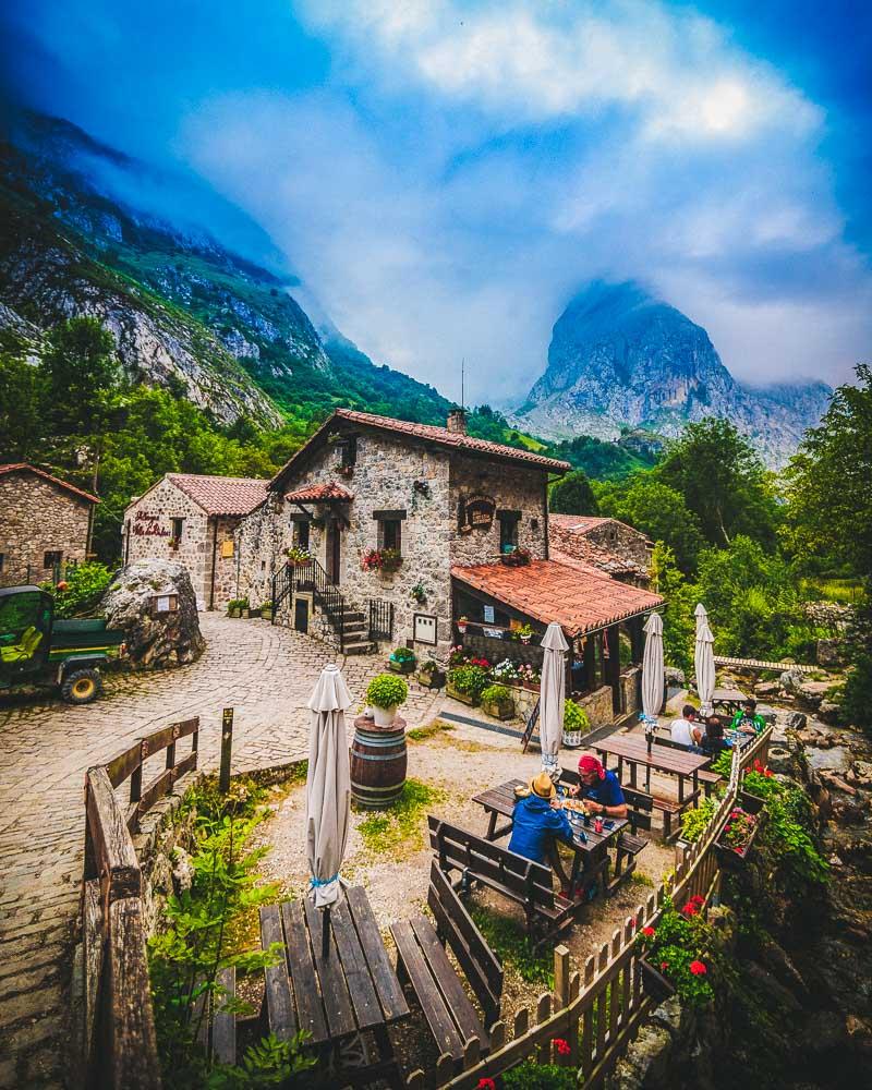
The hike itself is pretty nice, with views on the surrounding mountains, walking along the Texu Canal. But getting to Bulnes is the highlight of the hike: explore both parts of the village (lower Bulnes and higher Bulnes), have a taste of the local homemade food and don’t miss the local drink, sidra (cider).
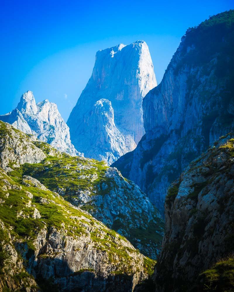
Hiking in the mountains used to be the only way to reach Bulnes; now there’s a funicular linking Poncebos to Bulnes. The hike is 3h long if you do the return, but you can make it shorter by taking the funicular. You can for example take the funicular up to Bulnes, explore the village, and then hike back down for a nice 1h30 hike.
Poncebos to Bulnes Hike

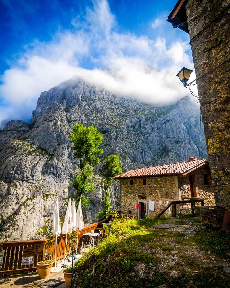
2. Sotres
Sotres is another mountain village in Picos de Europa, and as a matter of fact it’s the highest village in the National Park. The village itself is nice, but I definitely find Bulnes to be nicer.
The hike to Sotres, however, is much nicer!
The hike goes high up in the mountains and conditions can change pretty quick, making for pretty epic scenes. Local animals roam freely, adding to the overall experience.
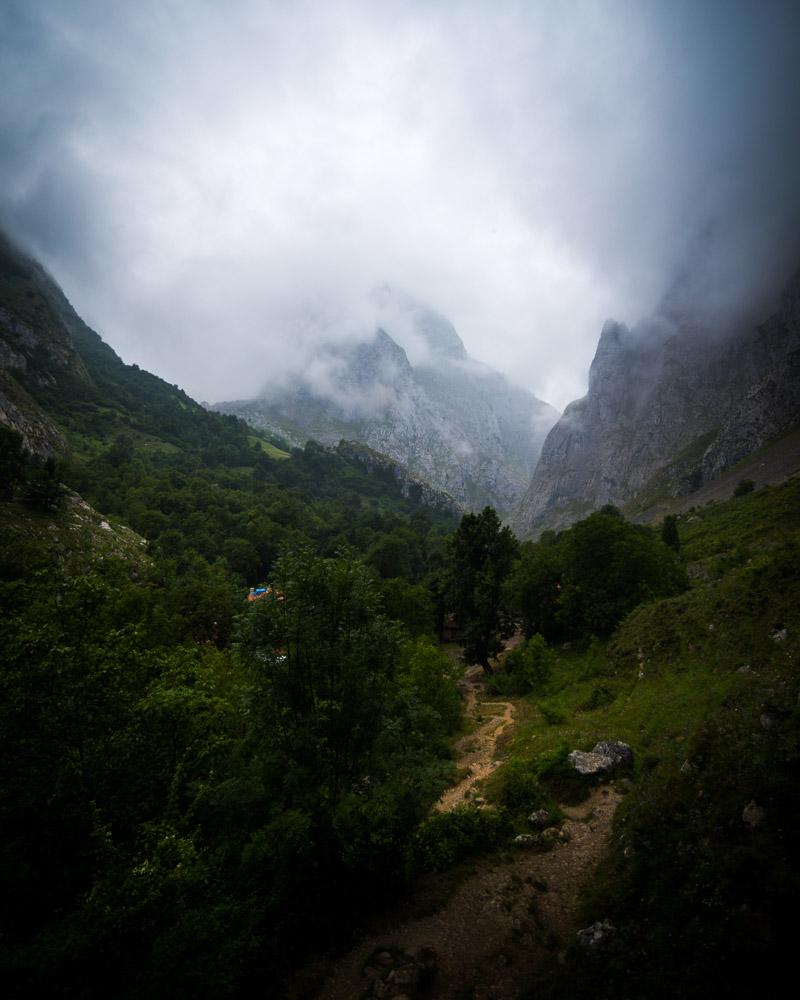
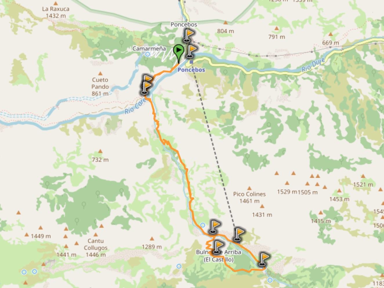
The hike starts in Poncebos, crosses Bulnes and finishes in Sotres. The full loop back to Poncebos takes the full-day. You can make the hike shorter by:
- taking the funicular to Bulnes (-1h30)
- sleeping in Bulnes and only starting the hike from Bulnes
- taking the funicular from Bulnes on the way back (-1h30)
- or even sleeping in Sotres making it a 4h30 hike from Poncebos to Sotres
Poncebos to Sotres Hike
3. Ruta del Cares
The Ruta del Cares is the most famous hike in Picos de Europa, and should definitely be listed in the world’s best hiking trails. The Ruta del Cares is a trail carved on the side of the mountain, with epic views all along.
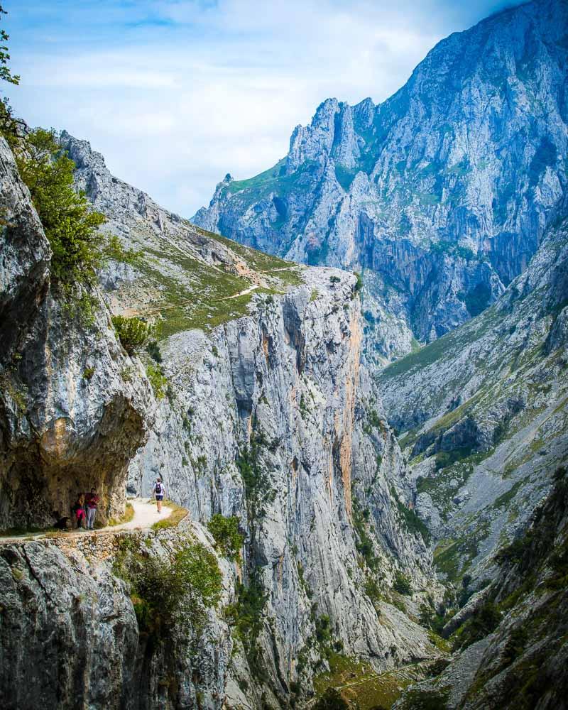
The trail is well-maintained, and it’s easy to walk there. It starts with a steep climb, but it’s pretty flat after that. The main difficulty of the hike is its length: you’ll need the full-day if you want to go from Poncebos to the end in Cain.
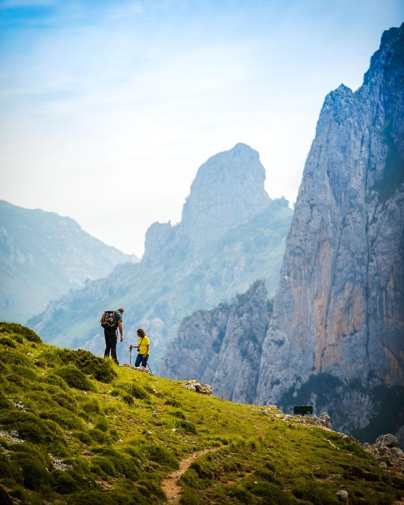
The hike is a loop, and you can make it shorter by turning back at any point you want. For example you can walk for 2h on the hike, then turn back if you’re getting tired.
Ruta del Cares
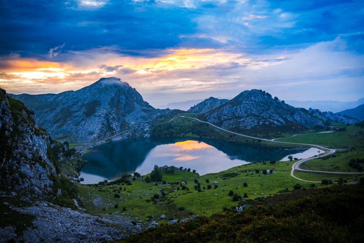
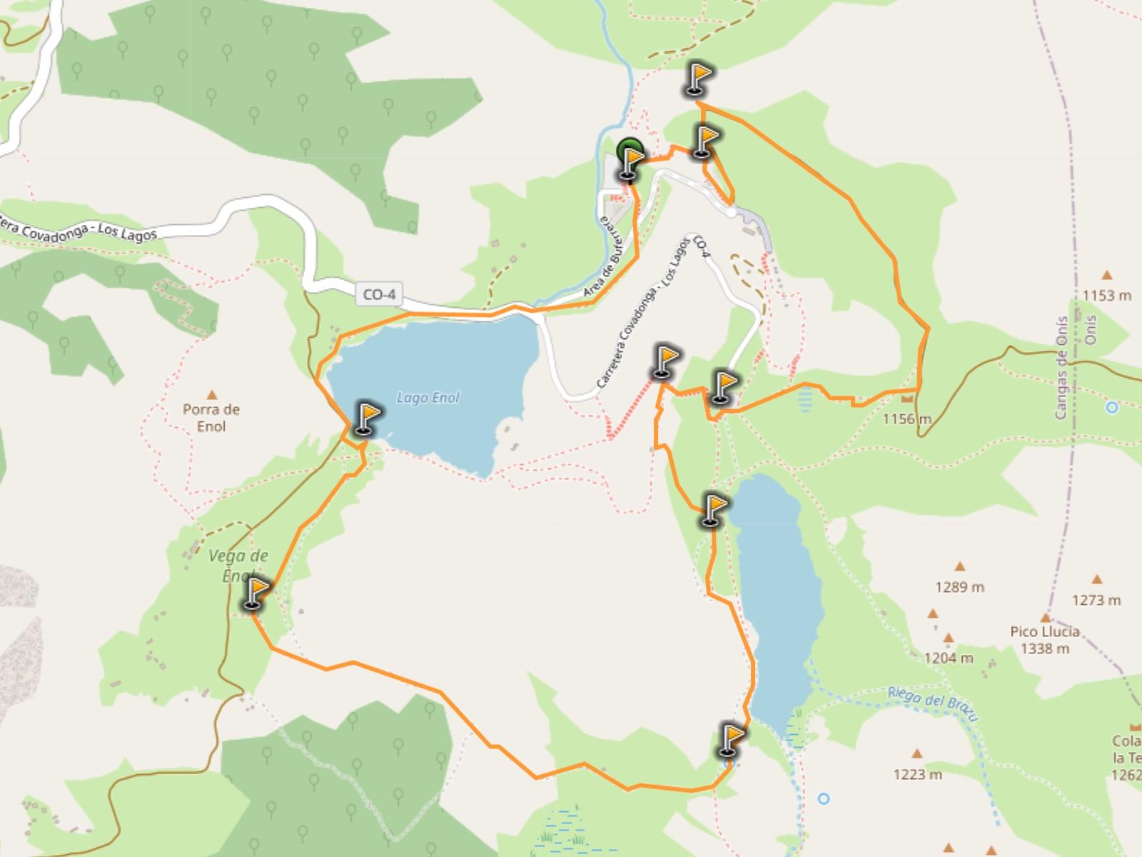
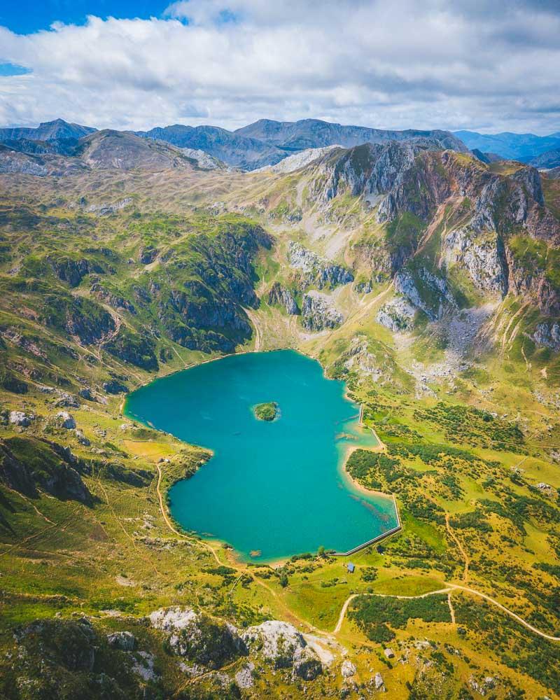
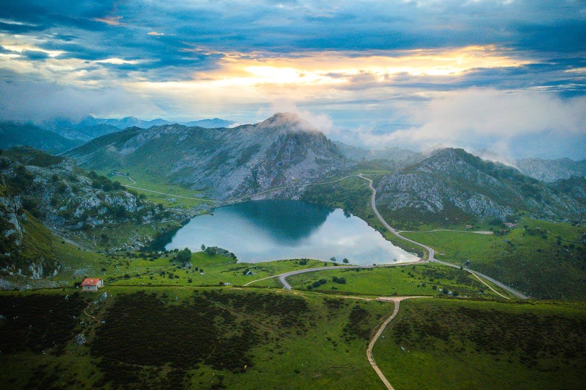
4. Lagos de Covadonga
Ah, the Lagos de Covadonga, my favorite Asturias hiking spot! The Covadonga lakes are 2 mountain lakes in Picos de Europa, and they were the very first part of the National Park (which is the first National Park in Spain).
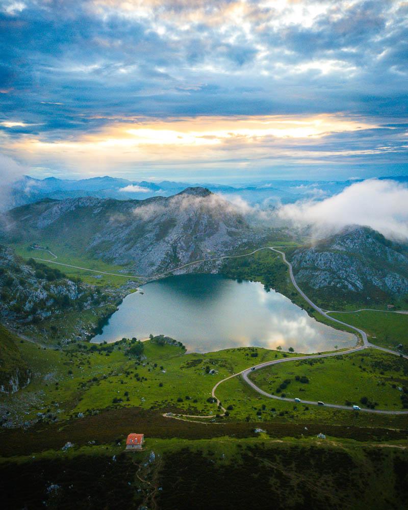
There are many hikes to do in the area; I’m highlighting the easiest one, a gentle loop around the lakes. There’s a very easy climb to the Mirador de Entrelagos (where you can see both lakes), and the hike around the lakes is a peaceful stroll.
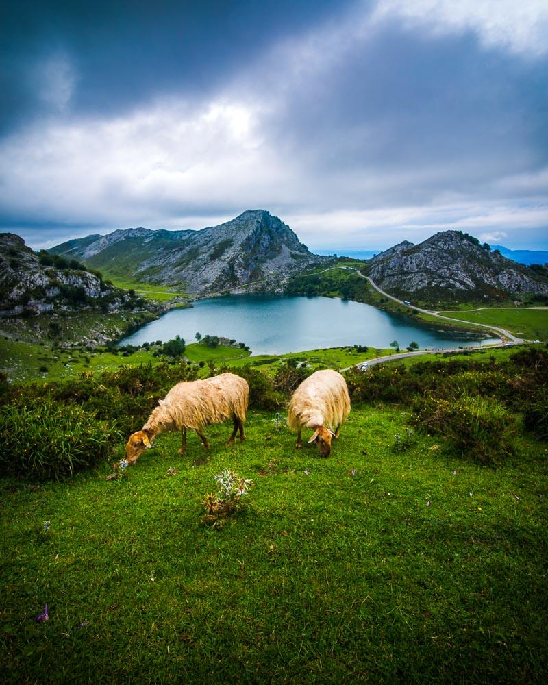
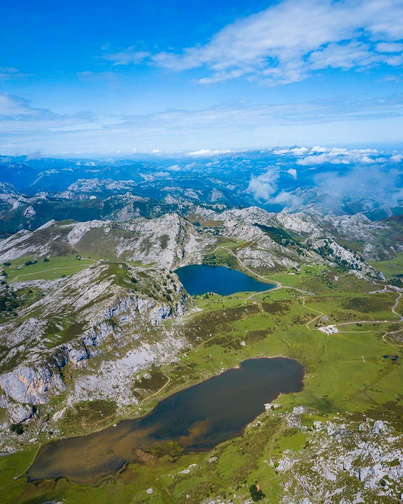
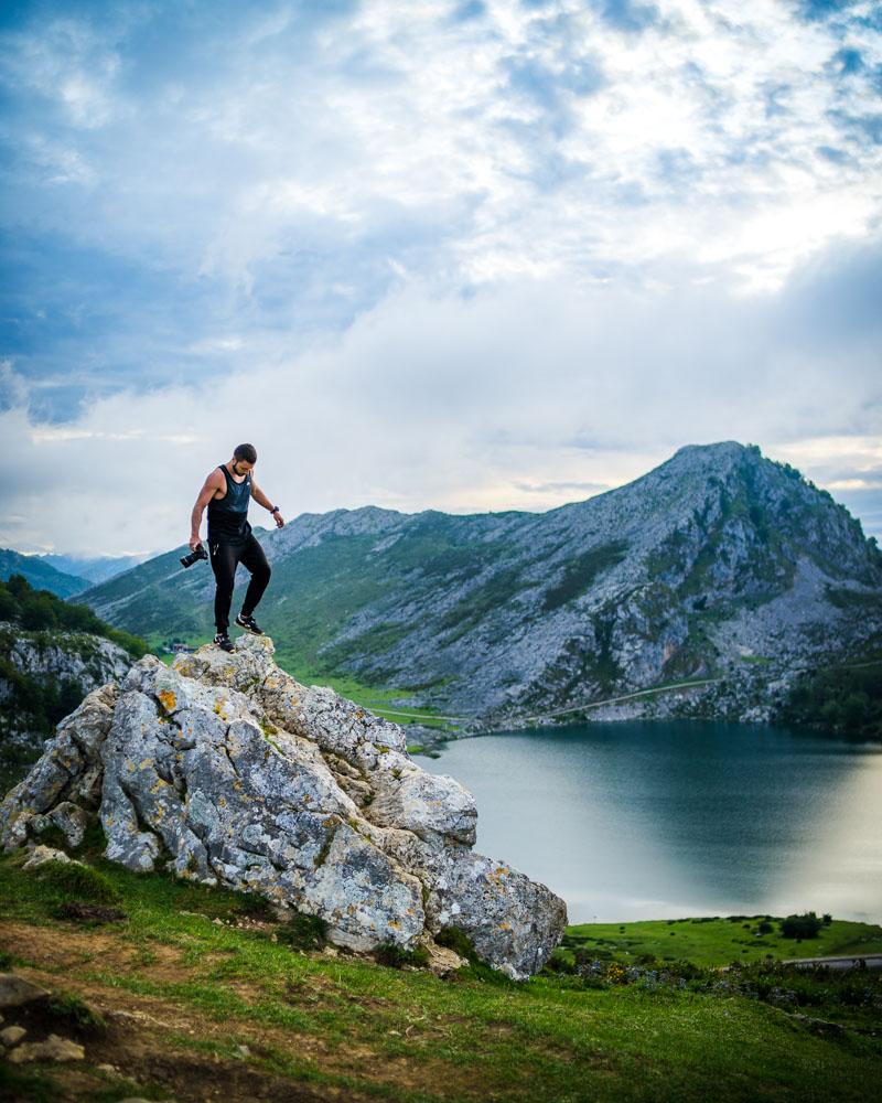
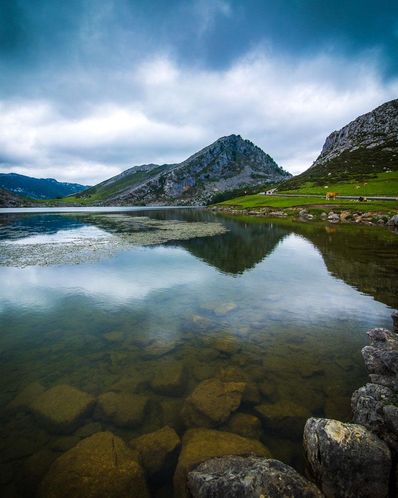
There are plenty of animals roaming freely in the area, and not much crowds once you leave the main trail. Apart from the hike, it’s easy to lose track of time there, and you end up staying the whole day (I know I did).
Lagos de Covadonga Hike

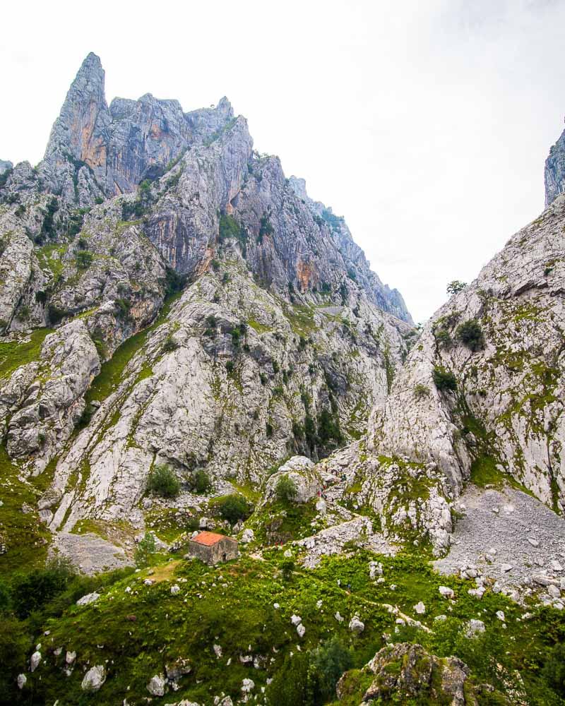
More Hikes in Picos de Europa
Picos de Europa is a paradise for hikers, and there is an almost endless supplies of trails in the area. Here are 5 more hikes there that make up my top 10.
- Full circuit Poncebos – Bulnes – Sotres – Tielve – Poncebos
- Ruta Puertos de Aliva in Fuente Dé
- Horcados Rojos Summit
- Vega de Ario
- Brez Canal de Arredondas
- Ordiales Scenic Balcony Trail
If you want more details about these 5 hikes, or if you want to see ALL of the hikes available in Picos de Europa, check out my dedicated guide here: Hiking in Picos de Europa – Complete Guide
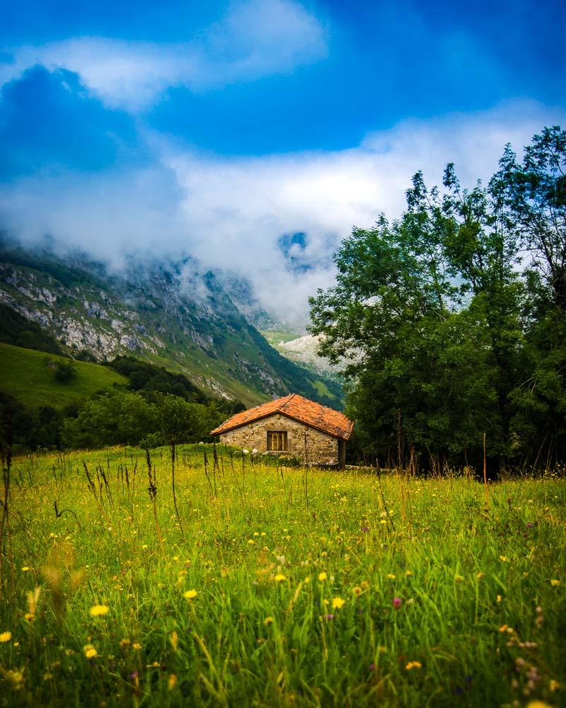
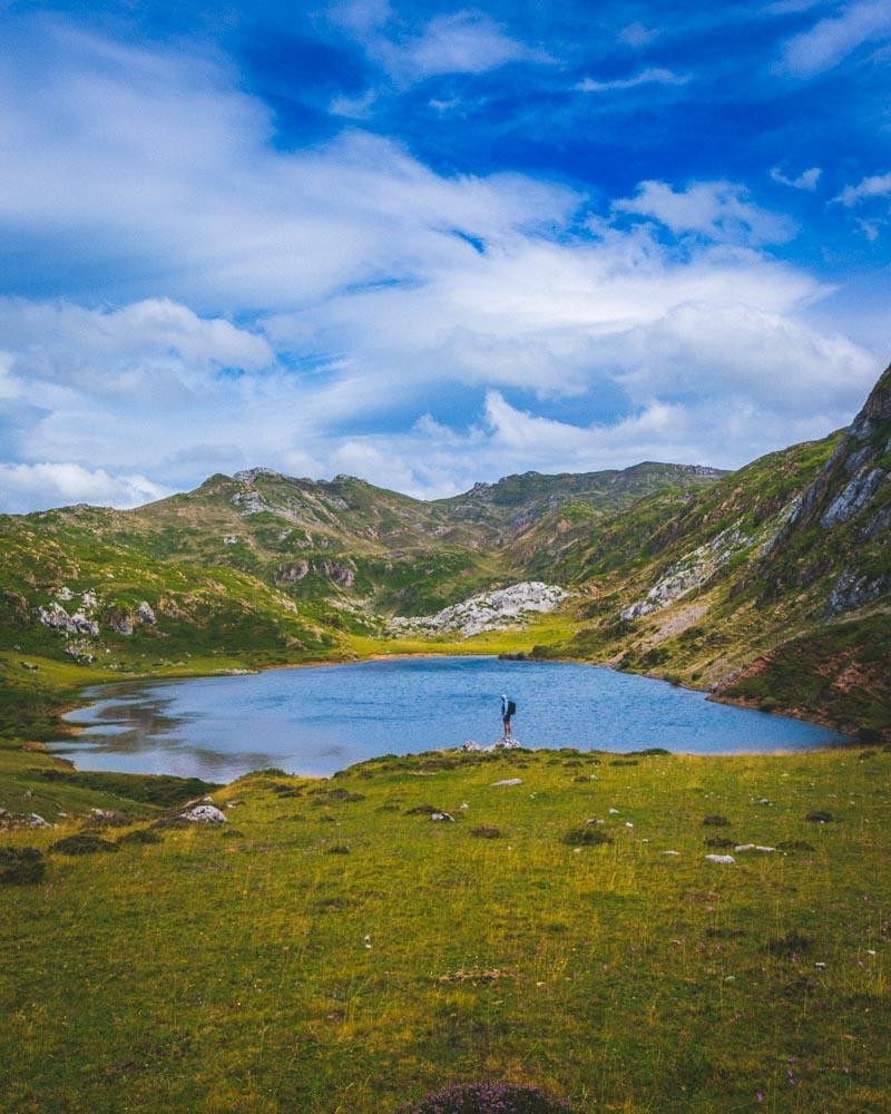
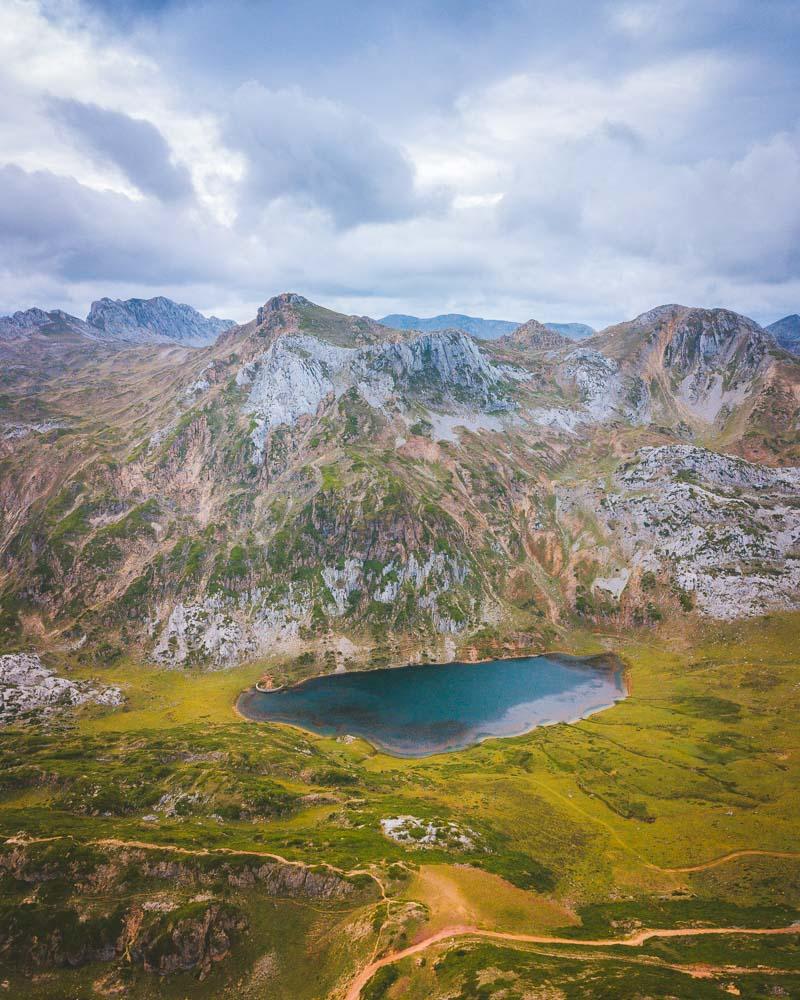
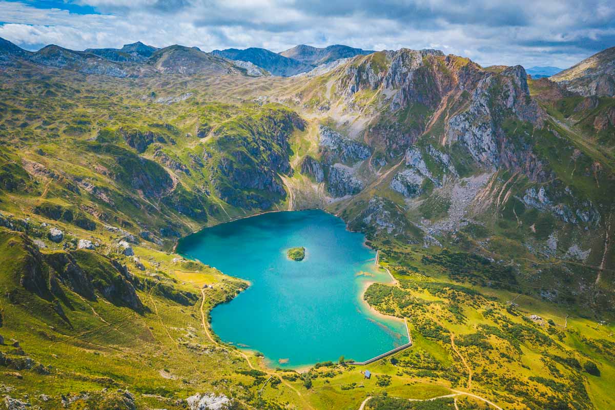
11. Lago del Valle
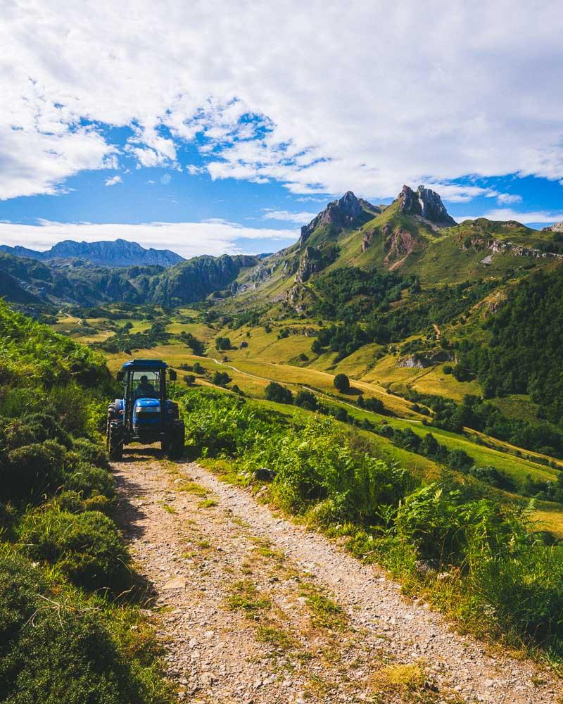
Alright, let’s move on from Picos de Europa and get to another interesting area for hikers in Asturias: Somiedo Natural Park.
The first hike we’re going to look at there is the Lago del Valle hike.
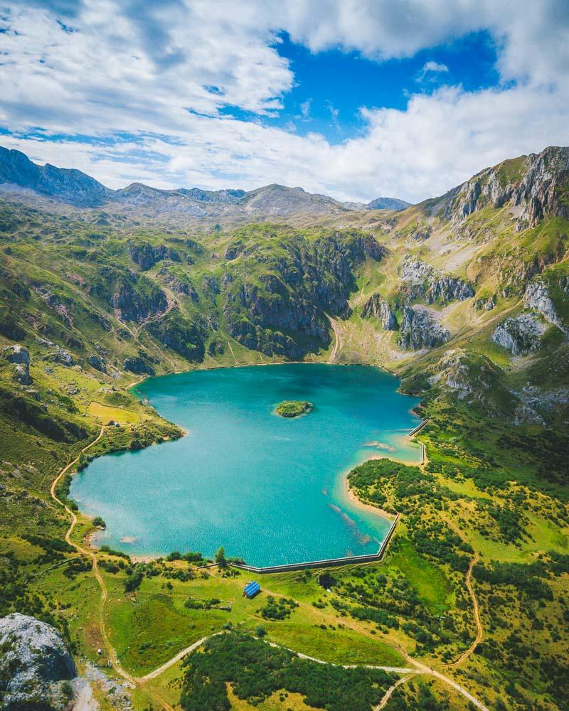
It’s an easy and short hike starting from the mountain village Valle de Lago, all the way to the lake you can see on the picture above, the Lago del Valle.
If you’re up for a day-hike, you can climb over the mountains and go to the Lagos de Saliencia in the next valley.
Lago del Valle Hike
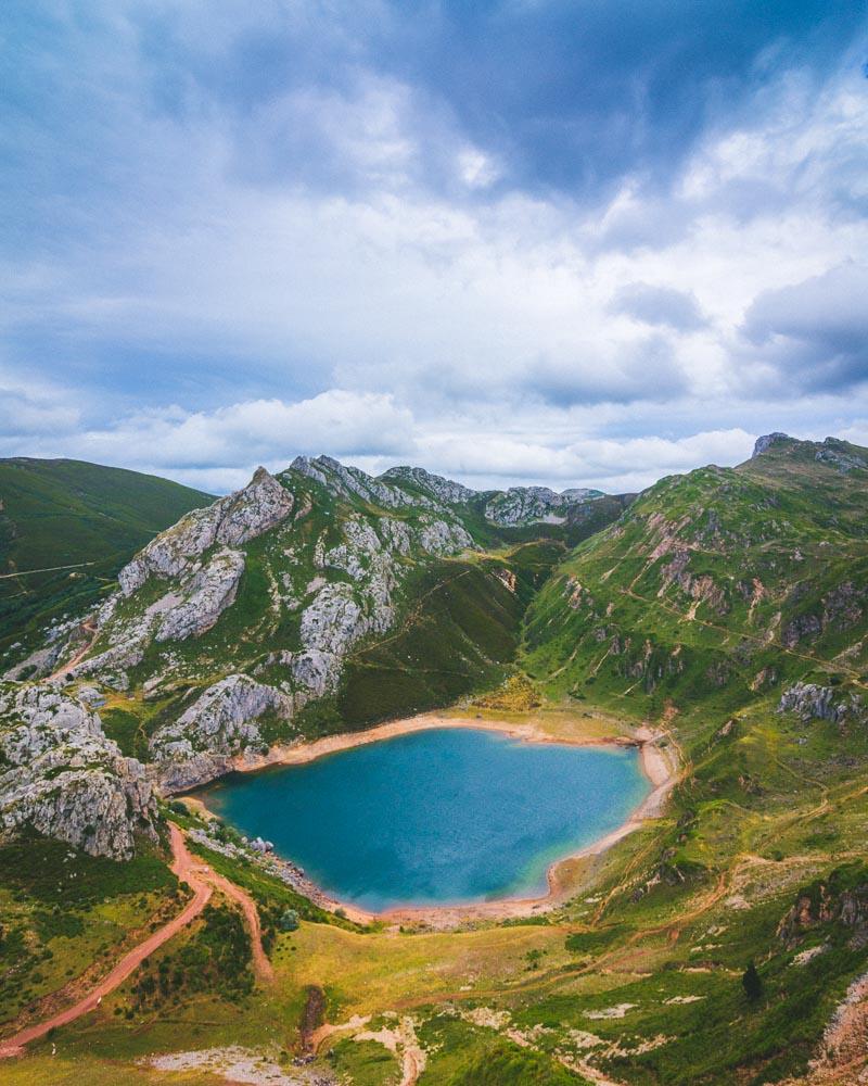
12. Lagos de Saliencia
The Lagos de Saliencia are 3 mountain lakes, located right next to the Lago del Valle in Somiedo Natural Park. Yes you read that right, 3 lakes in the same area!
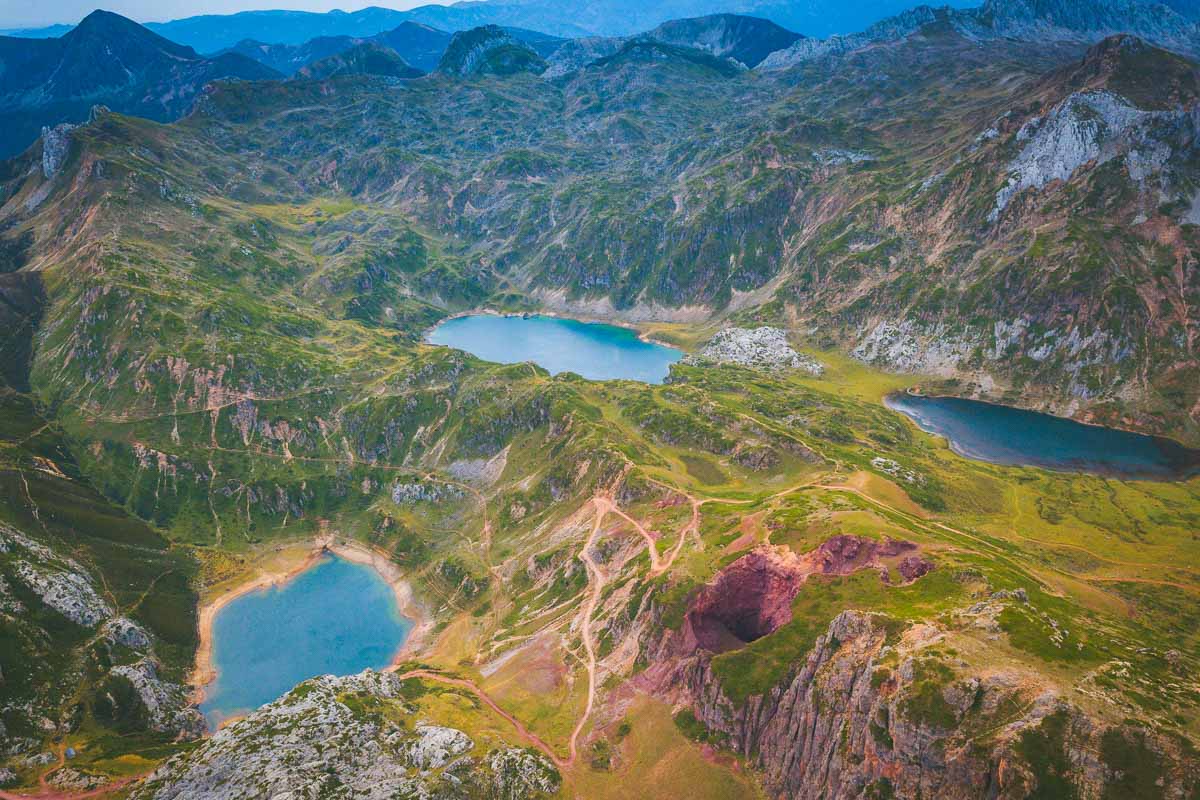
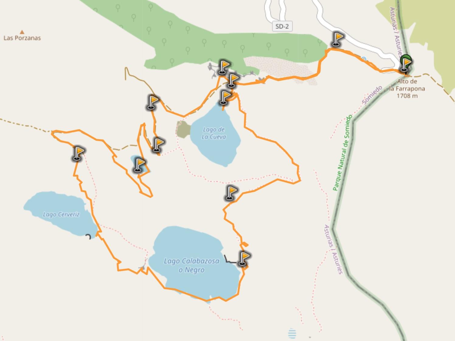
You can drive very close to the first lake, and park your car at the Alto de la Farrapona. Then the Ruta Lagos de Saliencia goes around the 3 lakes, giving you incredible views over the 3, which are all pretty in their own way. There’s a bit of elevation on the hike which makes me list it as “moderate”; other than that it’s an easy hike, with well-maintained trails and clear indications all the way.
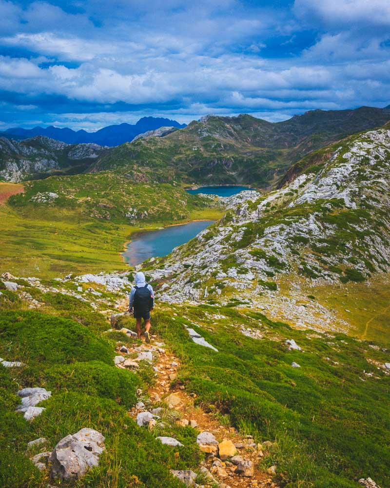
Just like the previous hike, you can extend the hike by going to the next valley and seeing the Lago del Valle, making it an 8h hike.
Ruta de Lagos de Saliencia
More Hikes in Somiedo
If you’re planning to visit Somiedo, you’ll find more hikes in this Natural Park. Here are 2 other epic hikes that I recommend:
If you want more information about Somiedo, including where to stay, what to do, and how to see the wild animals (we’re talking bears & wolves), check out the complete guide here: Somiedo Natural Park Travel Guide
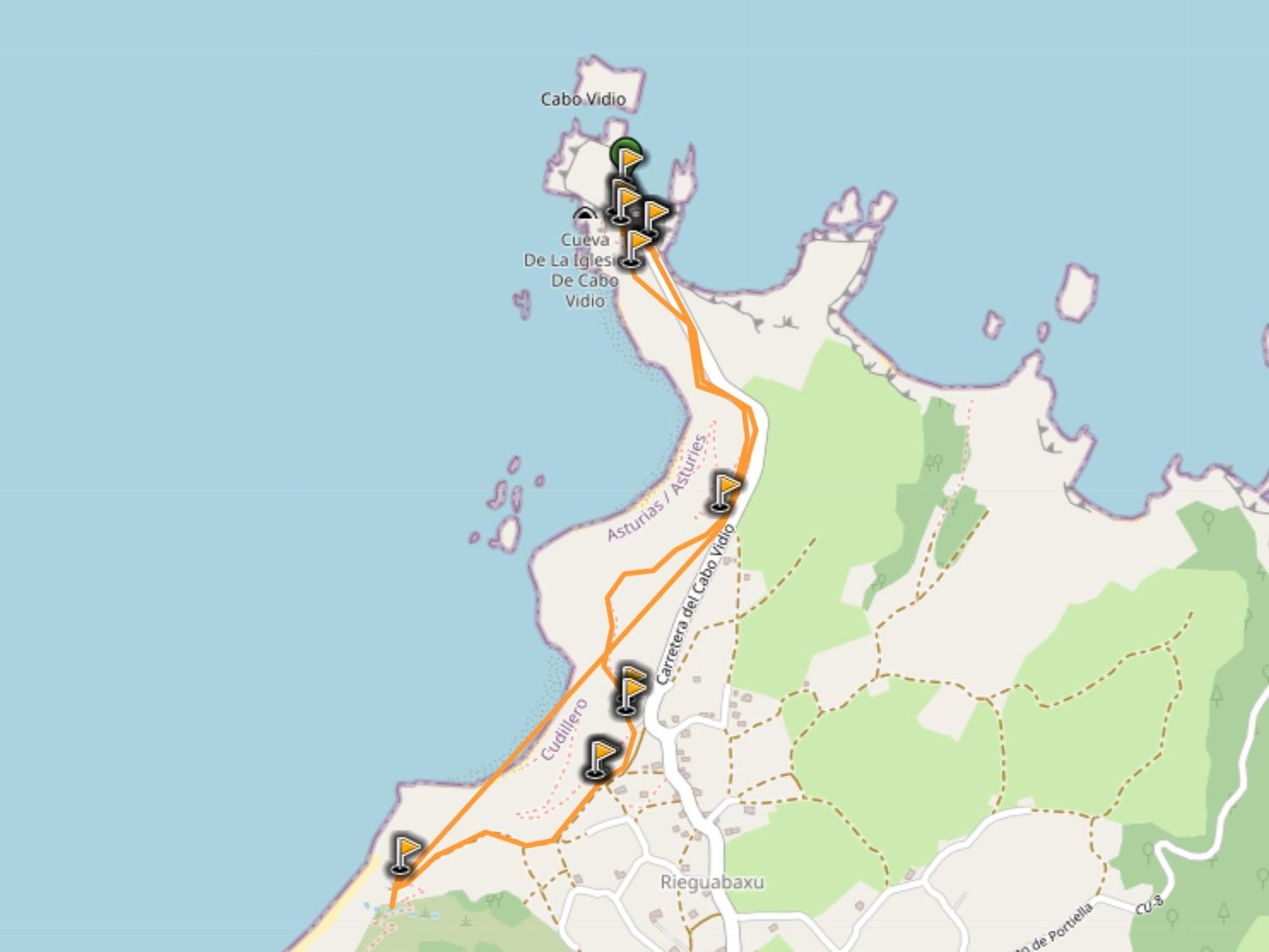
15. Cabo Vidio Loop
Alright, enough mountains for now; let’s move to the coast for some more Asturias hiking trails!
Our first coastal destination is Cabo Vidio, a wild & rugged cape with a lighthouse.
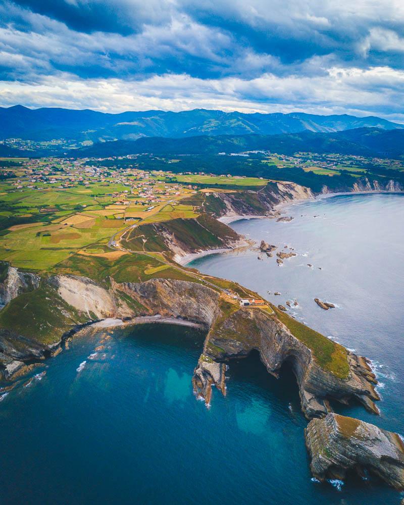
The hike starts at the lighthouse; you can drive up to it & park your car there. It then follows the coastal path along the cliffs, to discover some great viewpoints over the beaches. It’s an easy & short hike, but definitely plan for a bit more time to sit on the many benches and enjoy the view.
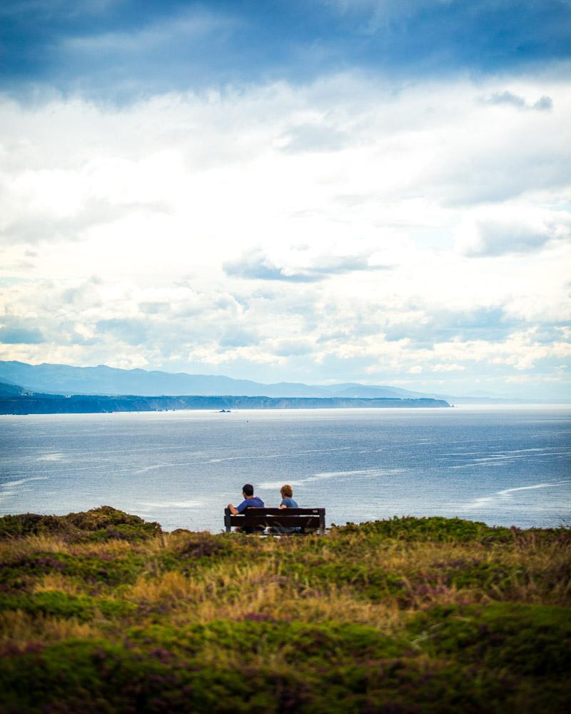
Cabo Vidio Scenic Loop
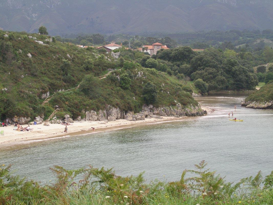
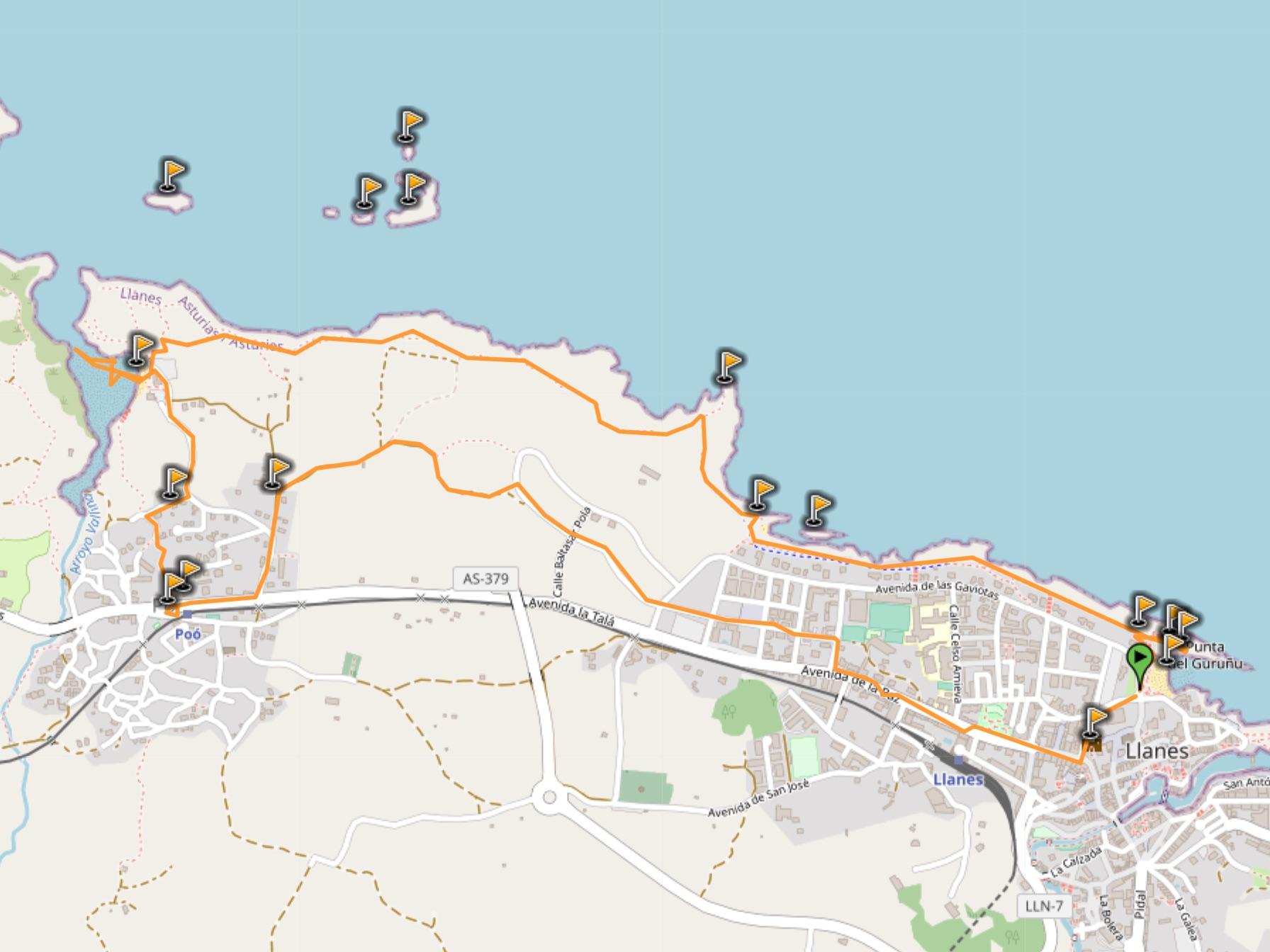
16. Llanes to Playa de Poo
Llanes is a gorgeous coastal village on the Costa Verde, and definitely a must-see in Asturias. The hike starts in Playa del Sablón, a beach right under the village, and listed as one of the best beaches in Asturias.
The hike follows the senda costera (coastal path), a flat path in grass and sometimes paved stones. It’s a family-friendly hike, which offers sweeping views of the coast every step of the way.
It will take you to another one of the best beaches in Asturias located nearby, the Playa de Poo. Despite its funny name, it’s a wonderful beach, and one of the best places to swim.
Llanes to Playa de Poo
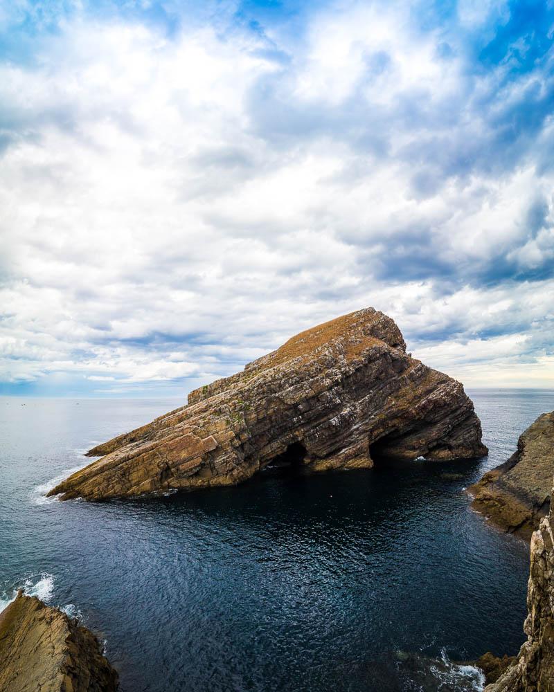
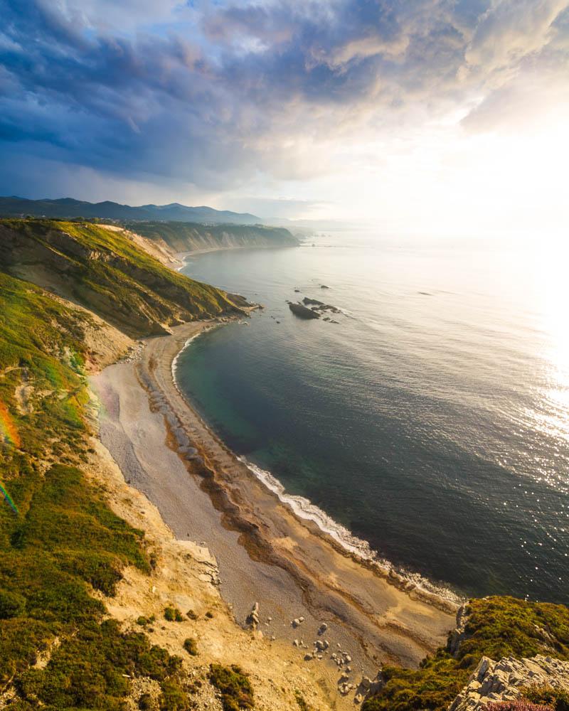
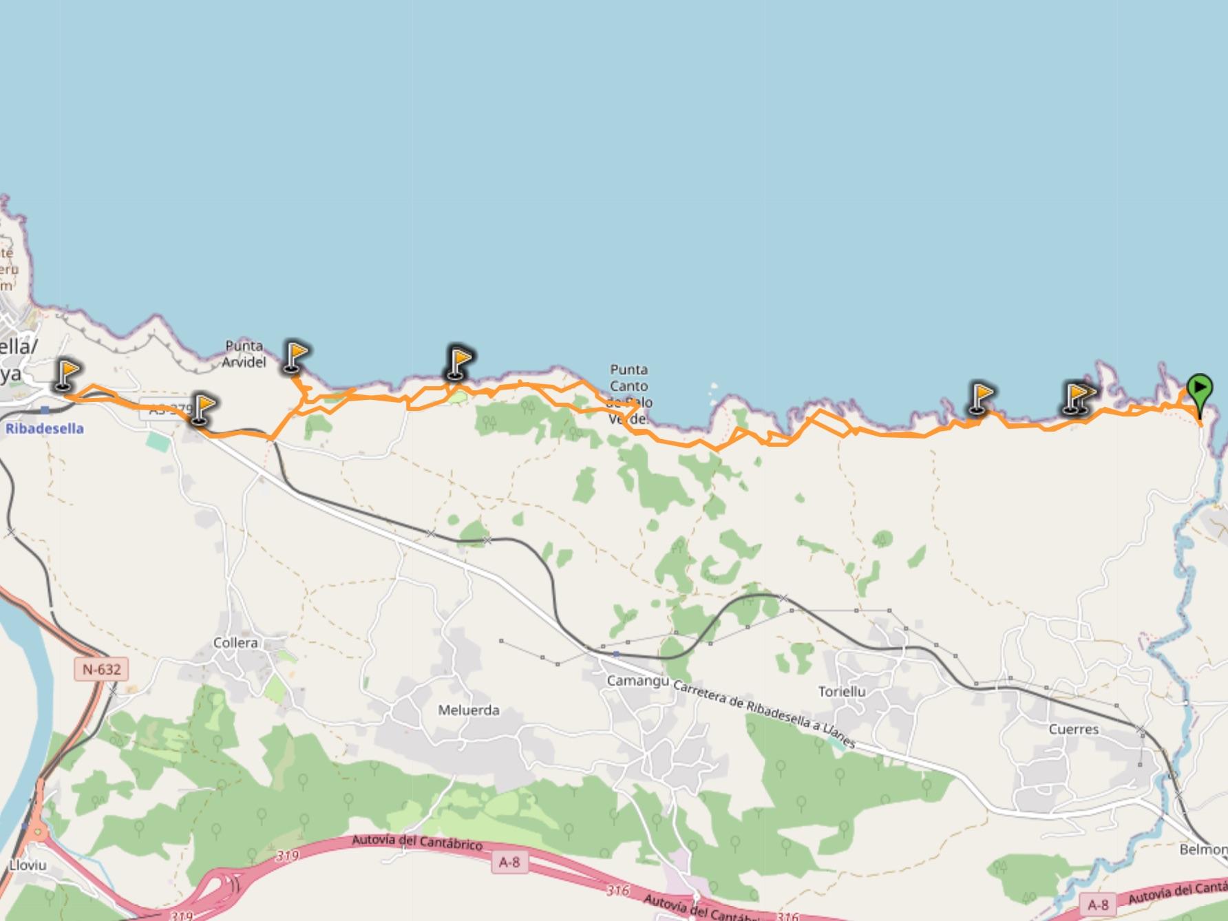
17. Bufones de Pria Loop
The Bufones de Pria loop is our last coastal hike for walking in Asturias Costa Verde trails.
The hike starts in Bufones de Pria, famous for its massive geysers.
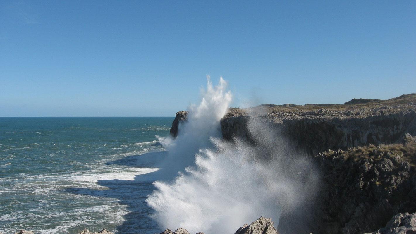
Once you’ve spent enough time watching the waves infiltrate the holes in the cliffs and blow up high in the air, you’re ready for the hike. It’s a flat trail along the cliffs, where you’ll discover interesting geological patterns, holes in the cliffs, and epic views.
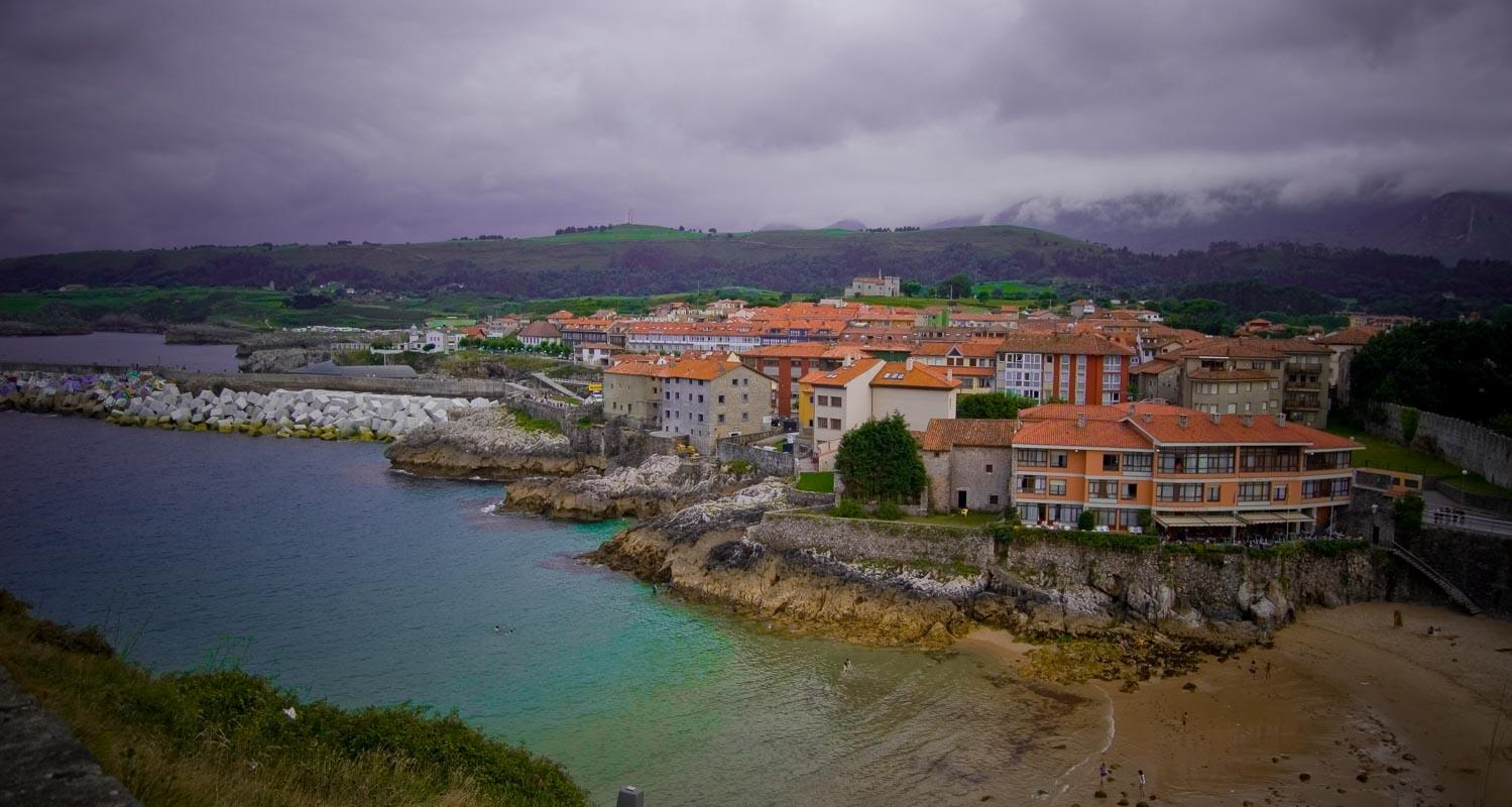
It goes all the way to Ribadesella, a coastal gem; if you have still some energy left in the tank when getting to Ribadesella, keep following the path on your right to the Ermita de la Virgen de Guia for the best view! Check out more info about Ribadesella here.
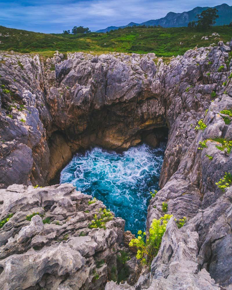
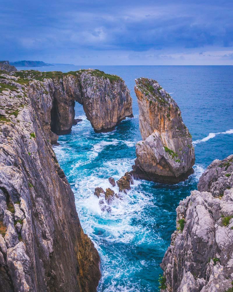
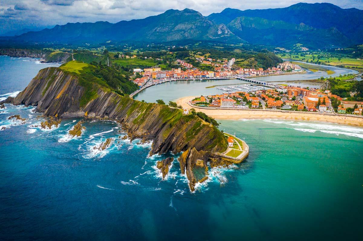
Bufones de Pria Loop
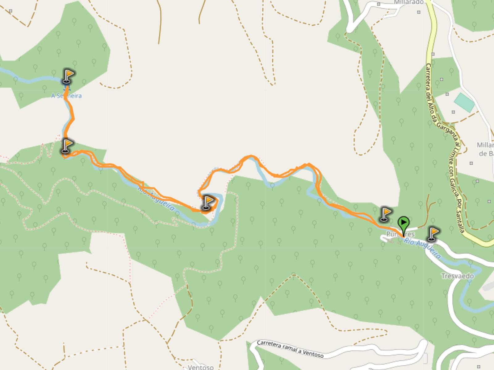
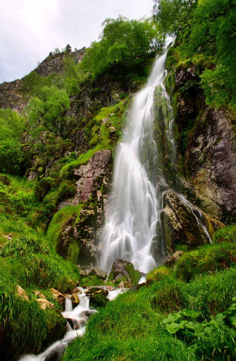
18. Ruta de la Cascada de Seimeira
We’ve seen hikes in mountains, and hikes on the coast; now let’s see some of the best waterfalls hikes in Asturias!
The first of our waterfall hike is the ruta de la Cascada de Seimeira.
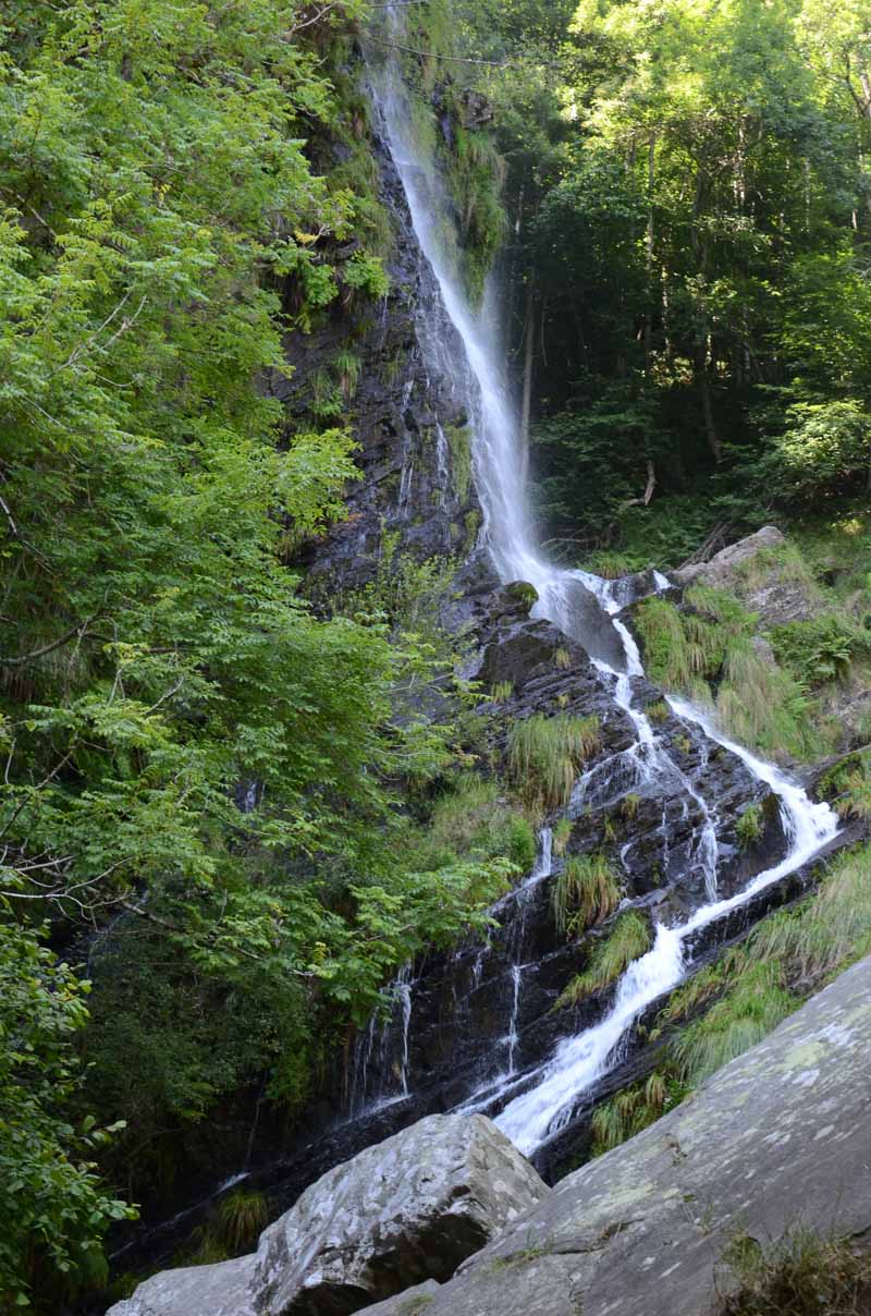
It’s an easy hike in the forest, on a trail that is mostly flat with little elevation. The route follows the river, and takes you to the Seimeira waterfall, the star of the show in the area.
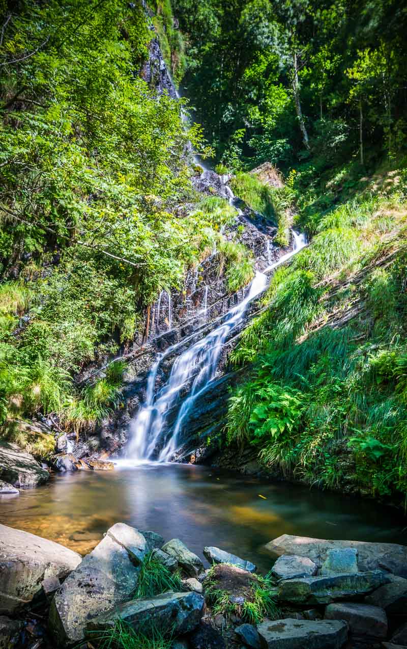
Ruta de la Cascada de Seimeira
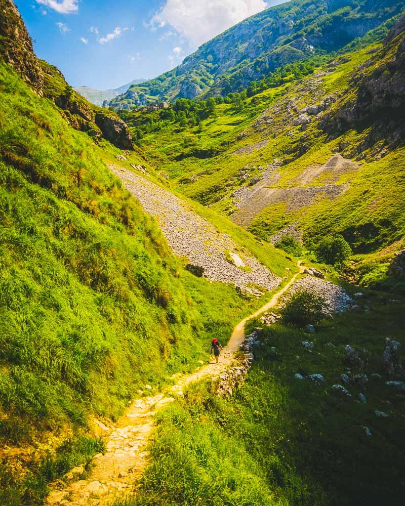
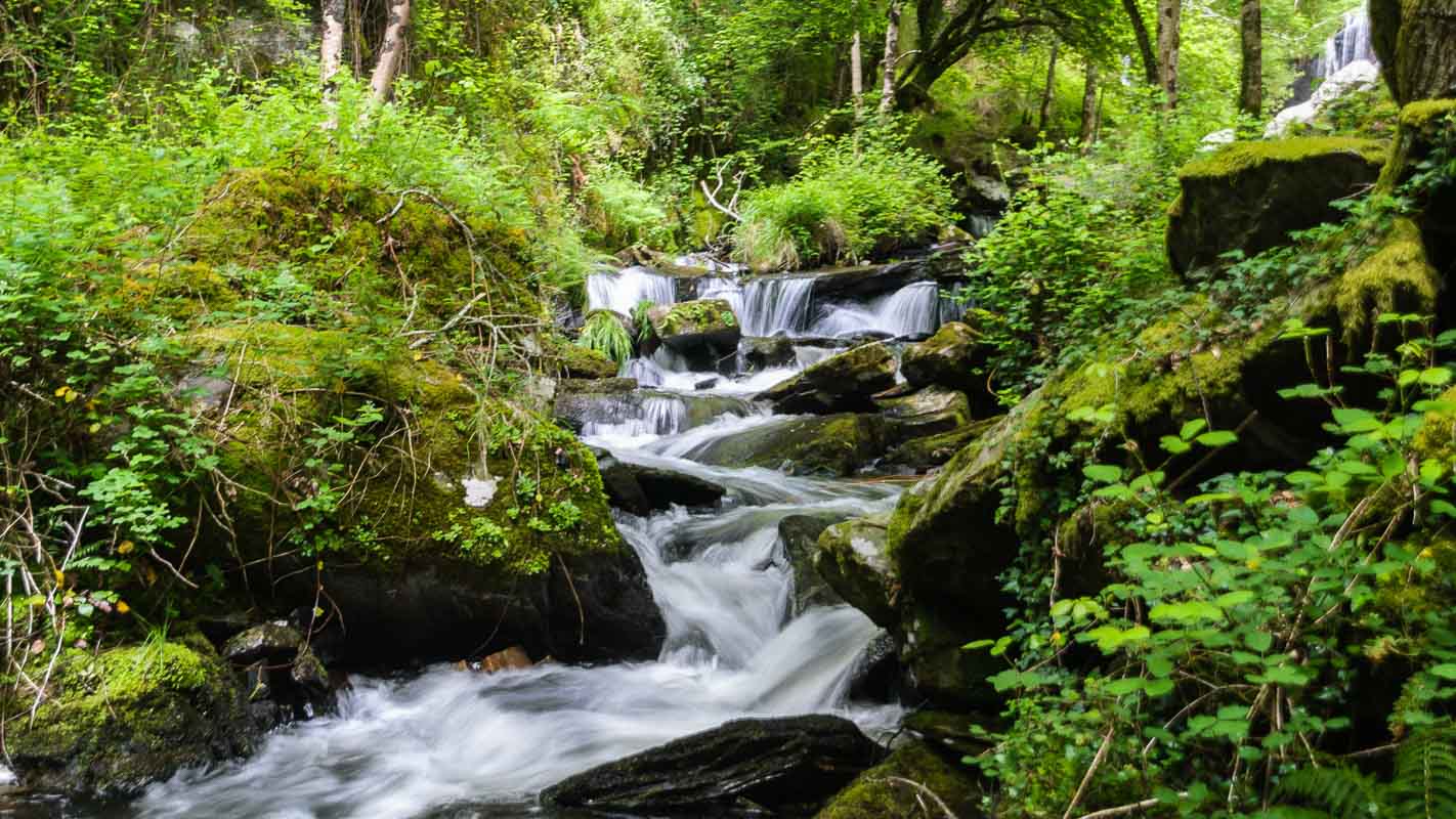
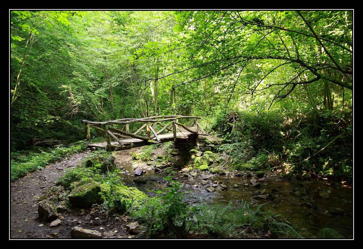
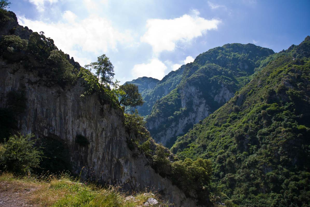
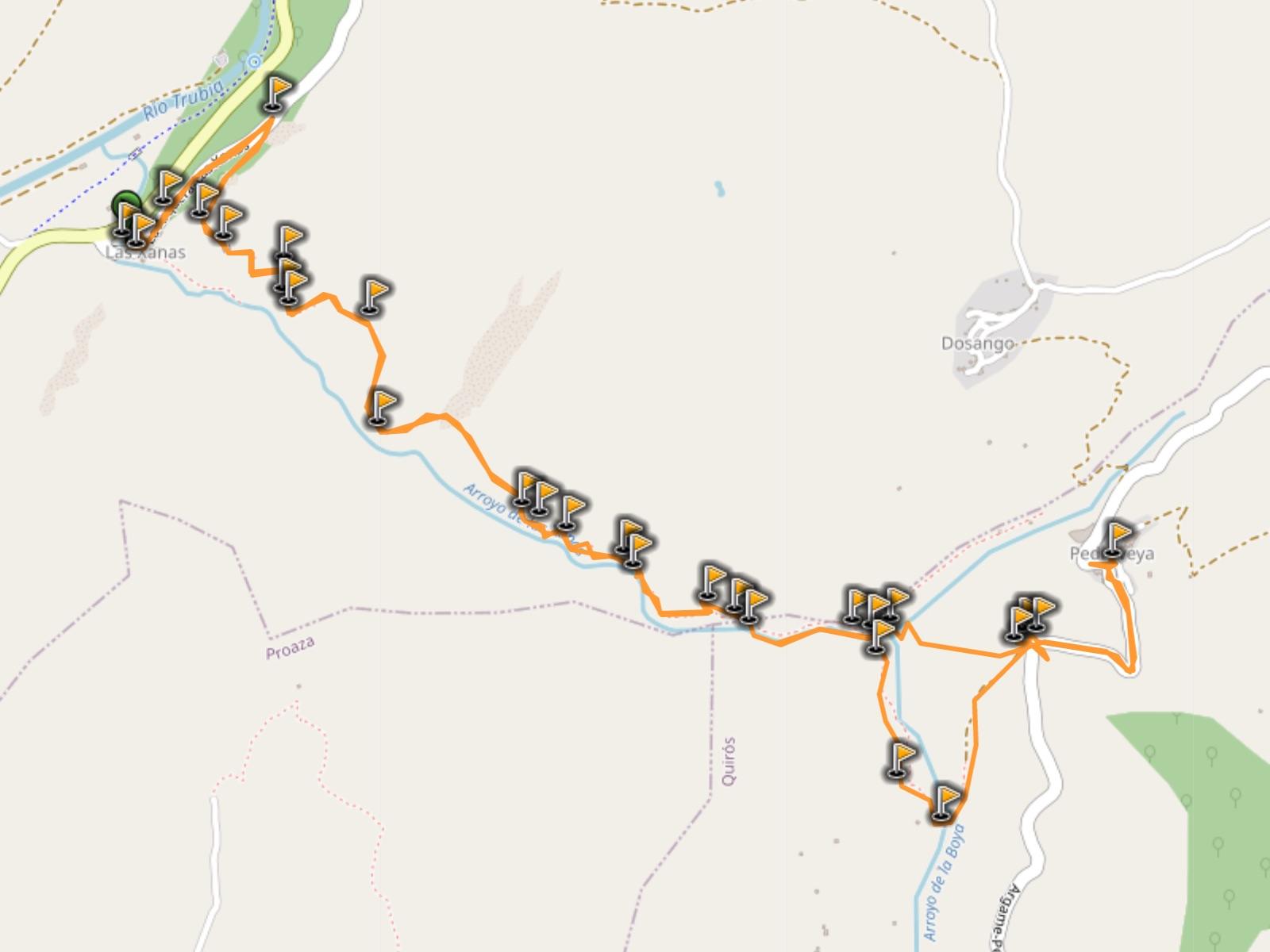
19. Ruta de las Xanas
The Ruta de las Xanas will take you both to mountains and waterfalls. It starts with a trail carved in the side of the mountain, with the river flowing down below the trail. After 2km (1.2 miles) you enter the forest, and the landscape suddenly changes.
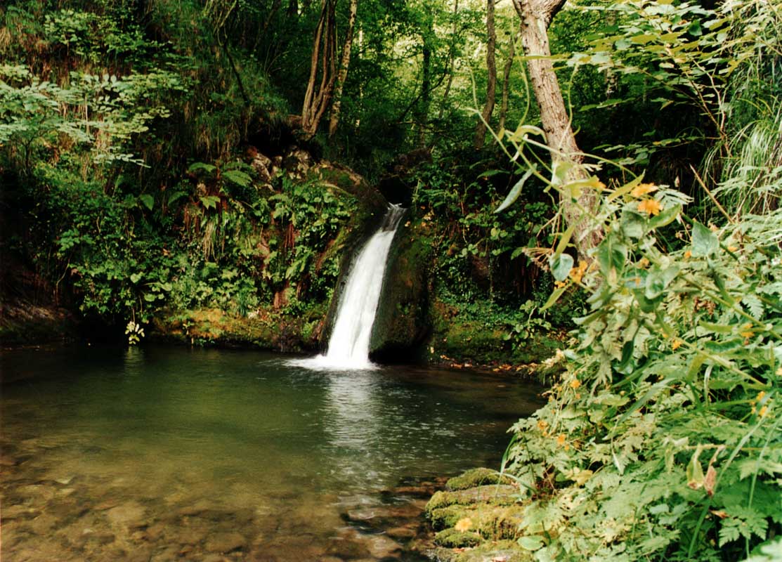
Once you get in the forest, you’re walking alongside the river. All along the hike you’ll see several waterfalls, of different sizes. It’s a peaceful area, and a pretty easy hike. You’ll need to watch your step on the first part of the hike, as there are no fences on the trail between you and the edge of the cliff.
Ruta de las Xanas
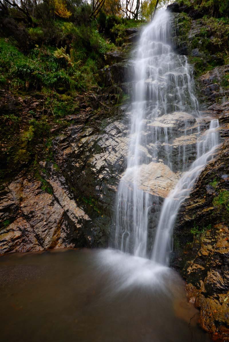
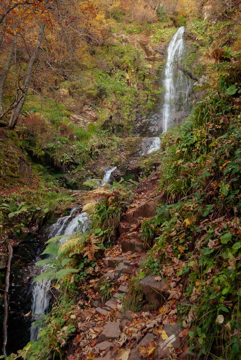
20. Tabayon Waterfall Trail
Still want more ideas for hiking in Asturias Spain?
The Tabayon waterfall trail is another hike that will get you to an epic waterfall: the Tabayón del Mongayu, also known as Cascada del Mongayo.
As you can see on the photos, it’s a pretty cool waterfall. The hike to get to it is clearly indicated, and you can reach the waterfall in under 2 hours. There’s significant elevation so get ready for the burn in the calves. The path can get muddy after heavy rain, so be careful when the ground is wet.

Tabayon Waterfall Trail
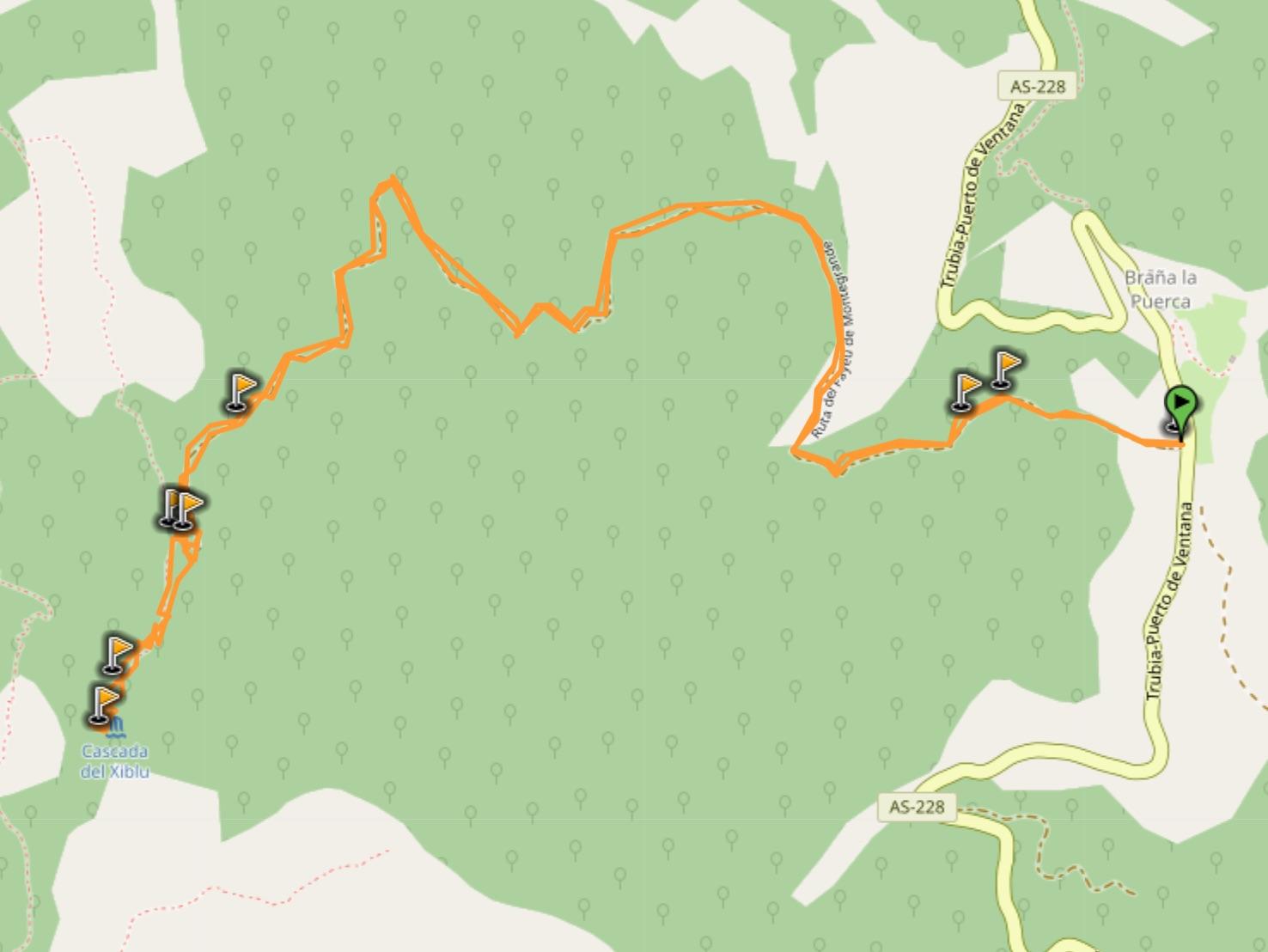
21. Xiblu Waterfall Hike
And finally, the last recommendation for hiking Asturias, Spain: the Xiblu waterfall hike.
The hike will get you to the Xiblu waterfall, which is definitely worth the effort. On top of the waterfall, the path crosses the Montegrande forest (Hayedo Montegrande); walking through the forest is a delightful experience in itself.
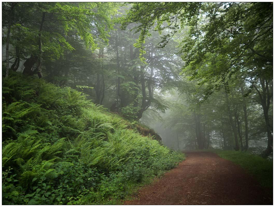
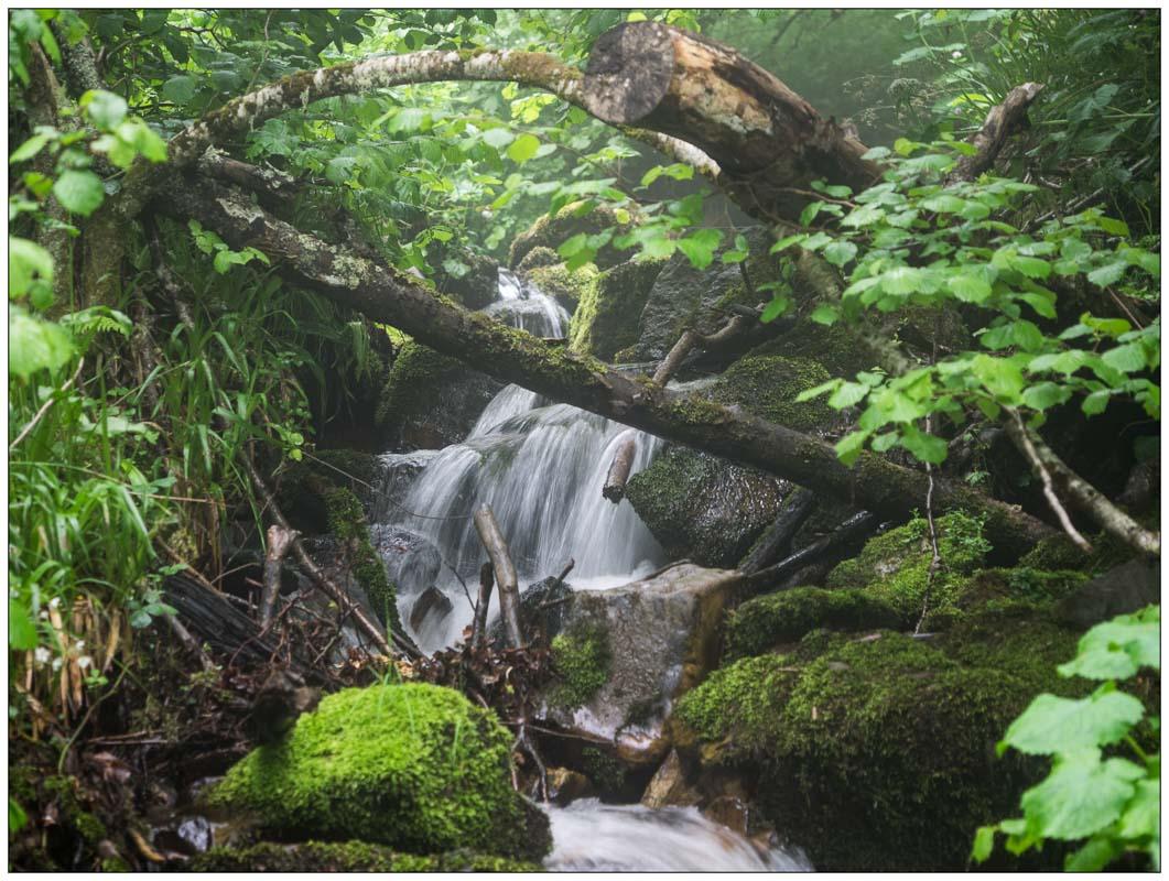
The final part of the hike gets tricky, which is why this hike is listed as “challenging”. To get to the Xiblu waterfall, there’s a steep climb. The trail gets narrow, and is often muddy due to the proximity of the waterfall. Be extra cautious on that final part, but other than that, the hike is pretty easy.
Xiblu Waterfall Hike

Check the Weather Before Your Visit
As you’ve seen in this guide of the best hikes in Asturias, the weather plays an important role in how your experience will be. Rain means some of the trails will turn to mud, creating slippery parts. Fog might hide the view, and you won’t get the epic view at the end of the hike.
Use this link to check the weather and plan your hikes
And check out these live webcams of Asturias spots
And obviously the weather also impacts how you’re going to prep for the hike: what clothes will you be wearing, and what do you need to pack.
Visit Spain
Planning a trip to Asturias and Spain? You can find below several other articles about this wonderful part of the world to help you plan your trip.
Asturias Guides:
- The Picos de Europa hiking guide: Hiking Picos de Europa
- Beaches guide: Best Beaches in Asturias
- The massive guide to Asturias: All Best Things to Do in Asturias
And finally, if you need more inspiration, see all my Spain travel guides
I hope you enjoy your trip to Asturias and to Spain; if you have any questions, let me know in the comments below, I always reply.
Help a fellow traveler and share this guide with the buttons below!
Travel Tools
Use any of our recommended links below to book your trip. You pay the same, and we earn a small fee; a great way to support us!
. spain travel places to visit | asturias spain travel | best hikes in spain | asturias spain map | spain bucket list )
Pin this to Pinterest!
Enjoyed this guide? Then help a fellow traveler and pin it! They'll most definitely love you for it, 100% guarantee.


Glad to have found your excellent site. Just started researching hiking Northern Spain. I have vertigo which is a shame as Picos de Europa region looks spectacular! Is it possible to hike here without risk of vertigo & the fear that goes with it?
Hello Kevmrc,
Congratulations for your wonderful blog of Asturias. I live in Miami, USA which is flat, flat, but always visit Celorio every summer and have only done the Bulnes hike, and short ones like the Llanes – Celorio which can continue beyond Poo Beach ☺️ and pass through Portiellu and San Martin beaches and it’s ruin. Also done Celorio – Barro. If I was in better shape, I could have continue from Barro to Torimbia beach which is gorgeous. This year I’m planning to do those again plus the del Cares because of your blog. I Love Asturias! Once again, thank you for inspiring me again to hike and keep up the good work!
Luisa
Hi Luisa, thank you so much for your kind words! I’m sure you’ll love Asturias as much as I did 🙂
I just finished the Camí de Cavalls in Menorca and Asturias is next on my mind. Wow, your information makes it even clearer now. Amazing work, thank you!
Hi Adam, many thanks for your kind word! We’re glad to know it helped 🙂
Your blog is a treasure trove of information. so glad I found it. thank you so much.
going to spend a boat load of time in this area and try to do everything.
what is the best way of traveling between trail heads in the picos the europa region?
rent a car? is there public transportation around the area?
Thanks again
Raviv
Hello Raviv, thank you for the kind word! Sorry for the delay, did you already visit?
Otherwise I’d suggest renting a car, it’s definitely the easiest way to get around.
There are some buses to get around, but they don’t go everywhere, and they’re pretty limited in the off season. Personally I had a car and it made it so much easier to get around!
Kevin,
I’m going on my first post Covid trip in the coming weeks and this guide has been really helpful – thanks for putting it together.
Hello Ferg, so excited for you; first post Covid trip, woohoo! Wish you all the best for the upcoming trip, enjoy 🙂