Sotres, Asturias – Hiking Guide to the Highest Village in Picos de Europa
Sotres, Asturias, is the highest village in Picos de Europa National Park.
While the village itself is not as charming as Bulnes, its neighbor, the hike to get to the village is a classic in the area and offers epic views over the mountain & the valley.
Whether you’re looking for more info on how to hike to Sotres, about the village itself, or simply looking for photos of the hike to decide if you want to go, this guide has everything you need.
Let’s get to it!

Where is Sotres?
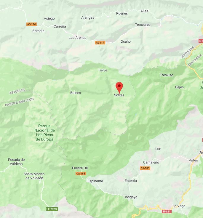
Sotres is located in the Picos de Europa National Park in the region of Asturias, Spain.
 Click on the map to open in Google Maps
The village is on the eastern part of the province, next to the border with Cantabria; it’s also close to the villages of Poncebos & Bulnes.
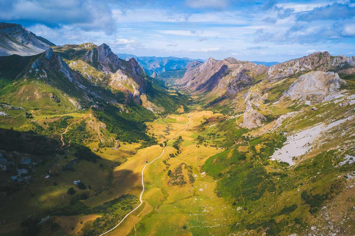
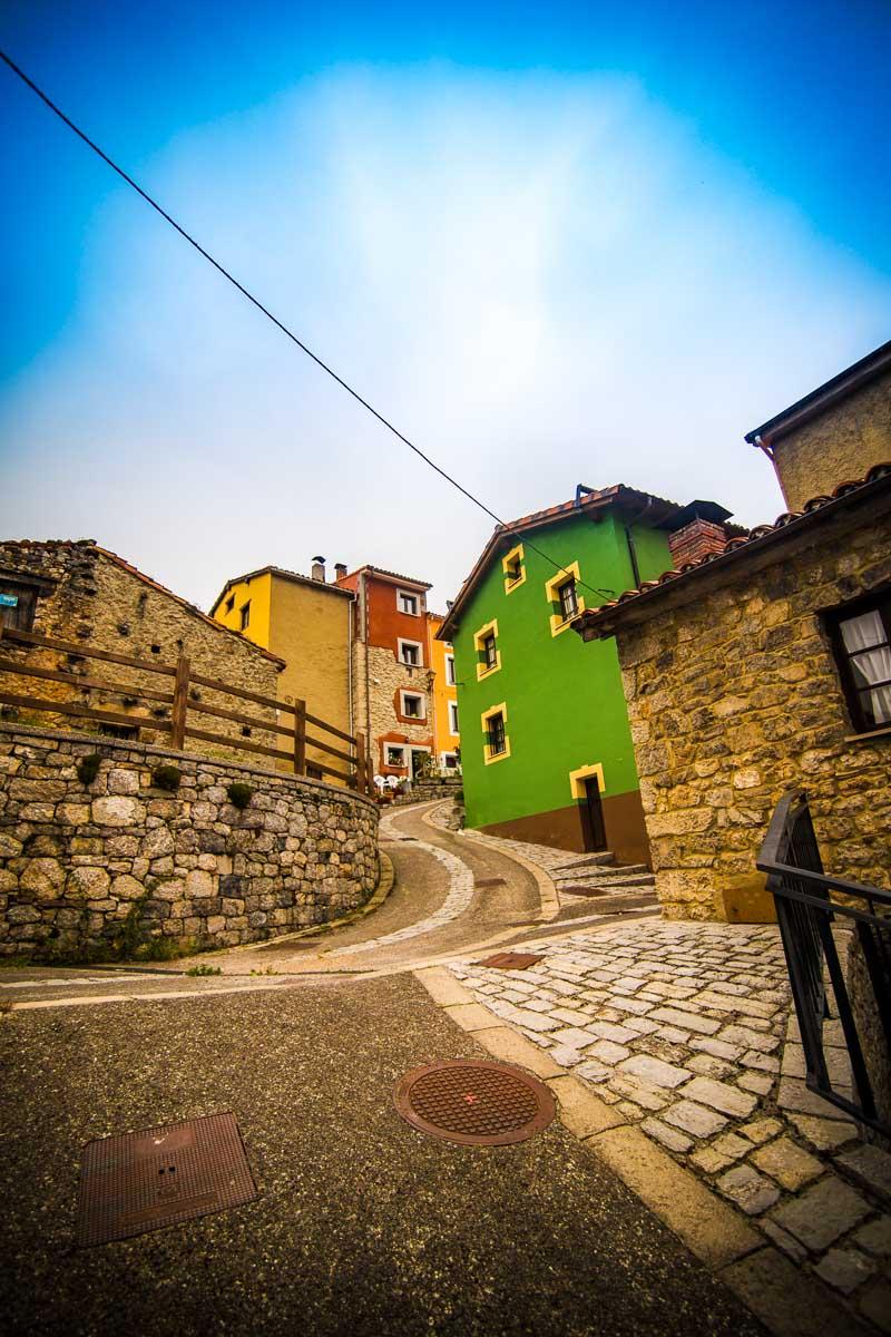
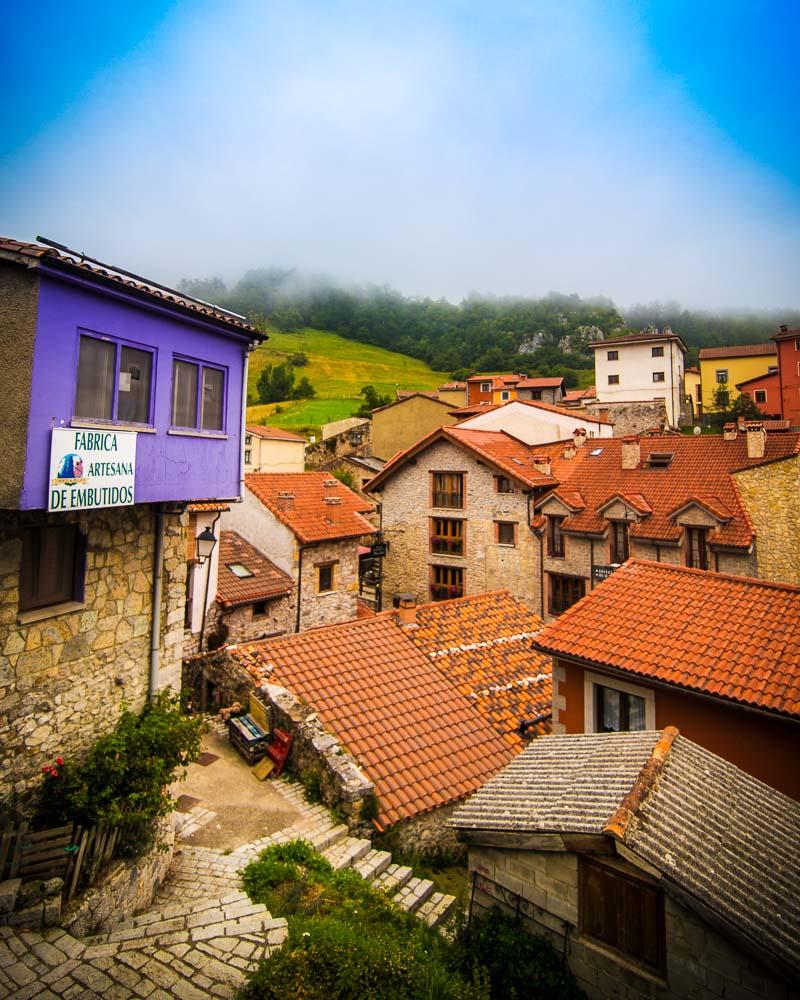
The hike to Sotres is the perfect illustration to the saying: “it’s not the destination, it’s the journey“. While the village of Sotres will probably not blow you away by its beauty (it’s now a town organized around tourism), the hike to get to it most certainly will.
I did this hike on my 2nd day in Asturias, and it was the perfect escape from the hustle & bustle of Paris.
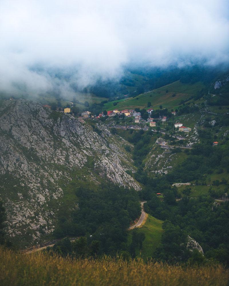
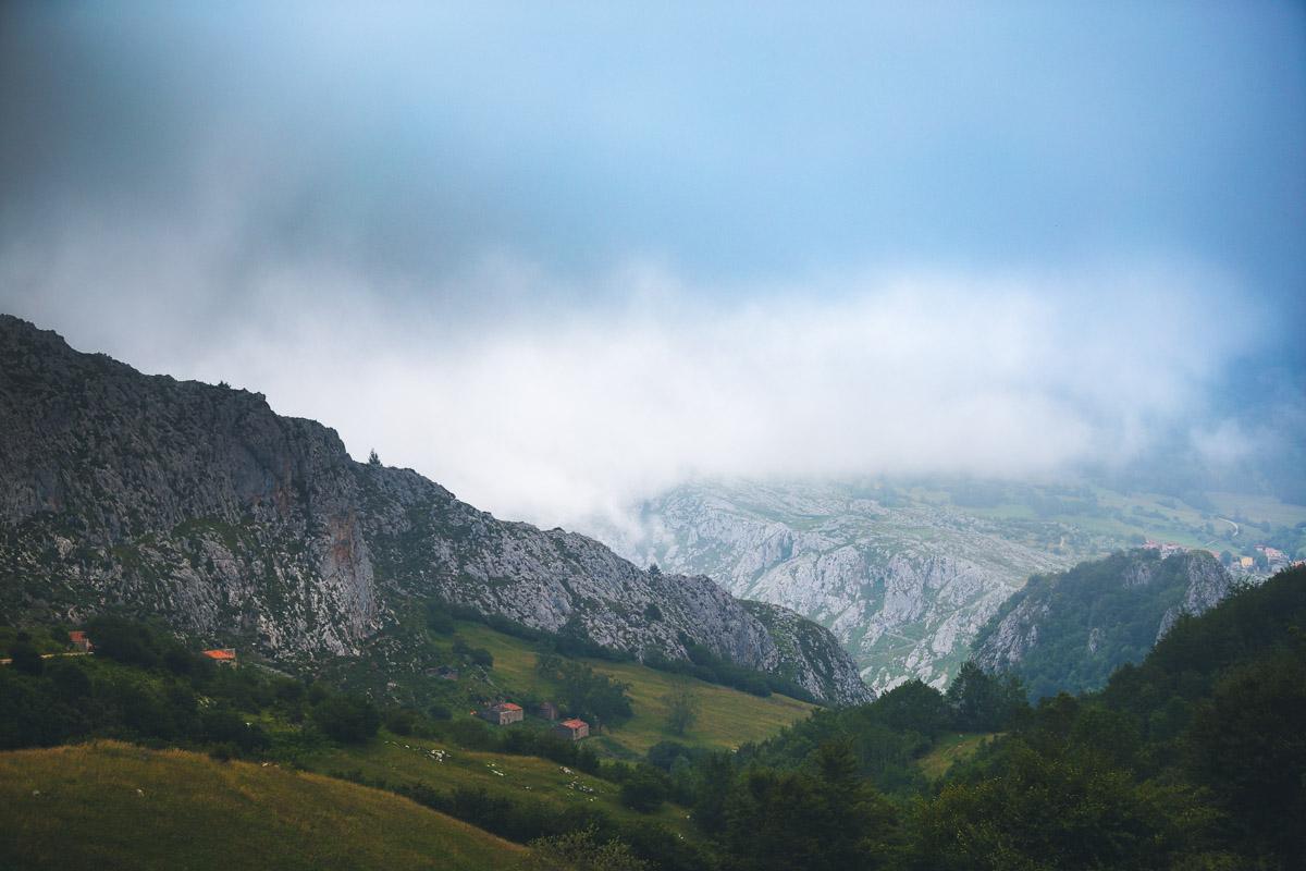
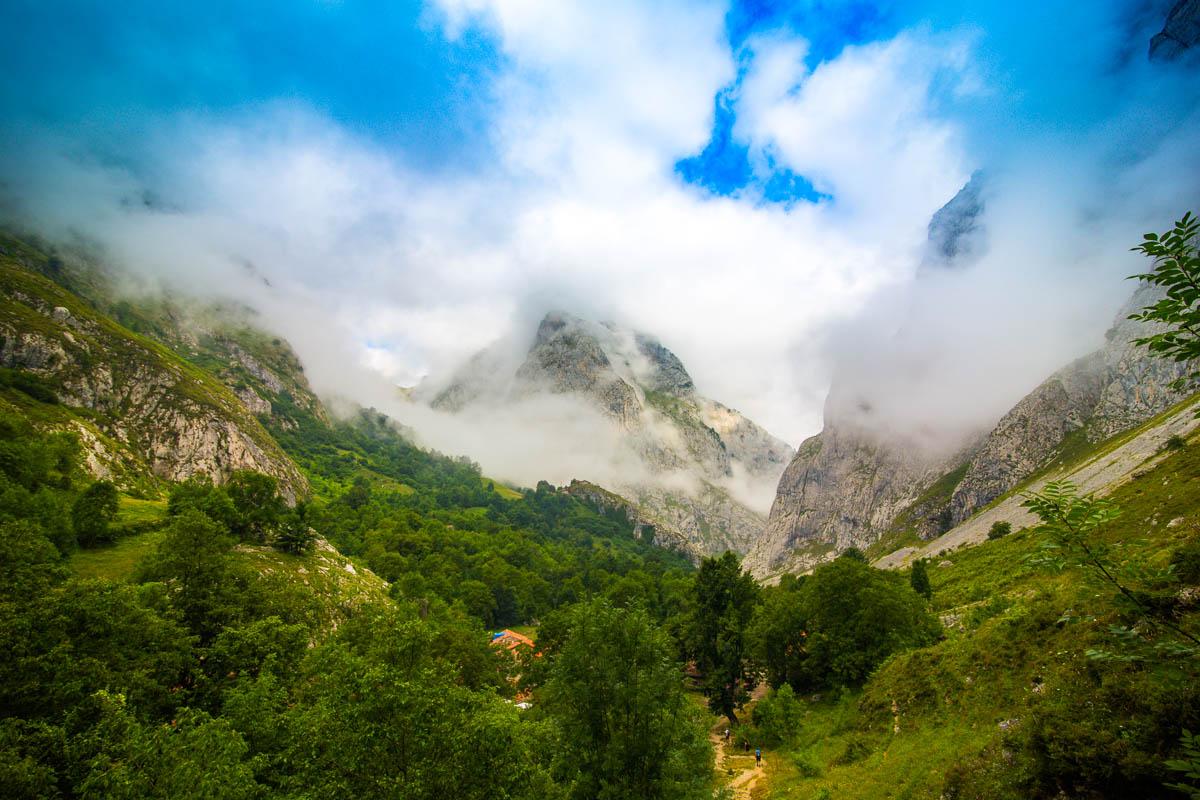
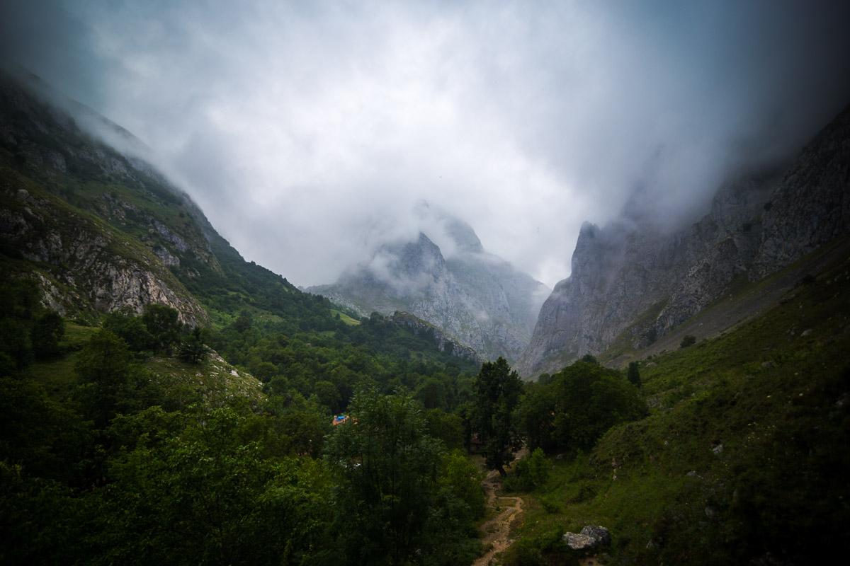
You’ll walk along local animals, get amazing views over the valley, be surrounded my mountains, and experience changing conditions from blue skies to fog as the day goes by.
There are 3 main hikes that will take you to Sotres:
- hike from Bulnes
- hike from Poncebos
- full circuit Poncebos-Bulnes-Sotres-Tielve-Poncebos
Let’s see all 3 of them in more details!
The 3 Hikes to Sotres
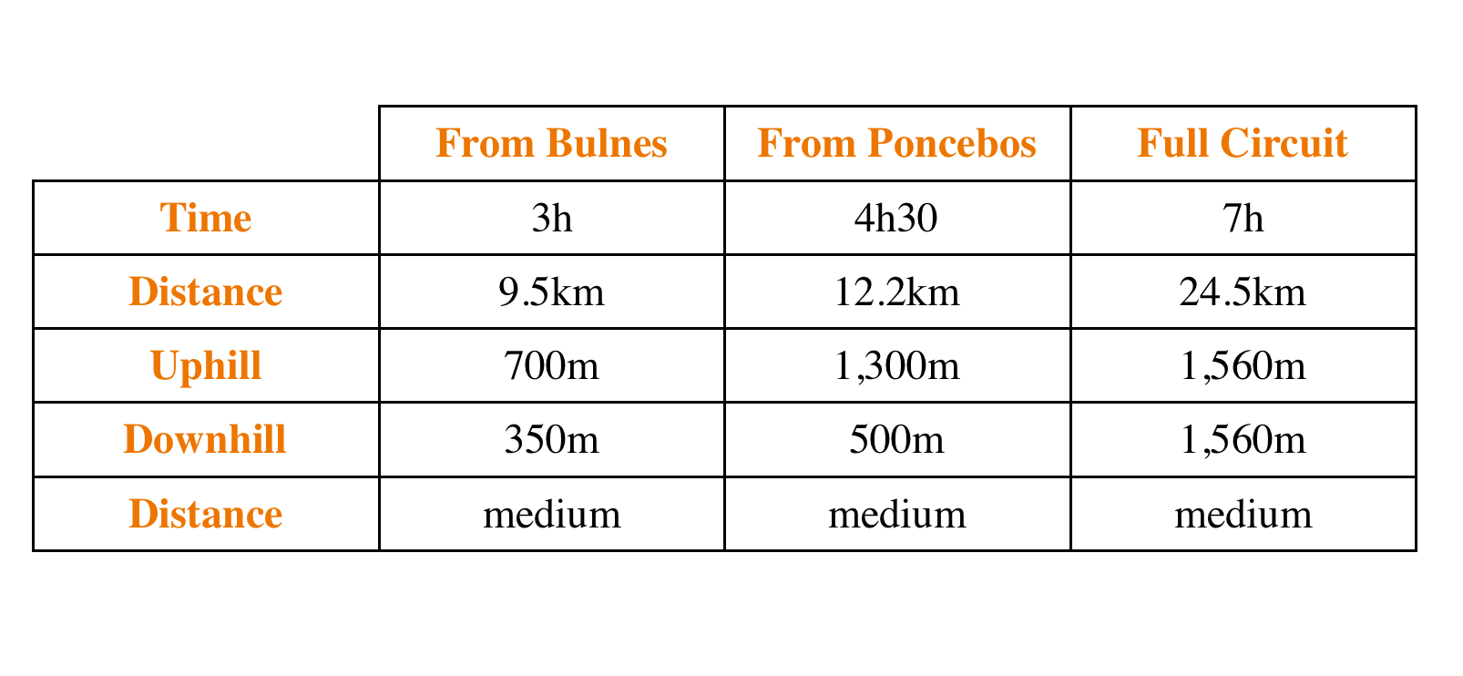
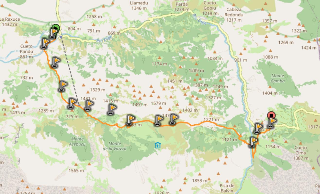
To make it easy for you to plan your trip and choose which hike you’ll be going for, I created a table with all the info for the 3 hikes:
Hike from Bulnes to Sotres, Asturias
The first hike to Sotres, Picos de Europa, is the hike from Bulnes; it’s also the shortest of the 3.
To start the hike from Bulnes, you have 2 options:
- hike from Poncebos to Bulnes the day before and sleep in Bulnes (that’s what I did)
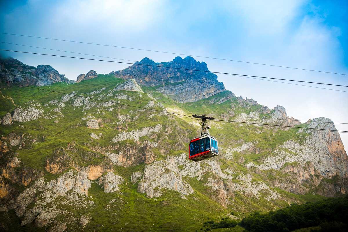
- take the funicular from Poncebos to Bulnes
Here’s the profil of the hike:
:hike: Hike Bulnes to Sotres
Distance: 9.5km / 6 miles
↗️ Uphill: 700m / 2,300 feet
↘️ Downhill: 350m / 1,150 feet
Difficulty: medium
I’ve rated this hike medium difficulty for 2 reasons: first there is a lot of elevation change throughout the hike, and second the trail can be tough to find at times. The weather changes quickly in Asturias mountains, and there is often fog making it hard to see where you’re going.
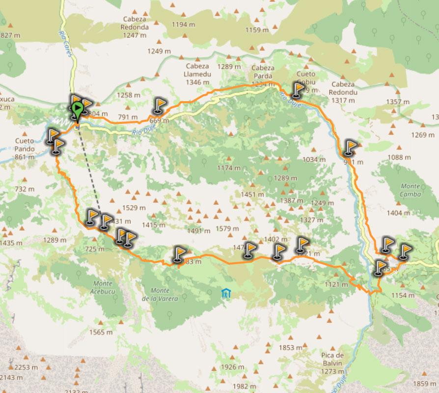
You’ll find below the map of the hike:
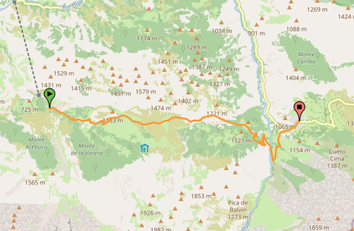
You can download the GPX file by clicking on the image above if you want to use in your GPS app/smartwatch.
P.S. the route I took was slightly different, I got out on the open at the first mountain hut instead of going straight in the forest; this a longer hike but it will take you to the Refugio de la Tenerosa (and you’ll get epic views)
Leaving Bulnes
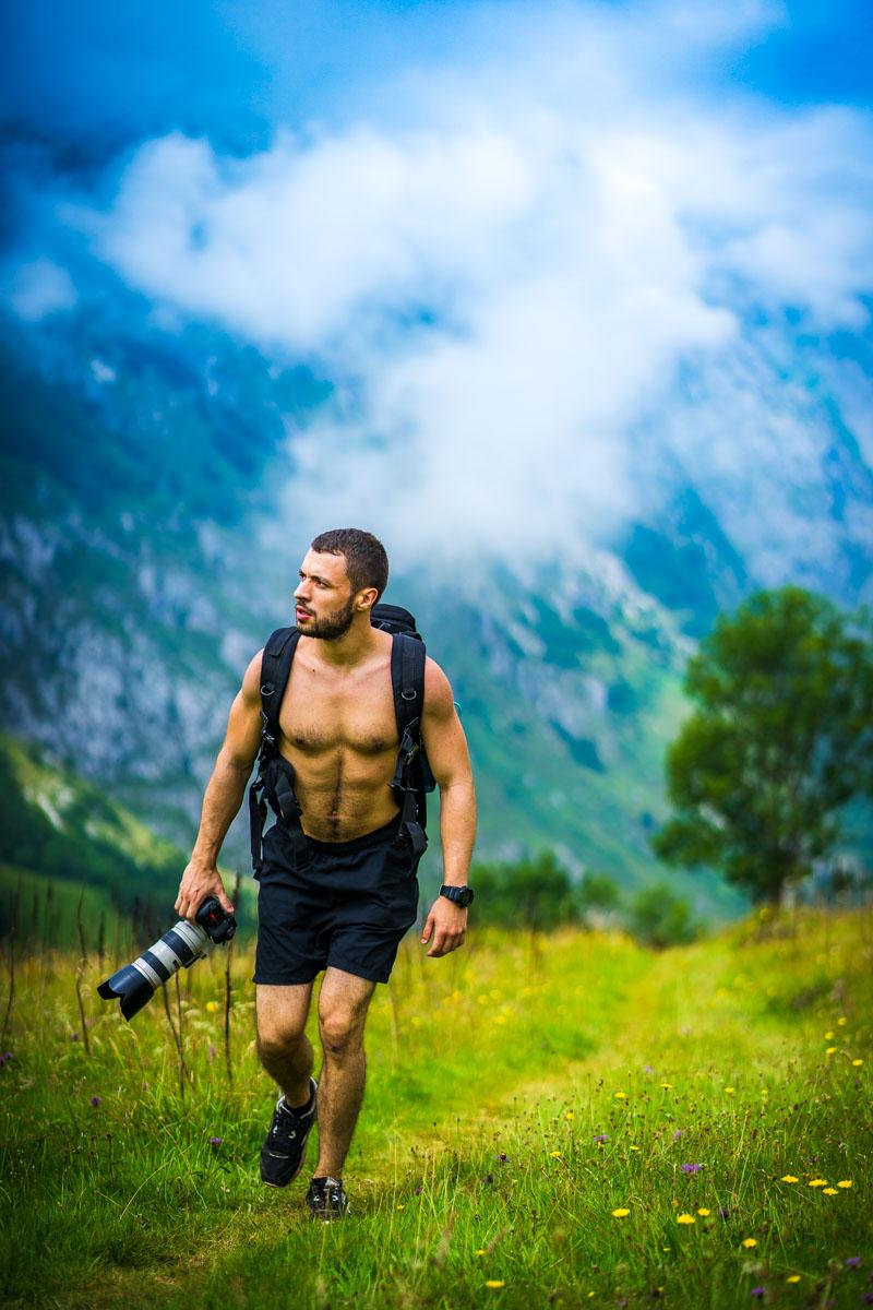
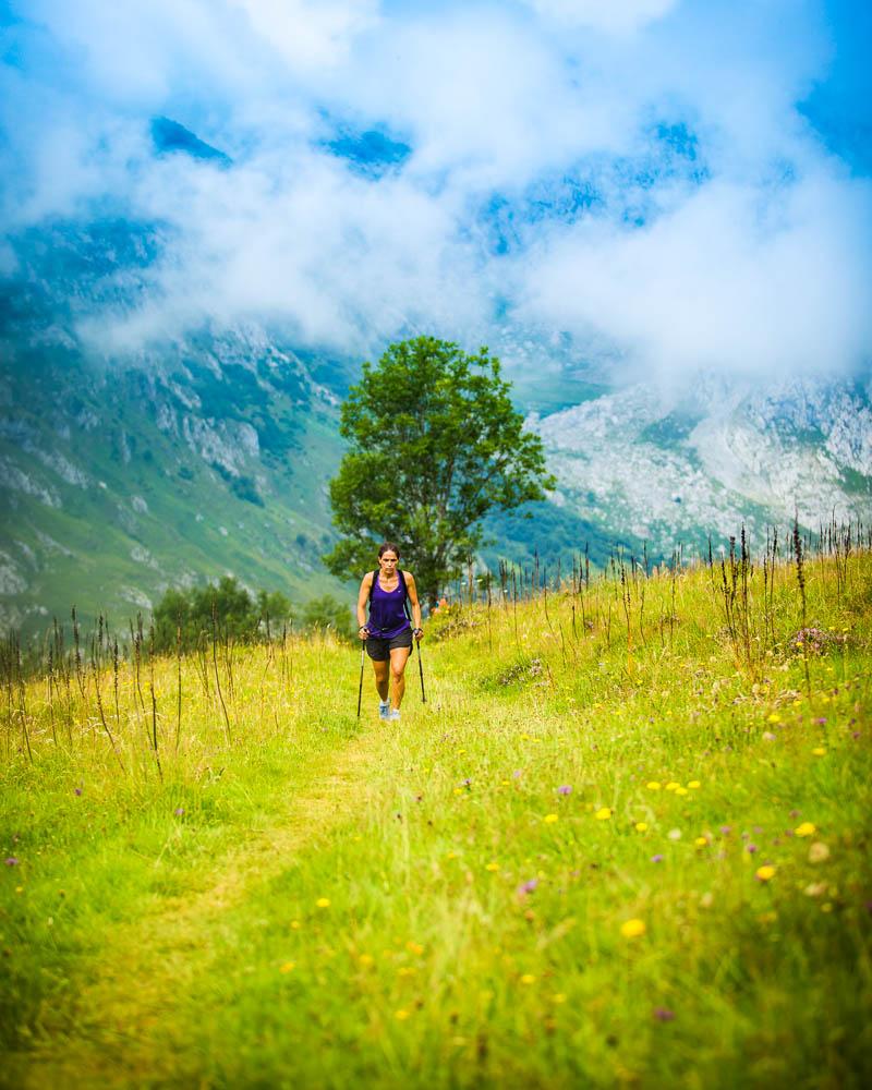
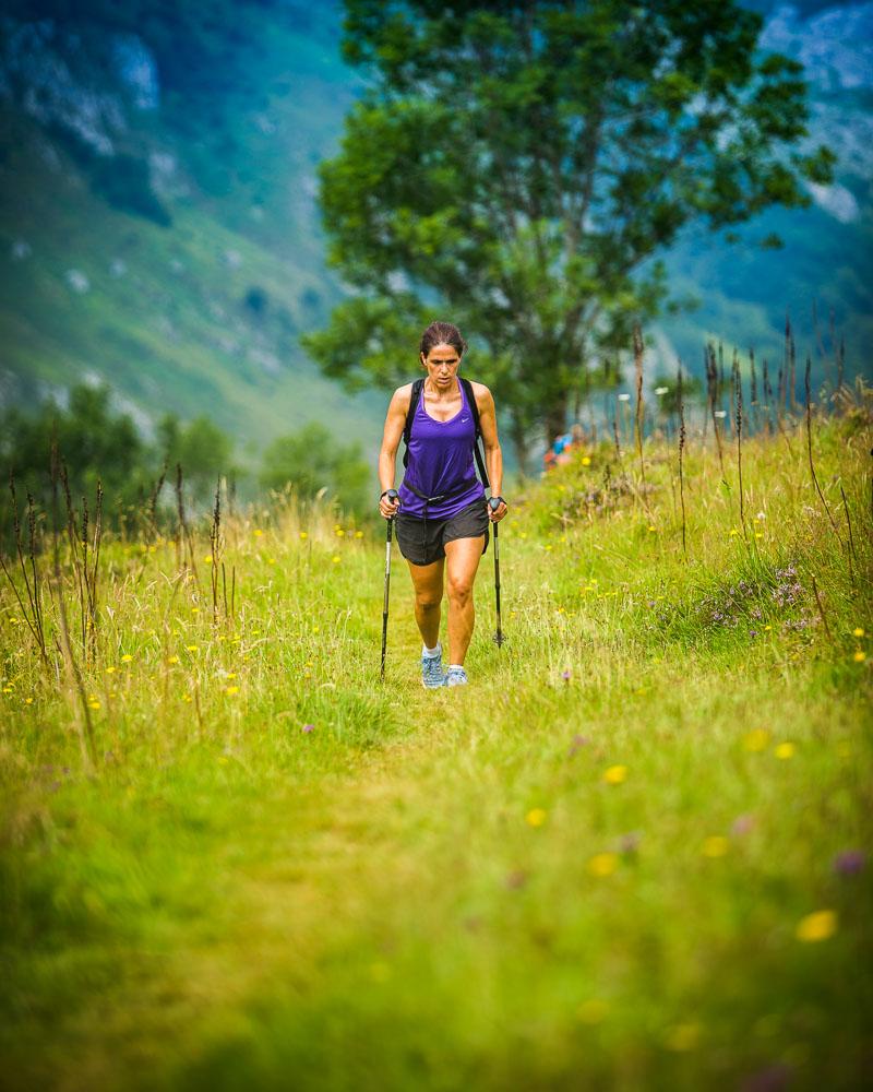
After hiking to Bulnes from Poncebos the day before and sleeping in an hostel in Bulnes, we woke up ready to tackle the hike to Sotres. As we were heading out of Bulnes, I turned back to the mountains to appreciate the sweet morning light.
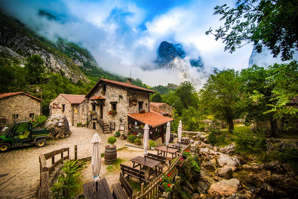
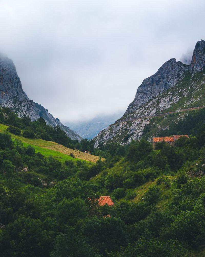
We crossed the small wooden bridge over the river and started the climb. The trail goes up pretty steeply straight out of the village, giving you a grand view over the mountain as you look back.
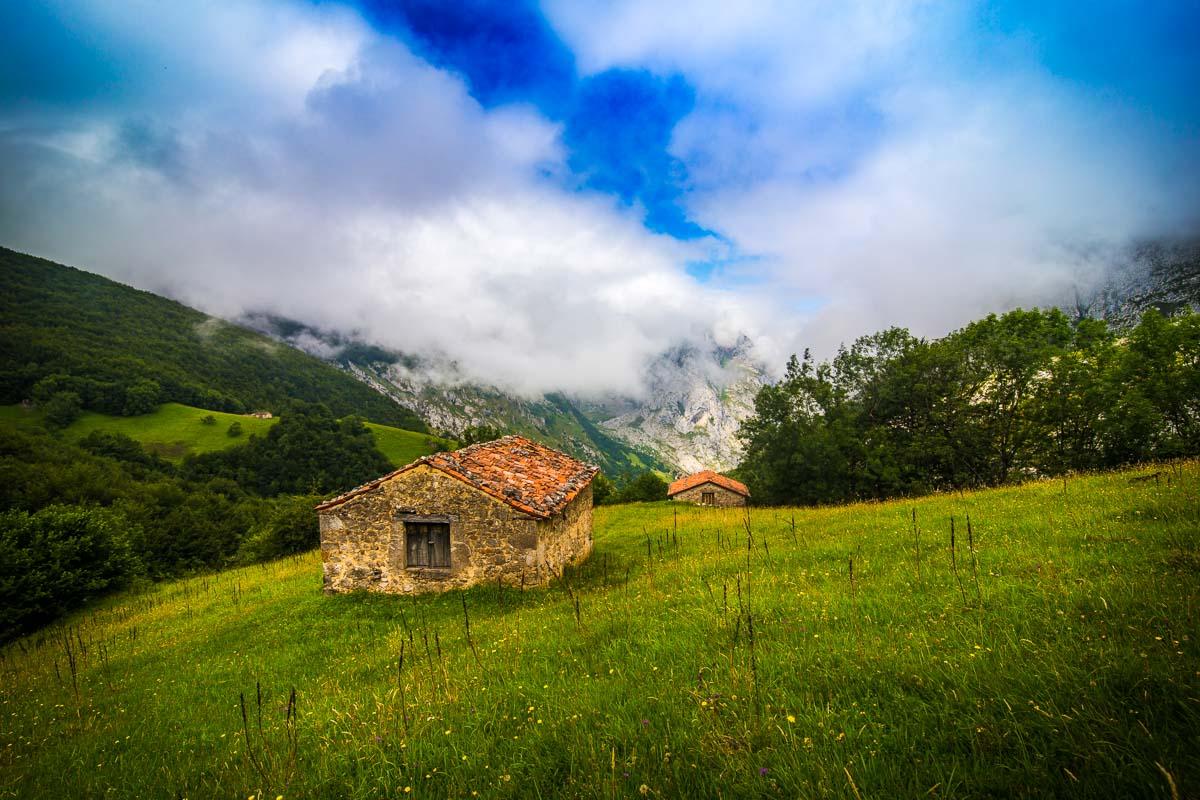
Because we had already explored the area the day before, we didn’t stop much on the first part of the hike and marched through to the next checkpoint. We passed the Mirador de Bulnes (5mn from the start), then climbed hard on a rocky trail, under the trees, without much of a view for about 1 hour.
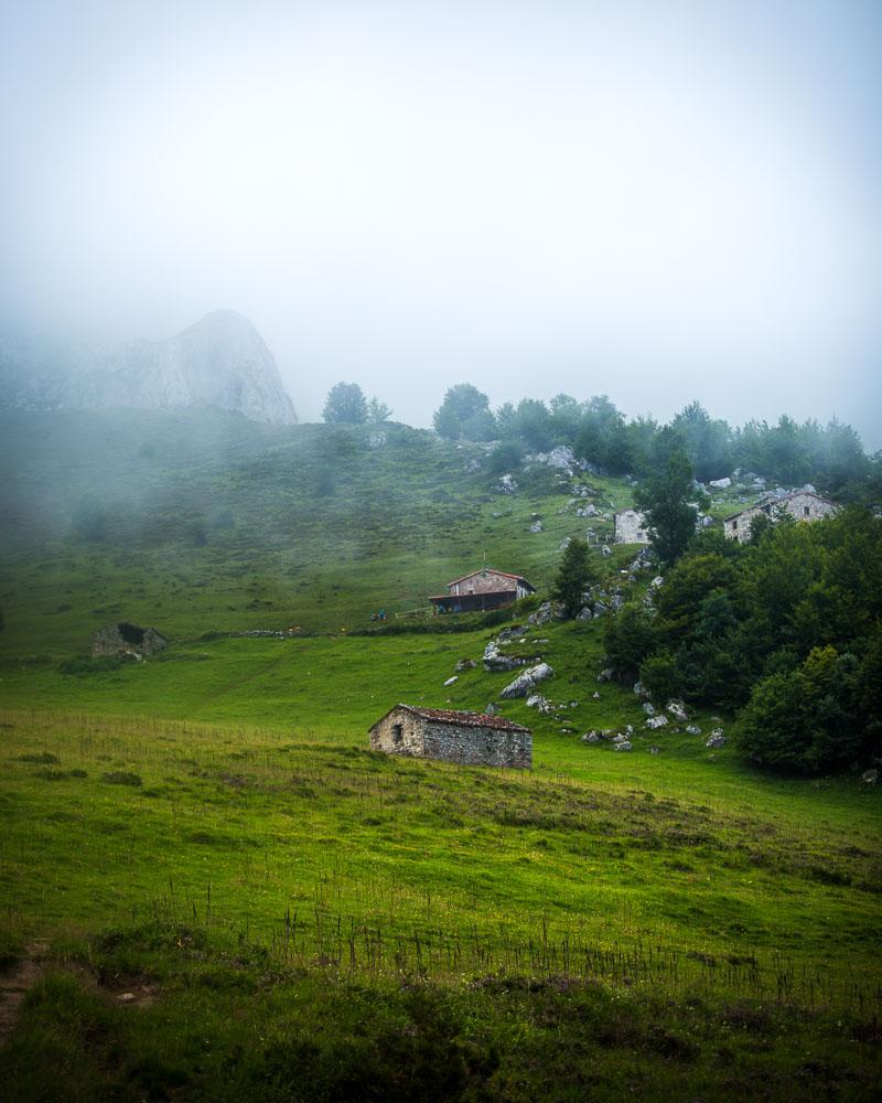
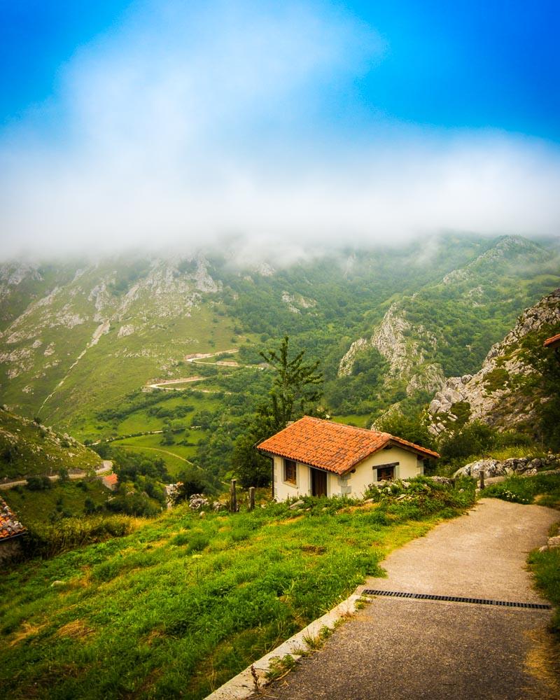
1 hour into the hike we finally got out of the trees, and reached the first mountain hut.
You’ll find fresh water just in front of this mountain hut (wish I knew this before so I could have drunk more water on the first part of the hike!).
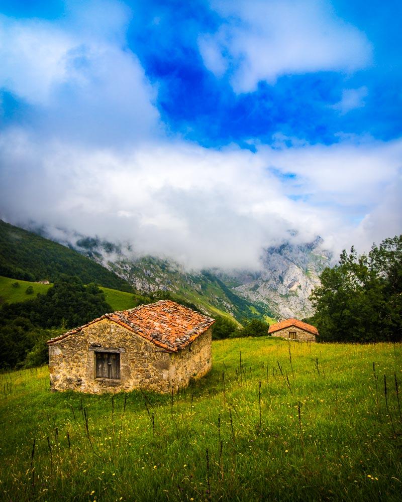
At this point, you’ll have 2 choices:
- go straight and stay in the forest: this is the fastest route to Sotres & there is not much elevation change (this is the path we took on the way back)
- go out in the open and follow the trail you see on the picture above: the path climbs to a mountain refuge and offers epic views (this is the path we took on the way to Sotres)
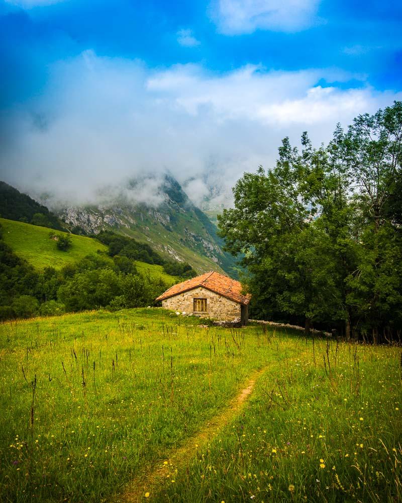
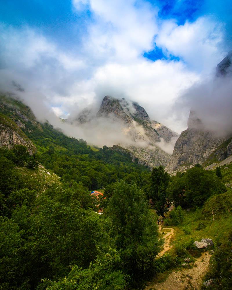
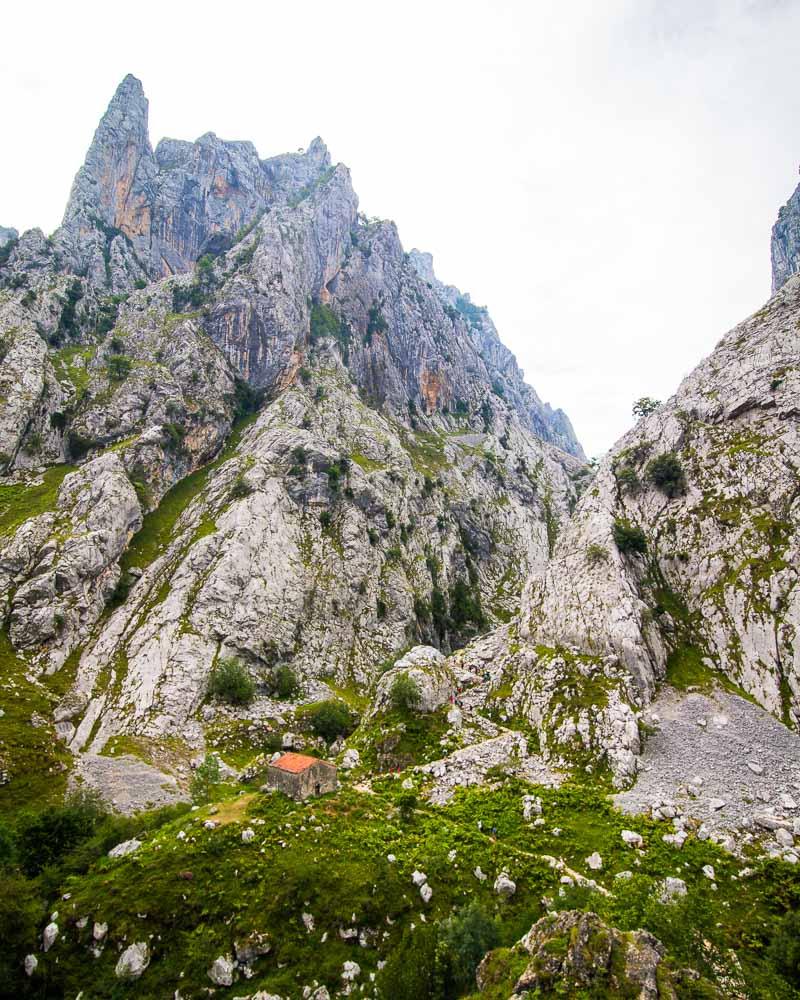
Mountain hut to the Refugio de la Tenerosa
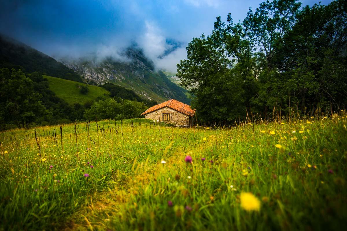
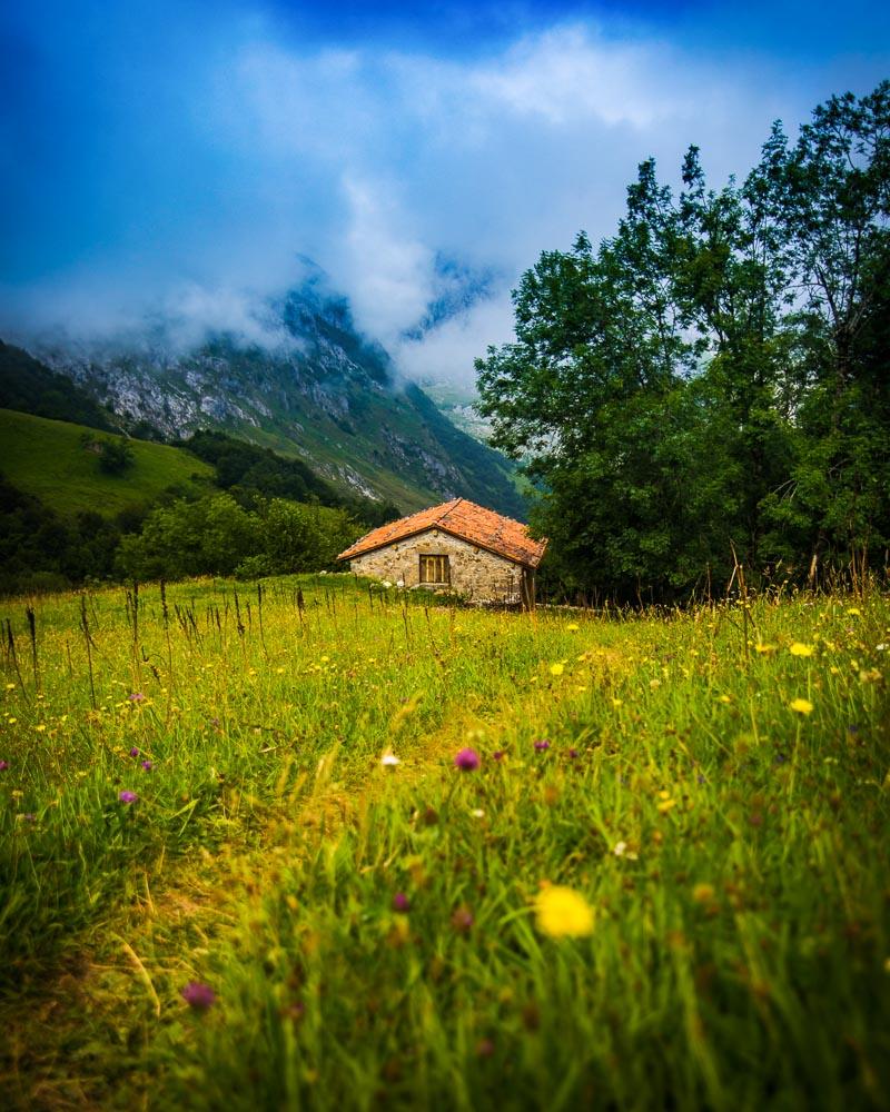
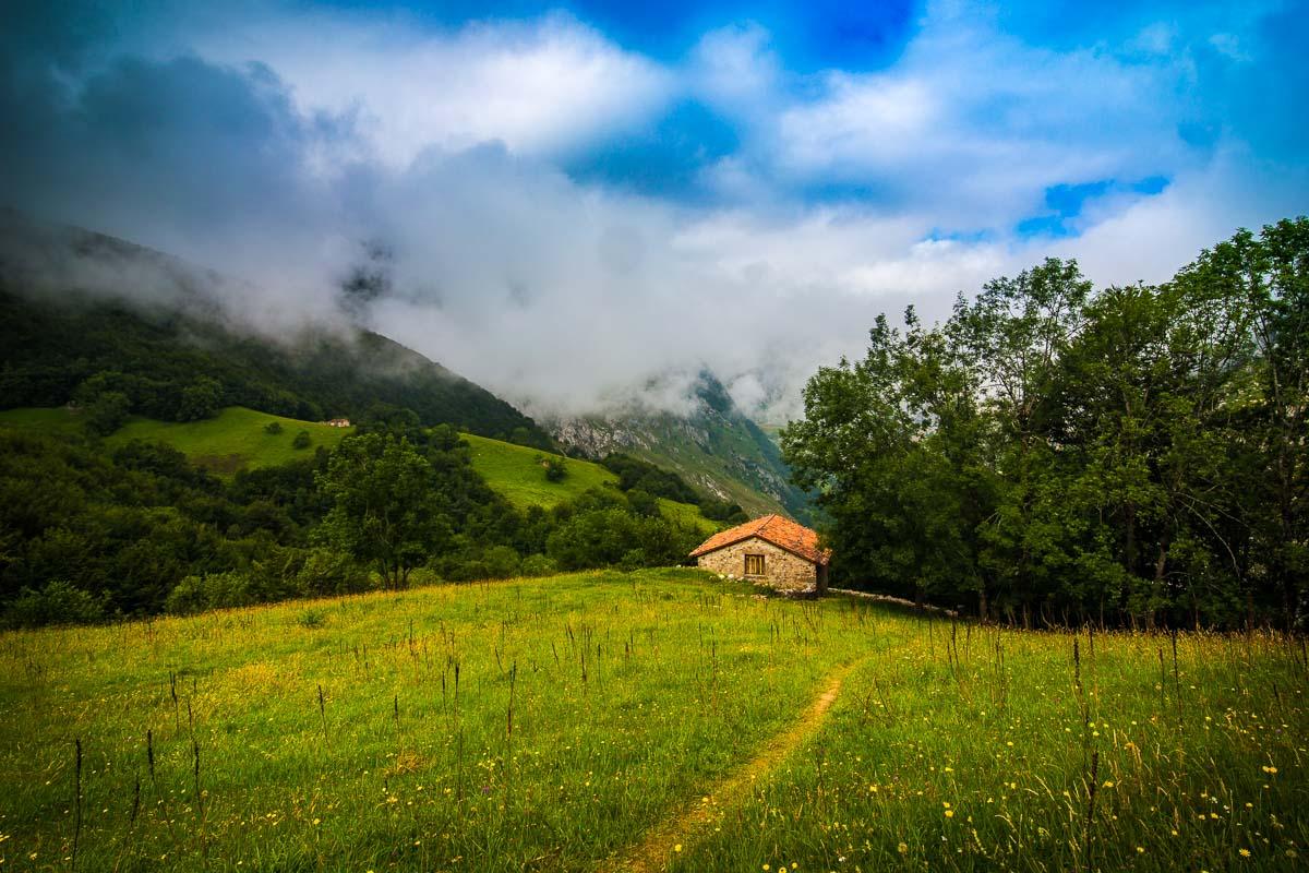
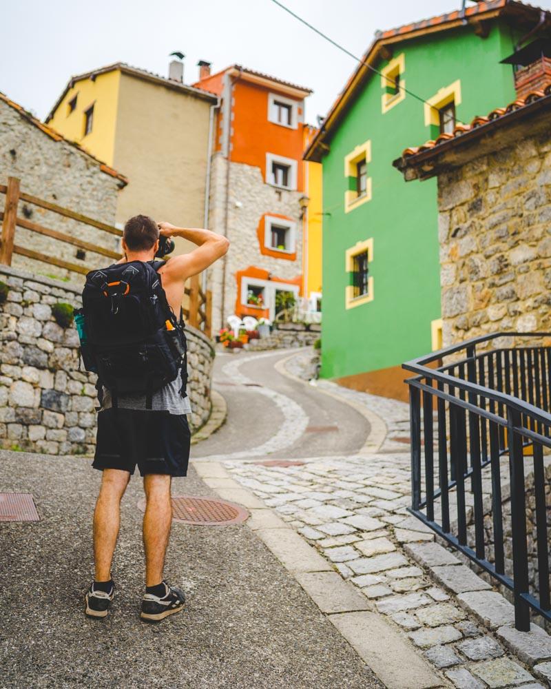
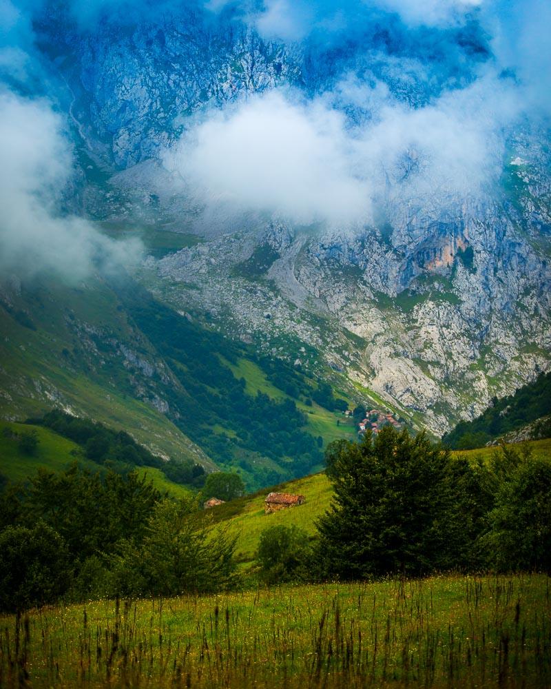
Of course this was way too pretty for us not to stop! We took off our heavy bags, got our cameras out and shot this beautiful landscape. This was also a nice excuse to rest our legs from the climb before the next step to the mountain refuge.
We then put our bags back on, and followed the trail up the mountain; as we were climbing, we kept discovering new mountain huts.
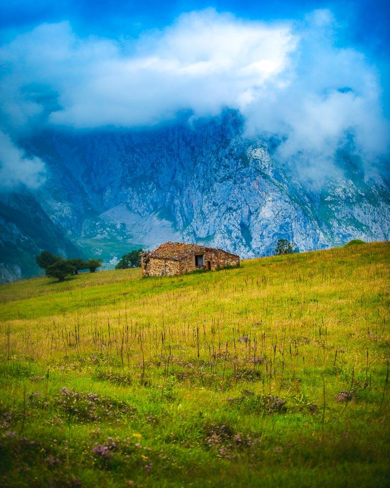
This trail from out of the forest above Bulnes to the mountain refuge of la Tenerosa was my favorite part of the hike to Sotres; we kept getting more and more epic views with each step and even though it was a steep climb, we stopped so often for photos that we had all the rest we needed.
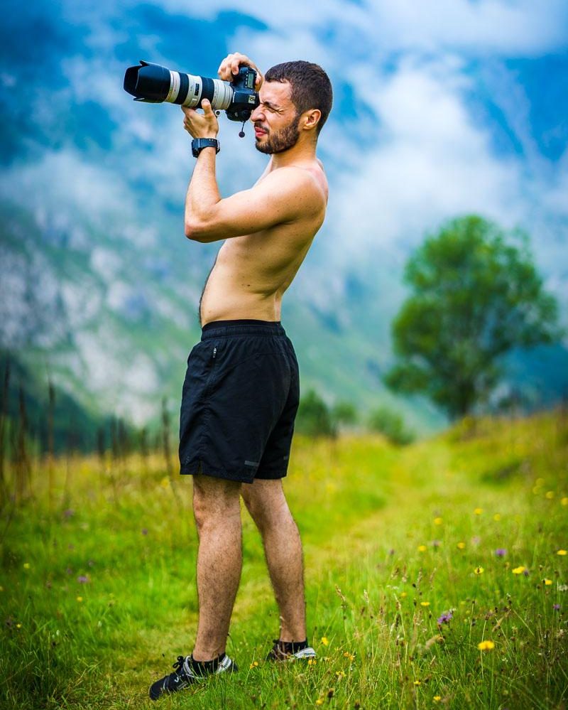
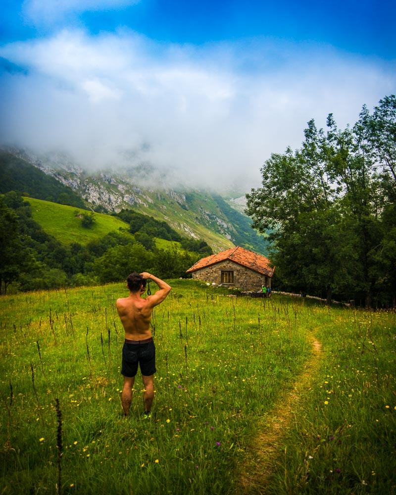
That’s me too busy taking in the views to pay attention to my burning calves
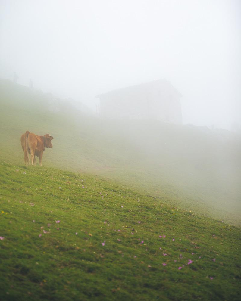
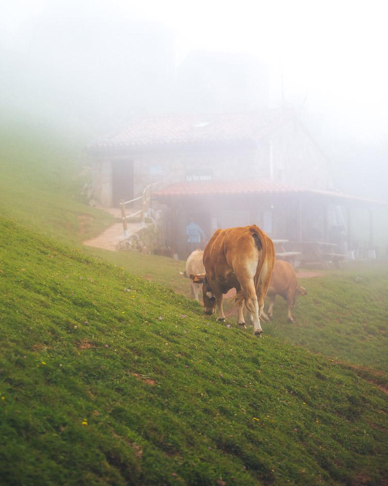
After around 1h, we almost reached the end of that trail and we saw the Refugio de la Tenerosa at the top. We climbed the final steep part, hopped over the electric fence (you can actually simply unhook it, go through and hook it back behind you, no need to jump – wish I knew that as well), and we finally reached the mountain refuge!
Time for lunch! We sat on a bench at the refuge, ate our sandwiches, and simply enjoyed being outside with epic views and curious locals. Oh and Emilio (the man working at the refuge) serves coffee, too!
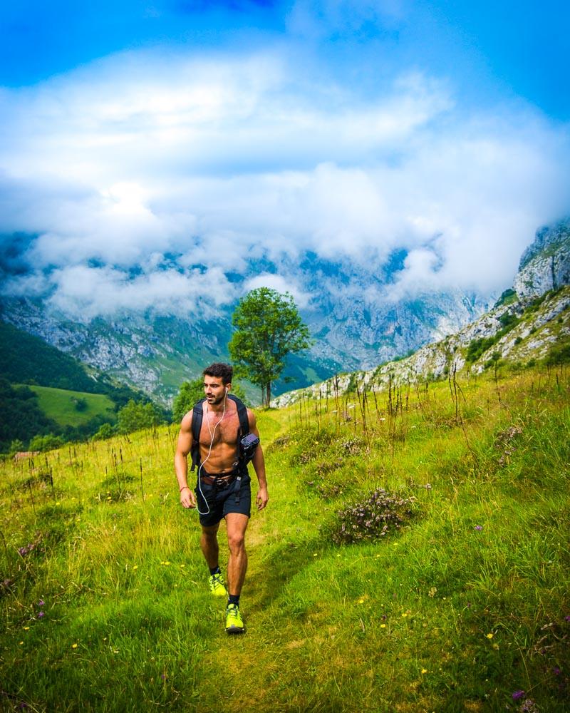
Final stretch down the mountain and up to Sotres
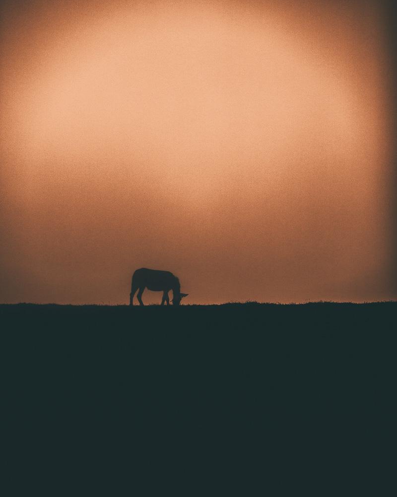
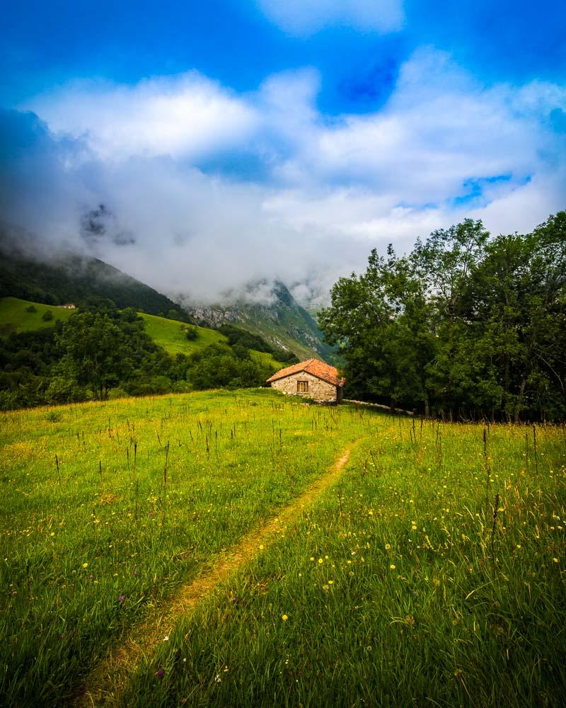
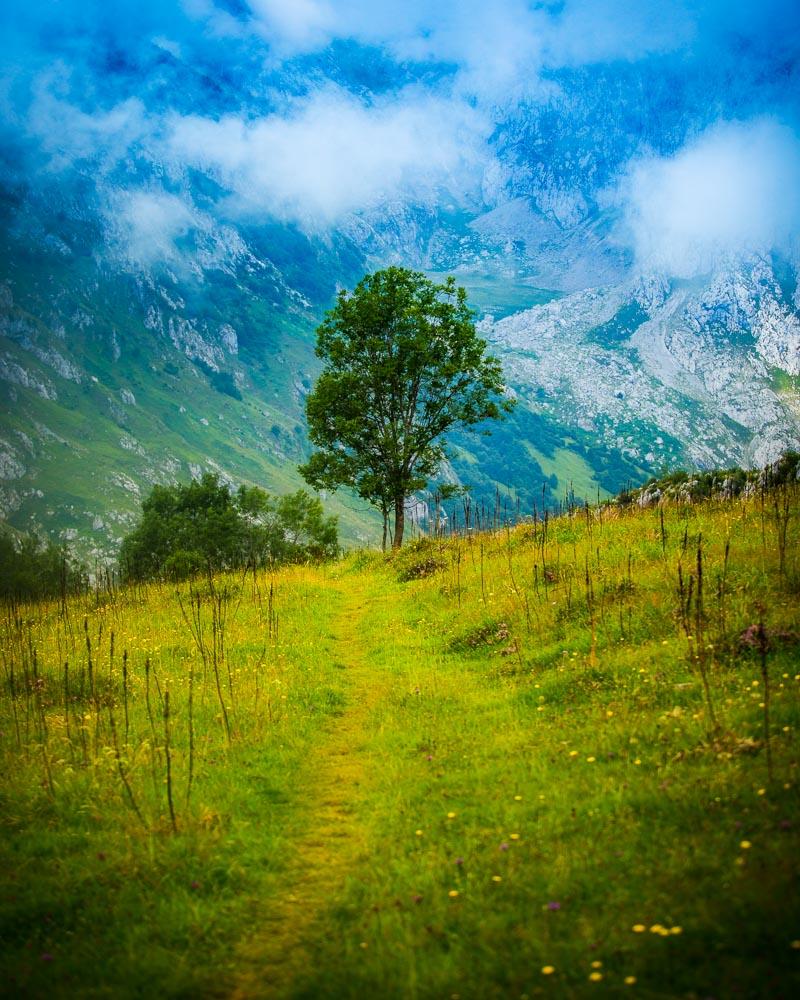
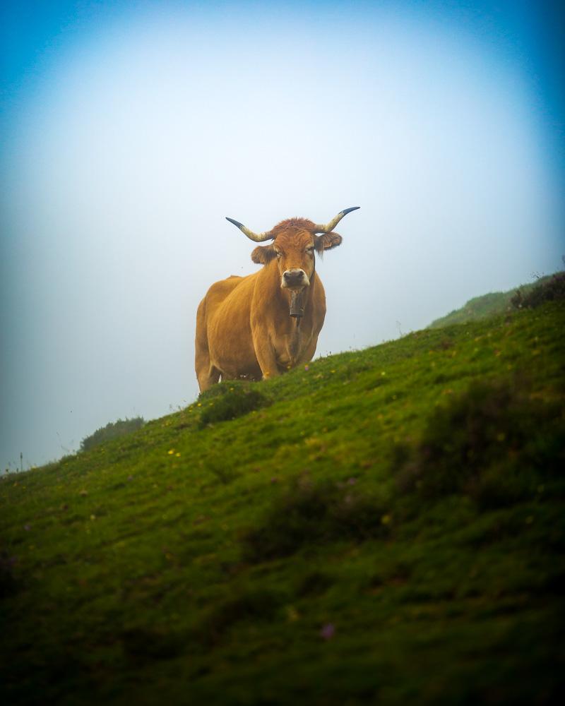
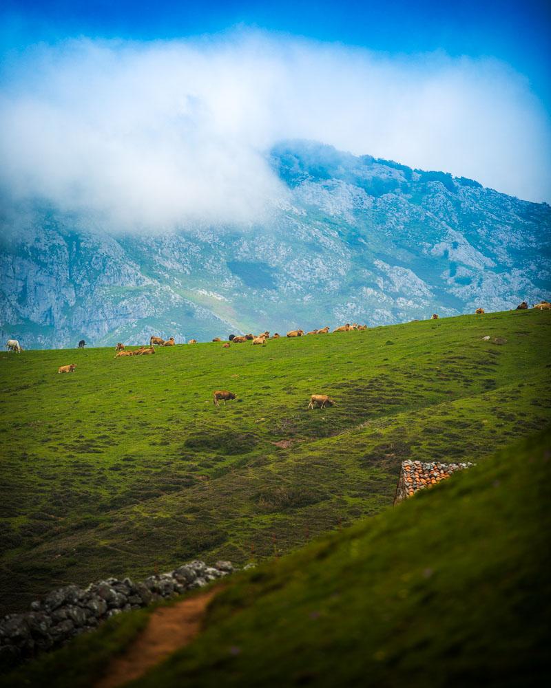
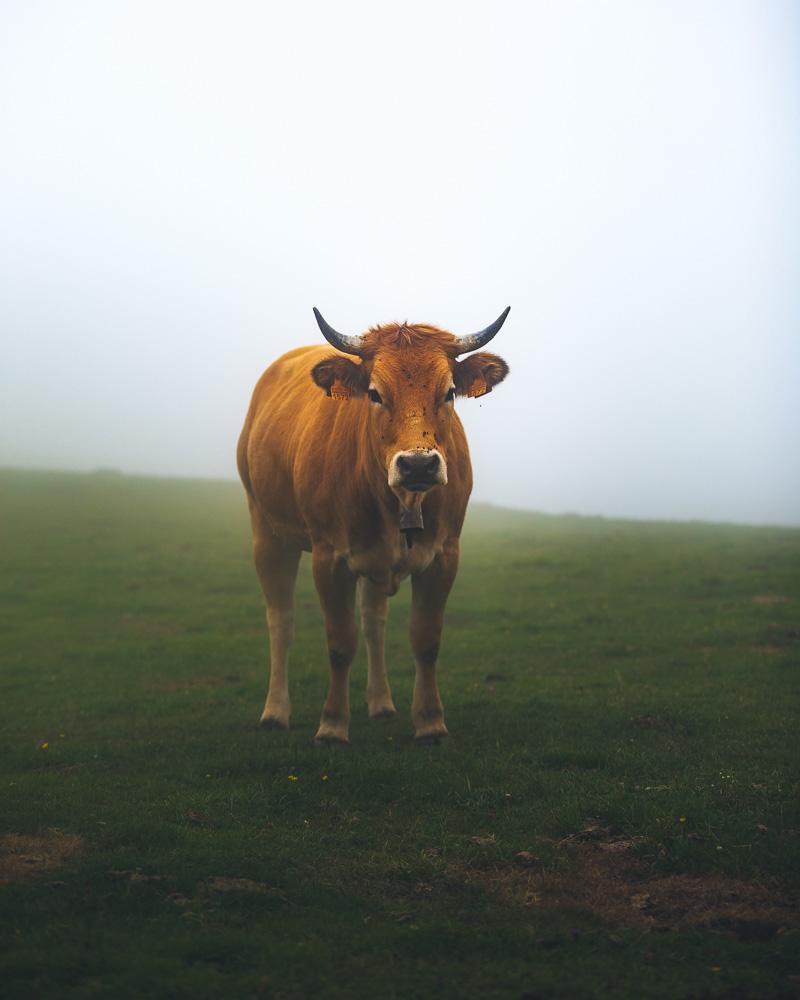
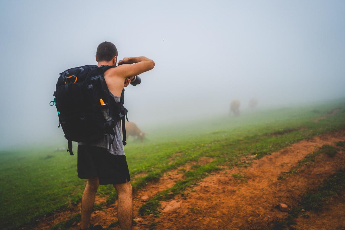
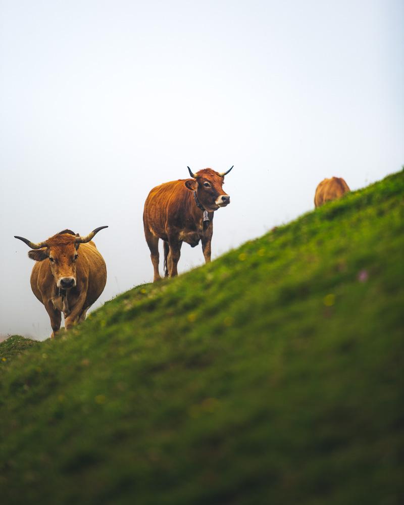
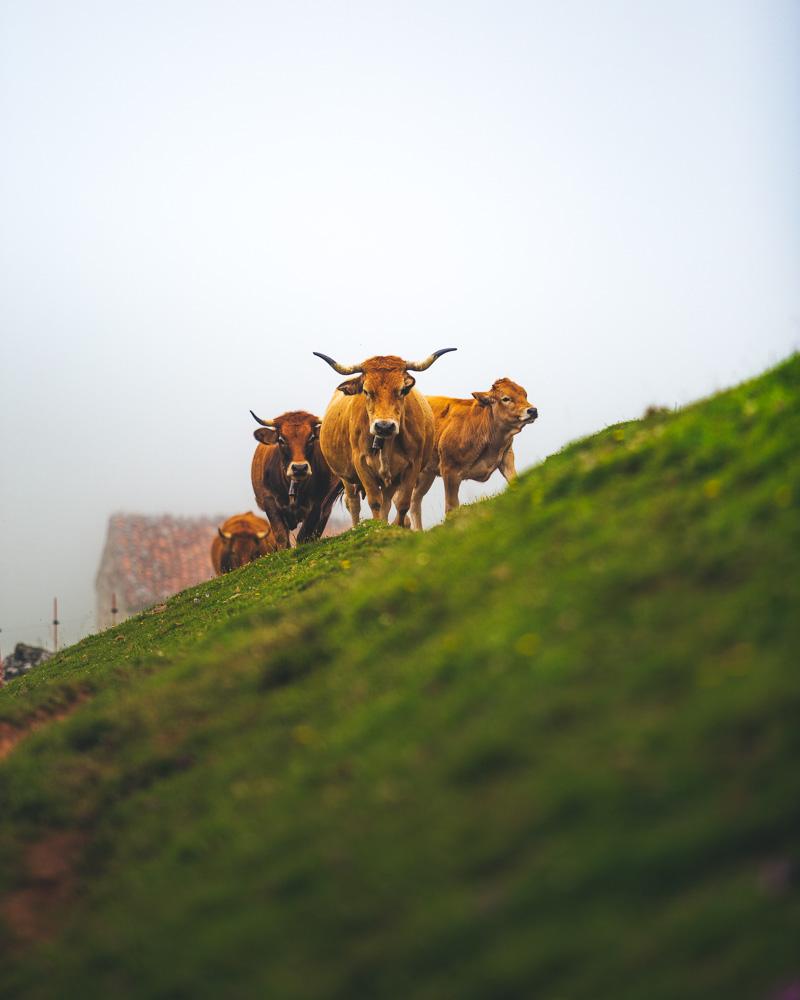
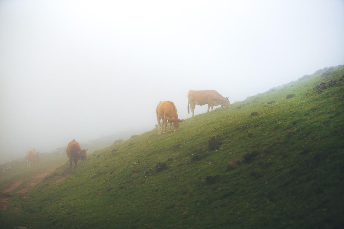
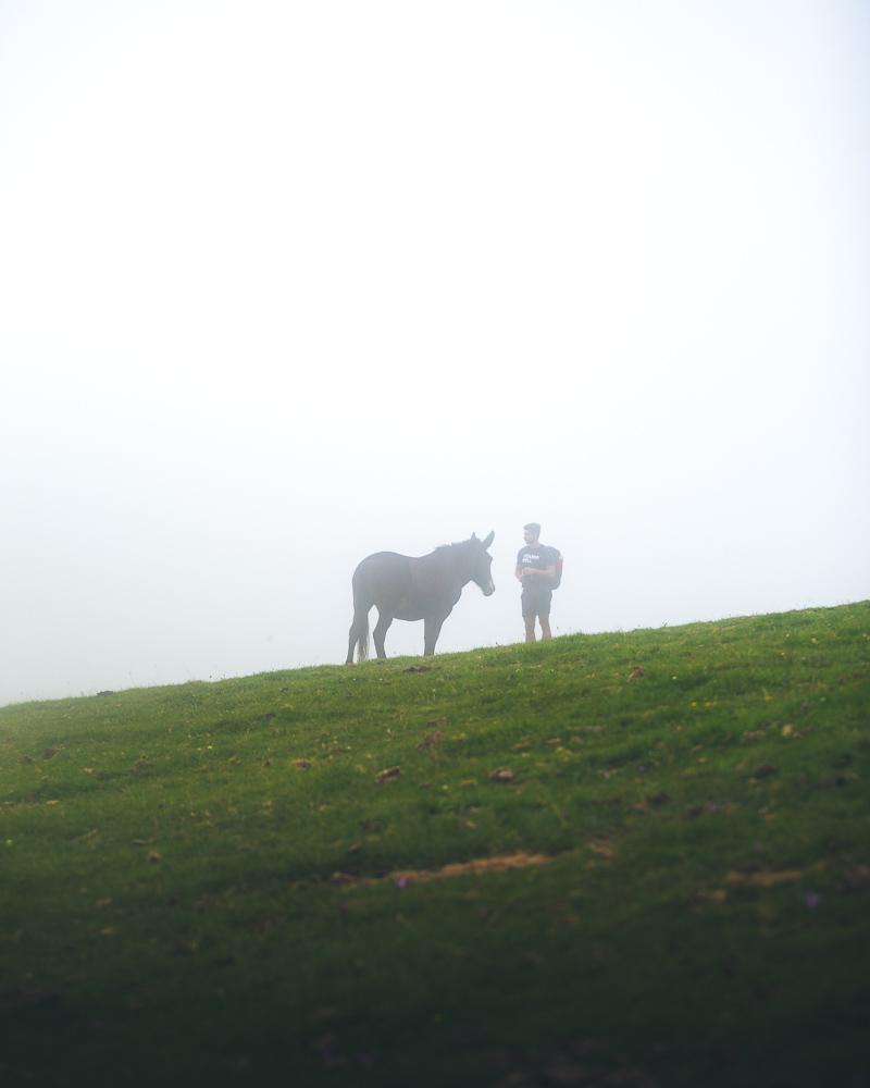
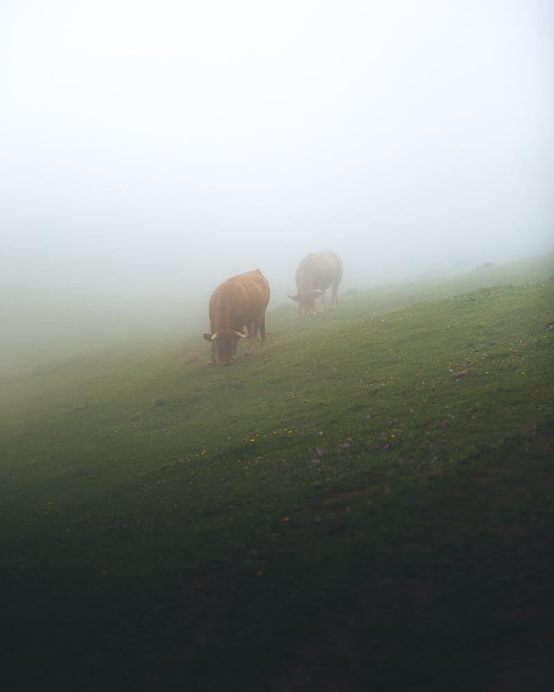
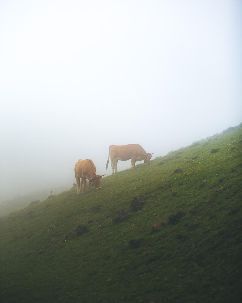
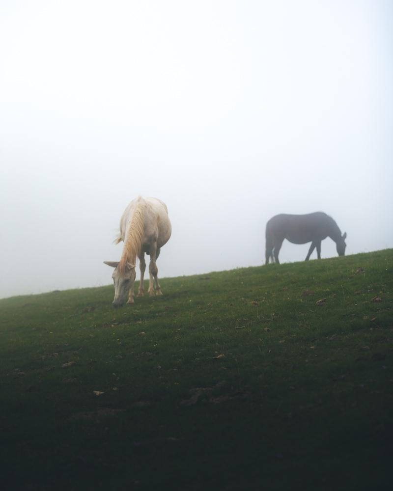
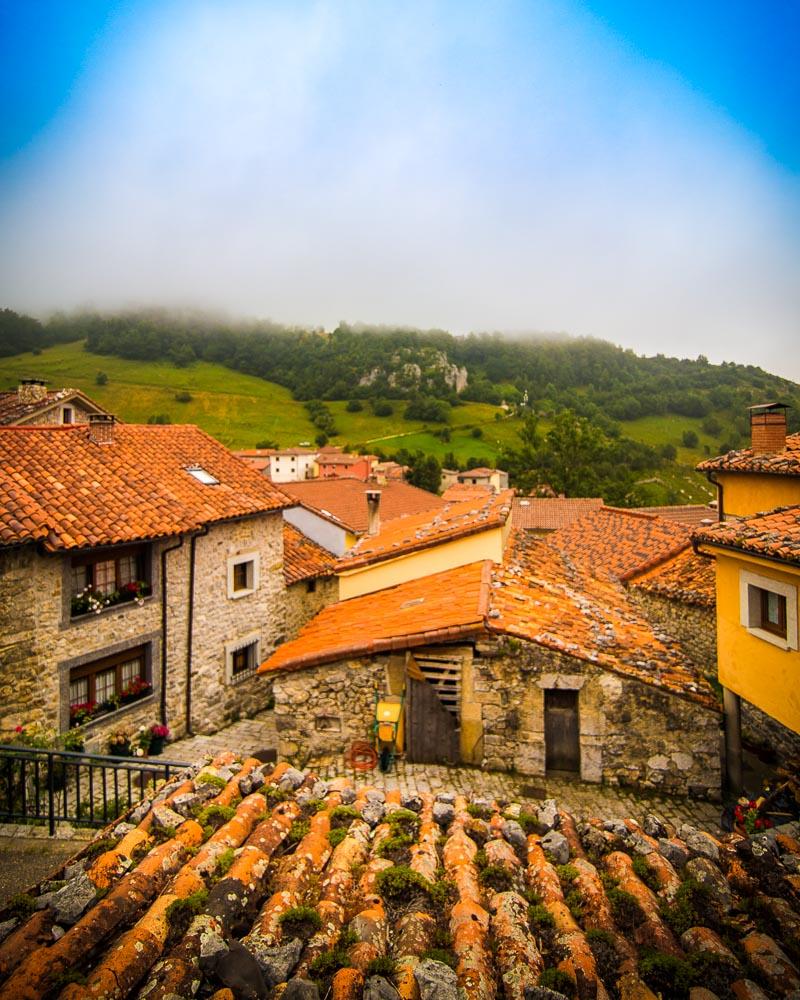
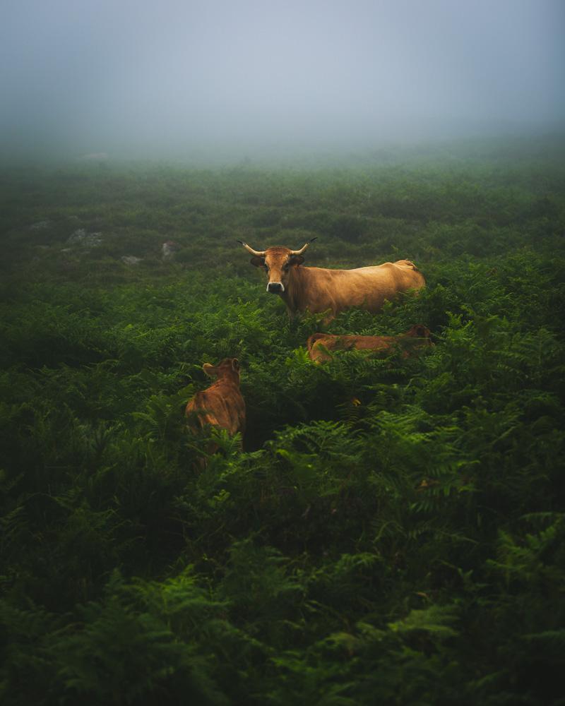
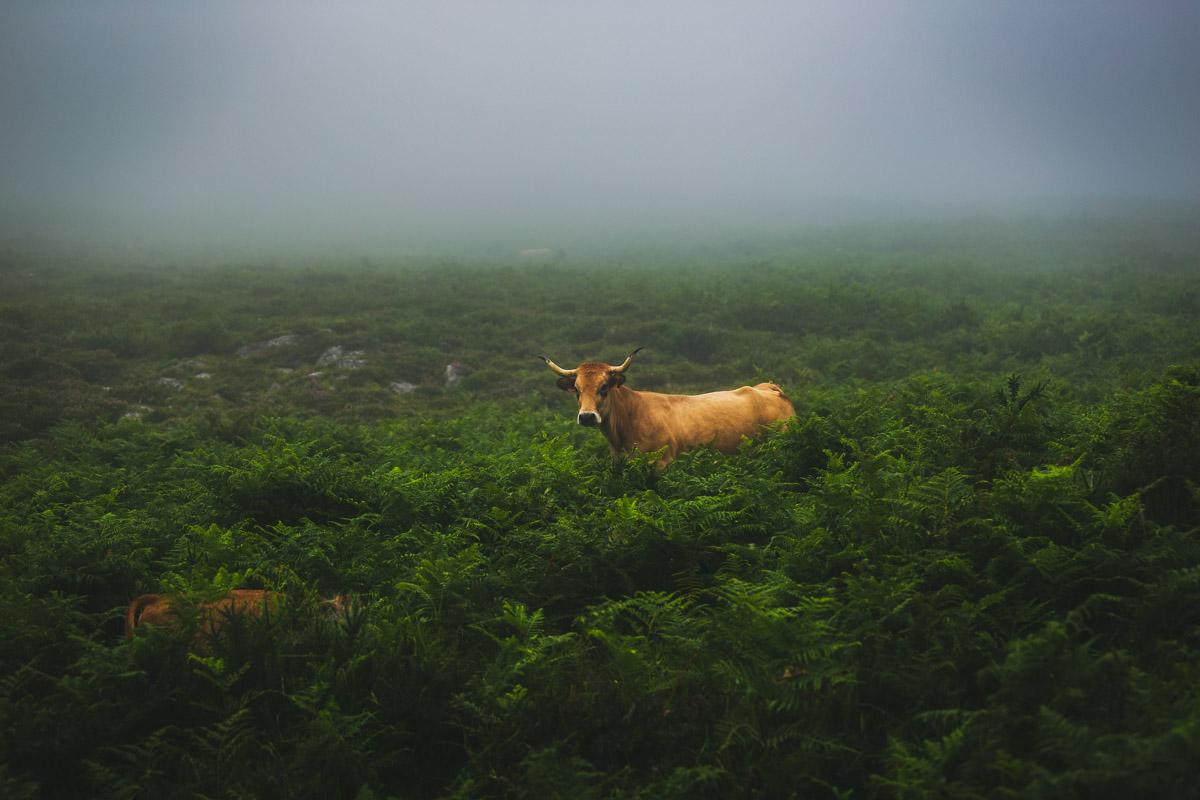
From the refuge, there is a small plateau where we walked for 10 minutes, surrounded by the cows, getting sidetracked as we were taking photos of the animals, and trying to find the trail in the fog (be careful of the fog and always have an eye on the trail!).
Here are a few photos of the local animals on the trail:
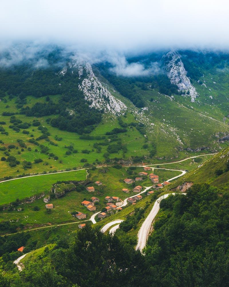
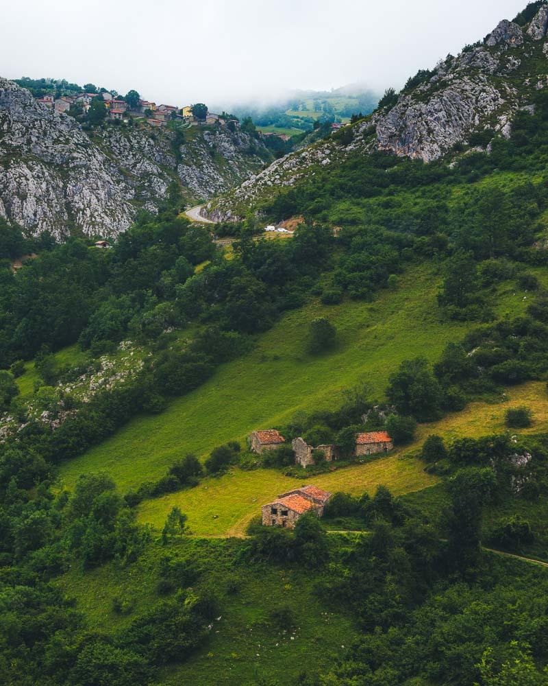
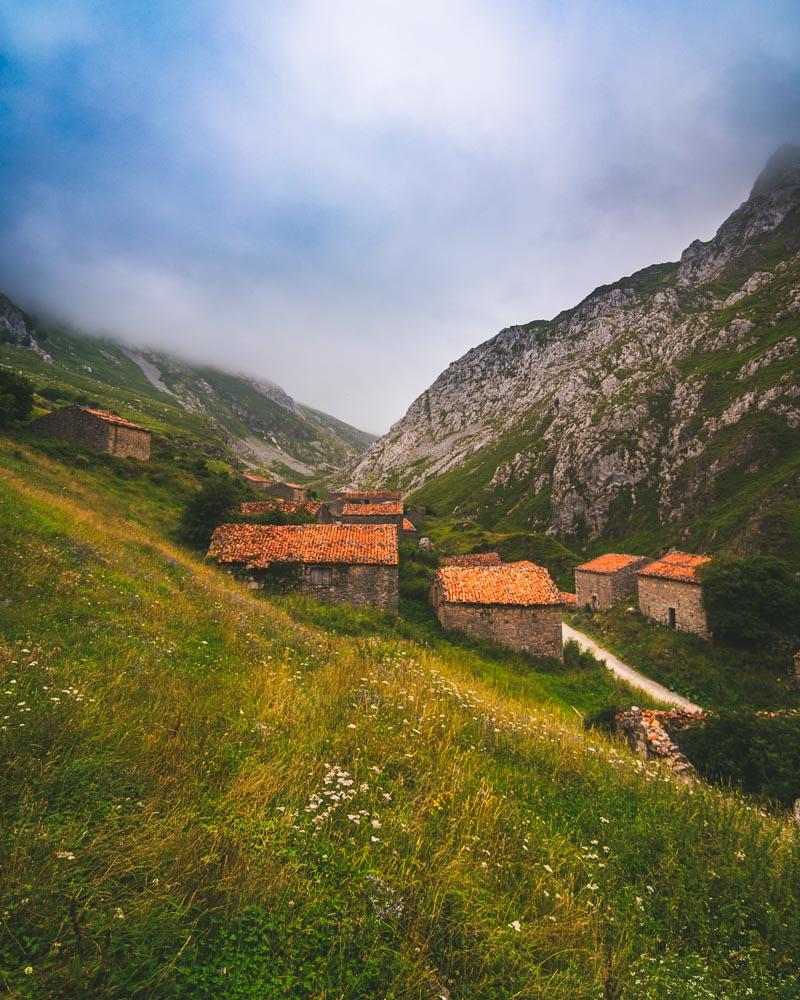
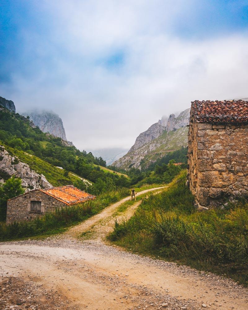
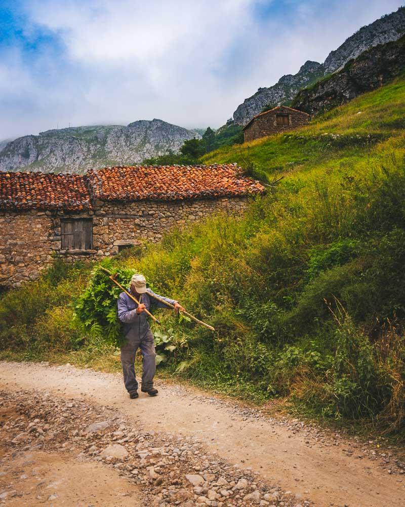
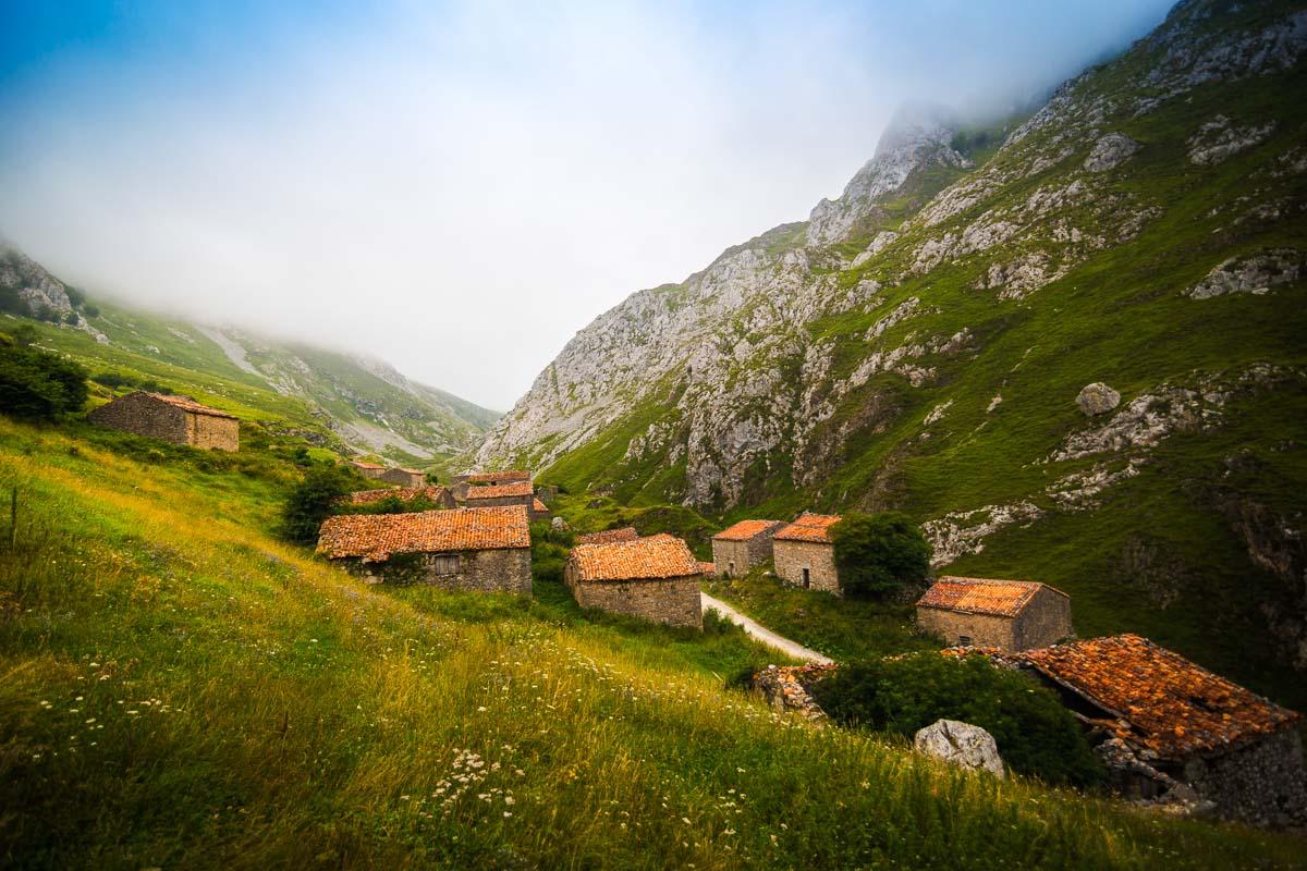
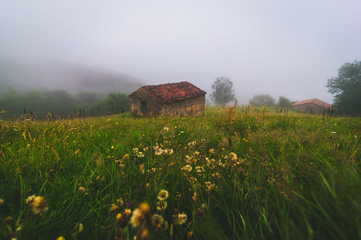
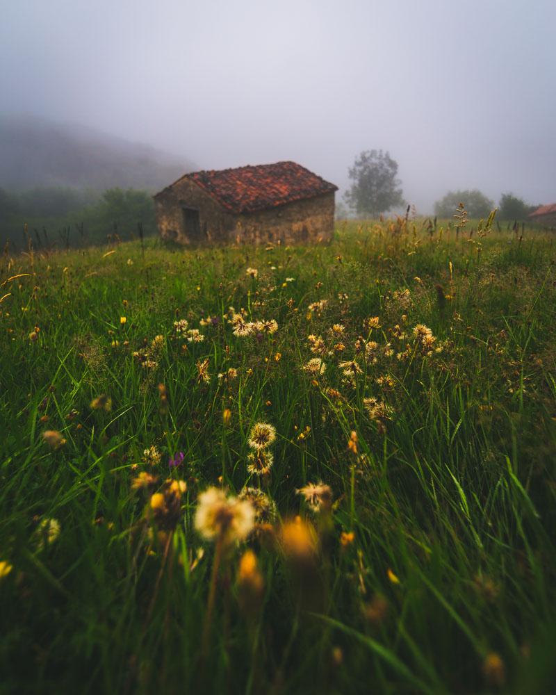
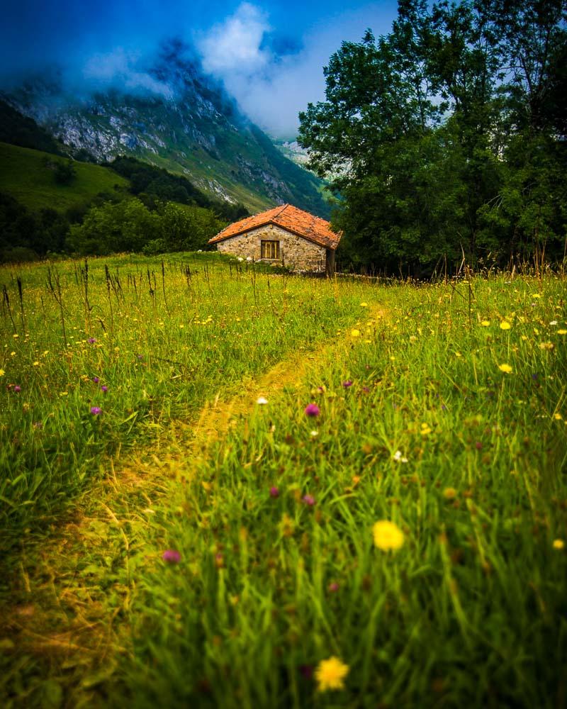
After the plateau, the trail goes down pretty steeply; we decided to run all the way down (& up) to Sotres. The first part of the way down is on a mudpath, that goes down to a parking lot. Then we where on the road, that goes down the valley, crosses an abandoned village of stone huts, and then goes all the way up for the final stretch.
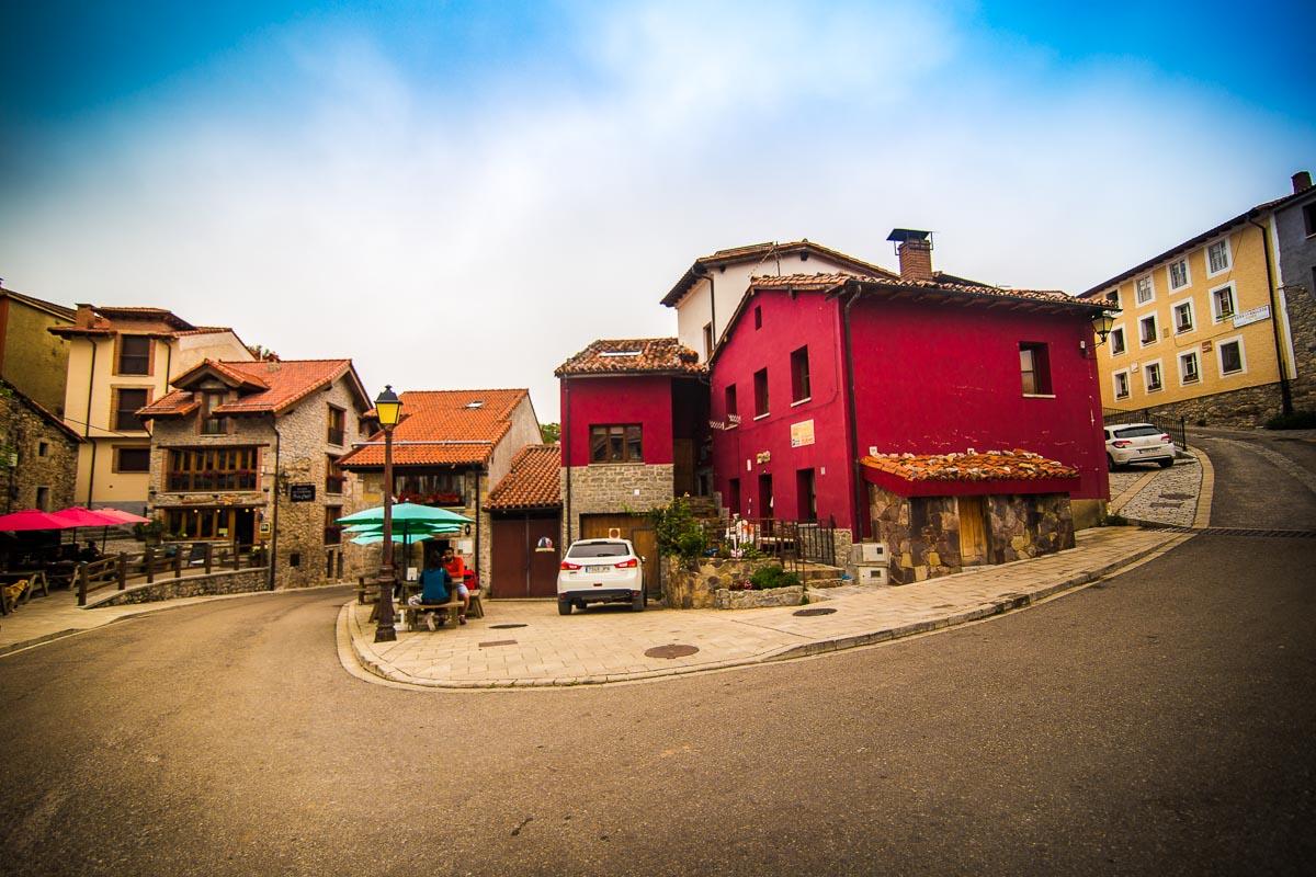
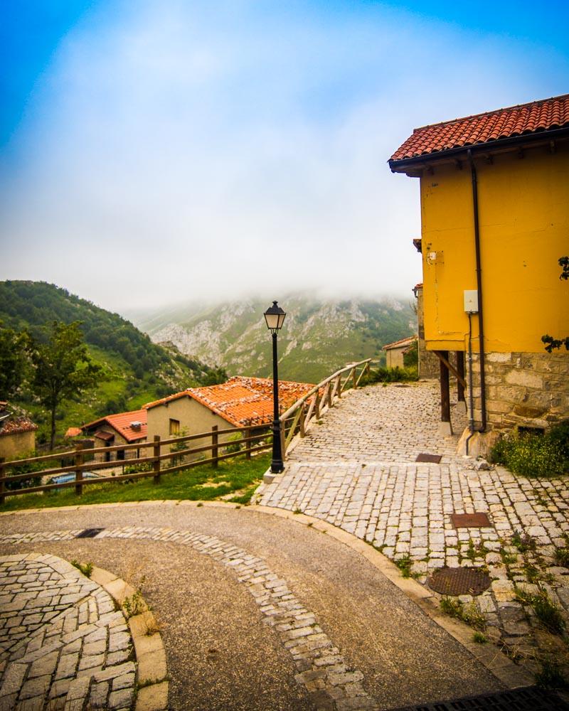
Exploring Sotres
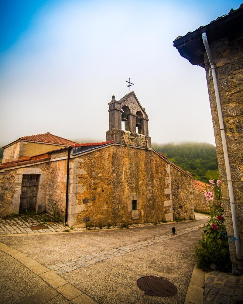
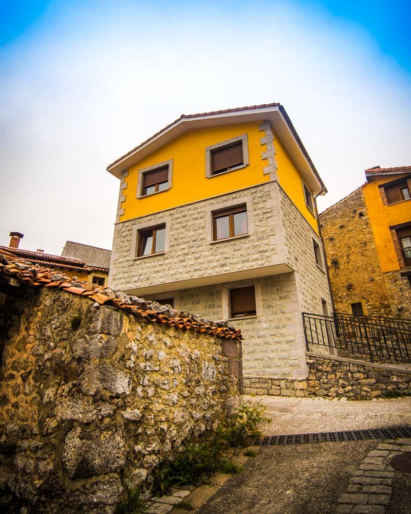
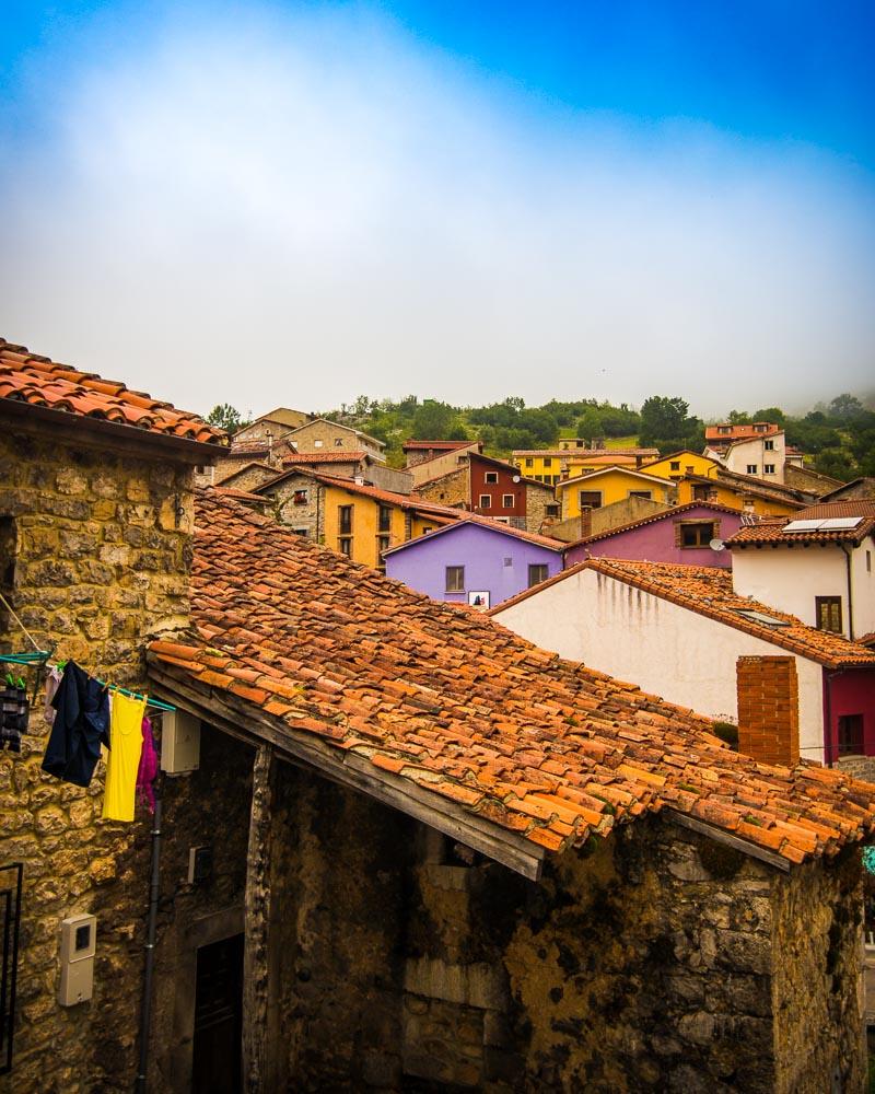
And finally, after 4 hours (we stopped a lot) we reached the colorful mountain village of Sotres, Asturias. We sat at the terrace of the first restaurant we saw, ordered sidra (cider) & enjoyed a cold drink and a well-deserved rest. We chilled there for around 1h, before getting ready to do the return hike back to Bulnes.
But first, we explored Sotres, of course!
The hike back to Bulnes
We had taken all of our time on the way to Sotres, enjoying the views, taking photos and chilling; it was time to hike straight to Bulnes without stopping too much.
We got down the mountain from Sotres in the valley with the abandoned village, and then began the first climb back on the opposite side of the mountain.
We reached the top of the mountain across Sotres, and got to the parking lot where we took a different route; either climb up to the Refugio de la Tenerosa, or straight to Bulnes on the side of the mountain (which we chose).
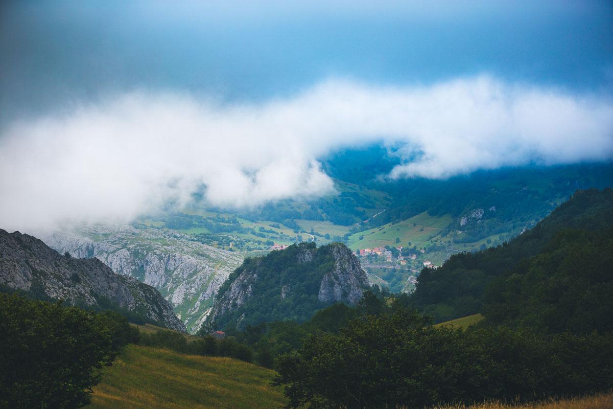
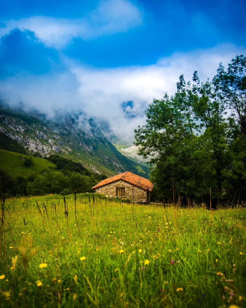
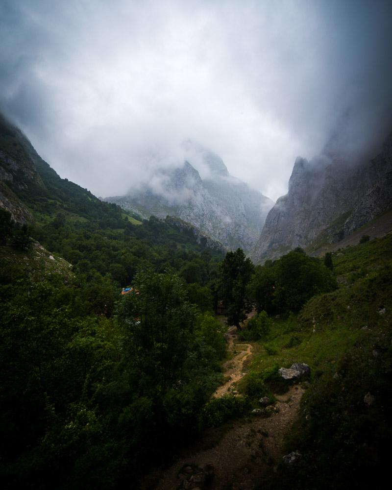
At that point, the weather had changed dramatically, as it’s often the case in Picos de Europa – the mountains are really close to the sea, and in the afternoon the fog rolls in.
We had company on the hike in the plateau, with local cows accompanying us in the fog.
We got a bit lost at the end of that path, and got out of the trees in the open, back on the path going down from the mountain refuge, where we saw the mountain hut the first time. It was so crazy seeing the same place in such different conditions, the first time in the morning with the summer feel, and in the afternoon with the fog!
The hike back from Sotres to Bulnes was way faster without all the stops, and took us a little bit under 3 hours. We got back to Bulnes at around 7:30pm, 8 hours after we left that morning.
We went straight to the same restaurant as the day before, ordered the exact same thing (with sidra of course), then went straight to bed, physically exhausted from that long day of hiking in the mountains.
Our next adventure? The Fuente Dé funicular!
Hike from Poncebos to Sotres, Spain
The second hike to Sotres is the hike from Poncebos; it’s almost the same as the hike from Bulnes to Sotres, but you just add the hike from Poncebos to Bulnes before.
Here’s the profil of the hike:
:hike: Hike Poncebos to Sotres
Distance: 12.2km / 7.6 miles
↗️ Uphill: 1,300m / 4,300 feet
↘️ Downhill: 500m / 1,650 feet
Difficulty: medium
The first part of the hike from Poncebos to Bulnes is easy, you walk on a well-maintained trail; the part from Bulnes to Sotres is medium, the trail turns to mud at times, and it can get hard to find the trail when the fog rolls in.
You’ll find below the map of the hike:
You can download the GPX file by clicking on the image above if you want to use in your GPS app/smartwatch.
The hike starts next to that little house, right at the Puente La Jaya. From Poncebos, follow the road along the Cares river until you reach this house on your left; then go down to the bridge, cross it, and begin the climb to Bulnes.
You can park your car on the side of the road at any point, but there is a very limited number of spaces. Make sure to arrive early if you want to be able to park right next to the start of the hike. Otherwise you’ll have to park down the road, or in front of the funicular.
Up until Bulnes, you’ll be going uphill the whole time, so be ready for some of that sweet calves burn coming in! Right before you reach Bulnes you’ll find bathrooms with fresh water to refill your bottles (1h from the start).
After Bulnes, it will take around 3h to reach Sotres; refer to the first hike above, Bulnes to Sotres.
Full Circuit Poncebos – Bulnes – Sotres – Tielve – Poncebos
The last hike to Sotres is the full circuit from Poncebos; it’s a long hike that will take you the whole day.
Here’s the profil of the hike:
:hike: Full Circuit from Poncebos
Distance: 24.5km / 15.2 miles
↗️ Uphill: 1,560m / 5,120 feet
↘️ Downhill: 1,560m / 5,120 feet
Difficulty: medium
Though the hike is long, the technical difficulty is medium, the trails are pretty well-maintained and unless there is fog rolling in it’s very easy to follow along.
You’ll find below the map of the hike:
You can download the GPX file by clicking on the image above if you want to use in your GPS app/smartwatch.
For the first half of the hike, from Poncebos to Bulnes & Bulnes to Sotres, please refer above.
Sotres to Tielve – 1h30
Once you reach Sotres, head to the north west part of the village (go here). Once you get there, follow the trail that will lead you all the way to Tielve. The trail goes down the entire time, and you’ll have epic views over the valley and the mountains the whole duration of the hike.
Tielve to Poncebos – 1h35
The final stretch of the full circuit is from Tielve back to the starting point in Poncebos. On this last part the best option is actually to walk on the main road, as the trail is not in a very good state (lot of loose rocks). Remember to walk on the left side of the road so you can see the cars coming on your side of the road.
Where to Stay in Sotres, Picos de Europa
If you plan to hike to Sotres, Spain, you have several options for where to stay:
If you start the hike from Bulnes like I did, I slept in the main hostel Albergue Villa de Bulnes.
The hostel is pretty recent, and everything is super clean. There are lockers under the beds, which are very convenient for leaving your stuff before heading out to hike in the mountains. And it also comes with included all you can eat breakfast, which is pretty cool.
If you start the hike from Poncebos, check out the Hostal Poncebos.
It’s the highest rated hotel in the area, and the best home base for the hikes in Picos de Europa. The prices are so low it’s hard to beat, and breakfast is included too!
And if you plan to sleep in Sotres, check out Albergue Pena Castil, a good hostel in the town. If you’re not a fan of huge dormitories and would prefer your own room, check out La Perdiz Hotel.
Visit Spain
Planning a trip to Sotres and Spain? You can find below several other articles about this wonderful part of the world to help you plan your trip:
Asturias Guides:
Hike around 2 mountain lakes? Yes please! Discover Covadonga Lakes
Want even more mountain lakes? Introducing Saliencia Lakes right next door!
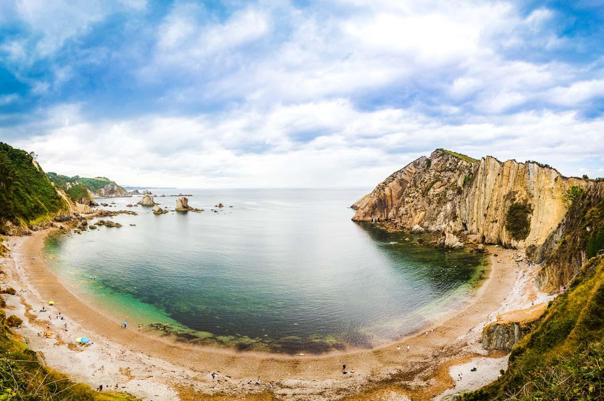
The Best Beaches in Asturias, Spain
Spain Guides:
Discover Toledo, the City of 3 Cultures
I hope you enjoy your trip to Asturias and to Spain!
If you have any questions, let me know in the comments below, I always reply.
Travel Tools
Use any of our recommended links below to book your trip. You pay the same, and we earn a small fee; a great way to support us!

Pin this to Pinterest!
Enjoyed this guide? Then help a fellow traveler and pin it! They'll most definitely love you for it, 100% guarantee.