Complete Guide to Hiking Capo San Marco, Sardinia
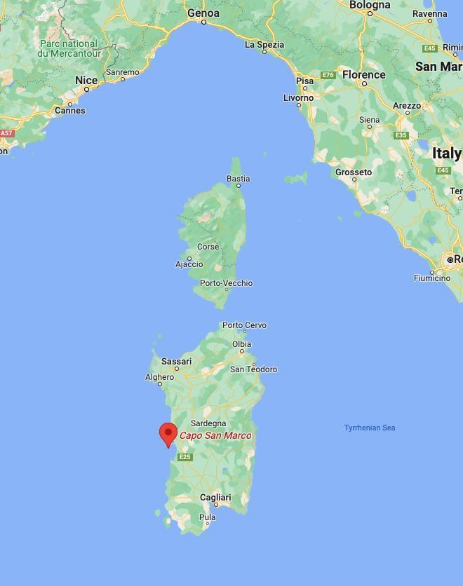
Capo San Marco is the southernmost point of the Sinis peninsula, in the west of Sardinia, Italy.
This rocky cape located just behind the archaeological site of Tharros impresses with its unique shape and offers a beautiful hiking trail between land and sea, as well as beautiful beaches.
Let’s see everything you need to plan your hike to Capo San Marco! 🚀
Where is Capo San Marco & What to Expect
Capo San Marco is the southern tip of the Sinis peninsula and is part of the town of Cabras in western Sardinia. It is easily accessible from Cagliari in about 1,5 drive north, and 2 hours drive south from Alghero.
Hiking Capo San Marco is a logical next step after a visit of Tharros, as they are situated right next to each other. In any case, the incredible landscape Capo San Marco offers will call you and you will go there naturally!
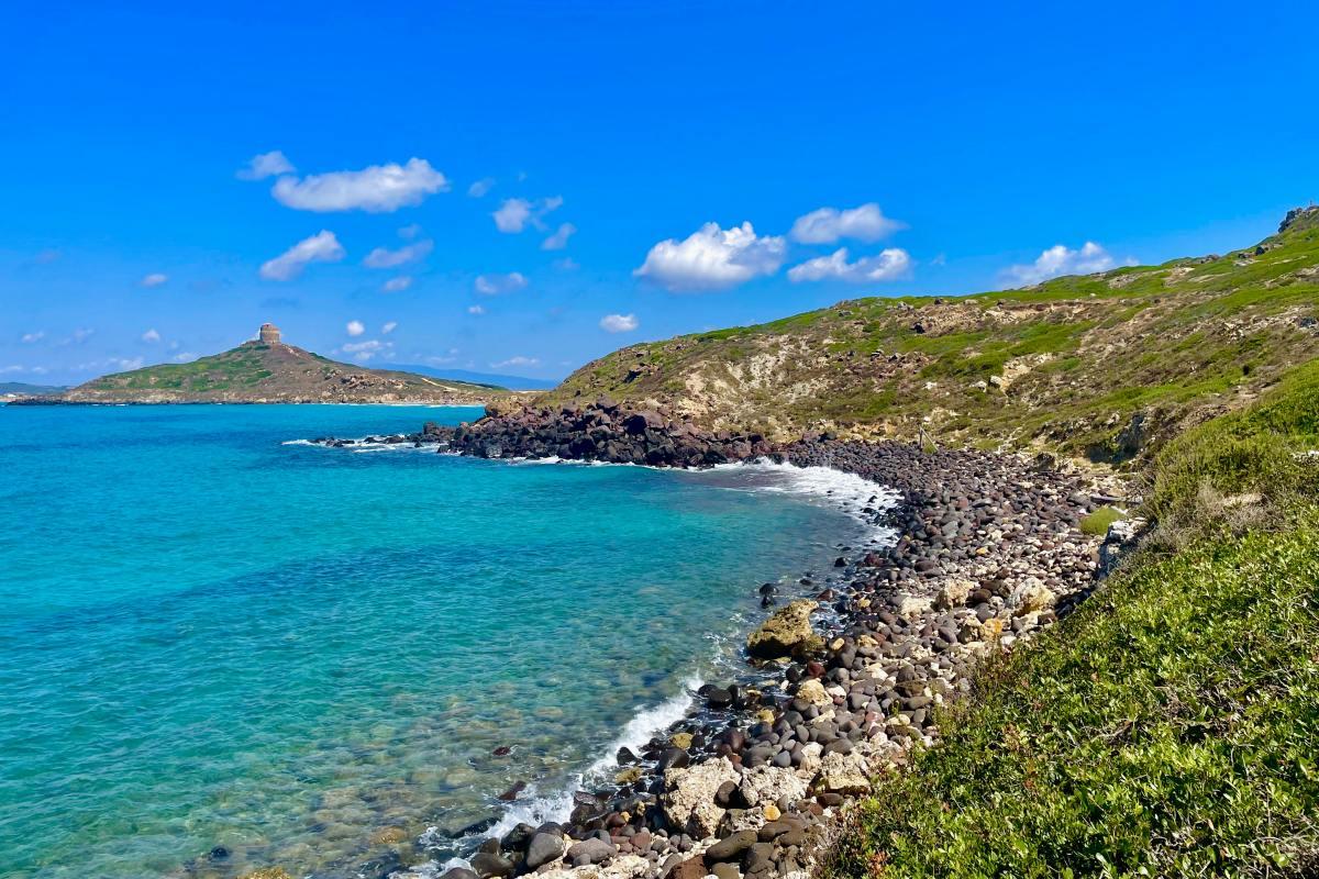
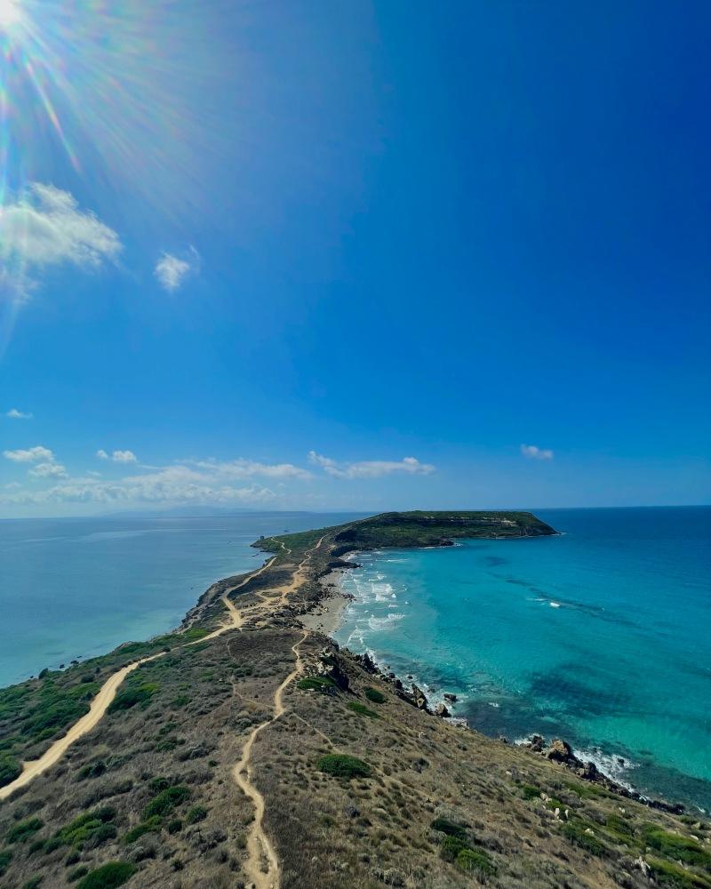
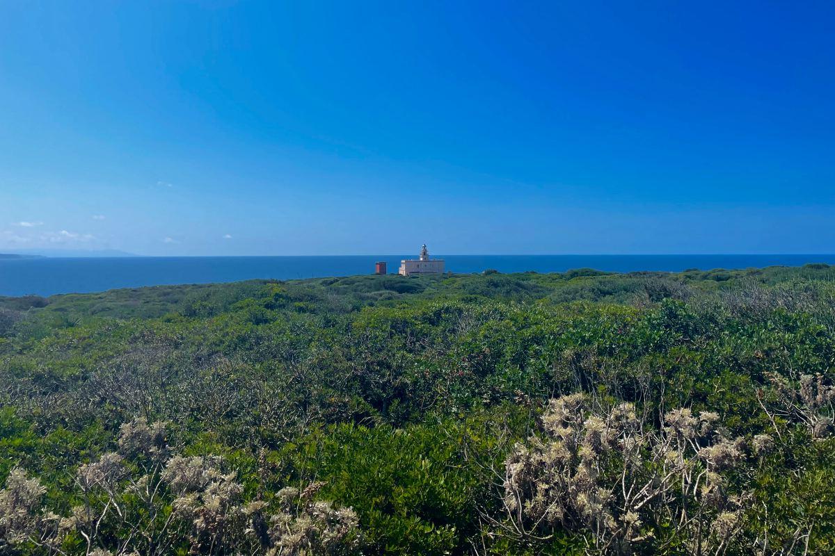
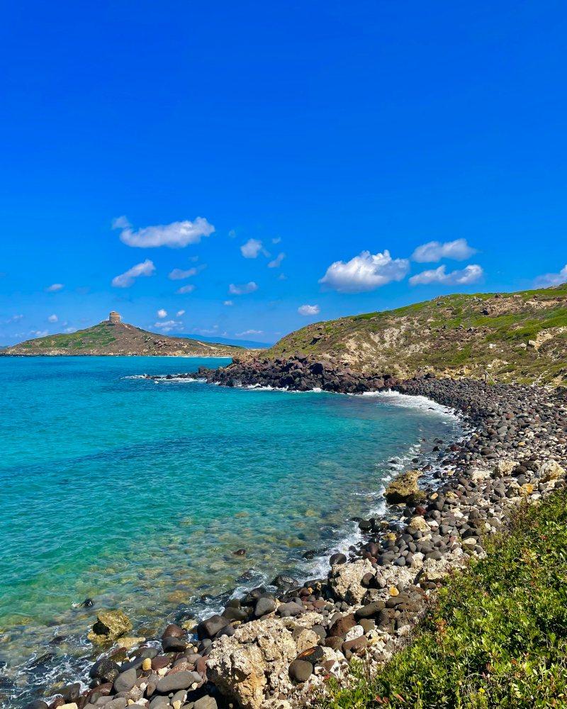
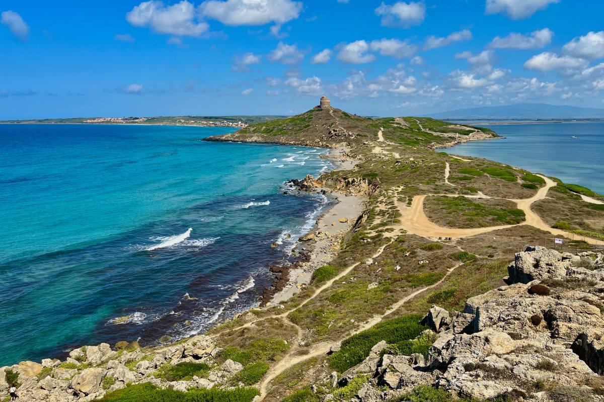
This thin strip of land bordered on both sides by the sea and small wild beaches has a special shape, like a snake trying to make its way through the sea. Photographers and Instagramers will be delighted by the sight!
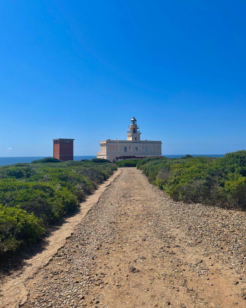
At the very end, stands the lighthouse of Capo San Marco which you can see only after a few kilometers of walking. It is a military lighthouse built in 1924.
How to Get to Capo San Marco
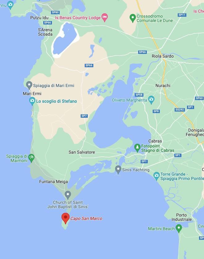
To get to the Capo San Marco hike starting point, you have to reach the Tharros entrance.
🚗 By car – the best option
You can simply write “Capo San Marco” or “Tharros on your GPS device, and you will quickly find it. Capo San Marco is served by route SP6 you can access through route SP7 when coming from north Sardinia, or SP1 when coming from the south.
- From Cagliari – 1h30 drive: drive north through route SS131 to SP70 towards Oristano, then take the SP57, SP93 and SP1 to SP6
- From Bosa – 1h15 drive: go south following the SP35 to SS292, then take the SP66 and SP7 to SP6
- From Alghero – 2h10: drive south through route SP105 to SP49, then take the SP66 and SP7 to SP6
If you have written “Capo San Marco” on your GPS, you will notice it will tell you to keep driving when arriving at Tharros’ first parking lot. But you should know it is a dirty road after, so if your car can’t handle it, prefer parking at the first parking lot.
If you keep driving, I recommend stopping at the second parking lot and not further to not enter Tharros’ archeological site.
🚌 By public transportation
There is no public transportation going directly to Capo San Marco. The closest you can get with public transport is Oristano, about 21 kilometers (13 miles) from Capo San Marco.
Even though I don’t recommend choosing this option, find below how to do so you know:
- From Cagliari: a direct train will take you to Oristano (Piazza Ungheria Fs station) in 1h20
- From Bosa: bus 703 will take you to Oristano in 2 hours for 4,90€
- From Alghero: you will arrive at Oristano in about 3h30 by taking 2 buses (line 9312 to Bosa, then line 703 to Oristano). It will cost about 9,50€
Wherever you come from by public transportation, you will have to take a taxi from Oristano to Capo San Marco for 30min, which will cost about 30€.
Capo San Marco Hike Details
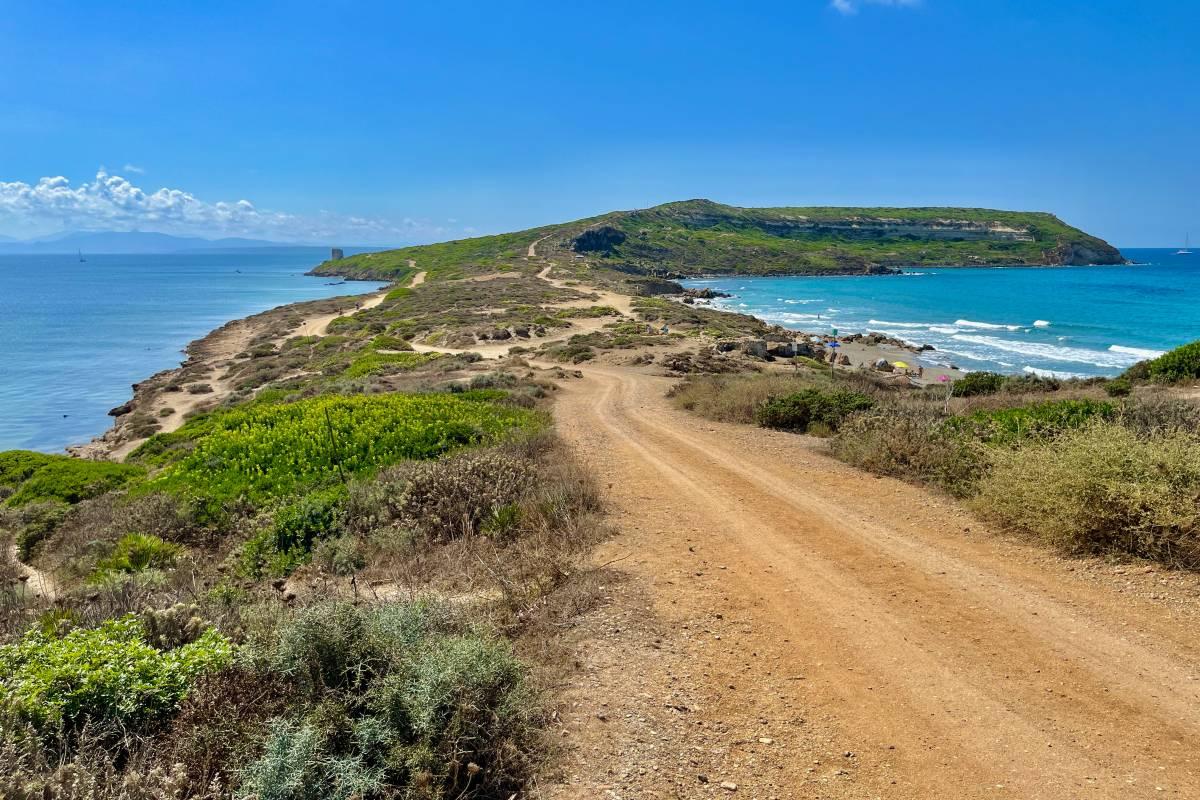
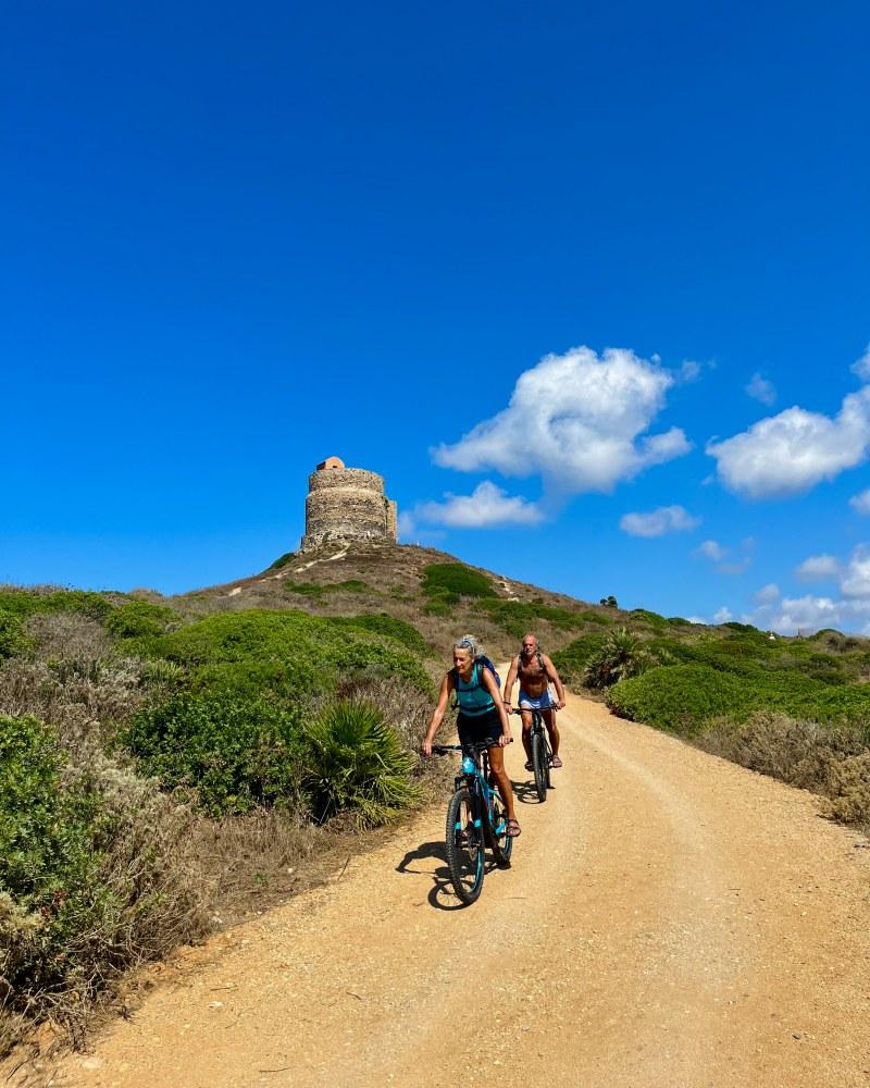
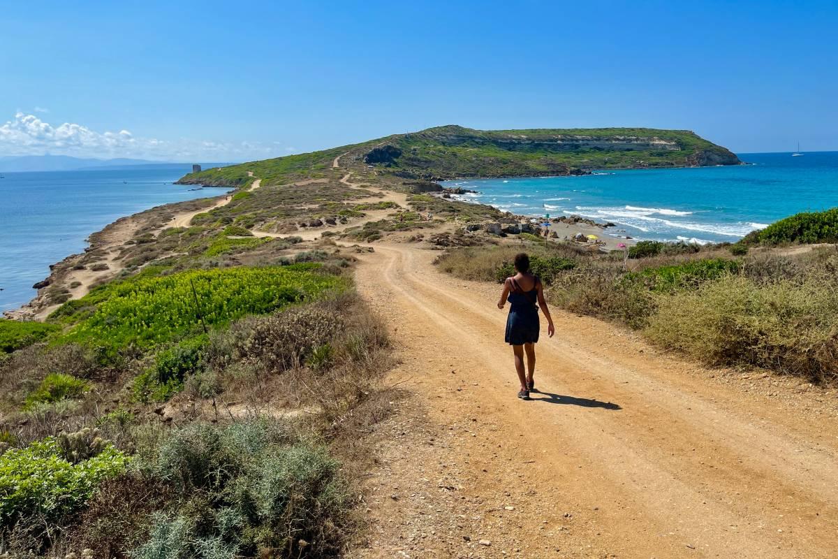
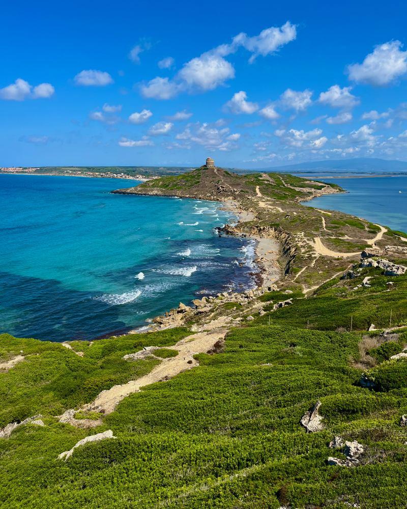
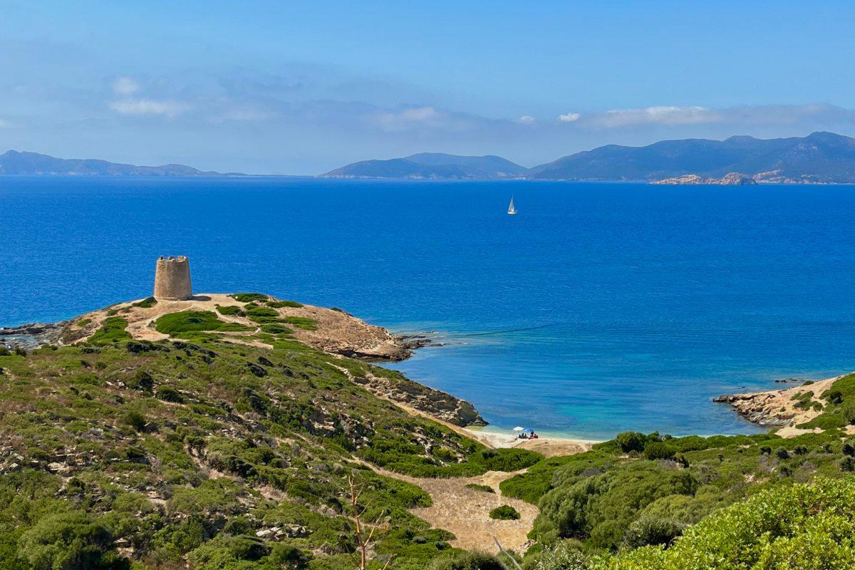
The hike to Capo San Marco is a loop trail that will lead you to the tip of the peninsula where stands a lighthouse. All along the way, you will have amazing views over the sea, the Torre Spagnola, and the unique shape of this piece of land.
Even though the whole hike is under the sun with no shade at all, it is a nice hike to do in summer thanks to the strong wind.
Here are the details of the hike:
Capo San Marco Hike

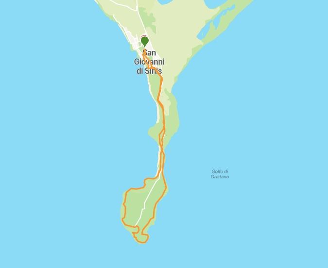
Hike distance: The distance of the hike is 6.05 km/3.76 miles including the return trip.
Hike duration: It will take you about 2 hours to do the loop.
Hike elevation: Only 169 m/554 ft total elevation on this hike, with a slow progressive hike at the beginning.
Hike difficulty: This hike is really easy with a large path to follow until reaching the lighthouse. After this, the trail becomes a bit tricky as it is on the edge and very narrow so you will have to push through the bushes sometimes, but nothing bad. Also, a few parts of the path had fallen when we did the hike, so we had to find a way but it wasn’t complicated.
Discovering Capo San Marco
Nesrine and I decided to hike Capo San Marco on the 6th day of our 7-day trip in Sardinia. We were visiting Tharros archeological site just before, so we kept walking south to Capo San Marco.
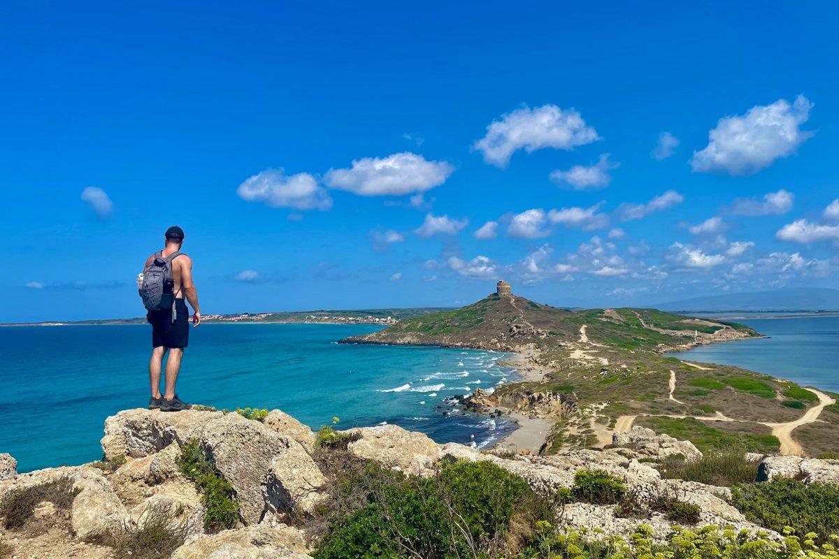
From the Torre Spagnola’s roof, the medieval tower located right next to the archeological area, we could already appreciate a 360° view of the Capo San Marco, so we couldn’t wait to hike to the tip.
View of Capo San Marco from the Torre Spagnola
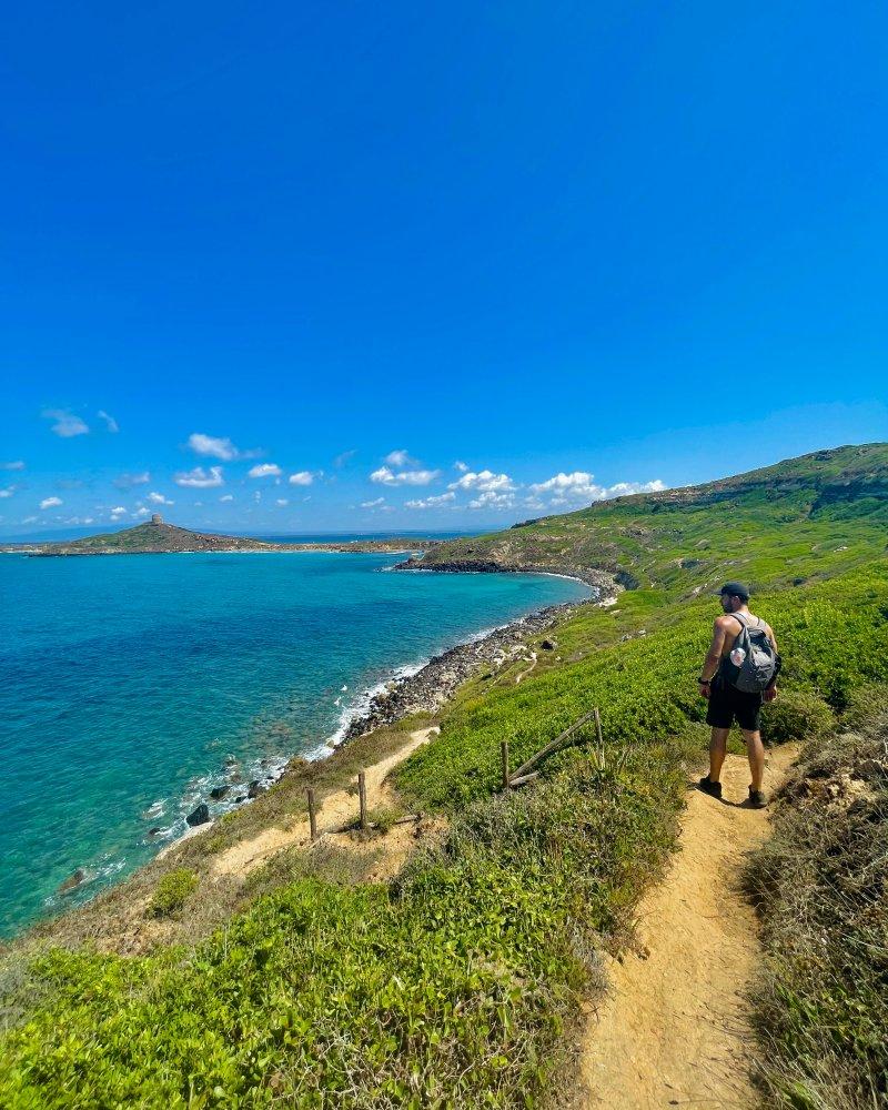
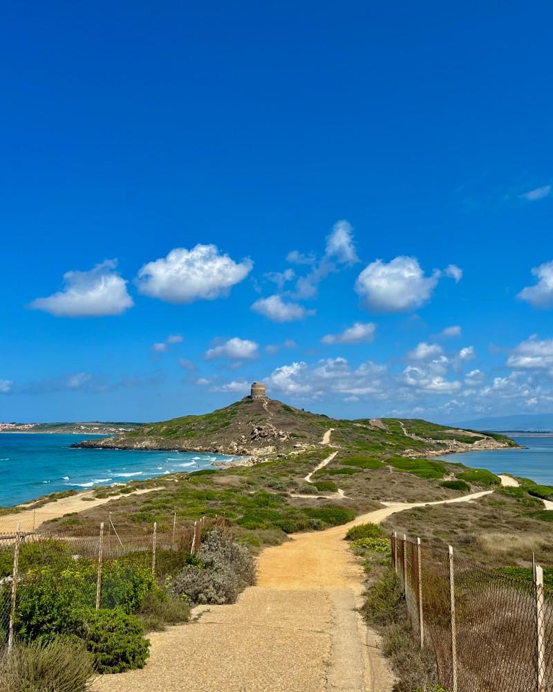
There is no sign indicating the start of the hike, but it was very easy to find our way as there is only one single large path towards Capo San Marco.
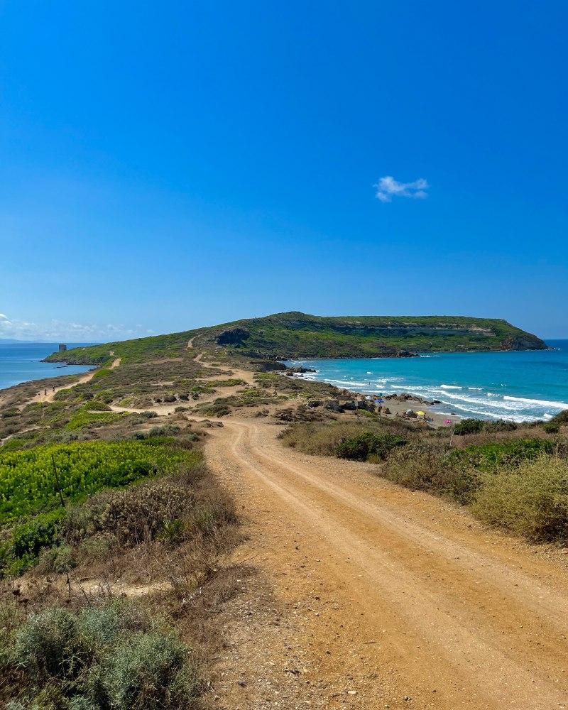
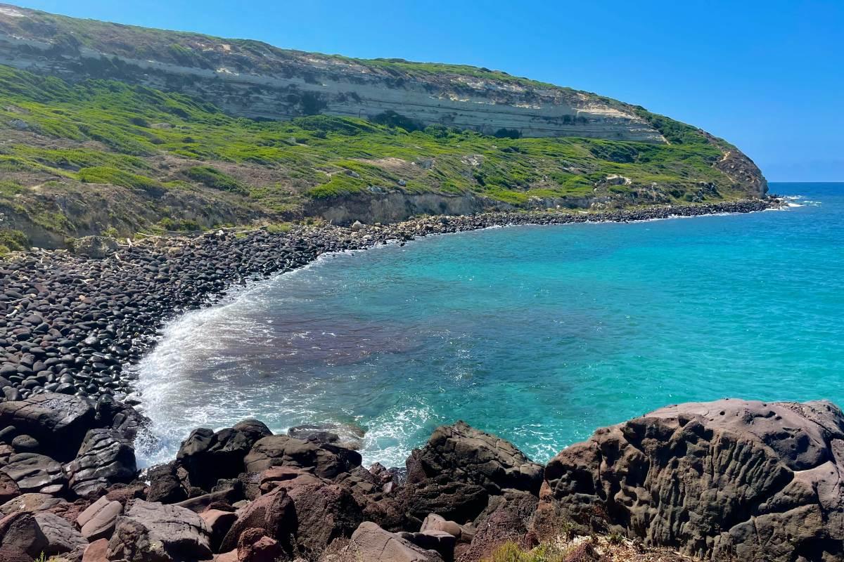
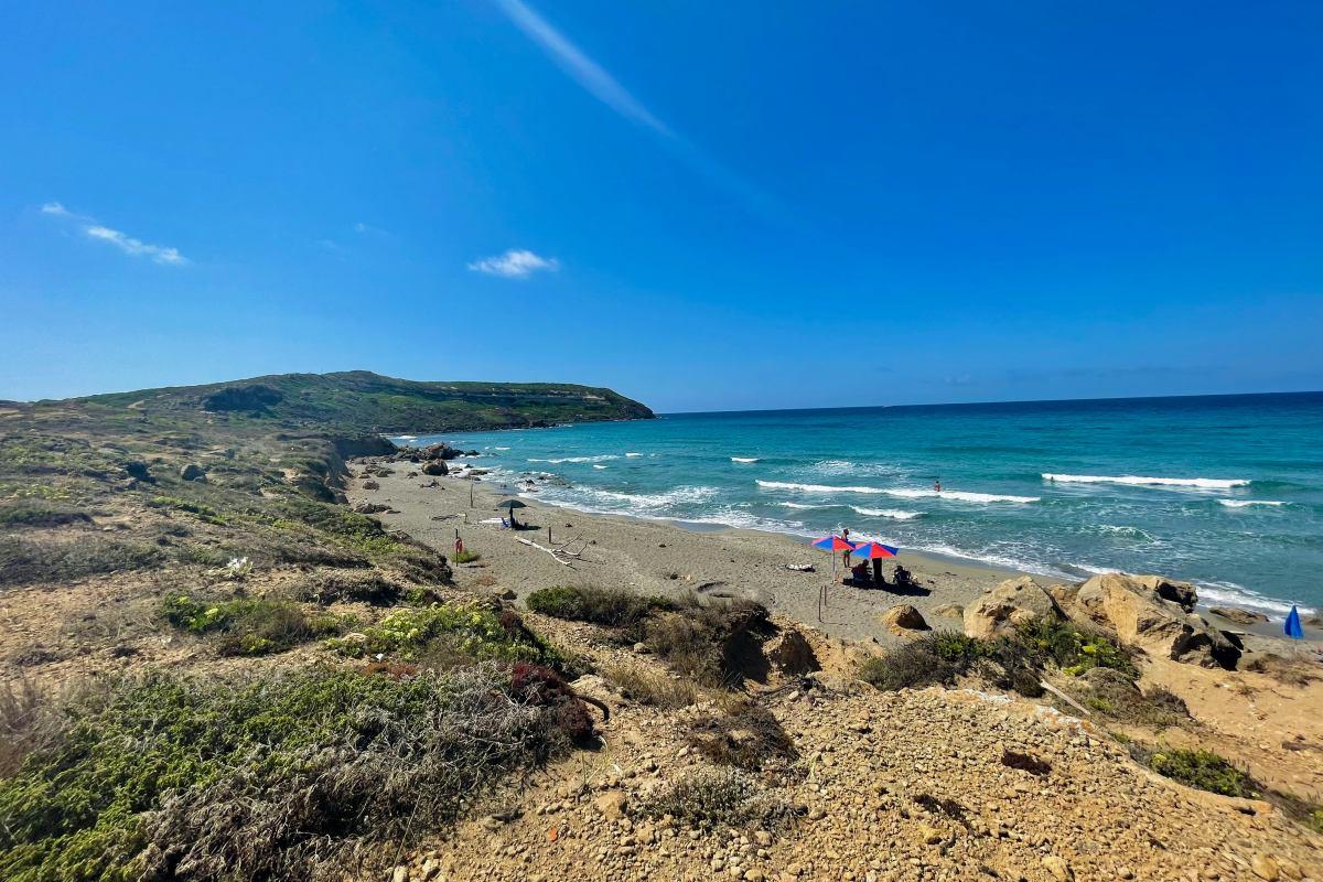
Quickly after starting the hike at 11.30 am, we quickly found ourselves almost at the seaside, at Capo San Marco Spiaggia. Even though the wind was strong and the sea was rough, the water was crystal clear and people were swimming.
You should know that this beach is one of the only ones in Sardinia that is dog-friendly, so if you are hiking with your dog, this is its chance!
There were other a few other wild beaches, small pieces of sand where you can lay your towel if you want.
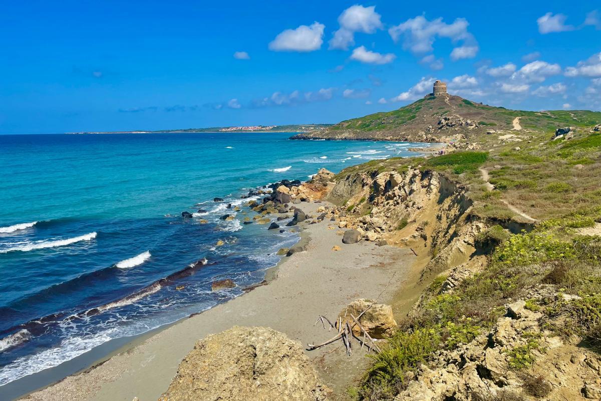
It is after these beaches that the path begins to go up a little bit, but absolutely nothing bad.
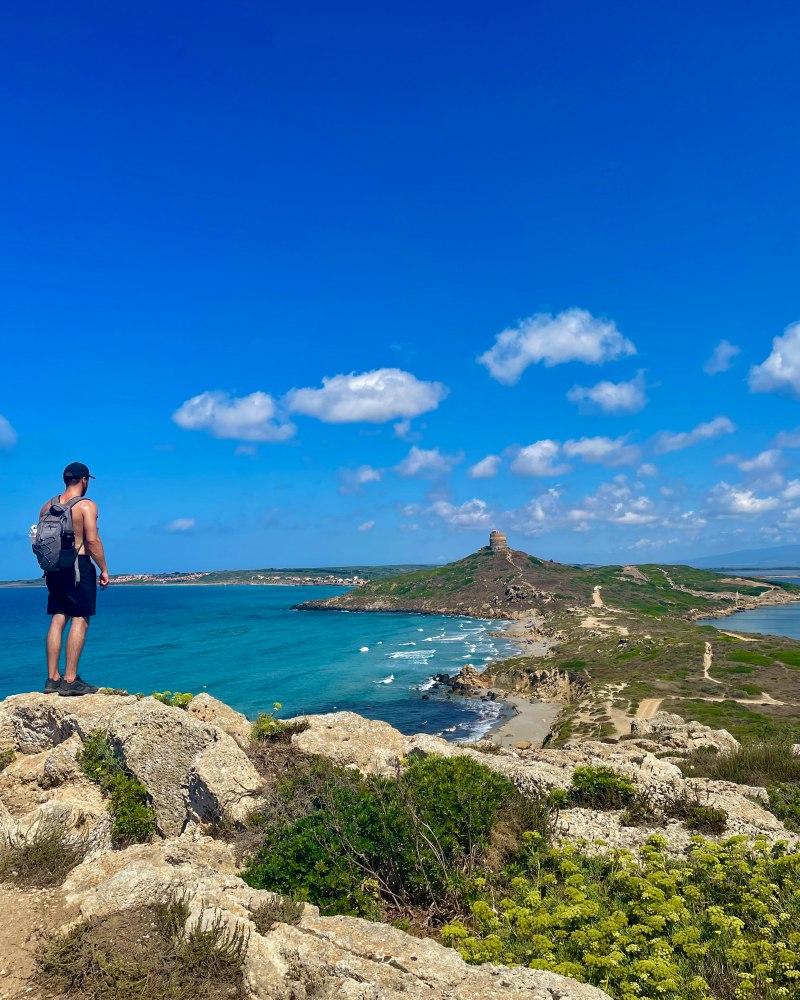
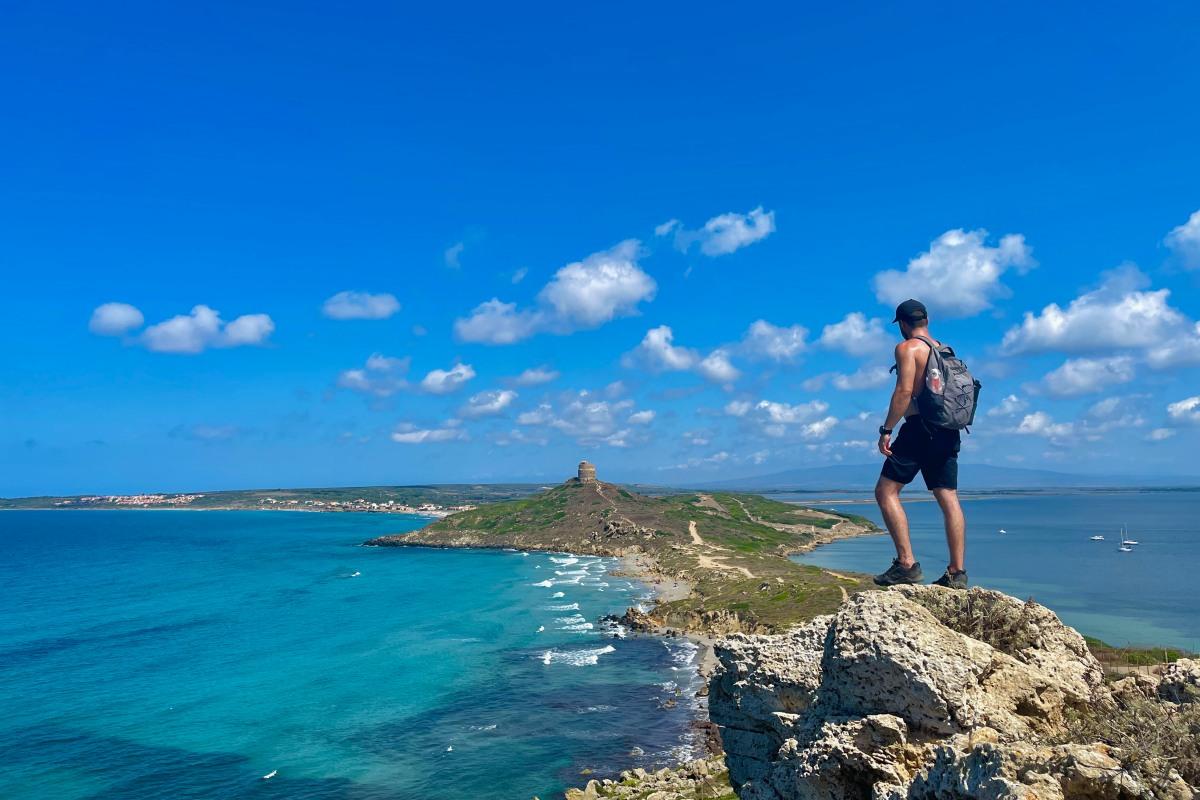
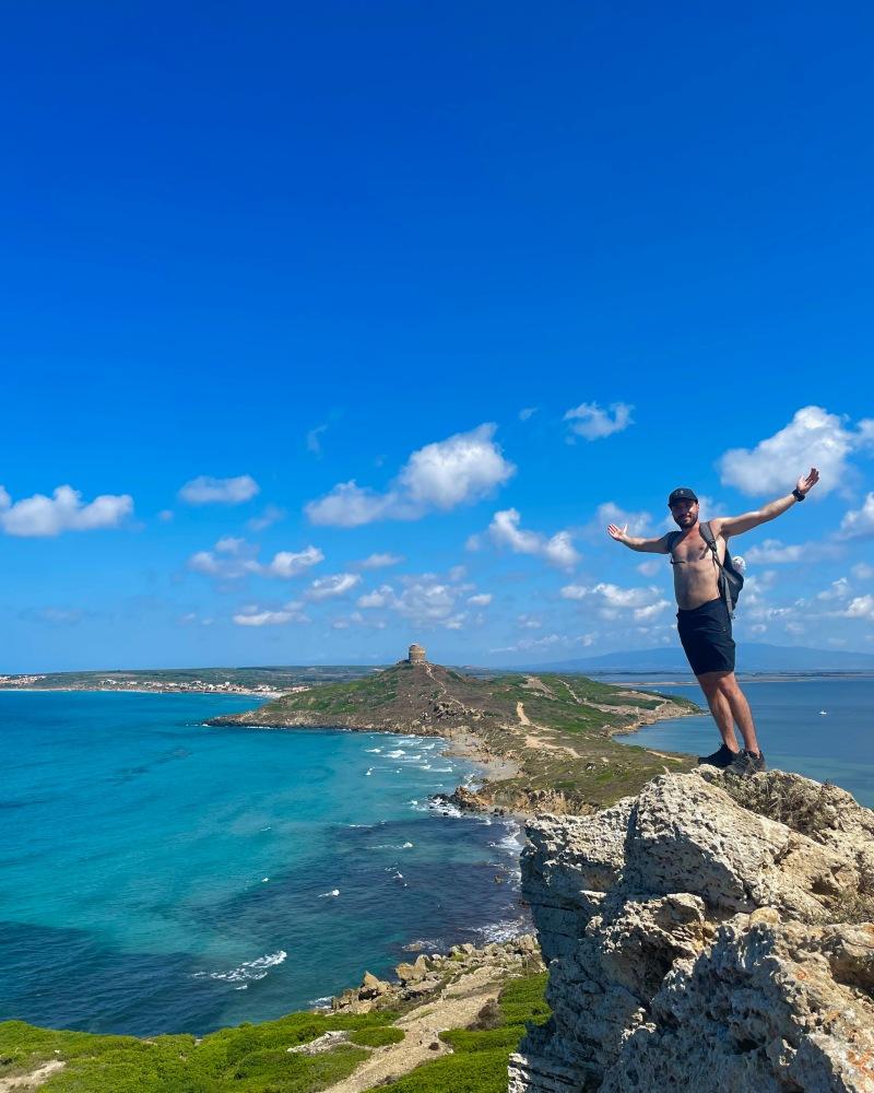
This climb allowed us to take a little height to admire the surroundings. We loved climbing on the rocks to take pictures of the tower dominating the whole cape. Look at this view!
As we kept walking, the vegetation became increasingly dense and the wind got also stronger. Which was great as it was a very hot summer day!
We arrived at the lighthouse and again, the view was marvelous. It looked like the lighthouse was built in the middle of a gigantic garden.
It is not allowed to enter it as it is an operating military building, but the view is enough for itself. The lighthouse is located at the very end of the tip, so there is no land after it, only the sea, which is very impressive.
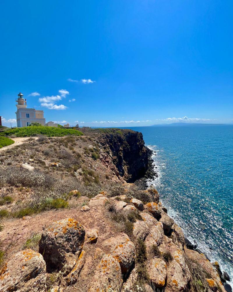
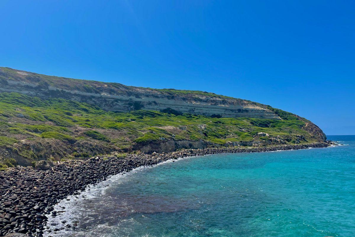
After our stop at the lighthouse, we started to loop back to the hike starting point. At this point, the trail is on the edge of the cliff, but big enough not to be scared. This is the section we liked the most because we had views of the huge dark cliffs.
Contrary to the climb up which was inland, the trail down is extremely narrow and completely on edge. Even though not difficult, we sometimes had to push our way through the bushes, and a few sections had fallen so we needed to get a bit acrobatic.
But, the views, the views, the views!!
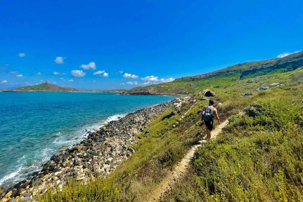
The way back is not entirely on the shore, so after about 15-20min walks on the edge, we were back inland to enjoy even more beautiful views of the Torre Spagnola overlooking the area.
We finished the hike at 1.40 pm, so it took us about 2 hours to do the whole loop. And it was our favorite hike of our trip to Sardinia because of the breathtaking views all along.
Visit Sardinia
Going to Sardinia? Here are further readings that will help you plan your trip to Sardinia:
👉 Here is the main travel guide: 7 Days Itinerary in Sardinia (with free map)
If you are looking for Sardinia’s best beaches, here are other dedicated guides:
- All the Most Beautiful Beaches in Sardinia
- The Best Beaches on La Maddalena archipelago
- The Best Beaches in Northern Sardinia
- The Best Beaches in Southern Sardinia
- The Best Spots to Snorkeling Sardinia
- The Best Beaches Near Olbia
Also, find below my guides to discovering some of Sardinia’s best attractions:
- The Best Things to Do in Olbia
- Visit Cala Goloritze in the Gulf of Orosei
- Hike Guide to Cala Napoletana, La Maddalena
- Discover Masua’s Porto Flavia & Pan di Zucchero
- Visit Laveria Lamarmora
- Discover Tharros Archeological Site
- Visit Neptune’s Cave
- Complete Guide to Cala Li Cossi
Finally, if you’re looking for a home base in Sardinia, you will find my best accommodation recommendations below:
- The Best Areas to Stay in Sardinia
- The Best Place to Stay in Sardinia for Couples
- The Best Places for Nightlife in Sardinia
I hope you have found everything you need to hike Capo San Marco Cabras; if you have any questions, let me know in the comments below.
Help a fellow traveler and share this guide using the buttons below! 🙂
Travel Tools
Use any of our recommended links below to book your trip. You pay the same, and we earn a small fee; a great way to support us!

Pin this to Pinterest!
Enjoyed this guide? Then help a fellow traveler and pin it! They'll most definitely love you for it, 100% guarantee.


![[Sardinia Guide] Discovering Porto Flavia & Pan di Zucchero, Masua](https://www.kevmrc.com/wp-content/uploads/2022/10/full-guide-to-discover-porto-flavia-pan-di-zucchero-sardinia.jpeg)