Le Roc de Chère Hike in Annecy (+ free hiking map)
Le Roc de Chère is a rocky outcrop on the shore of Lac d’Annecy in Annecy, France.
On one side there’s a golf course and on the other is a Nature Reserve. It’s the perfect spot for a nice hike in the forest, with 2 epic viewpoints over the lake.
Let’s see the hike & how to get to it!
Where is Le Roc de Chère
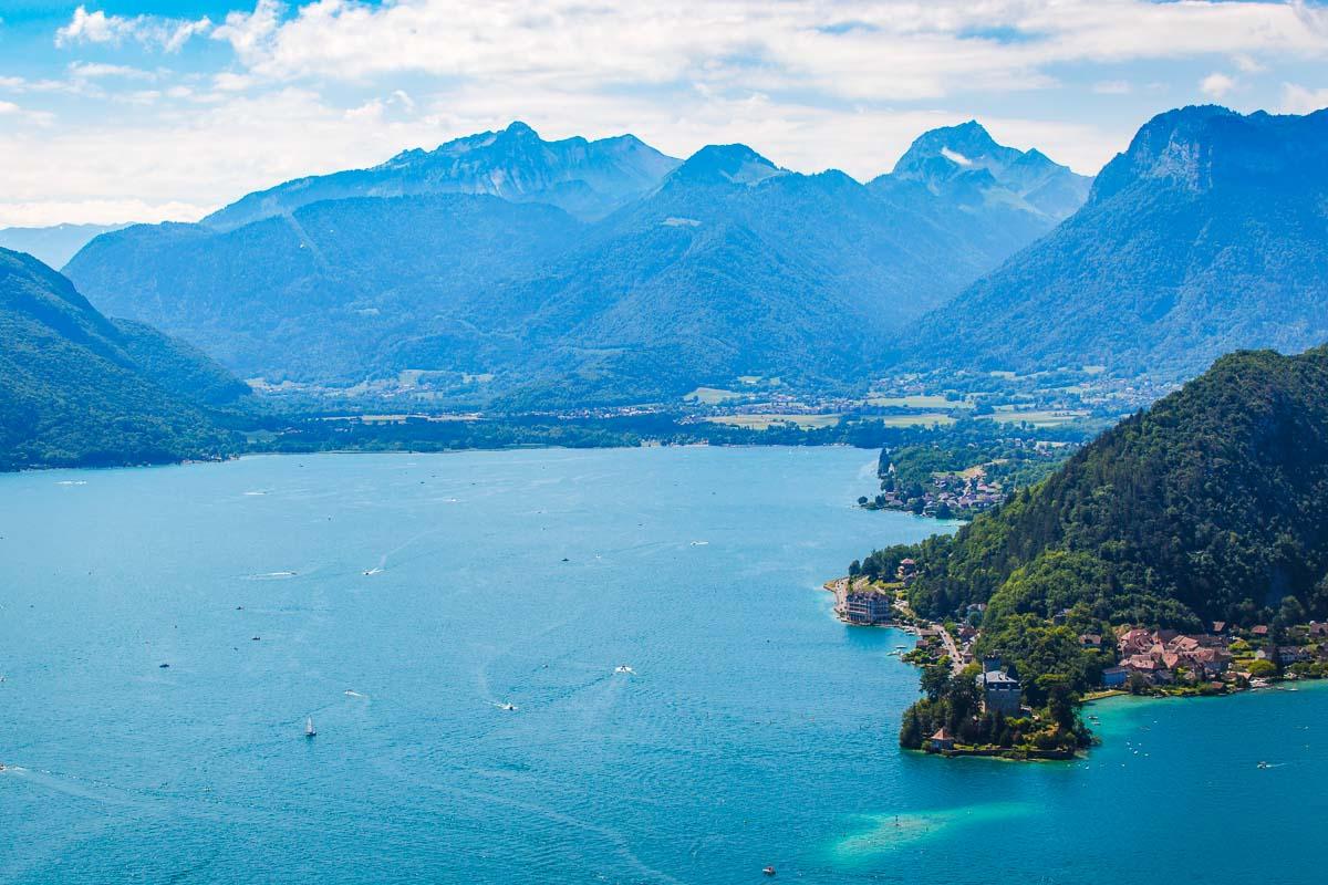
Le Roc de Chère is located in the south west of Haute-Savoie, in the city of Talloires. It’s on the shore of the Lac d’Annecy, 20mn south of Annecy.
Location: Google Maps
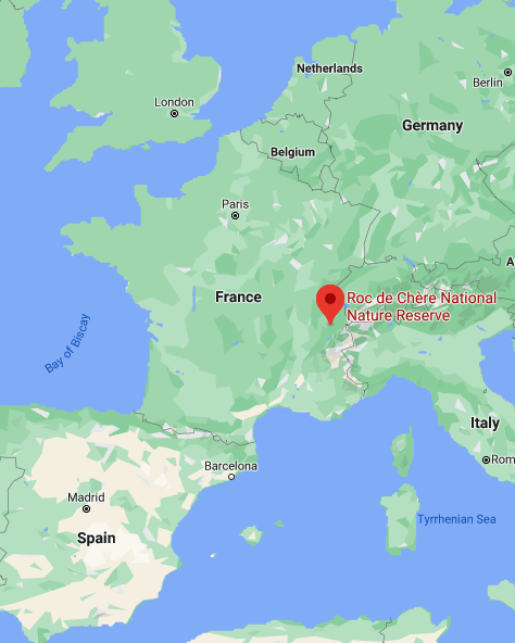
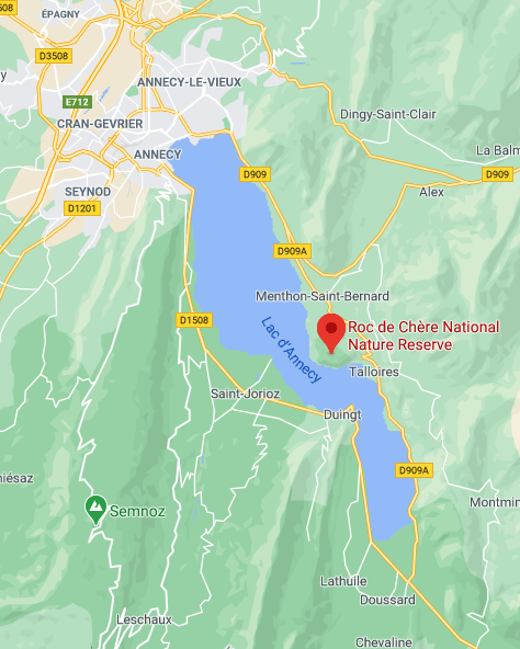
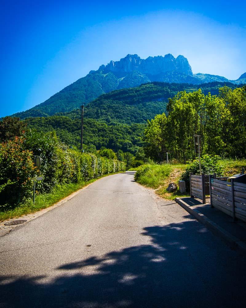
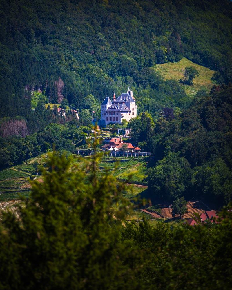
It’s on the eastern shore of the lake, in between the Mont Veyrier and La Tournette. It’s also right below the famous Château de Menthon, which is only 10mn away.
How to Get to Le Roc de Chère, Annecy
You can drive straight to the Roc de Chère, which is the best way to reach it. Follow the D909 heading south from Annecy, and you’ll reach it in under 20 minutes. You can park your car on this free parking lot, which is literally seconds away from the main road.
Annecy gets pretty crowded in summer, and the traffic is usually pretty bad on the roads around the lake. Best to leave early to avoid traffic, or just get ready to be stuck for a while (not that bad with the view of the lake, but still).
If you’re not driving, you can take the bus 61 from Annecy to the stop “Talloires-Montmin Echarvines”. It takes around 30mn, and costs 1.50€ for the trip. From the bus stop it’s a 5mn walk to the Roc de Chere.
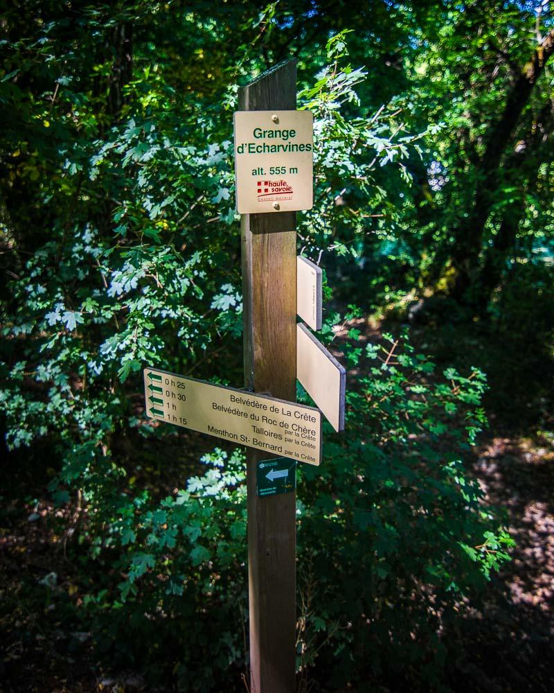
To start the hike, head to the Parking Roc de Chère. The hike starts right in front of the parking lot, there are big signs there you can’t miss it.
Roc de Chere Hike Details
The Roc de Chere Annecy hike will lead you to 2 viewpoints, with a great view over the lake and the moutains around. It’s an easy hike that takes less than an hour, with very slight incline.
Here are the details of the hike:
Roc de Chere Hike

![]()
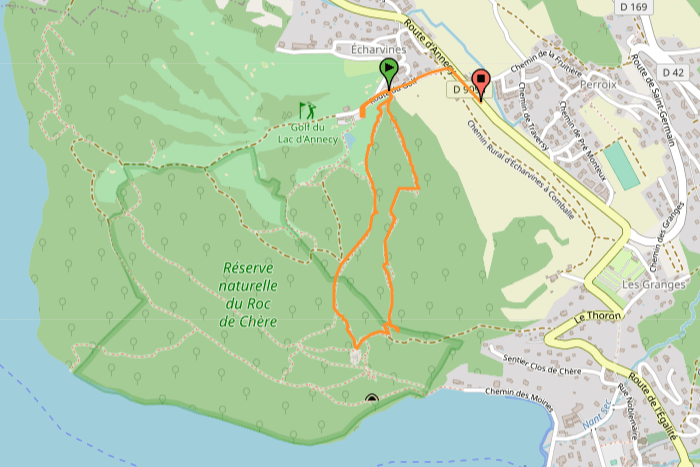
Hike distance: The distance of the hike is 2.82km / 1.7 miles including the return trip.
Hike duration: If you simply go down & back up, it will take you around 45mn.
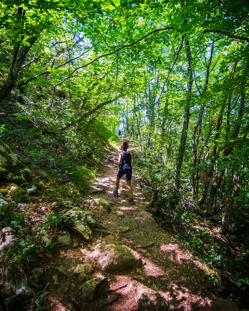
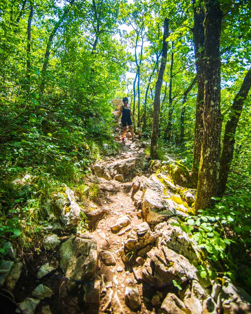
Hike difficulty: nothing difficult about this hike, it’s short and easy. A few rocks and roots here & there on the trail, but mostly a large forest trail, suited for kids too.
Hike elevation: only a 150m (492 feet) slow progressive climb to the 2 viewpoints.
Hiking the Roc de Chere, Annecy
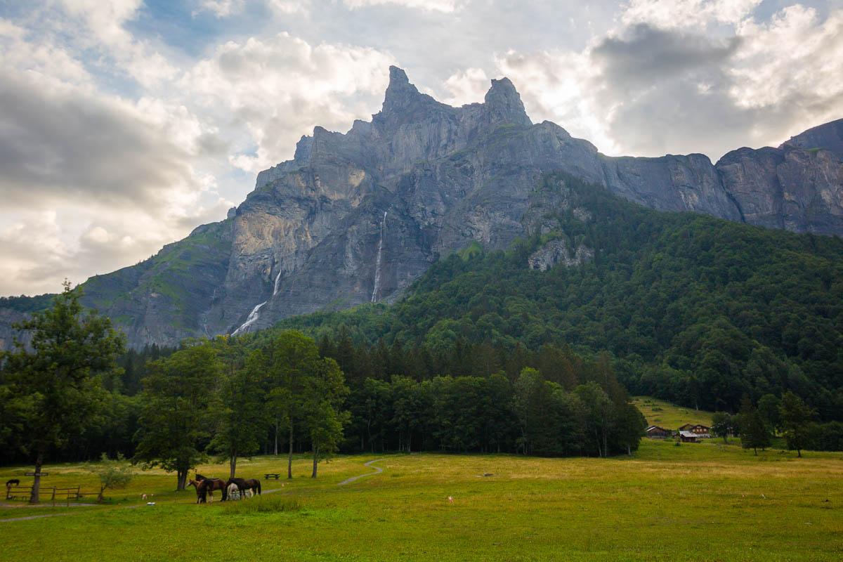
Our exploration of Annecy started by hiking 2 of the main trails on the eastern side of Lac d’Annecy: La Tournette and Mont Veyrier/Mont Baron. After these 2, there was a last hike on this side of the lake: the Roc de Chere hike.
We left the Airbnb a tad late, and paid the price by sitting in traffic on our way to the hike. We got to the parking lot and somehow found a spot as someone left right as we arrived.
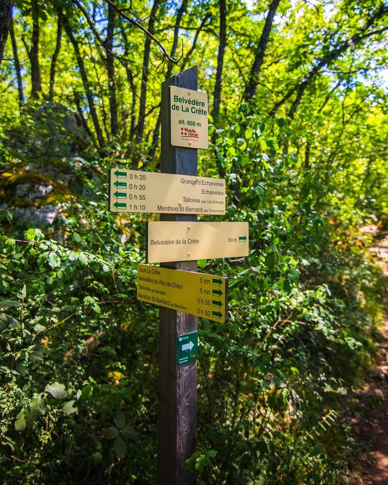
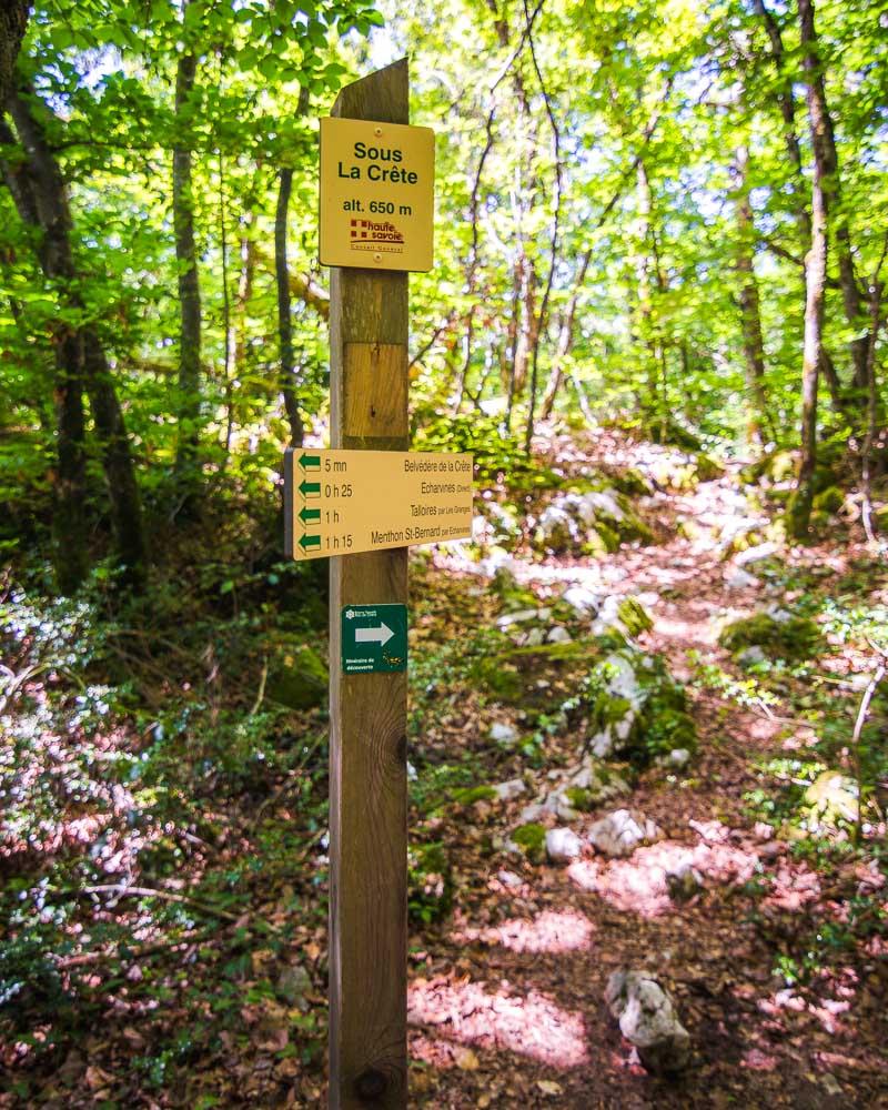
Not a bad view to start the hike! We crossed the road and were directly at the start of the hike, with plenty of signs showing the way.
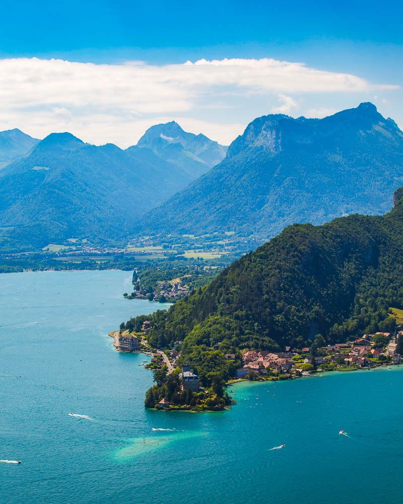
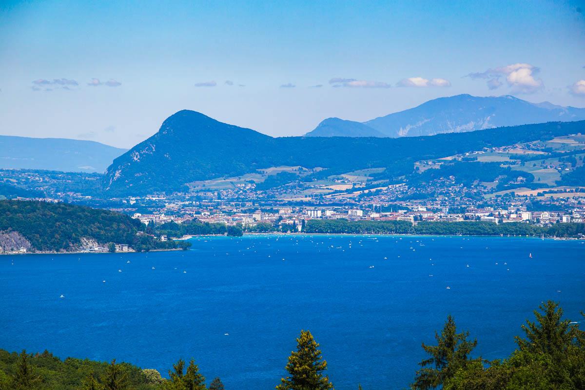
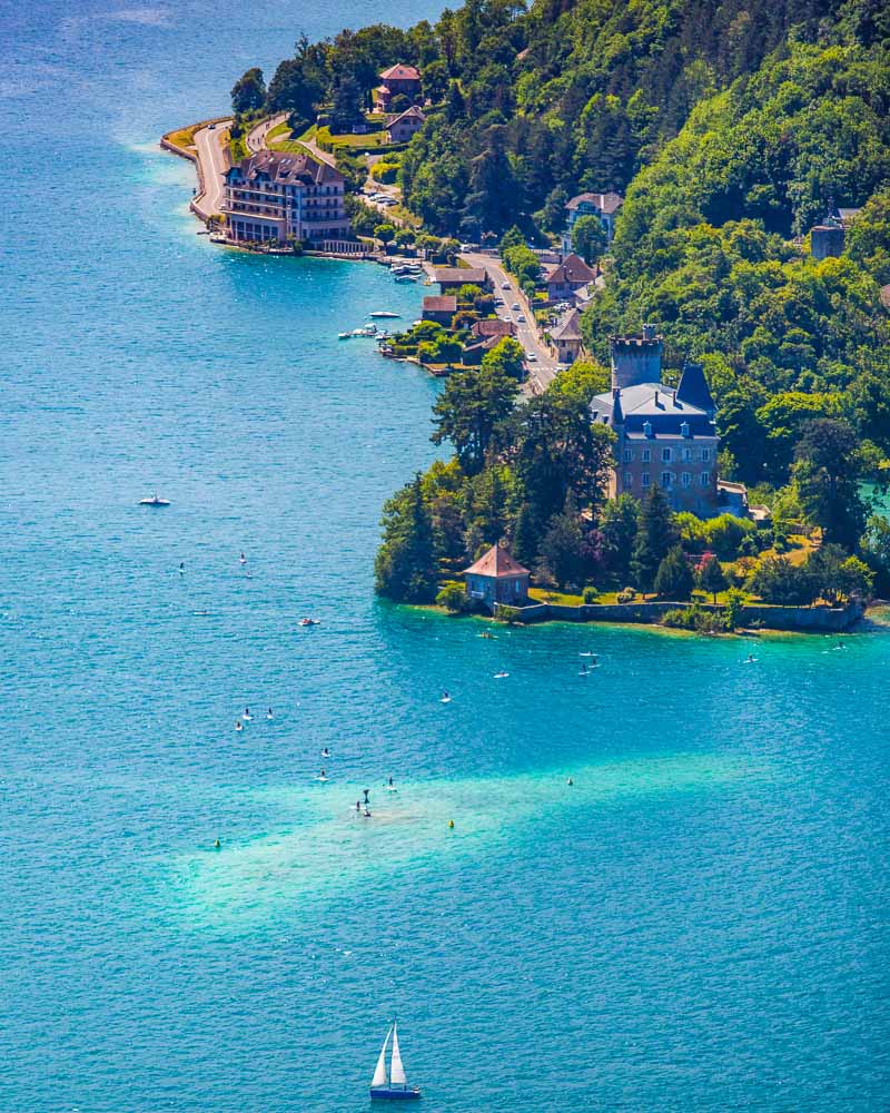
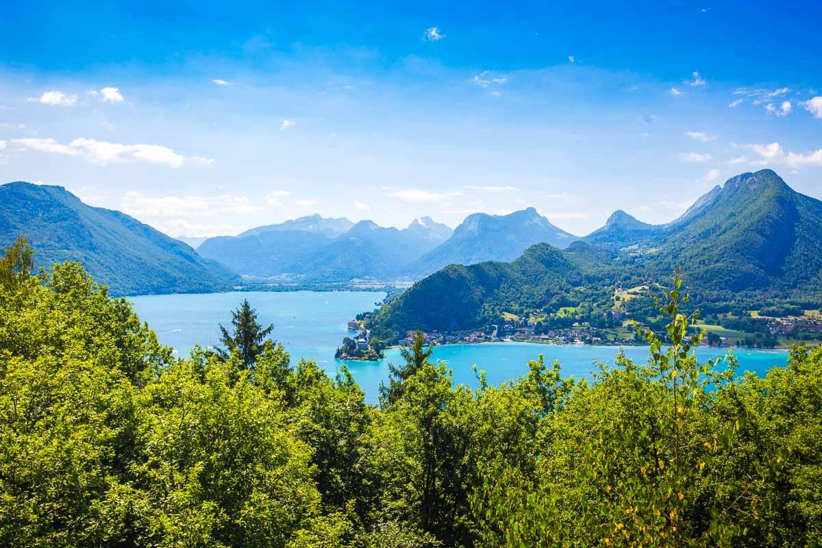
We soon reached a first viewpoint, that’s not on the map but still offers a great view over the Lac d’Annecy and Annecy in the background. We got a first glimpse of the Château de Menthon, standing far in the distance.
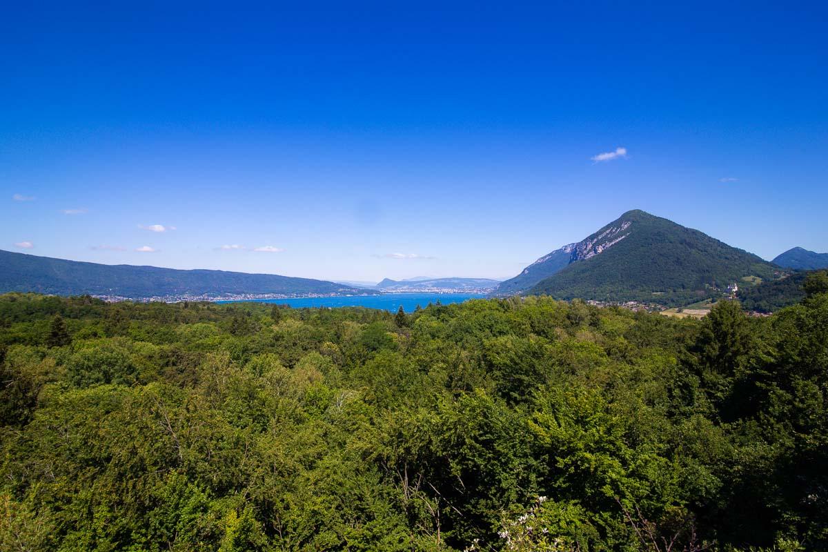
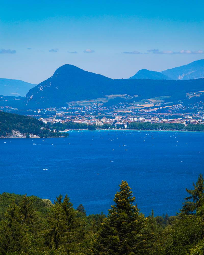
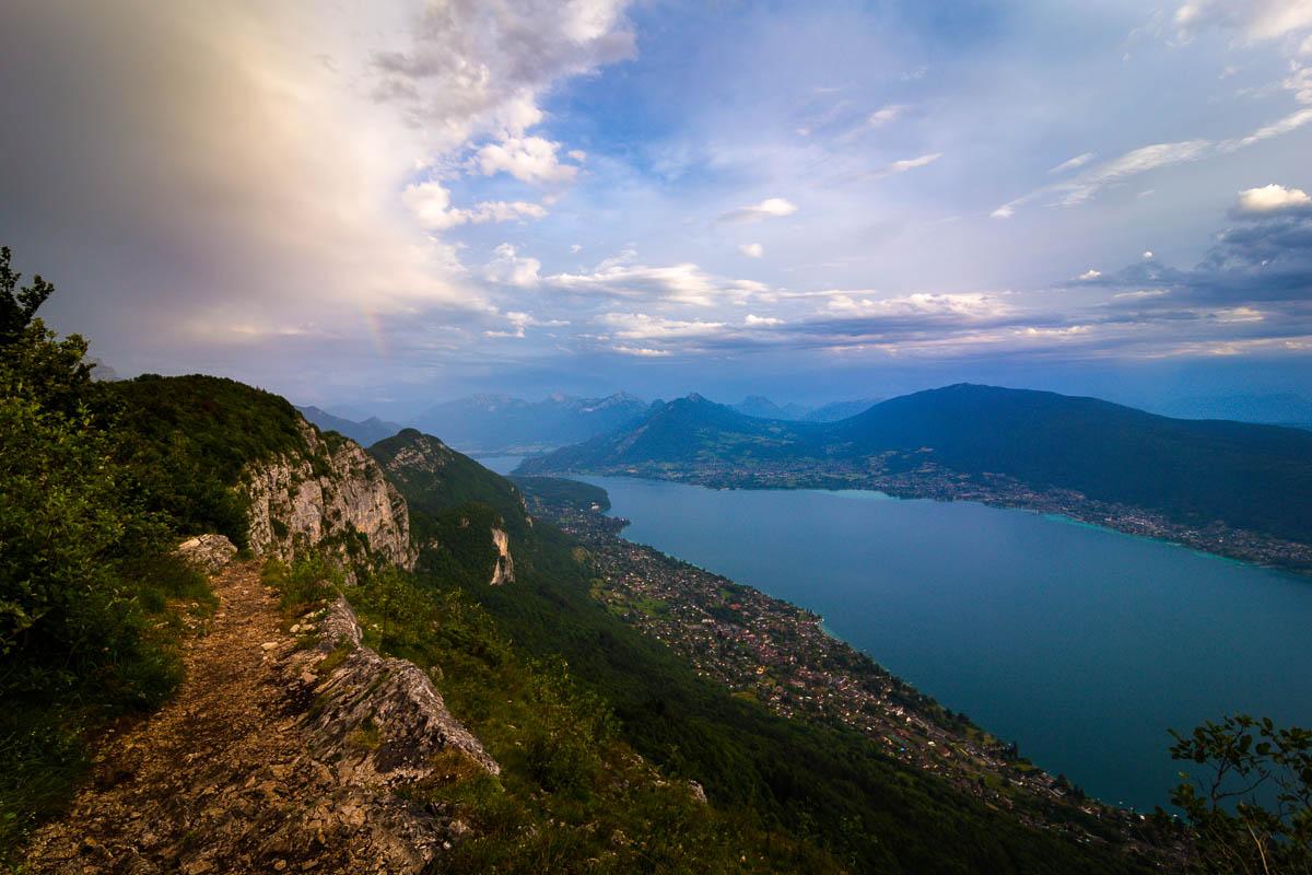
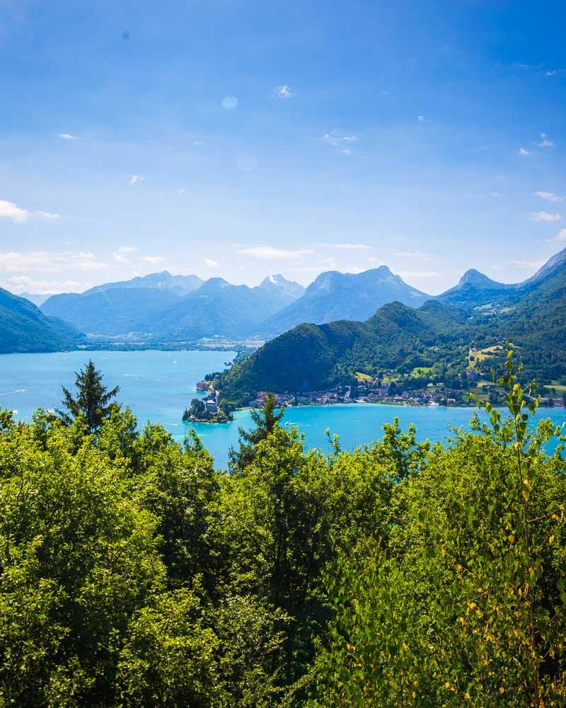
We kept the slow climb along the forest trail, and finally got to the main attraction on the hike: the Belvédère de la Crête. This is a viewpoint, with a great unobstructed view over the other side of the lake.
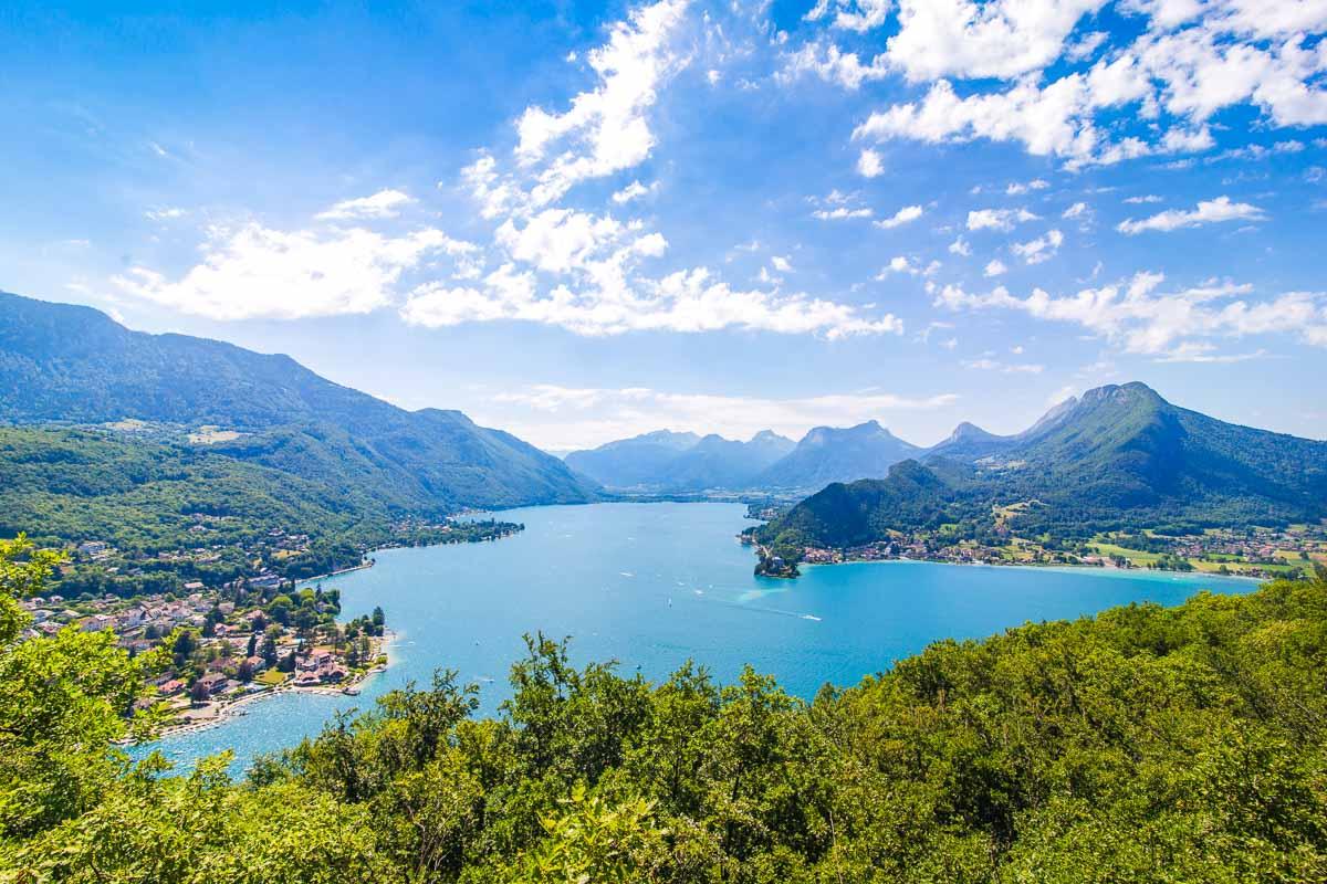
On the forefront you can see the Château de Duingt, a pretty epic castle built right on the shore. Sadly it’s privately owned, and people live there, which means you can’t visit it. But hey, you can look at it all you want!
The viewpoint is pretty small, so it can get crowded quick. If you’re looking for a place to stop & have lunch, keep going to the next viewpoint which has way more space.

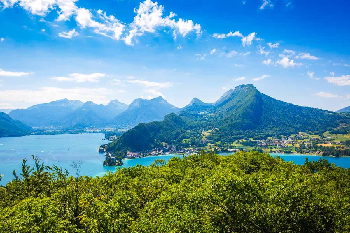
From the Belvédère de la Crête, it’s only a 5mn hike to the next viewpoint, the Belvédère du Roc de Chère. There are signs along the trail, and it was easy to find our way through the forest.
And we finally reached the last stop, the Belvédère du Roc de Chère. The view is pretty similar to the one at the previous viewpoint, but there are a lot of trees covering the bottom part of the view.
For the view itself, the first viewpoint was my favorite. But for a place to stop & rest, the second one is definitely the best. There’s a huge rock facing the lake, with plenty of space for everyone to sit down and relax. The perfect place for a snack.
From the viewpoint, it was a pretty straightforward 20mn hike back to the car. Follow the signs to “Echarvines” and you’ll be good to go. And that was the end of our hike to Le Roc de chère, Annecy!
Visit Haute-Savoie
Planning your trip to Haute-Savoie? You’ll find below a few other travel guides & key spots to see in the area.
Best hikes around Annecy:
Great outdoor destinations near Annecy:
The BIG guides:
I hope you enjoy your trip to Annecy and to France; if you have any questions, let me know in the comments below, I always reply.
Help a fellow traveler and share this guide with the buttons below!
Travel Tools
Use any of our recommended links below to book your trip. You pay the same, and we earn a small fee; a great way to support us!

Pin this to Pinterest!
Enjoyed this guide? Then help a fellow traveler and pin it! They'll most definitely love you for it, 100% guarantee.