Hiking Picos de Europa – The Ultimate Guide (+ free maps)
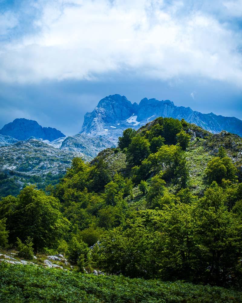
The Parque Nacional Picos de Europa, or Picos de Europa National Park, is the very first National Park in Spain, created in 1918.
It’s an absolutely stunning area of Spain made of rivers, mountains & alpine lakes, full of wild animals.
Hiking in Picos de Europa is one of my favorite things to do in Asturias, and I’m sure you’ll enjoy it too!
I’ve created this guide so that you’ll have everything you need to plan your trip there.
Let’s get started!
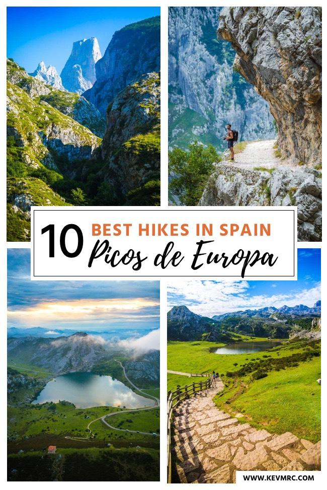
TABLE OF CONTENTS
- Where to Stay in Los Picos de Europa
- Where is the Picos de Europa National Park?
- The 10 Best Trails for Hiking in Picos de Europa
- The Ultimate Hike – Anillo Picos de Europa
- The Complete List of All the Hikes in Picos de Europa
- Mountain Refuges – Refugios Picos de Europa
- Map of Picos de Europa Asturias
- How is the Weather in Picos de Europa?
- Tips for Your Trip to the Parque Nacional Picos de Europa
- Visit Spain
Where to Stay in Los Picos de Europa
When exploring Picos de Europa, I stayed in different areas over the days, to experience different parts & be closest to the hikes I was going to do the following day.
I’ve listed below my favorite places & the best central option for your home base in the park.
Best Home Base – Hostal Poncebos
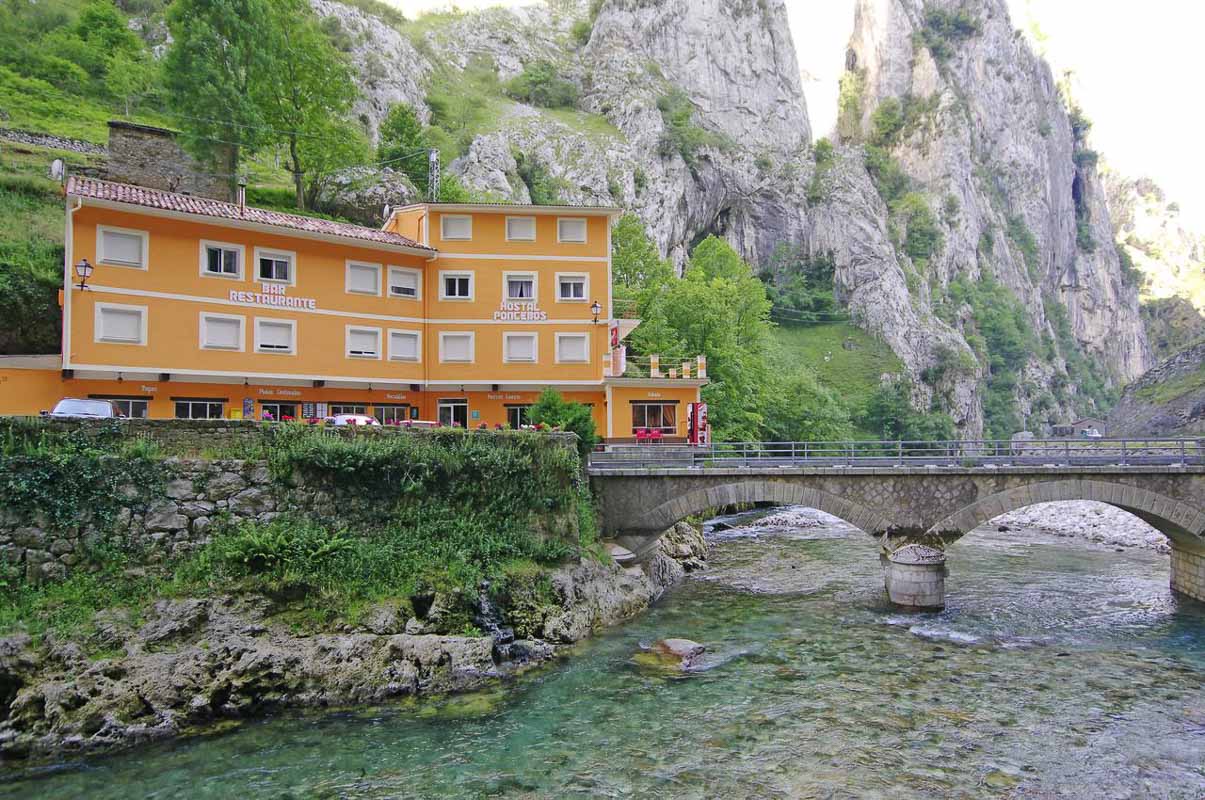
The Hostal Poncebos has the best location!
It’s the highest rated hotel in the area, and the best home base for the hikes in Picos de Europa.
The prices are so low it’s hard to beat, and breakfast is included too! It gets booked out pretty quick, so make sure to secure your spot fast.
Best Comfy Hotel – Hotel Picos de Europa
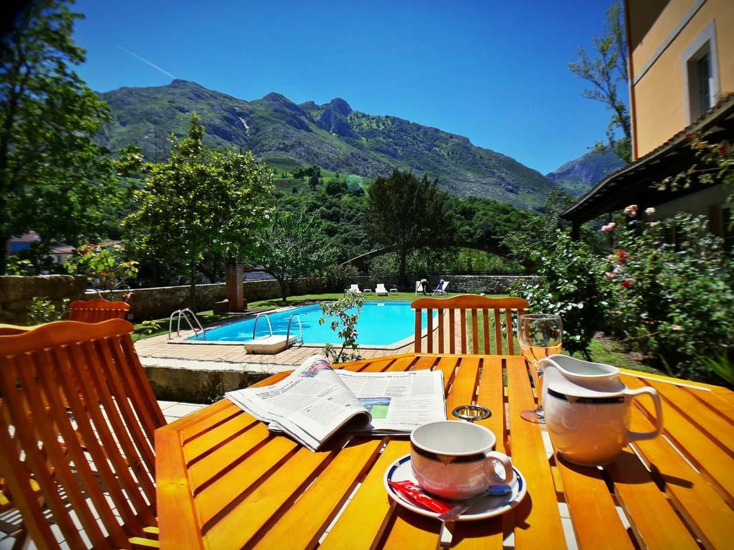
The Hotel Picos de Europa is the best to relax after hiking
If the Hostal Poncebos is already full, the Hotel Picos de Europa is my second go-to accommodation.
The room is pretty cozy, everything is super clean, and you’ll even have a pool to relax after a long day of hiking! The Hotel Picos de Europa is definitely my top choice for a comfy stay.
Best Hotel in Covadonga Lakes – Casa Rural Priena
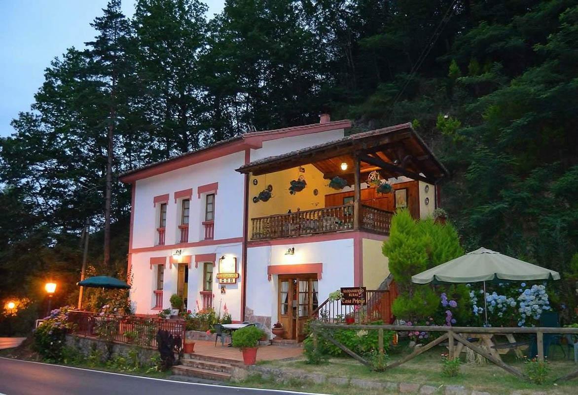
The best hotel in Covadonga lakes
The Casa Rural Priena is my favorite place to stay at near the Lagos de Covadonga.
It’s the highest rated hotel in the area, and it’s literally minutes away from the lakes. The rooms are very comfy, and it comes with an included delicious breakfast.
Read more: Find the best town and best hotel where to stay in Picos de Europa
Where is the Picos de Europa National Park?
The Picos de Europa National Park is located in the north of Spain, a 2-hour drive west of Bilbao.
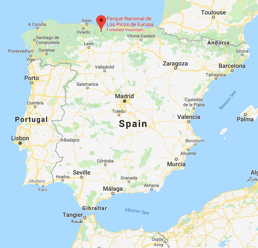
The National Park is in 3 different regions of Spain – Asturias, Cantabria, and Castile & León – and spans over 646.60km² / 250 square miles.
The 10 Best Trails for Hiking in Picos de Europa
There are so many hikes in Picos de Europa: with 30 short routes (PR), 2 long routes (GR), and 4 high mountain routes, we’re looking at dozens of hikes available for walking in the Picos de Europa.
Unless you’re spending several months in the area, it’s impossible to walk them all.
But don’t worry; I have listed for you the very best trails for hiking in Picos de Europa.
Best Trail Picos de Europa:
- Poncebos – Bulnes via the Canal del Texu
- Hike from Bulnes to Sotres
- Full Circuit Poncebos – Bulnes – Sotres – Tielve – Poncebos
- Ruta del Cares
- Ruta Puertos de Aliva in Fuente Dé
- Horcados Rojos Summit
- Lagos de Covadonga Hike
- Vega de Ario
- Brez Canal de Arredondas
- Ordiales Scenic Balcony Trail
Keep reading below for more details about each of these hikes, including hike duration, hike profile, map & photos!
1- Poncebos – Bulnes via the Canal del Texu
The first hike on this list of best hikes in Picos de Europa is the Poncebos to Bulnes hike via the Canal del Texu.
Bulnes is a small mountain village in the north of Picos de Europa, that was once only reachable by hiking. There is now a funicular that gets you there from Poncebos in 5 minutes, but if you’re looking for outdoors experience, the hike is a much better choice.
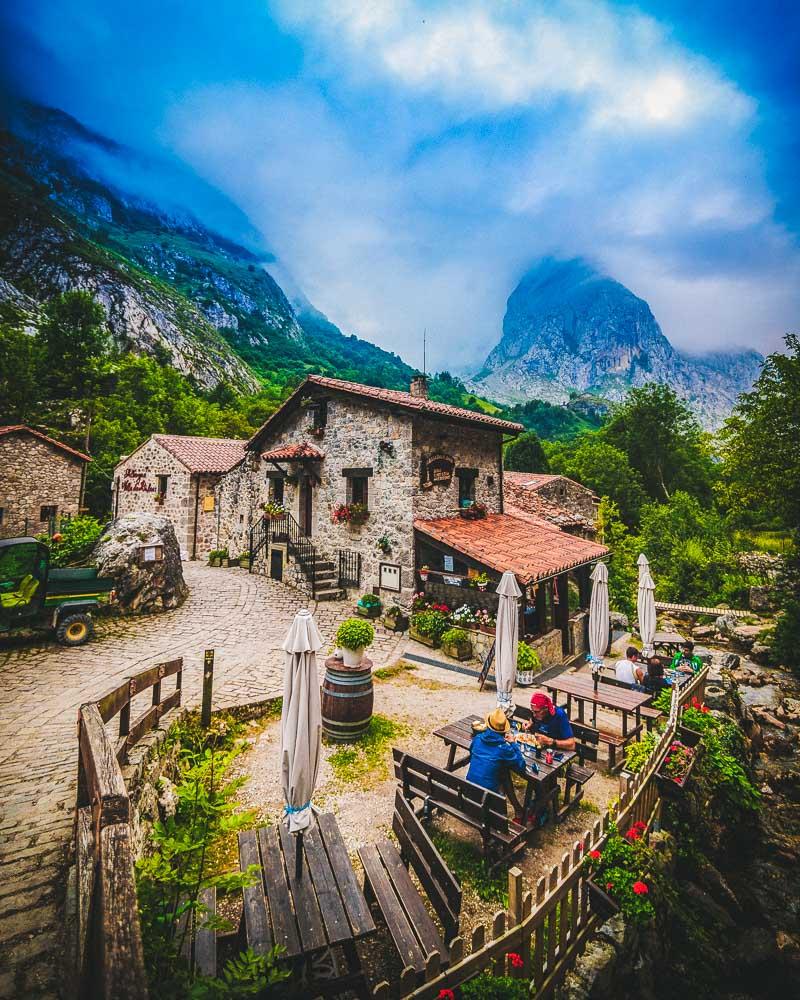
This is where you’ll arrive after less than 2 hours of hiking; this remote village is truly a gem and I highly recommend hiking to it.
The hike is pretty easy, and can be done in 3 hours including the return trip. Another option if you’re not feeling like hiking too much, or if you’re with your kids, is to take the funicular to Bulnes and then hike back down to Poncebos.
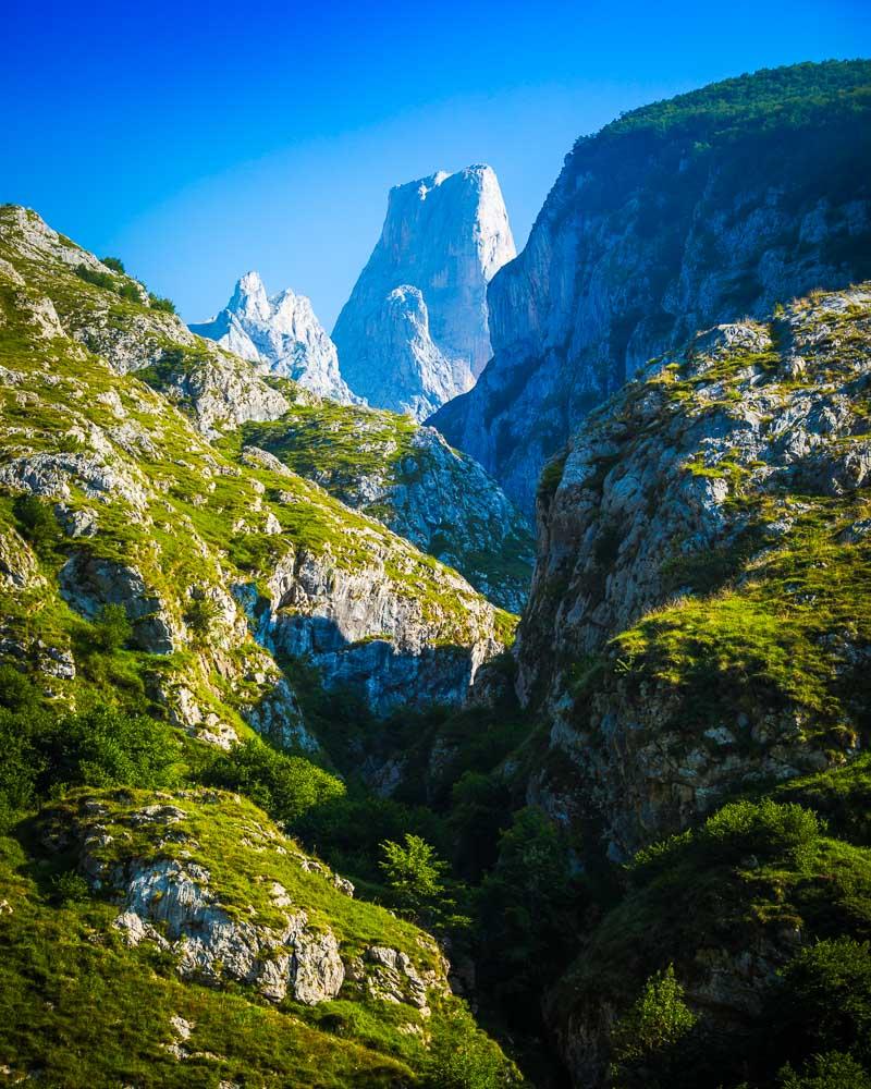
You’ll also have a pretty good view on the Naranjo de Bulnes, one of the most famous mountains in Spain.
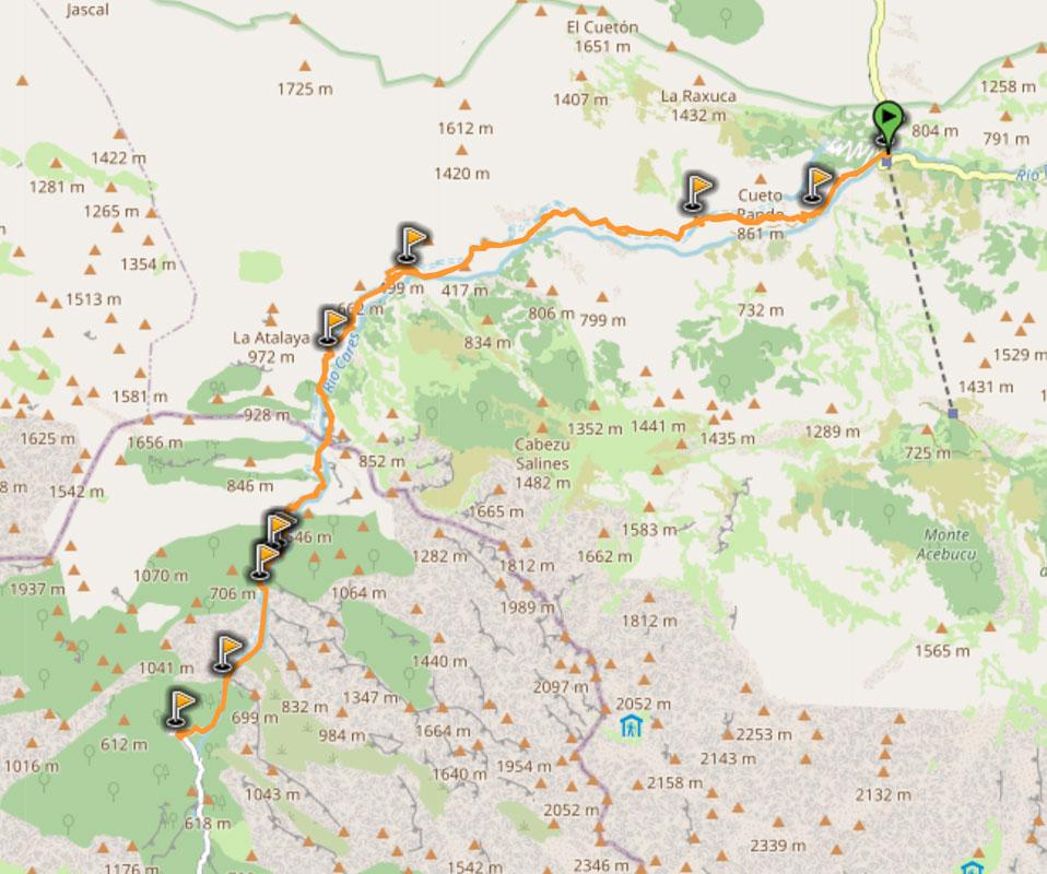
Here’s the profil of the hike:
 Hike Poncebos to Bulnes
📏 Distance: 4km / 2.5 miles
↗️ Uphill: 400m / 1,300 feet
↘️ Downhill: 85m / 278 feet
💪 Difficulty: easy
You’ll find below the map of the hike:
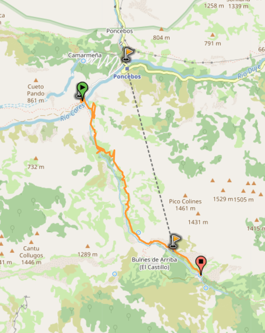
You can download the GPX file by clicking on the image above if you want to use in your GPS app/smartwatch.
Full Guide: PONCEBOS TO BULNES HIKE
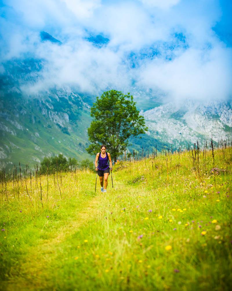
2- Hike from Bulnes to Sotres
The 2nd hike in the Parque Nacional Picos de Europa that I recommend is the hike from Bulnes to Sotres.
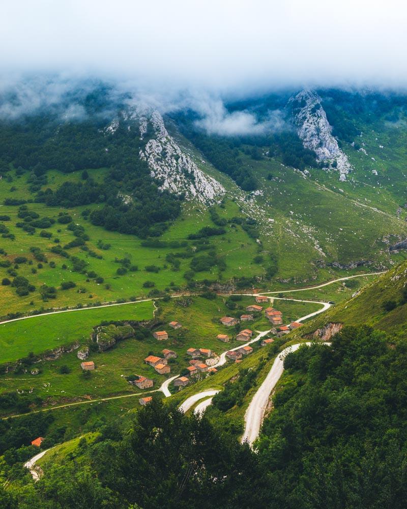
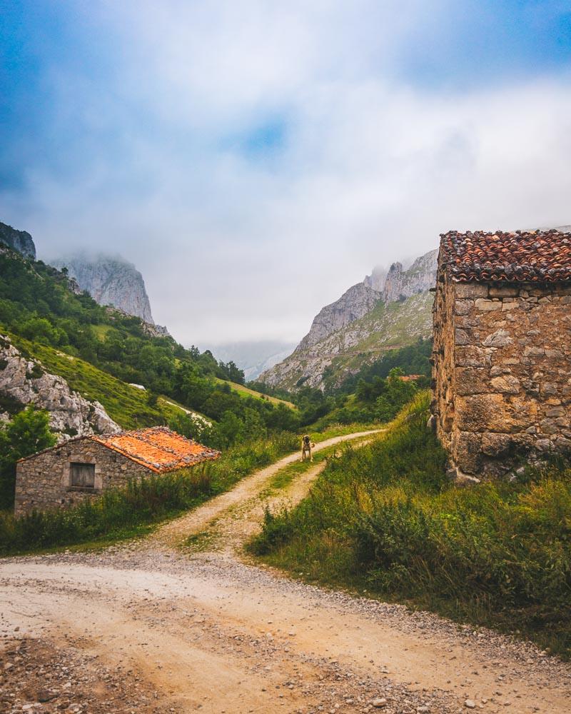
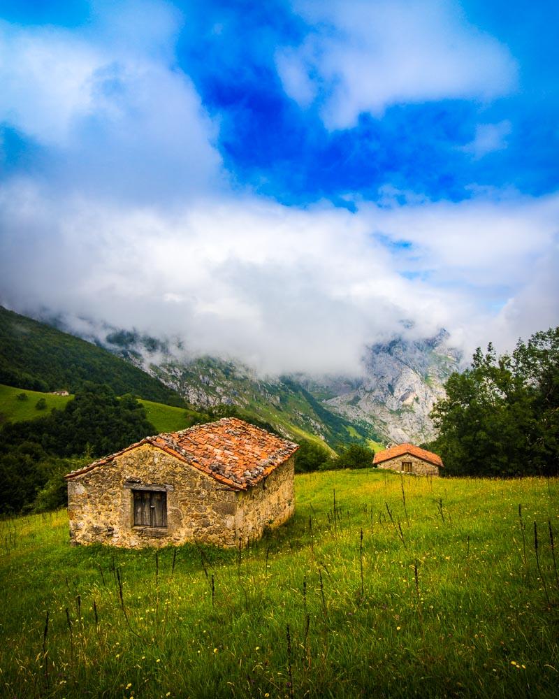
Sotres is the highest village in Picos de Europa and even though it’s a nice village, the most interesting part of the hike to Sotres is the hike itself – you’ll get jaw-dropping views of Bulnes behind you as you climb up, go through flower fields with beautiful stone houses, and you’ll probably see a lot of animals.
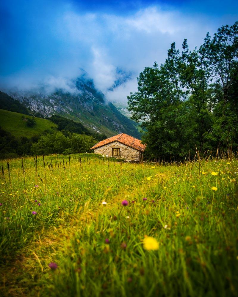
Once you’ll reach Sotres, take the time to explore the colorful little village, and have a taste of the local sidra (cider) before hiking back to Bulnes.
Here’s the profil of the hike:
Hike Bulnes to Sotres
📏 Distance: 9.5km / 6 miles
↗️ Uphill: 700m / 2,300 feet
↘️ Downhill: 350m / 1,150 feet
💪 Difficulty: medium
You’ll find below the map of the hike:
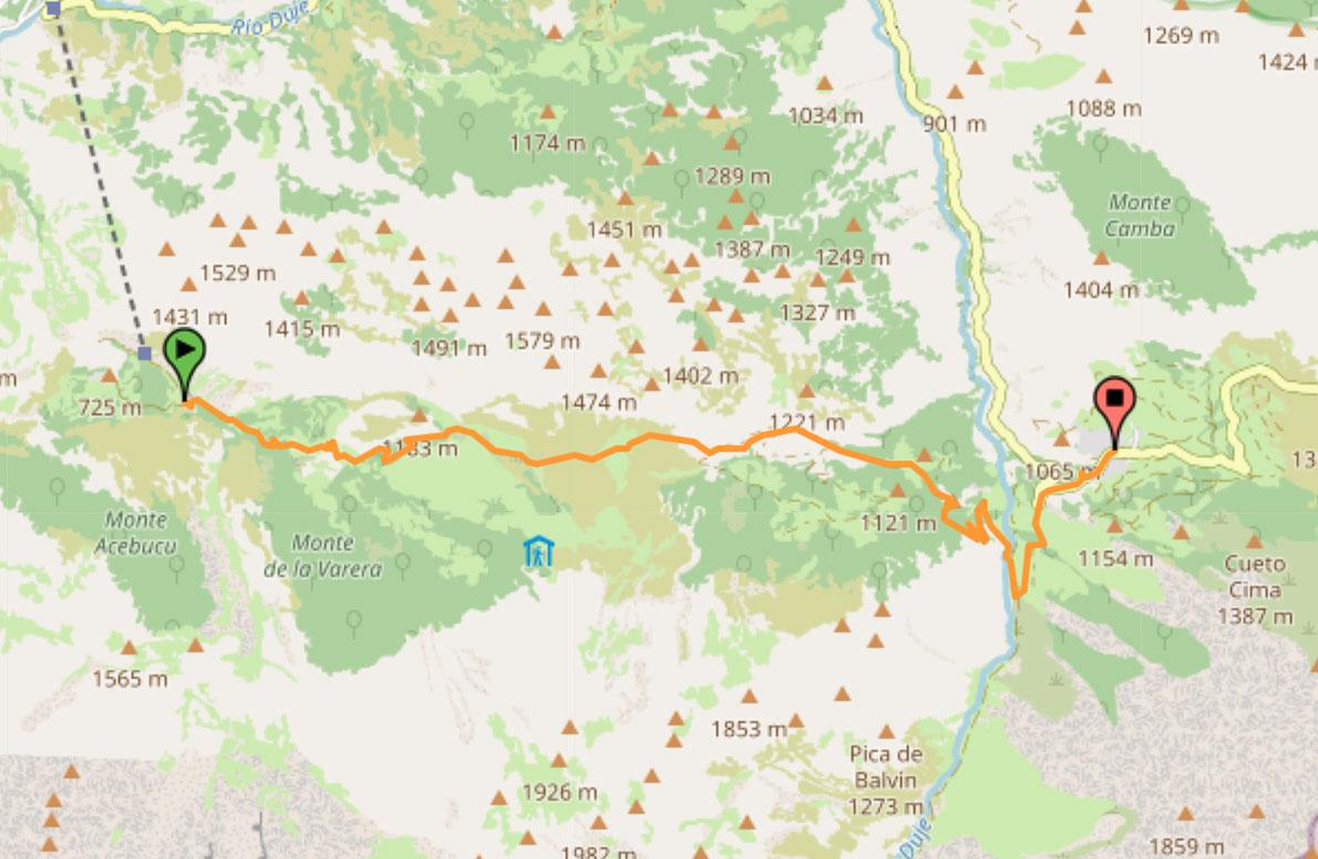
You can download the GPX file by clicking on the image above if you want to use in your GPS app/smartwatch.
P.S. the route I took was slightly different, I got out on the open at the first mountain hut instead of going straight in the forest; this a longer hike but it will take you to the Refugio de la Tenerosa (and you’ll get epic views)
Full Guide: BULNES TO SOTRES HIKE
3- Full Circuit Poncebos – Bulnes – Sotres – Tielve – Poncebos
Ready for a tougher hike? Then you’ll love the Full Circuit Hike from Poncebos to Bulnes, Sotres, Tielve and back to Poncebos.
This day hike is only for the experienced hikers, but it’s definitely a must-do in Picos de Europa. It will take you through the first 2 hikes above, and you’ll keep on going to Tielve on the Roman road before finally reaching Poncebos at the end of the day.
This is one of the best hikes to do to discover all that the Parque Nacional de los Picos de Europa has to offer; you’ll see all kind of different landscapes, from rocky terrain to forests and flower fields, from flowing river to abandoned villages, and of course epic views all along.
Here’s the profil of the hike:
Full Circuit from Poncebos
📏 Distance: 24.5km / 15.2 miles
↗️ Uphill: 1,560m / 5,120 feet
↘️ Downhill: 1,560m / 5,120 feet
💪 Difficulty: medium
You’ll find below the map of the hike:
You can download the GPX file by clicking on the image above if you want to use in your GPS app/smartwatch.
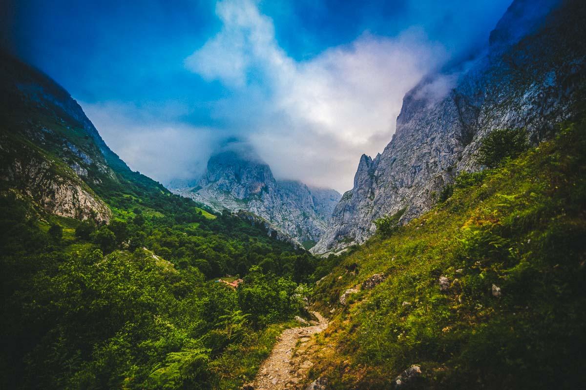
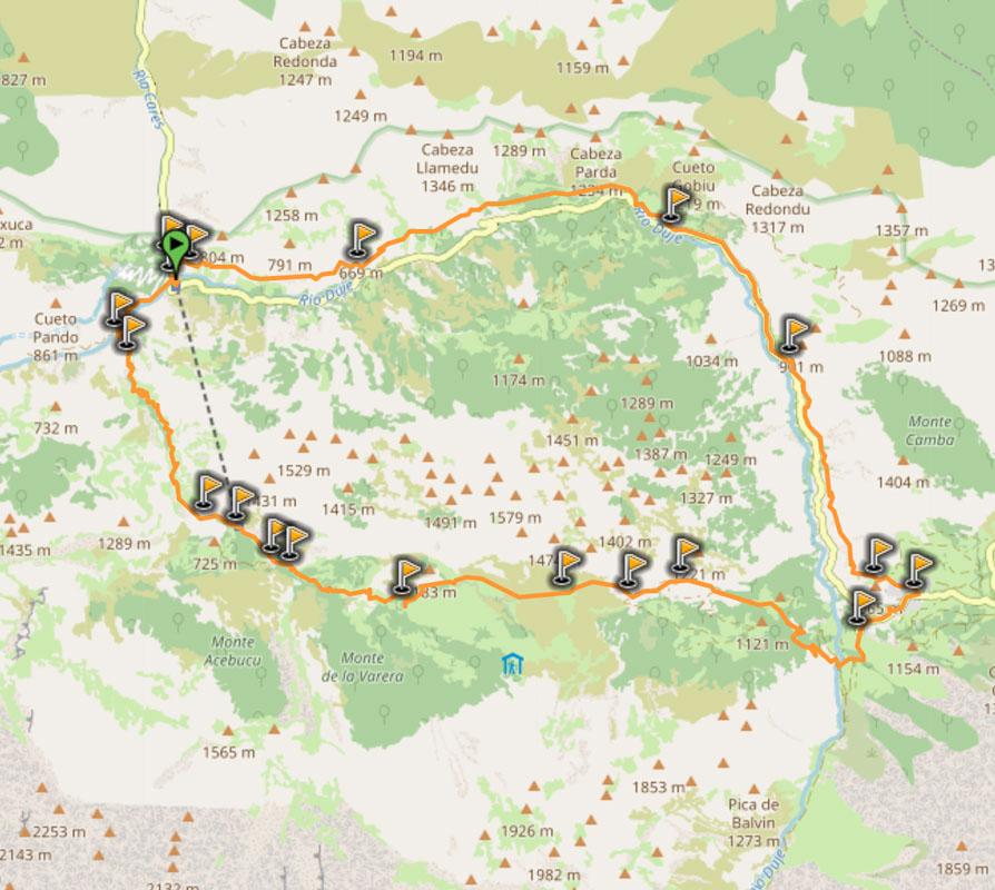
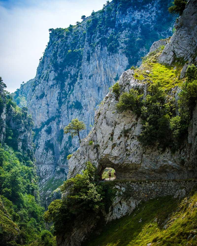
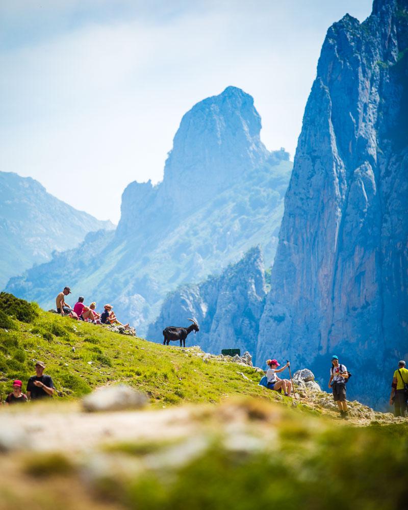
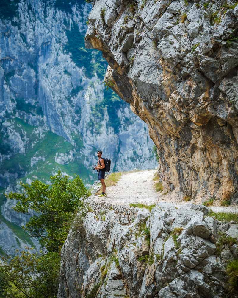
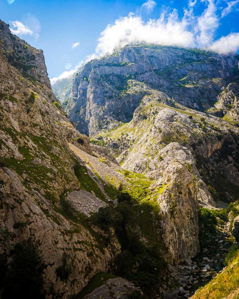
4- Ruta del Cares
If you ask me what was my favorite hike in Picos de Europa, the answer is: the Ruta del Cares.
Why? It’s a hiking trail carved directly on the side of the mountain, with jagged cliffs, populated by friendly mountain goats, and offering absolutely grand views during the whole hike.
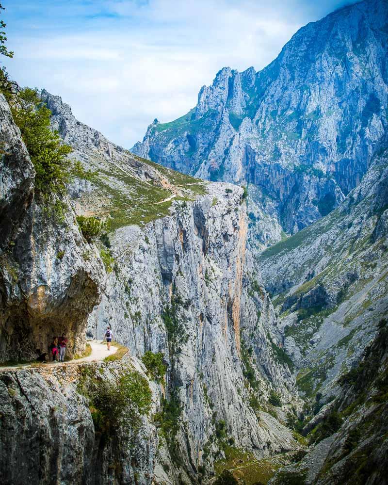
The hike goes from Poncebos to Cain, and the whole return trip takes about 8 hours including breaks. It’s a day-hike, but it’s a loop, which means you can walk only a part of it then turn back if you’re not feeling like doing the full hike.
If you have only one day to spend in los Picos de Europa, this is the hike I recommend doing. It’s one of the most epic rutas Picos de Europa has to offer.
Here’s the profil of the hike:
Hike Ruta del Cares
📏 Distance: 24.3km / 15 miles
↗️ Uphill: 504m / 1,650 feet
↘️ Downhill: 504m / 1,650 feet
💪 Difficulty: medium
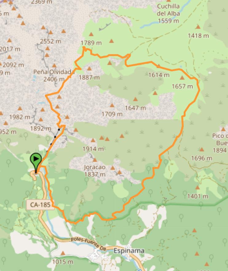
You’ll find below the map of the hike:
You can download the GPX file by clicking on the image above if you want to use in your GPS app/smartwatch.
Full Guide: RUTA DEL CARES
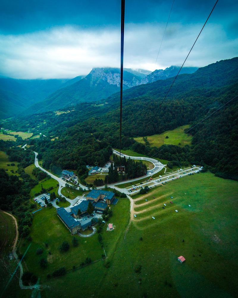
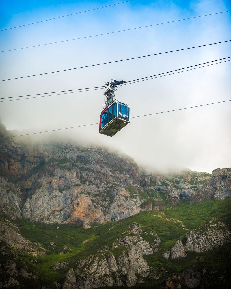
5- Ruta Puertos de Aliva in Fuente Dé
Let’s move to the southern part of the Picos de Europa, in Cantabria. We’re going in Fuente Dé, famous for its funicular.
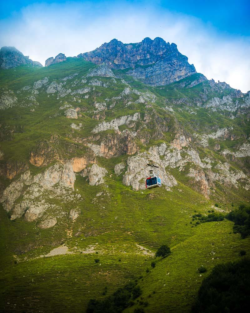
The first part of the hike is pretty fun (and it’s not really hiking): we’re taking the funicular all the way up to 1,823 meters high (6,000 feet).
From up there, the hike begins. The Ruta Puertos de Aliva will take you to the Refugio de Aliva, and then all the way back down to Fuente Dé. It’s a nice hike to do because all the hard climbing is done with the funicular, and you get to enjoy the nice stroll down with epic views of the valley.
Here’s the profil of the hike:
Hike Ruta Puertos de Aliva
📏 Distance: 14km / 8.7 miles
↗️ Uphill: 0m / 0 feet
↘️ Downhill: 933m / 3,060 feet
💪 Difficulty: medium
You’ll find below the map of the hike:
You can download the GPX file by clicking on the image above if you want to use in your GPS app/smartwatch.
Full Guide: TELEFERICO FUENTE DE
6- Horcados Rojos Summit
The Horcados Rojos Summit hike is also in Fuente Dé. It’s a tougher hike than the Ruta Puertos de Aliva, and will take you all the way up the Torre de los Horcados Rojos, one of the most famous mountain peak in Picos de Europa, and also one of the most climbed -if not the most climbed.
To get to the start of the hike, you’ll need to take the funicular up the mountains (you can also climb to the top, but that will add 4 hours to the overall time).
Once you’re up there, you’ll climb all the way to the Summit on a well-maintained trail. The last part to the summit itself is a bit tricky, with a lot of loose rocks, so you’ll definitely need a bit of experience to reach the top.
After the summit, you’ll hike back to the cable car & ride it to get down to Fuente Dé.
Here’s the profil of the hike:
Hike Loop to Horcados Rojos
📏 Distance: 10.3km / 6.4 miles
↗️ Uphill: 568m / 1,860 feet
↘️ Downhill: 568m / 1,860 feet
💪 Difficulty: medium
You’ll find below the map of the hike:
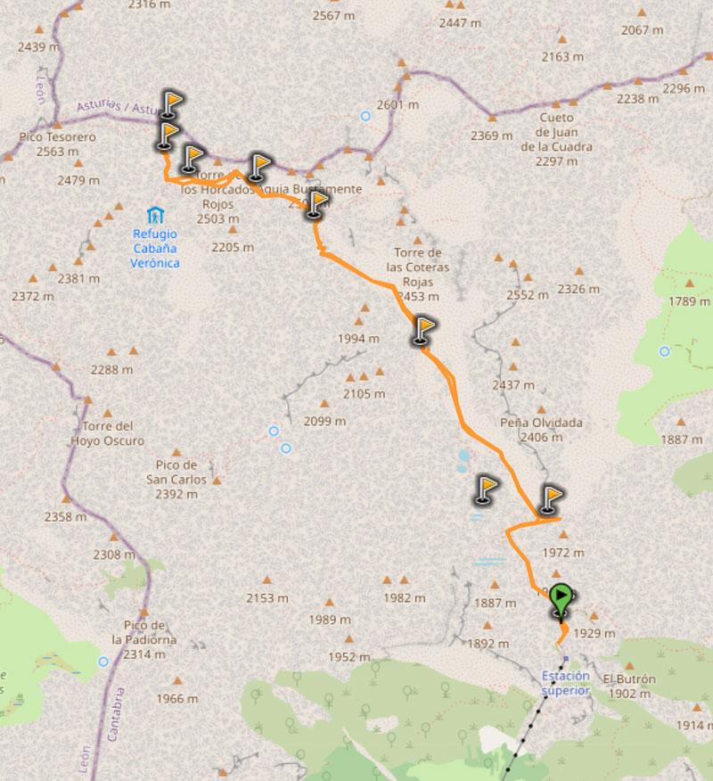
You can download the GPX file by clicking on the image above if you want to use in your GPS app/smartwatch.
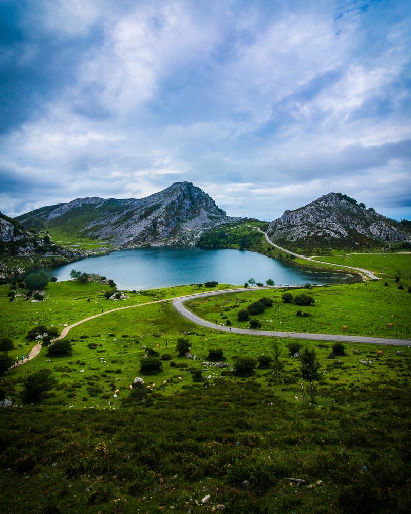
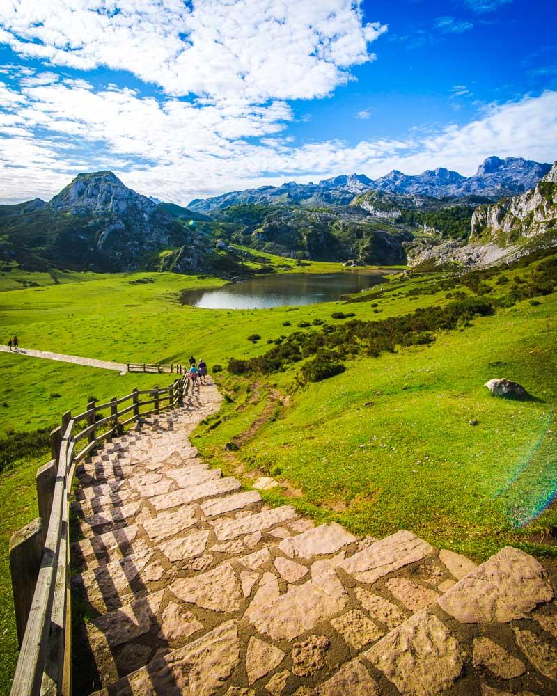
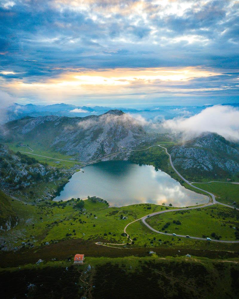
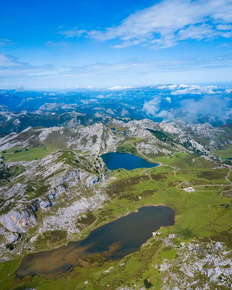
7- Lagos de Covadonga Hike
The Lagos de Covadonga are my favorite spot in the Picos de Europa. So no wonder that the Lagos de Covadonga hike is among this list of the best Picos de Europa hiking spots. I’ll even go as far as saying that it’s one of the best hikes in Spain.
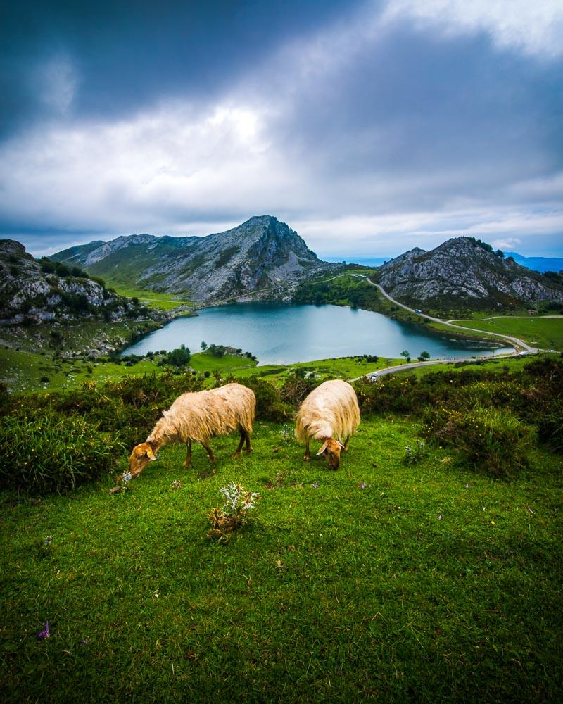
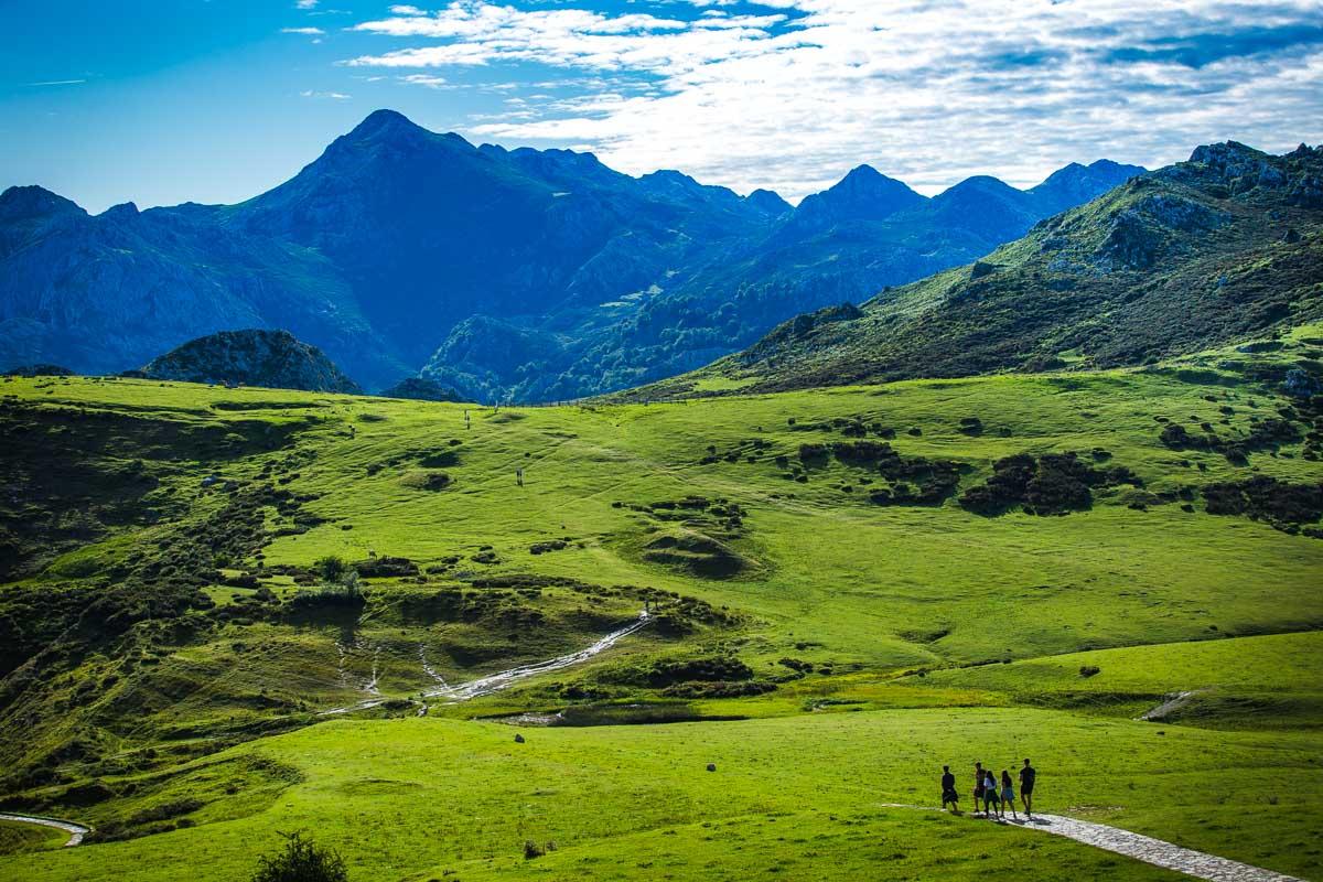
The hike starts with a climb to the Mirador de Entrelagos, where you’ll see both lakes (Lago de Enol & Lago de la Ercina) from above. It’s the only real climb in the hike, and trust me it’s worth it for the view you’ll get.
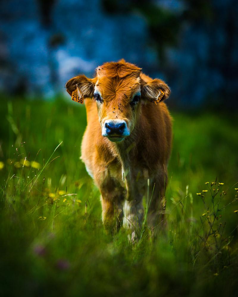
After that, it’s a gentle stroll around both lakes, to discover more of the area, and go behind the mountains where you’ll be away from the crowds & see a lot of animals (cows, sheeps, goats and horses).
Here’s the profil of the hike:
Hike Ruta Lagos de Covadonga
📏 Distance: 7.2km / 4.5 miles
↗️ Uphill: 210m / 688 feet
↘️ Downhill: 210m / 688 feet
💪 Difficulty: easy
You’ll find below the map of the hike:
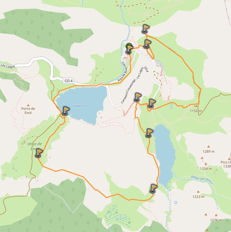
You can download the GPX file by clicking on the image above if you want to use in your GPS app/smartwatch.
Full Guide: LOS LAGOS DE COVADONGA
8- Vega de Ario
The Vega de Ario hike starts from the Lagos de Covadonga. It goes to the mountain refuge Refugio Vega de Ario and back to Lago Ercina, one of the two Covadonga lakes.
It’s a longer hike than the regular hike around the lakes, and it’s a good option if you want to spend the full day out in nature. You can start your day by exploring the lakes, then taking on the Vega de Ario hike, and you’ll be back at the lakes for sunset. Then you can hike at night around the area to experience it in a different way.
Here’s the profil of the hike:
Hike Vega de Ario
📏 Distance: 14.7km / 9.1 miles
↗️ Uphill: 654m / 2,150 feet
↘️ Downhill: 654m / 2,150 feet
💪 Difficulty: medium
You’ll find below the map of the hike:
You can download the GPX file by clicking on the image above if you want to use in your GPS app/smartwatch.
Check out the Mirador de la Reina before the hike
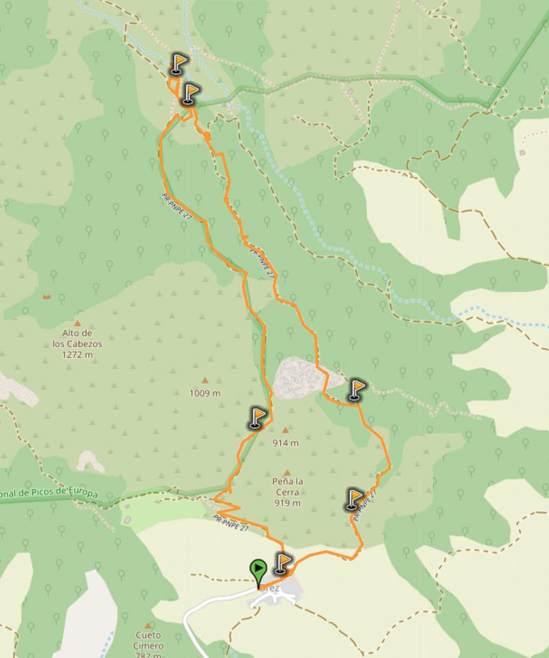
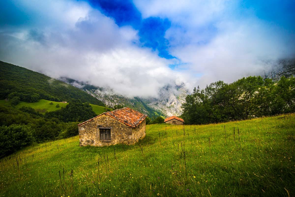
9- Brez Canal de Arredondas
If you’re looking to go on walking holidays in Spain with your kids, then the Brez – Canal de Arredondas hike is the perfect hike for you.
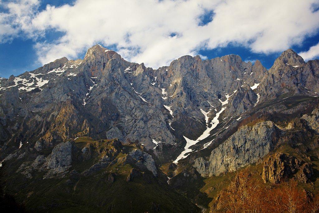
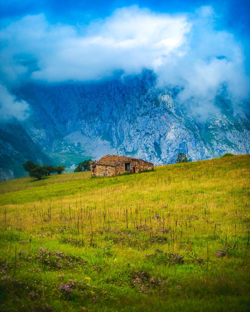
The hike starts from the town of Brez in Cantabria, and goes alongside the canal de las Arredondas. All along the hike you’ll have absolutely magnificent views over the eastern massif of Picos de Europa, just like you see in the image above.
It’s a very easy hike, with almost no elevation, making it a perfect choice for walking in Picos de Europa with kids.
Here’s the profil of the hike:
Hike Brez – Canal de las Arredondas
📏 Distance: 7km / 4.4 miles
↗️ Uphill: 315m / 1,034 feet
↘️ Downhill: 315m / 1,034 feet
💪 Difficulty: easy
You’ll find below the map of the hike:
You can download the GPX file by clicking on the image above if you want to use in your GPS app/smartwatch.
10- Ordiales Scenic Balcony Trail
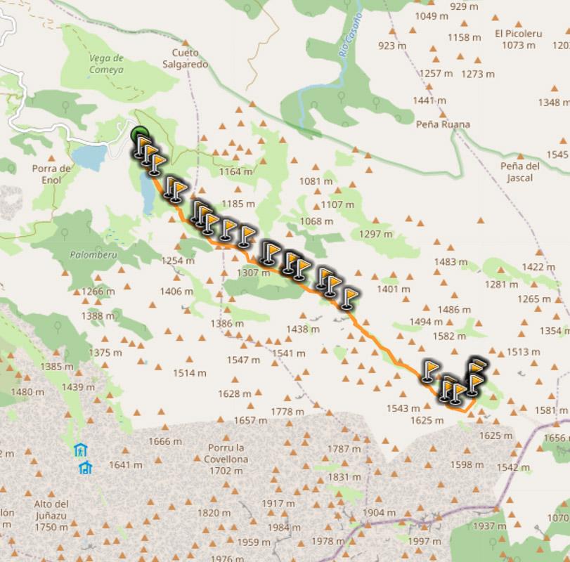
The last hike on this list of best spot to hike Picos de Europa is the Ordiales Scenic Balcony Trail, a famous walk in Spain. It’s a long day-hike that starts from the Covadonga Lakes, and climbs all the way up to the Mirador de Ordiales.
This trek goes high, and you might have snow all around if you go in the colder months. You’ll walk up the refugio Vegarredonda, where you can spend a night and make it a 2-day trail.
At the end of the hiking path you’ll reach the Mirador de Ordiales, where you’ll have an incredible view over the valley. It’s also a very history-rich place: it holds the tomb of Pedro Pidal, Marquis de Villaviciosa, responsible for the creation of the Picos de Europa National Park.
Here’s the profil of the hike:
Hike Ordiales Scenic Balcony Trail
📏 Distance: 20.3km / 12.6 miles
↗️ Uphill: 1,085m / 3,5600 feet
↘️ Downhill: 1,085m / 3,5600 feet
💪 Difficulty: medium
You’ll find below the map of the hike:
You can download the GPX file by clicking on the image above if you want to use in your GPS app/smartwatch.
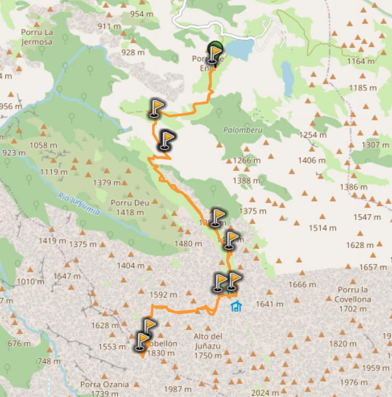
The Ultimate Hike – Anillo Picos de Europa
Ready to take your hiking game to the next level? The Anillo Picos de Europa is the ultimate route for hiking Picos de Europa, but be warned it is not for the faint-hearted.
What is “El Anillo de Picos”? It’s a massive hike going all over the Picos de Europa national park over a period of 9 days, with stops in 9 of the mountain refuges.
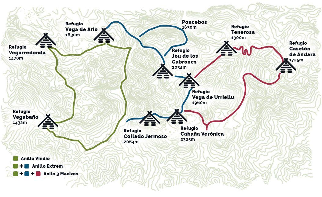
Ultimate hike in Picos de Europa – map from https://elanillodepicos.com/home/
You have several options to hike the Anillo: 3 different levels by combining the green part, the green+blue, and green+blue+red.
Alternatively, you can also do each color on its own (green, blue or red).
Anillo Vindio
The first option is the hike in the western massive, named Anillo Vindio. It’s the easiest option, but still remains a good challenge.
Western Massive / Anillo Vindio
📏 Distance: 63km / 39 miles
↗️ Elevation: 3,900m / 12,800 feet
💪 Difficulty: medium
You’ll find below the map of the hike:
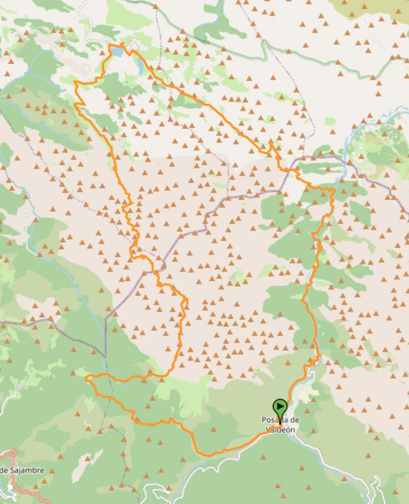
You can download the GPX file by clicking on the image above if you want to use in your GPS app/smartwatch.
Anillo Extrem
The second option is the Anillo Extrem, combining the green & blue parts. You will hike in the western massive and the central massive of Picos de Europa.
Anillo Extrem
📏 Distance: 82km / 51 miles
↗️ Elevation: 7,050m / 23,130 feet
💪 Difficulty: high
You’ll find below the map of the hike:
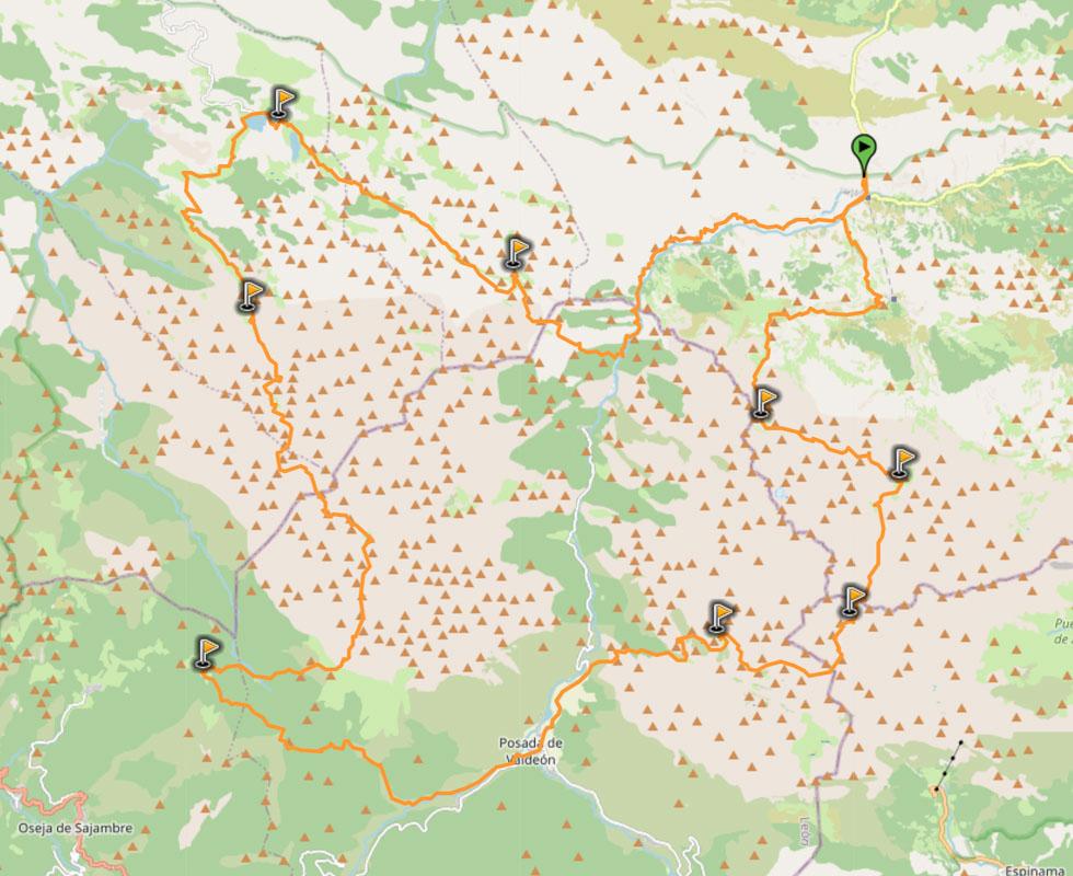
You can download the GPX file by clicking on the image above if you want to use in your GPS app/smartwatch.
Anillo 3 Macizos
And finally the last option is the Anillo 3 Macizos, combining the green, blue & red parts. You will experience all parts of Picos de Europa, the western, central and eastern massives. It’s the most challenging hike, and shouldn’t be attempted without any prior experience.
Anillo 3 Macizos
📏 Distance: 110km / 68 miles
↗️ Elevation: 9,350m / 30,675 feet
💪 Difficulty: Very high
You’ll find below the map of the hike:
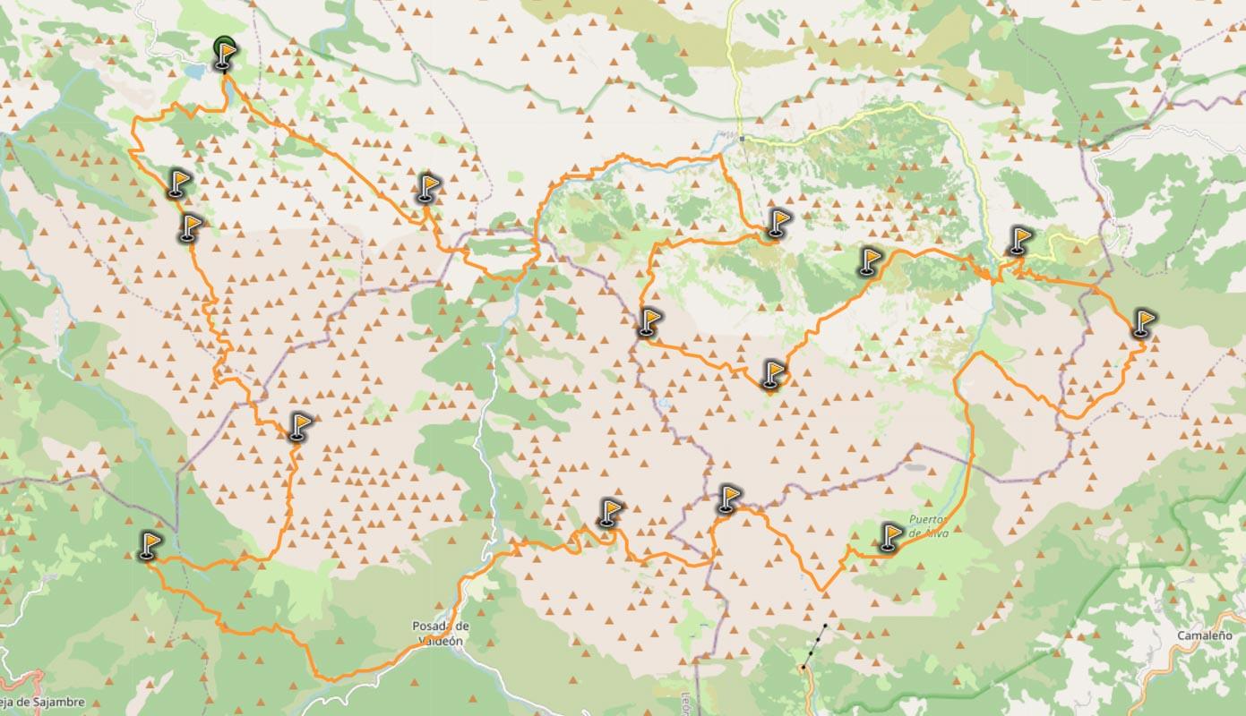
You can download the GPX file by clicking on the image above if you want to use in your GPS app/smartwatch.
You will need to book nights in the different mountain refuges in order to complete these multi days hikes. Scroll down below to see the list of all the mountain refuges with the contact info, and how to book a night!
The Complete List of All the Hikes in Picos de Europa
Well I guess I couldn’t title this guide “The Ultimate Guide for Hiking in Picos de Europa Asturias” without having the full list of all the hikes in the national park.
In Picos de Europa, there are 34 short walks (PR) and 2 long walks (GR).
I’ve listed in the table below all of the walks in Picos de Europa with the distance, the duration, the elevation change & the difficulty.
| # | | ? | ⏱ | ↗️↘️ | ? |
| 1 | Route of Frassinelli | 15.1km | 3h30 | 970m | medium |
| 2 | Lakes of Covadonga | 5km | 2h30 | 50m | low |
| 3 | Cares Gorge | 21km | 5h30 | 740m | medium |
| 4 | Vega de Ario | 7.6km | 3h30 | 610m | medium high |
| 5 | Buferrera – Ordiales | 10.2km | 3h30 | 640m | medium high |
| 6 | Vega de Orandi | 4.3km | 2h30 | 430m | low |
| 7 | La Jocica – Carombo | 17.5km | 6h | 550m | medium |
| 8 | Demués – Los Lagos | 10.1km | 3h30 | 700m | medium |
| 9 | Soto de Sajambre – Vegabaño | 9.8km | 3h | 390m | medium |
| 10 | Pueblos de Sajambre | 13.8km | 4h30 | 600m | low |
| 11 | Panderruedas – Posada del Valdeón | 13.5km | 4h | 511m | low |
| 12 | Vega de Llos | 12km | 5h | 596m | medium |
| 13 | Cueva de Santibañas | 4.3km | 2h30 | 500m | low |
| 14 | Montó | 4.3km | 2h30 | 500m | low |
| 15 | Senda del Mercadillo | 15km | 5h30 | 832m | medium high |
| 16 | Collado Jermoso | 4.2km | 4h | 1214m | high |
| 17 | Entorno de Tresviso | 2.9km | 1h30 | 330m | low |
| 18 | Jou de los Cabrones | 5.5km | 5h | 1430m | high |
| 19 | Canal de Camburero | 4.3km | 4h30 | 1300m | high |
| 20 | Monte Camba | 14.1km | 5h | 530m | medium |
| 21 | Vega de Urriellu | 8.6km | 4h30 | 1070m | high |
| 22 | Peña Oviedo | 10km | 3h | 700m | low |
| 23 | Horcados Rojos | 11km | 4h30 | 510m | medium high |
| 24 | Puertos de Áliva | 13.3km | 5h | 970m | medium |
| 25 | Vega de Liordes | 11km | 5h30 | 970m | high |
| 26 | Hayedo de Las Ilces | 10.2km | 4h30 | 300m | low |
| 27 | Brez – Canal de Arredondas | 5.4km | 2h | 220m | low |
| 28 | Macizo de Ándara | 25km | 7h30 | 1110m | medium |
| 29 | Pasá del Picayo | 6.7km | 4h | 730m | high |
| 30 | Urdón – Tresviso | 13.6km | 5h | 830m | high |
| 31 | Camarmeña | 2km | 1h30 | 200m | low |
| 32 | Pandetrave – Collado Jermoso | 11.9km | 6h30 | 800m | high |
| 33 | Panderruedas – Oseja de Sajambre | 6.4km | 2h | 708m | low |
| 34 | Oceño – San Esteban de Cuñaba | 11.2km | 5h | 990m | medium high |
| 201 | Senda del Arcediano | 27.5km | 9h30 | 900m | medium high |
| 202 | Ruta de la Reconquista | 58.6km | 20h30 | 1050m | high |
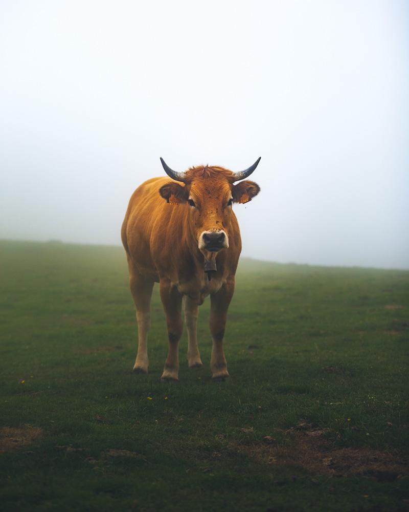
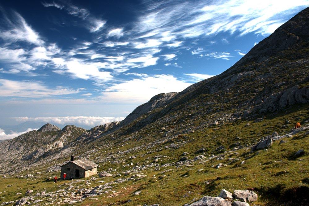
Mountain Refuges – Refugios Picos de Europa
If you’re planning trekking Picos de Europa, you’re probably considering longer hikes, that take several days to complete. For these kind of hikes, a good option is to stay in a mountain refuge for the night.
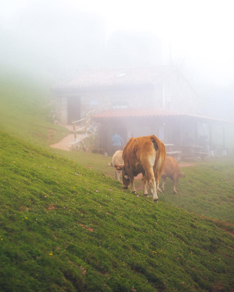
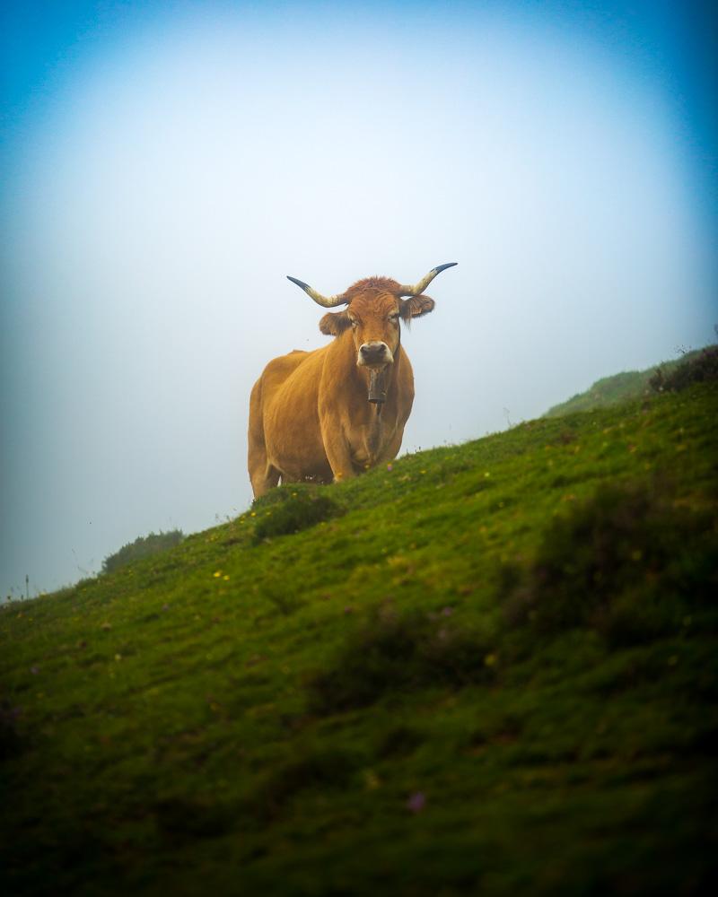
Cows in the mist in front of the Refugio de la Tenerosa
Even if you don’t spend a night there, there are a great place to stop & enjoy a warm meal or hot beverage.
I’ve listed below all of the refuges, with their contact information.
Refugios Picos de Europa:
- Albergue Pena Castil
- Andara
- Cabana de Pastores
- El Redondo
- Hou los Cabrones
- Refugio Aliva
- Refugio Collado Jermoso
- Refugio Urriellu
- Refugio Vegabano
- Terenosa
- Vega de Ario
- Vegarredonda
Albergue Pena Castil
Location: in Sotres
Open: all year
Contact: (+34) 985 945 040
Andara
Location: above Sotres
Open: all year
Contact: (+34) 985 846 487
Cabana de Pastores
Location: Covadonga Lakes
Open: only in summer
Contact: (+34) 985 849 261
El Redondo
Location: in Fuente Dé
Open: all year
Contact: (+34) 942 736 699
Hou los Cabrones
Location: near Torrecerredo
Open: from May to October
Contact: (+34) 650 780 381
Refugio Aliva
Location: in Fuente Dé
Open: from May to September
Contact: (+34) 942 730 999
Refugio Collado Jermoso
Location: near Torre Palanca
Open: from May to October
Contact: (+34) 616 904 353
Refugio Vega de Urriellu
Location: near Naranjo de Bulnes
Open: all year
Contact: (+34) 985 925 200
Refugio de Vegabaño
Location: above Soto de Sajambre
Open: from March to January
Contact: (+34) 699 633 244
Terenosa
Location: above Bulnes
Open: from May to October
Contact: (+34) 985 252 362
Vega de Ario
Location: near Covadonga Lakes
Open: from May to October
Contact: (+34) 639 812 069
Refugio de Vegarredonda
Location: near the Mirador de Ordiales
Open: from March to October
Contact: (+34) 985 929 952
So there you have them, the refuges in Picos de Europa, Spain.
If you plan to stay in a refuge, make sure to book in advance as they all have limited number of beds, and they get booked pretty quickly.
You also need to bring your own sleeping bag – some refuges have blankets or sleeping bags, but not all, hence it’s strongly recommended that you bring your own.
Average Price per night: 10€
Breakfast: 5€
Lunch & Dinner: 14€
Book here: Book Refugio Picos de Europa
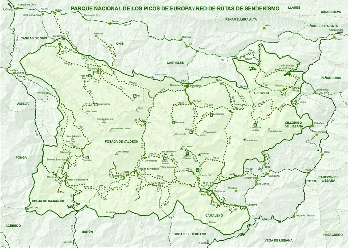
Map of Picos de Europa Asturias
In the “best hikes” part above, I gave you a lot of maps of hike to download for free. But sometimes, technology can fail us, and it’s good to have a proper paper map when this happens.
The best option is to buy an actual map of Picos de Europa online or at the tourism office.
No time for that?
You’ll find below a Picos de Europe hiking map that you can print out & take with you on your trip!
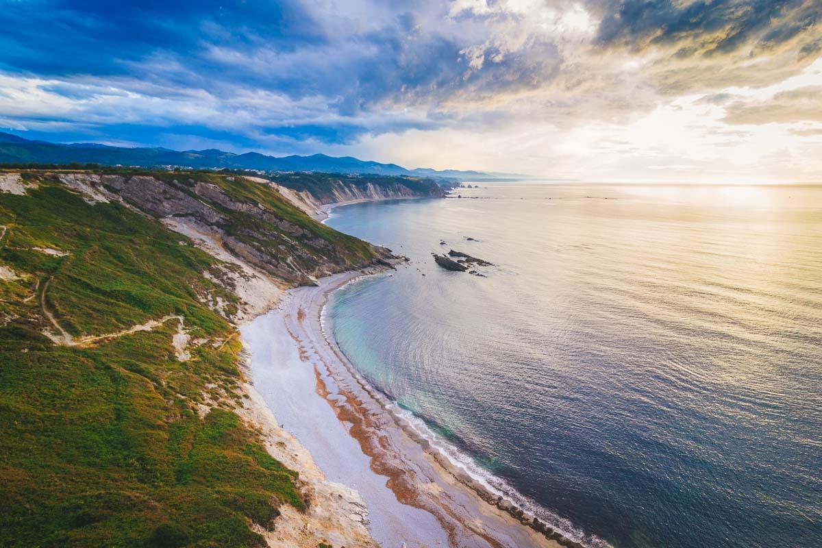
How is the Weather in Picos de Europa?
Picos de Europa is located very close to the sea (yes, there are amazing beaches in Asturias!). Due to that, there are 2 climates in the park: continental & maritime. What does this mean? Well, that means that you should expect sudden changes in weather, and pack accordingly.
You’ll see below what to expect for the weather in Picos de Europa based on the different seasons you’re planning to go there.
Spring
Average Temperature: 18°C / 65°F
The weather is usually sunny in spring, but the weather will change quickly and bring a lot of rain.
You will find snow in the high altitude of the park until the end of June.
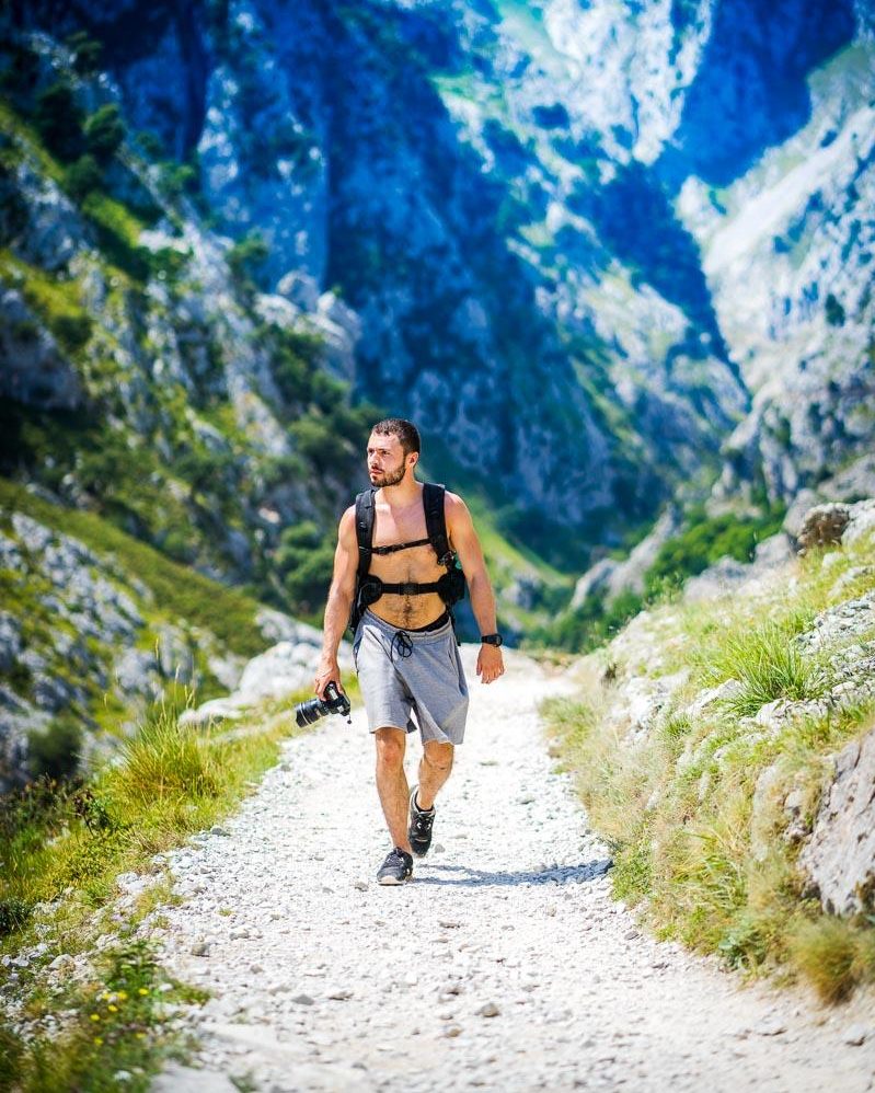
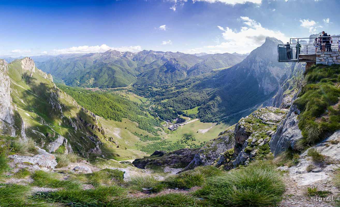
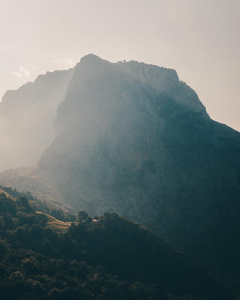
Summer
Average Temperature: 27°C / 81°F
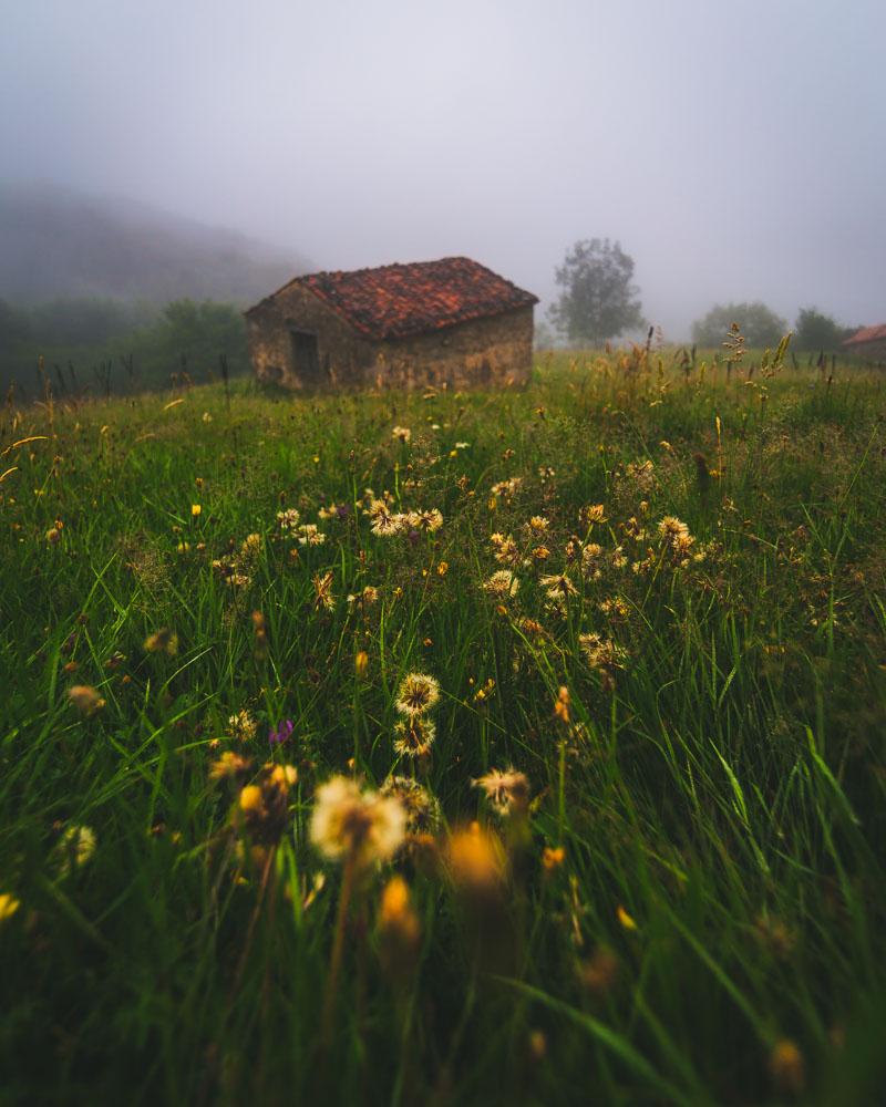
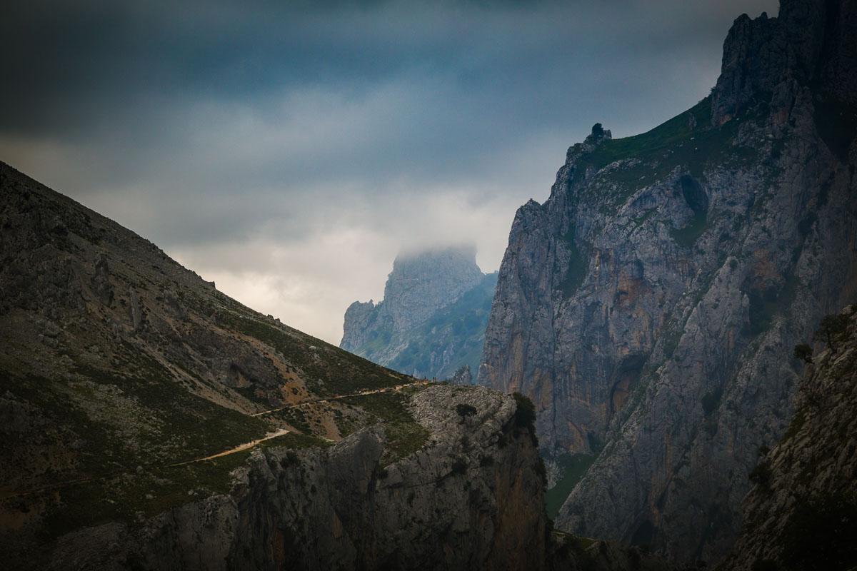
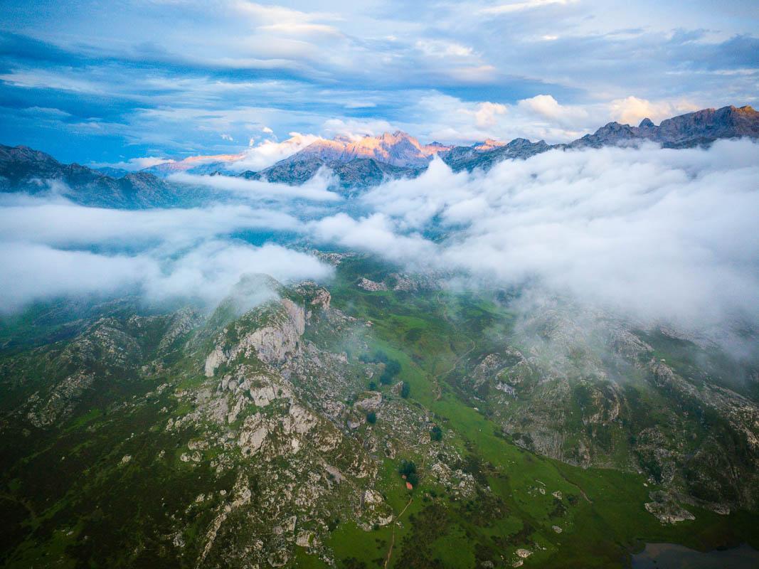
Warm & sunny days are the norm in summer, but the weather often changes during the afternoon and it gets a bit colder with the mist.
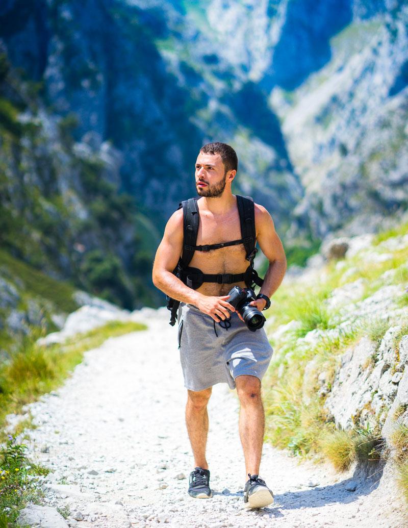
That’s me enjoying the summer in Picos de Europa
Fall
Average Temperature: 12°C / 53°F
The temperature drops in fall, and you’ll have regular rain showers. Snow also starts to fall from the end of September.
Winter
Average Temperature: 5°C / 41°F
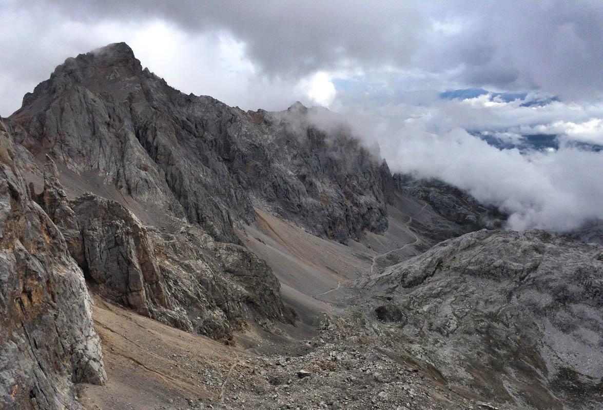
The Picos de Europa weather in winter is the regular mountain winter, cold & with snow.
Make sure to check the snow forecast before heading out: snow forecast Picos de Europa
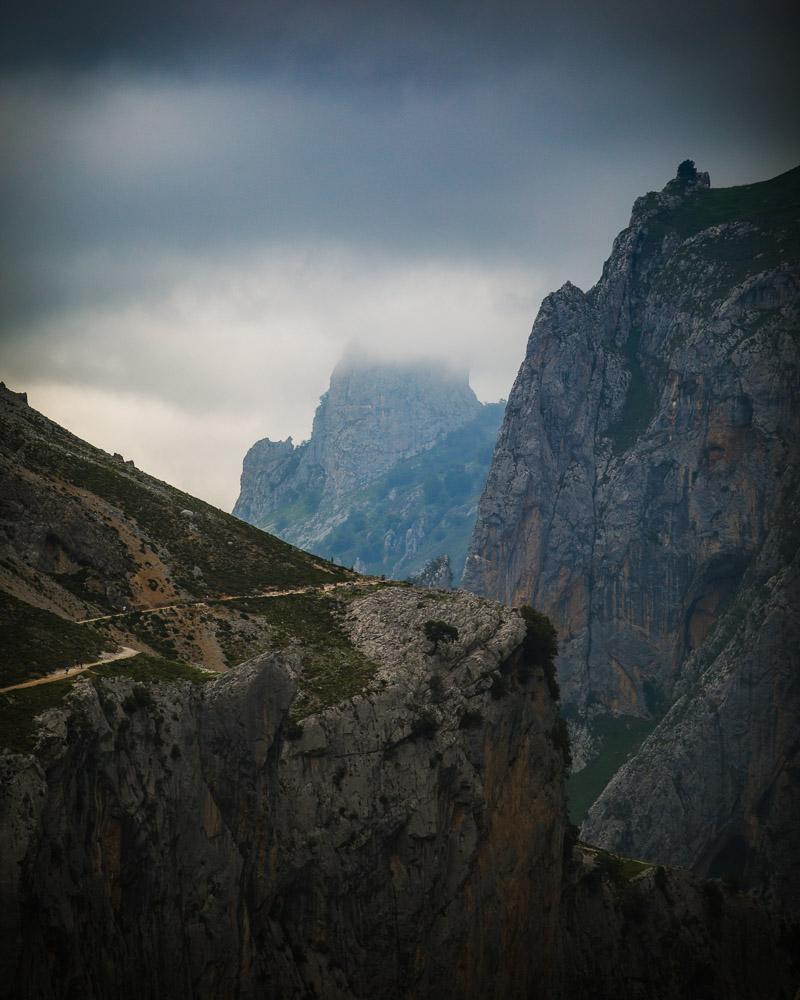
The same place as the photo above, just a few hours after
Check live weather forecast for Picos de Europa here: Weather Picos de Europa
One of the good ways to check the weather & the conditions in the park is to check on one of the many webcams in the park. This way you’ll know exactly how it looks like at this exact moment! Click here to see: Webcam Picos de Europa
Tips for Your Trip to the Parque Nacional Picos de Europa
Ready to discover Picos de Europa? Here are a few tips for you so you make the most out of your time in this beautiful part of Spain:
- Make sure to pack at least 1.5L of water & snacks for the day. Also, try to pack light so you can move easily when hiking.
- Download the area of Picos de Europa in your offline google maps before going, so that you’ll have a map even with no cell network
- Download the hiking routes given above to always be on the right path
- There is often a lot of mist in the mountains, and it can be hard to find your way; if you’re not sure where to go, look for hiking route marks on the rocks or signs. If you don’t find any, try to wait a bit to see if the mist rises
- If you go hiking alone, always warn someone beforehand – tell people in the refuge, leave a sign in your car or tell your plans to your family
- in summer, pack a jacket because mist often rolls in during the afternoon and brings cold air
- in spring & fall, pack a rain jacket in prevision for the rain showers
- in winter, bring reliable snow-hiking boots
- most animals in the park are very friendly, but they remain wild animals; don’t disturb them
- it’s forbidden to swim in the lakes & rivers of the park outside of the designated swimming areas
- please collect your garbage with you and don’t throw it out in nature
Visit Spain
Planning a trip to Asturias and Spain? You can find below several other articles about this wonderful part of the world to help you plan your trip.
Asturias Guides:
Discover another gem of Asturias: Somiedo Natural Park
See all the BEST things to do in Asturias
Looking for a stunning beach? Check out the Playa del Silencio
Spain Guides:
Discover the 27 Best Things to do in Toledo, next to Madrid
In love with castles? Here are the 36 Best Castles in Spain!
Go from Madrid to Segovia on an amazing day trip
I hope you enjoy your trip to Asturias and to Spain!
If you have any questions, let me know in the comments below, I always reply.
Travel Tools
Use any of our recommended links below to book your trip. You pay the same, and we earn a small fee; a great way to support us!

Pin this to Pinterest!
Enjoyed this guide? Then help a fellow traveler and pin it! They'll most definitely love you for it, 100% guarantee.

Hi Kevin, thanks for your guides to the Asturias region, they’ve been very helpful in organizing my own trip this summer! 🙂
Hey Kevin!
A friend and I are planning a hiking trip around the Picos in April this year. Have read your article and it’s the most in depth and helpful of anything I’ve found – thank you SO much! We have a few questions and would love your advice on…
1) how far in advance do you have to book the refuge huts?
2) is wild camping permitted in the Picos?
3) ideally we would like to do a 4-5 day hike from hut to hut. We’re fit and often walk long distances eg. 25-30km a days or 20km if 1500m+ so 7-8hrs of hiking. What route / huts would you recommend for this kind of trip? Or would you suggest taking a car and hiking for two days e.g around Poncebos and then driving over to Cadavonga to do another two day hike?
Thanks so much in advance!
I’m interested in doing something similar (multi-day hike, 4 days) too
Hey Kevin,
This year we have plans to do a 3 day hut to hut hiking in the Picos with our 2 girls (9 and 12 years old). Since you have a lot of knowledge of the area I was wondering if you could give us some advice. We would like to start in Cavadongo on the first day and hike to refugio Vegarredonda. On the second day we thought it would be nice to go to the refugio Vega de Ario. And from there one go back to Cavadongo again. Unfortunately I cannot find a lot of information if this hike is suitable for kids (e.g. not too steep).
Many thanks in advance!! Your advice is highly appreciated 😊
Warm-regards,
Christel
Hello, I happened to see your comment, and I wanted to please ask, we are also planning to travel this year with 2 children aged 12 and 9. Do you have any recommendations? What routes did you do in the end? I would appreciate information about routes you have taken, and where you got more information about the difficulty of the route (my children are doing well, but I want to verify all the details before and what is possible, etc.). I would be very happy if you could contact me by email, thanks in advance, Dorit doritfink@gmail.com
Hi Kevin – I’m curious if you know the regulations regarding backcountry camping in the park. I’m more inclined to want to backpack and sleep away from the refuges. Any info you might have would be appreciated.
Hi Gwen – did you end up doing this trip? We’re in the same boat as you – trip in late April, trying to pitch a camp rather than stay in a refugio. Let me know if you have any intel. Thanks!
Hi,
The following link provides more information on the regulations around camping and many other things:
https://parquenacionalpicoseuropa.es/english/plan-your-visit/
Hello!
I’m wondering how to get to the trail heads without a car. Are there buses? If I could only get to one trail head which one would you recommend?
Hello Allee!
Yes there are buses, but not to everywhere (but way more in summer than other seasons). You can check quickly on Google, or ask the locals (at your hotel, hostel, …).
You could also get a taxi from/to your hotel.
If you could only do one I’d recommend Covadonga Lakes! Really easy to hike around, plenty to see, perfect for a full day.
Hi Kevin,
Thank you for this list of hikes! I visited Picos de Europa for the first time last week, I had no idea where to start, and this guide has been very helpful! Most of the hikes that I did were part of your top 10. Thanks for the gpx files! I just wanted to add a few personal comments about this list:
(1) Hike #4 ruta del cares is indeed a very nice one but my favorite by far is one that is not on your list: Sotres to Refugio de Urriellu (see PR 21; it reaches the foot of Naranjo de Bulnes). It took me 7h30 from/to the center of Sotres, including a 1h lunch break at the refugio but most guidebooks recommend 8h30-9h from Stores (2h30 shorter from Pandebanos). It’s a long climb, but the views are great all along, and they are in my opinion more diverse than Ruta del Cares.
(2) Your hikes #3 (Poncebos – Bulnes – Sotres – Tielve – Poncebos) and #4 (Ruta del cares) are both 24.5 km long, both listed as moderate, but you suggest 7h for #3 and 8h for #4, although #3 has 1500m elevation difference and #4 has only 500m. That didn’t seem logical to me. I did both hikes and #3 took me 8h30 (including breaks) instead of 7h, whereas #4 took a bit less than 7h, with a long lunch break in Cain, instead of the 8h that you mention. So to everyone interested in these hikes: #3 is much harder and longer than Ruta del Cares. It also contains two not-really-pleasant sections: the climb from Poncebos (scrambling on a pile of rocks, trail not always easy to find) and the section between Pandebanos and Bulnes (swampy). This said, I loved Bulnes!
(3) Ruta del Cares is not difficult at all – it’s probably the easiest of the “moderate hikes” listed here. Most of the hike is flat, you can have a relaxed lunch in one of the bars – restaurants of Cain, and it’s really accessible: I saw many families with children doing it. The length is the only “difficulty”.
Finally, the GPS files of all the PR hikes, including PR 21 mentioned above, as well as a general map of the hikes (very useful to select them) are available here: https://parquenacionalpicoseuropa.es/visitas/cartografia-y-tracks/ and https://parquenacionalpicoseuropa.es/wp-content/uploads/2016/03/Rutas-senalizadas.pdf
Ah yes, a comment regarding hostal Poncebos: it is indeed well located near the start of several hikes but I wouldn’t stay there. There is absolutely nothing around (Arenas de Cabrales is about 5 km away), and it’s just next to the hydroelectrical plant – not the nicest place to be. Personally, I would go for Sotres: cute and quiet little village, next to the start of many hikes, great views… only possible issue is that it’s at 1050 m of elevation so it’s in the clouds when the weather is bad.
Hello Seb, thanks for taking the time to write such a thought-out comment, and sorry for the delay to answer!
I’m so glad to know the guide was helpful to plan your Picos de Europa trip, did you load the gpx files in your smartwatch?
Here are my answers on your feedback:
(1) The hike to Refugio de Urriellu definitely seems nice, but seemed a bit tough (haven’t done it). I’ll need to come back and try it for sure.
(2) It’s true that the full circuit hike #3 is a lot harder than #4 Ruta del Cares. While they are the same length, #3 has several tricky parts where #4 is rather easy, only difficulty is indeed the length and the first climb that is pretty steep.
(3) Pretty much goes back to 2nd point, totally agree with you on this one. I’m currently updating my “difficulty” ratings, and creating a page to explain how I rate the hikes. It will be divided in 5 levels of difficulty: easy, moderate, challenging, hard and extreme. Difficulty won’t be affected by the length of the hike, but solely on the terrain, elevation and tricky parts. Based on this new scale, #3 hike will be challenging while #4 will be moderate.
I love Poncebos as a base because you can climb up to Bulnes & Sotres and come back to Poncebos to sleep; then go on Ruta del Cares the next day. But Sotres is definitely a good choice too!
Thanks again for your feedback, it’s very precious; where are you headed next?
Hi Kevin
These guides are amazing! Thanks for all the maps all the details. I’m wondering if you have a suggestion on where to you could leave the car for a couple days… in order to go on it to a couple of the hikes while staying in the refuges, and then ending up back to the car.
Thanks in advance!
oops – go on* a couple hikes
Hey Kelley, glad to know the guide is helpful!
It will depend on where you start the hike; when I was there I just parked the car on the side of the road where other cars were parked, right next to the start of one of the hikes.
I left the car there for 2 days with no issues. As long as you don’t leave anything valuable inside it should be fine (laptop, camera, …)!
I can’t seem to find the gpx file download button. I was looking to download the anillo 3 macizos map. I appreciate it, thank you. 🙂
Hello Nathan, sorry about that!
I’ve fixed the issue, it should be all good now. Thanks for letting me know.
Have a great hike there, and get ready because you’re in for a challenge ?